June 23 , 2022.
Italy , Vulcano :
WEEKLY BULLETIN, from June 13, 2022 to June 19, 2022, (issue date June 21, 2022)
ACTIVITY STATUS SUMMARY
In the light of the surveillance data, it is highlighted:
1) Temperature of the crater fumaroles: Still stable and high temperature values of the fumarolic emissions present on the rim of the crater.
2) CO2 flux in the crater area: In the VCS site, the values of the CO2 flux emitted by the ground are recorded in line with those of the previous week, equal to approximately 5000 g/m2/day (day June 20 ).
3) SO2 flux in the crater area: SO2 flux at a high level; data updated on 06/12/22
4) Geochemistry of fumarolic gases: The concentration of magmatic species (CO2, He, N2) is slightly decreasing (13 mol% CO2 on 05/30/2022).
5) CO2 fluxes at the base of the La Fossa cone and in the Vulcano Porto area: No significant variation is observed, the CO2 fluxes recorded in the C. Sicilia and P4max sites continue to remain at average values- high; at Rimessa there is a slight downward trend, at the Faraglione site the values are stable at near-bottom levels.
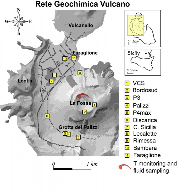
6) Geochemistry of thermal aquifers: The physico-chemical parameters of thermal aquifers show stable values. There are no significant changes.
7) Local seismicity: Reduction of local micro-seismicity, with low and medium-low values of the event occurrence rate.
8) Regional seismicity: Absence of regional earthquakes of magnitude equal to or greater than 1.0.
9) Deformations – GNSS: No significant variation is reported
10) Deformations – Inclinometry: No significant variation is reported
11) Other observations: Gravimetry: No significant variation was recorded.
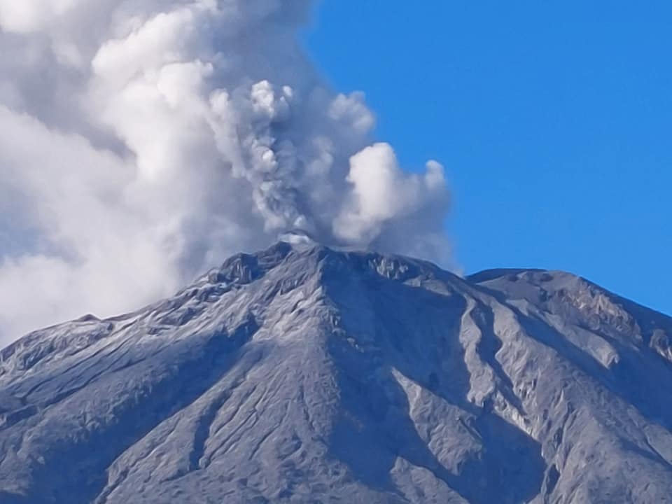
CRATER FUMEROLES TEMPERATURE:
Along the upper edge, the maximum emission temperature has extremely stable values, with an hourly maximum of 380°C and an unchanged weekly average of 379°C (T1). The fumarolic field presents homogeneous emission temperatures all along the summit fracture line, confirming a thermal anomaly still maintained by a stable vapor flow.
The thermal signal of the T3 sensor (fumarole F5) overlaps the temperatures recorded in T2 (fumerola F5AT) while the site on the internal side after June 6 presents obvious disturbances (predominant modulation) of an exogenous nature and only reaches its maximum value at occasionally ( T = 105°C 112°C).
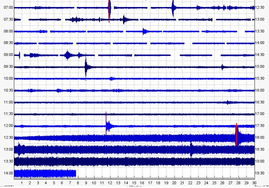
LOCAL SEISMICITY:
During the week, micro-seismicity related to hydrothermal fluid dynamics, as a whole, showed a clear downward trend. Indeed, the decreasing trend in the frequency of occurrence of micro-shocks continued with the spectral peak > 1 Hz (Fig. 9.1) and the phase of increasing low frequency events (VLP; spectral peak below 1 Hz) has been interrupted, recorded over the past week, with an obvious easing in the rate of occurrence of these events.
Source : INGV.
Photos : INGV , Viaggi e Vulcani.
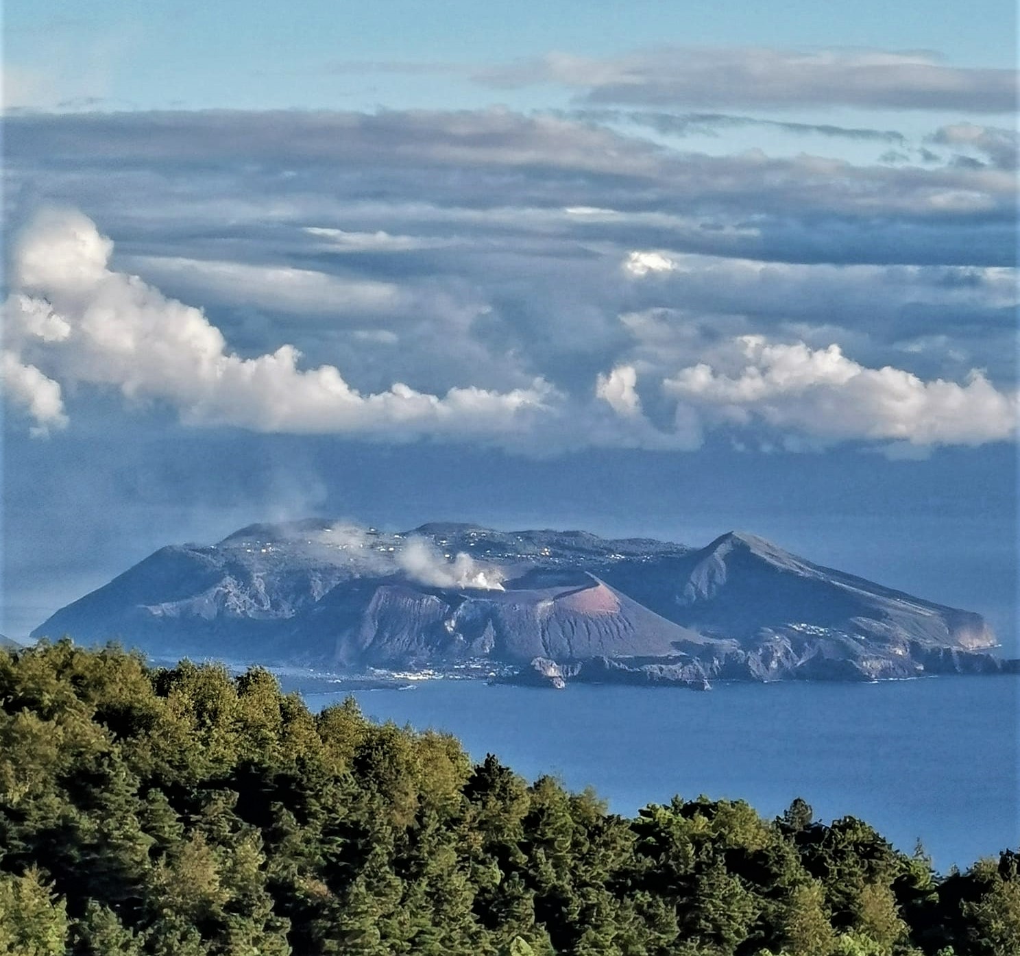
Colombia , Chiles / Cerro Negro :
Chiles and Cerro Negro volcanoes weekly activity bulletin
Volcano activity continues at YELLOW LEVEL ■ (III): CHANGES IN THE BEHAVIOR OF VOLCANIC ACTIVITY.
From monitoring the activity of the CHILES AND CERRO NEGRO VOLCANOES, the COLOMBIAN GEOLOGICAL SERVICE (SGC) reports that:
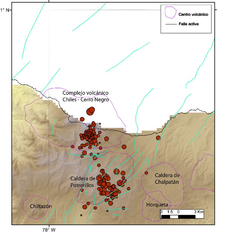
Between June 14 and 20, 2022, the seismic swarm process that began on May 27, 2022 continued, exhibiting fluctuations in both the number and daily energy of earthquakes.
During this week, 13,511 events were recorded, mainly associated with a fracture of the crustal material inside the volcano. The earthquakes were located in two areas, most located south of the Chiles volcano less than 4 km and at depths less than 6 km from its summit (4700 m). The second zone, in which the seismic activity has considerably decreased, is also located south of the Chiles volcano, at a distance of between 6 and 9 km and a depth of between 7 and 9 km, from its summit (4700 m ) . During the assessed week, 13 events of local magnitude between M2.0 and M3.4 occurred, two of which were reported as felt within the volcanic influence zone.
Some sensors that are part of the deformation network show changes which, although of low amplitude, can be associated with the seismic process. No manifestation of surface activity has been observed and the other volcanic monitoring parameters remain stable.
The COLOMBIAN GEOLOGICAL SERVICE and the GEOPHYSICAL INSTITUTE OF THE NATIONAL POLYTECHNIC SCHOOL of ECUADOR remain attentive to the evolution of the volcanic phenomenon and will inform on any changes that may occur in due course.
Information VOLCÁN CHILES, Wednesday, June 22, 2022:
As of 11:50 p.m. (local time) on Tuesday, June 21, the joint monitoring network of IG-EPN and OVSP records a swarm of earthquakes under the Chiles volcano, on the Ecuador-Colombia border (province of Carchi and Department of Nariño respectively). The largest earthquakes recorded in the region so far were 4.3 Mlv at 23:50 (local time) on 06/21 and another 3.5 Mlv at 03:31 (local time) on 06/22. These events were reported as felt, mainly in the province of Carchi and Imbabura in Ecuador and in Tuquerres, Pasto, Ipiales and Cumbal in Colombia. The Geophysical Institute of the National Polytechnic School and the Volcanological and Seismological Observatory of Pasto will continue to report any activity that occurs in the area. The Geophysical Institute is monitoring and any news will be reported.
Source : SGC. IGEPN / BERNARD P, ACOSTA.
Photos : Travelgrafía , IGEPN.
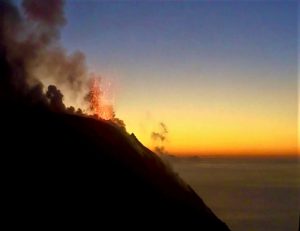
Indonesia , Ibu :
VOLCANO OBSERVATORY NOTICE FOR AVIATION – VONA
Issued : June 22 , 2022 .
Volcano : Ibu (268030)
Current Aviation Colour Code : ORANGE
Previous Aviation Colour Code : orange
Source : Ibu Volcano Observatory
Notice Number : 2022IBU41
Volcano Location : N 01 deg 29 min 17 sec E 127 deg 37 min 48 sec
Area : North Maluku, Indonesia
Summit Elevation : 4240 FT (1325 M)
Volcanic Activity Summary :
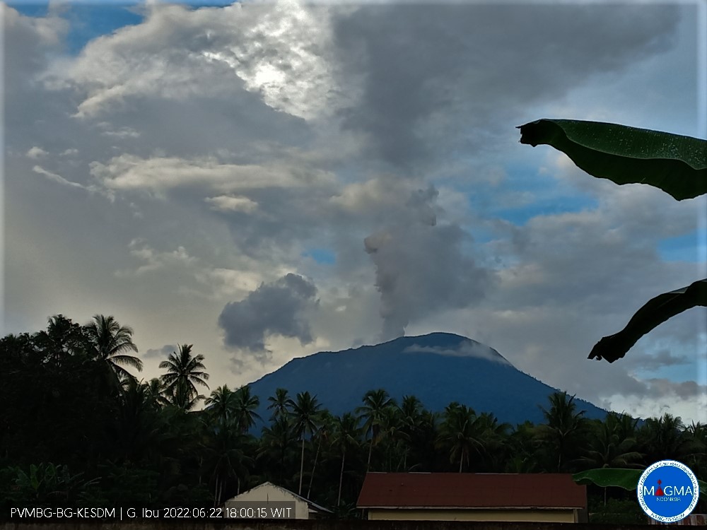
Eruption with volcanic ash cloud at 08h57 UTC (17h57 local).
Volcanic Cloud Height :
Best estimate of ash-cloud top is around 7440 FT (2325 M) above sea level, may be higher than what can be observed clearly. Source of height data: ground observer.
Other Volcanic Cloud Information :
Ash-cloud moving to west.
Remarks :
Eruption and ash emission is continuing.
Mount Ibu erupted on Wednesday, June 22, 2022 at 5:57 p.m. WIT with an ash column height observed at ± 1000 m above the peak (± 2325 m above sea level). It is observed that the ash column is white / gray with a thick intensity, oriented towards the West. This eruption was recorded on a seismograph with a maximum amplitude of 25 mm and a duration of 73 seconds.
Recommendation
Communities around Mount Ibu and visitors/tourists are advised not to travel within a radius of 2.0 km with a sector expansion of 3.5 km to the opening of the crater in the northern part of the crater asset of Mount Ibu.
Source : Magma Indonésie .
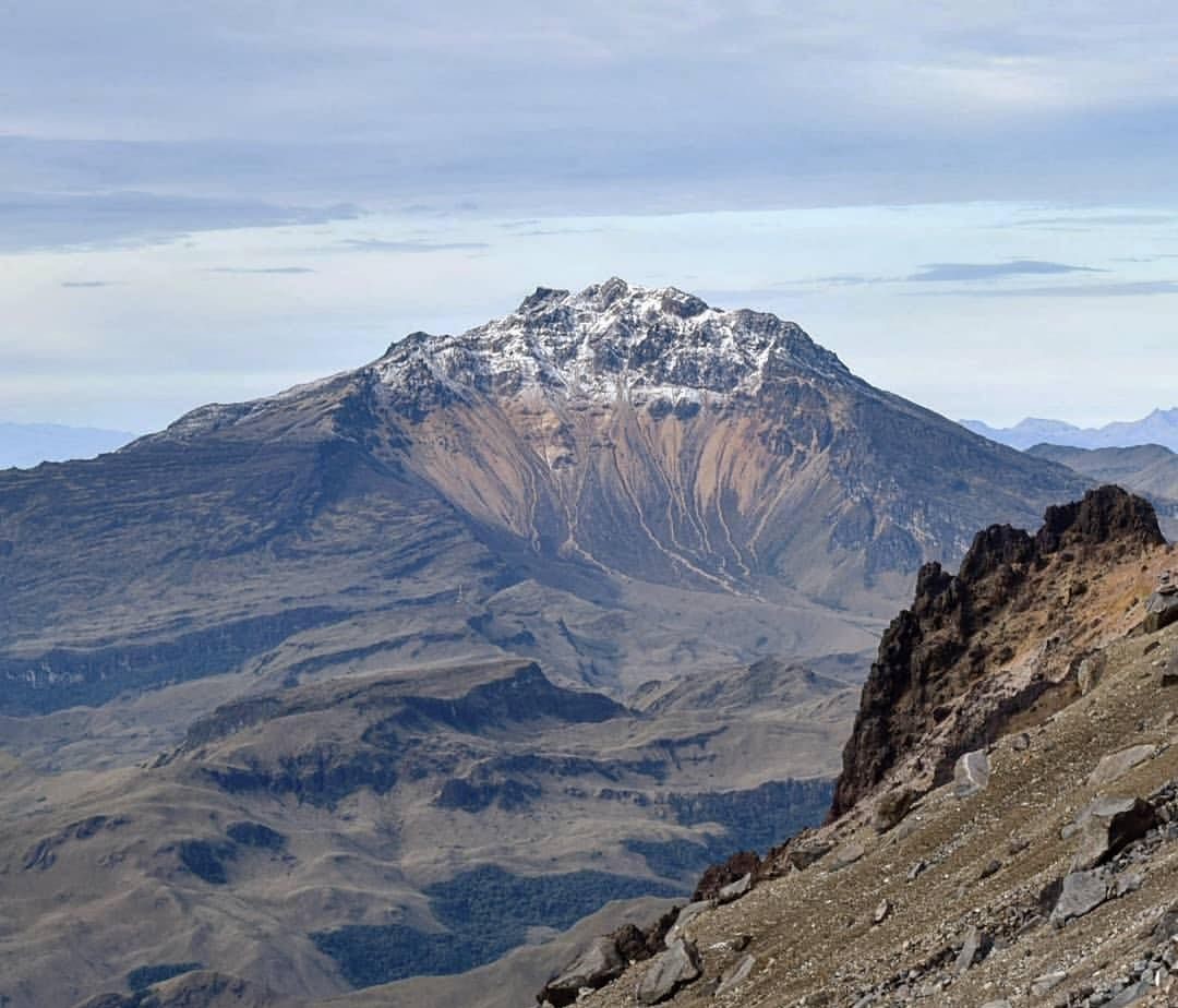
Ecuador , Sangay :
Quito, Wednesday, June 22, 2022
Today, from around 12:30 p.m., the SAGA seismic station records seismic signals corresponding to the descent of mudslides and debris (lahars) on the Sangay volcano. These signals did not exceed the threshold established for reporting according to previous lahars, however, given the long duration of the signal (more than two consecutive hours), this report is issued as a preventive measure.
Lahar-type phenomena have been recurrent since the start of activity in May 2019 and this is due to the fact that the rains on the volcano remobilize the abundant volcanic material accumulated in recent weeks. As a precautionary measure, it is recommended not to enter or approach the beds of the Sangay Norte, Culebrillas, Palora, Volcán and Upano rivers.
The Geophysical Institute is monitoring and any news will be reported.
Source : IGEPN / BERNARD P, AGUAIZA.
Philippines , Bulusan :
PHIVOLCS reported that unrest continued at Bulusan during 15-21 June. Emissions, sometimes voluminous, rose 100-500 m above the summit and drifted NW, WSW, and SW. Daily sulfur dioxide emissions were 660-1,255 tonnes per day. During 0500-2345 on 20 June the seismic network recorded 65 volcanic earthquakes, including one low-frequency volcanic earthquake; most of the events were weak and shallow. The Alert Level remained at 1 (on a scale of 0-5) and PHIVOLCS reminded the public not to enter the 4-km-radius Permanent Danger Zone (PDZ) nor the 2 km Extended Danger Zone (EDZ) on the SE flank.
Luzon’s southernmost volcano, Bulusan, was constructed along the rim of the 11-km-diameter dacitic-to-rhyolitic Irosin caldera, which was formed about 36,000 years ago. It lies at the SE end of the Bicol volcanic arc occupying the peninsula of the same name that forms the elongated SE tip of Luzon. A broad, flat moat is located below the topographically prominent SW rim of Irosin caldera; the NE rim is buried by the andesitic complex. Bulusan is flanked by several other large intracaldera lava domes and cones, including the prominent Mount Jormajan lava dome on the SW flank and Sharp Peak to the NE. The summit is unvegetated and contains a 300-m-wide, 50-m-deep crater. Three small craters are located on the SE flank. Many moderate explosive eruptions have been recorded since the mid-19th century.
Source :Philippine Institute of Volcanology and Seismology (PHIVOLCS) , GVP
Photo : Sorsogon news.
Japan , Suwanosejima :
JMA reported that the eruption at Suwanosejima’s Ontake Crater continued during 13-20 June. Crater incandescence was visible at night. Emissions rose as high as 1.6 km above the crater rim and material was ejected as far as 300 m from the vent. The Alert Level remained at 3 and the public was warned to stay 2 km away from the crater.
The 8-km-long, spindle-shaped island of Suwanosejima in the northern Ryukyu Islands consists of an andesitic stratovolcano with two historically active summit craters. The summit is truncated by a large breached crater extending to the sea on the east flank that was formed by edifice collapse. Suwanosejima, one of Japan’s most frequently active volcanoes, was in a state of intermittent strombolian activity from Otake, the NE summit crater, that began in 1949 and lasted until 1996, after which periods of inactivity lengthened. The largest historical eruption took place in 1813-14, when thick scoria deposits blanketed residential areas, and the SW crater produced two lava flows that reached the western coast. At the end of the eruption the summit of Otake collapsed forming a large debris avalanche and creating the horseshoe-shaped Sakuchi caldera, which extends to the eastern coast. The island remained uninhabited for about 70 years after the 1813-1814 eruption. Lava flows reached the eastern coast of the island in 1884. Only about 50 people live on the island.
Sources : Agence météorologique japonaise (JMA) , GVP.
Photo : Ray Go.