June 14 , 2022.
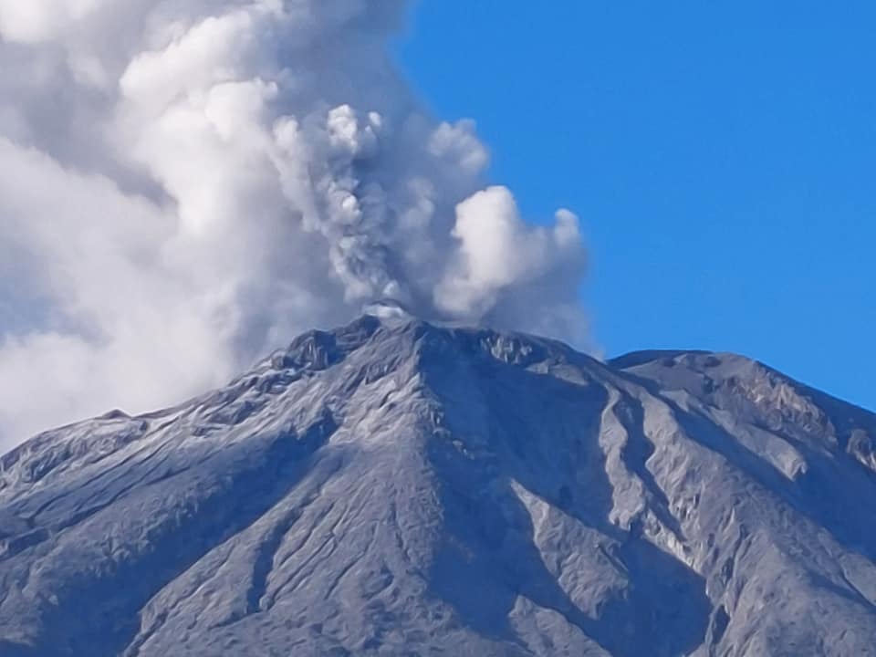
Philippines , Bulusan :
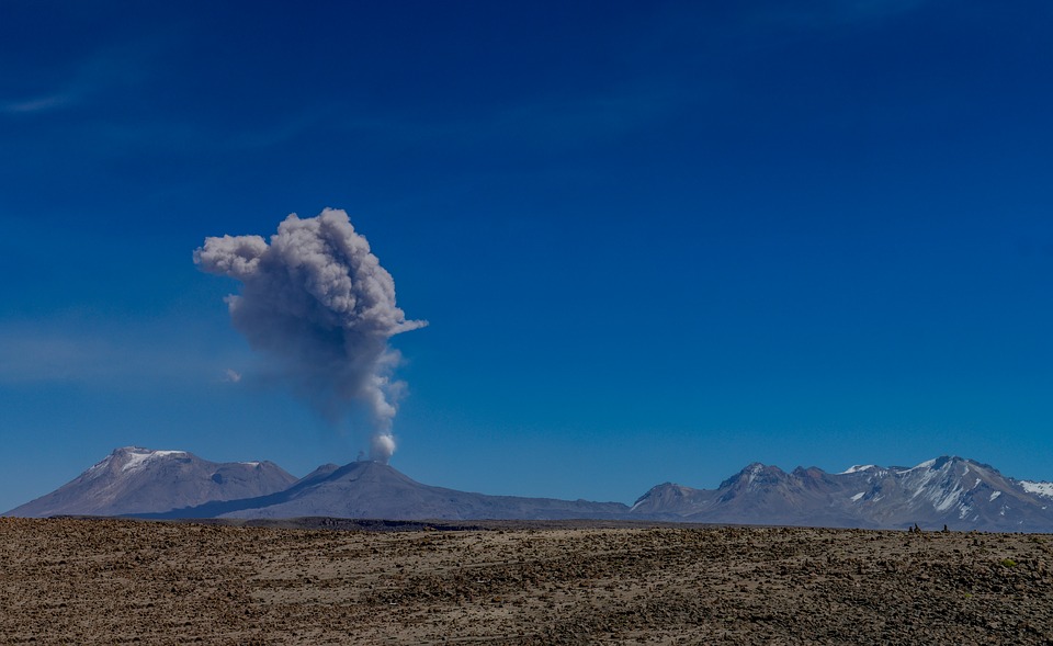
Since its 3:37 AM eruption , 12 June 2022, Bulusan Volcano has remained restive as degassing from its summit vents continues. Steam-laden plumes have been generated with periods of profuse volume and sporadic ashing that began at 4:30 AM today. Noticeably increased ash in the plumes at 9:00 AM was later followed by reports of light ashfall on Catanusan, Juban, Sorsogon and observations of ashfall on the upper northwest slopes. At least five episodes of gray ash plume emission from the Blackbird Crater and profuse steaming from the summit vents were observed from IP cameras of the Bulusan Volcano Network (BVN). These events registered very weakly or not at all in the seismic record and not at all in the infrasound record of the BVN. Much of the ash was dispersed to the northwest of the summit, but no ashfall on population centers has been additionally reported. The plumes have varied in ascent between 400 meters and 750 meters and have been strongly drifted to the northwest.
Alert Level 1 status remains in effect over Bulusan as the volcano is still in a state of hydrothermal unrest. Local government units and the public are reminded that entry into the 4-kilometer radius Permanent Danger Zone (PDZ) must be strictly prohibited and that vigilance in the 2-kilometer Extended Danger Zone (EDZ) on the southeast sector must be exercised due to the increased possibilities of sudden and hazardous phreatic eruptions that can occur without warning. Civil aviation authorities must also advise pilots to avoid flying close to the volcano’s summit as ash from any sudden phreatic eruption can be hazardous to aircraft. Furthermore, people living within valleys and along river/stream channels especially on the southeast, southwest and northwest sector of the edifice should be vigilant against sediment-laden stream flows and lahars in the event of heavy and prolonged rainfall should phreatic eruption occur.
DOST-PHIVOLCS is closely monitoring Bulusan Volcano’s condition and any new development will be communicated to all concerned stakeholders.
Source : Phivolcs
Photo : Sorsogon news
Colombia , Chiles / Cerro Negro :
Extraordinary bulletin of activity of the Chiles and Cerro Negro volcanoes
The activity level of volcanoes remains at the YELLOW LEVEL ■ (III): CHANGES IN THE BEHAVIOR OF VOLCANIC ACTIVITY
From monitoring of CHILES VOLCANO activity, the COLOMBIAN GEOLOGICAL SERVICE (SGC) reports that:
This June 12, 2022 at 2:05 a.m., 2:16 a.m., and 4:02 a.m. there were 3 earthquakes with a local magnitude of 3.4, 3.1, and 3.0, respectively, which were reported to be felt by residents of Resguardos
Indígenas de Chiles, Panán and Mayasquer (municipality of Cumbal) and the city of Tufiño on the Ecuadorian side. These earthquakes are part of a seismic swarm process which, until
midday of June 12 recorded 1217 earthquakes, associated with crustal material fracture, most of them low energy. 221 earthquakes located in two main areas were located. The first to the south of the Chiles volcano at distances less than 3 km and depths less than 6 km from the height of the summit of the Chiles volcano (4700 m above sea level); the second zone also located south of the Chiles volcano at distances between 3.5 and 9 km with depths between 7 and 9 km from the summit of the Chiles volcano. The occurrence of 3 other earthquakes stands out, at 01:19, 01:24 and 01:35, respectively with a local magnitude of 2.8, 2.7 and 2.4, of which no felt earthquake report was received .

As mentioned in the weekly and monthly bulletins for May, the seismicity of the fractures began to increase from May 27, with a total of 17,185 low-energy events recorded until June 11. From this seismicity, it was possible to locate 3047 events located mainly in the southern quadrant of the Chiles volcano, at distances between zero and 4 km, with depths less than 6 km from the summit of the Chiles volcano (4700 m above sea level), highlighting the recording of 9 earthquakes of local magnitude between 2.1 and 2.5, with no report of having been felt.
In general, this activity has a behavior similar to what has been recorded in the region of the Chiles – Cerro Negro volcanoes since the end of 2013, with the recording of relevant seismic episodes, which mainly involve low-energy events, but also some important ones in their energy that can be felt, mainly, by the inhabitants who reside in the areas of influence of these volcanoes, both on the Colombian and Ecuadorian side.
Based on the current behavior of this seismicity and what has been recorded historically in this active volcanic region, it is recommended that civil and indigenous authorities be attentive to official communications, inform their communities of what is happening and, in cases where there are houses or buildings with conditions of structural vulnerability, take preventive measures to avoid conditions that generate risks for its inhabitants. Appropriate management of communication with communities will avoid falling into situations of alarm or misinformation.
Source : SGC.
Photo : hablemosdevolcanes.com
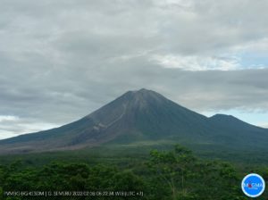
Peru , Sabancaya :
Analysis period: from June 06, 2022 to June 12, 2022, Arequipa, June 13, 2022.
Alert level: ORANGE
The Geophysical Institute of Peru (IGP) reports that the eruptive activity of the Sabancaya volcano remains at moderate levels, that is to say with the recording of an average of 8 daily explosions, with columns of ash and of gas up to 2.5 km altitude above the summit of the volcano and their subsequent dispersion. Therefore, for the following days, no significant change is expected in eruptive activity.
The IGP recorded and analyzed the occurrence of 187 earthquakes of volcanic origin, associated with the circulation of magmatic fluids inside the Sabancaya volcano. An average of 8 explosions was recorded daily, in addition to recording Volcano-Tectonic (VT) type events associated with rock fracturing inside the Sabancaya volcano.
Monitoring the deformation of the volcanic structure using GNSS techniques (processed with fast orbits) does not show any significant anomalies. However, in general, an inflation process was observed in the northern sector (surroundings of the Hualca Hualca volcano). Visual surveillance identified columns of gas and ash up to 2.5 km above the summit of the volcano, which were scattered towards the eastern and northeast sectors of Sabancaya. Satellite recordings have identified the presence of 11 thermal anomalies, with a maximum value of 23 MW, associated with the presence of a lava body on the surface of the volcano’s crater.
RECOMMENDATIONS
• Keep the volcanic alert level orange.
• Do not approach within a radius of less than 12 km from the crater.
Source : Cenvul
Photo : Pixabay.
Iceland , Reykjanes Peninsula :
Reykjanes Earthquakes: Uncertainty Phase Lifted
The National Police Commissioner has, after conferring with the Reykjanes Police commissioner, lifted the Department of Civil Protection and Emergency Management’s Uncertainty Phase due to the ongoing Reykjanes earthquakes in southwest Iceland.
The uncertainty phase was declared on May 15 this year, when the Reykjanes earthquakes had been ongoing for a few weeks. Land rise of up to 5.5cm was detected from April 28 to May 28 by mt. Þorbjörn, along with the increased seismic activity of up to 800 quakes per day. The land rise is thought to be due to the formation of a magma intrusion similar to the ones occurring in 2020, one of which led to the 2020 Reykjanes eruption. In recent days, seismic activity has decreased again. The recurring seismic activity support theories that the Reykjanes peninsula might be entering a new eruptive phase. The last such period was 800-1240, with 18 known eruptions over 440 years.
The Department of Civil Protection and Emergency Management will continue preparing risk assessments, counter-action plans and response programs with national and local authorities, companies, and institutions to prepare for what comes next.
If seismic activity increases again in concurrence with land rise in the area, authorities will declare an uncertainty phase again.
Source : icelandreview.com.
Photo : Birgir Þór Harðarson – RÚV
New Zealand , Ruapehu :
Volcanic tremor remains weak and lake temperature continues to decline. The Volcanic Alert Level remains at Level 2.
Volcanic tremor has continued at weak levels at Mt Ruapehu over the past week but has remained elevated above the background levels recorded since 2013. Crater Lake (Te Wai ā-Moe) temperature has further declined to 23 °C this past week. This is consistent with heat flow of around 100-160 MW, which corresponds to the long-term average heat flow into the lake. Lake level and overflow rates have remained elevated in response to periods of intense rainfall.
The relatively high sulphur dioxide (SO2) and carbon dioxide (CO2) measurements from mid-May and the short period since tremor and lake temperatures declined are consistent with a continued period of moderate volcanic unrest at Mt Ruapehu. Despite the observed decline in some of our monitoring parameters, there is still uncertainty about the state of the volcanic process that has been driving the current unrest period. We will carry out a gas flight to update aerial gas observations as soon as the weather allows, which will provide further insights into current volcanic processes. As noted last week, the level of unrest is now considered moderate rather than heightened, however the potential for eruptive activity remains.
Within the next four weeks, the most likely outcome of the ongoing unrest is no eruption. However, minor eruptive activity, confined to the lake basin, is also possible. Minor eruptions may generate lahars (dangerous volcanic mudflows) in the Whangaehu River.
Our interpretation of the observational data and activity is consistent with moderate volcanic unrest and therefore the Volcanic Alert Level remains at Level 2. The Aviation Colour Code remains at Yellow.
Mt Ruapehu is an active volcano and has the potential to erupt with little or no warning when in a state of moderate volcanic unrest.
Source : Geonet / Yannik Behr / Duty Volcanologist
Photo : Geonet.
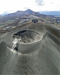
Chile , Descabezado – Grande :
Seismology
The seismological activity of the period was characterized by the recording of:
37 VT-type seismic events, associated with rock fracturing (Volcano-Tectonic type). The most energetic earthquake presented a value of local magnitude (ML) equal to 2.3, located 6.7 km north-northeast of the volcanic edifice, at a depth of 1.8 km by relative to the crater.
2 LP-type seismic events, associated with fluid dynamics within the volcanic system (Long Period type). The most energetic earthquake presented a reduced displacement value (RD) of 3 cm2 and a local magnitude value (ML) equal to 1.6, located 11.6 km north-northeast of the volcanic edifice, at a depth of 4.0 km from the crater.
Fluid Geochemistry
No anomalies were reported in the emissions of sulfur dioxide (SO2) into the atmosphere in the area near the volcanic complex, according to data published by the Tropospheric Monitoring Instrument (TROPOMI).
Satellite thermal anomalies
During the period, no thermal alerts were recorded in the area associated with the volcanic edifice, according to analytical processing of Sentinel 2-L2A satellite images, in a combination of false color bands.
Geodesy
From the data provided by 2 GNSS stations recently installed on the volcanic edifice, which make it possible to measure the deformation of the earth’s surface, we record rates of
displacement of less than 0.2 cm/month, a value considered low, also with no change in the vertical component. Therefore, no evidence of deformation of the volcanic system associated with changes in depth during the period was observed.
Surveillance cameras
The images provided by the fixed camera installed near the complex do not record the degassing columns or the variations linked to surface activity.
Activity remained at levels considered low, suggesting stability of the volcanic system.
The volcanic technical alert is maintained at:
GREEN TECHNICAL ALERT: Active volcano with stable behavior – There is no immediate risk.
Source : Sernageomin
Photo : Wikiheinz