March 19 , 2022.
Indonesia , Merapi :
Merapi activity report from March 11 to 17, 2022.
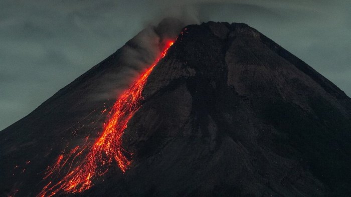
– This week 119 lava avalanches were observed towards the South-West, descending towards the Bebeng River with a maximum sliding distance of 2,000 m and 4 times towards the South-East (upstream of the Gendol River) with a distance maximum slip of 1,000 m.
– The morphological analysis showed a decrease in the height of the South-West dome of approximately 2 m due to the activity of the avalanches. No significant morphological changes were observed in the central lava dome. According to photo analysis, the volume of the Southwest lava dome is 1,546,000 m3 and the central dome is 2,582,000 m3.
– The intensity of the tremor this week is higher than last week.
Mount Merapi’s deformation, which was monitored using EDM this week, showed a distance shortening rate of 0.5 cm/day.
– The rainfall intensity was 45 mm/hour for 70 minutes at Kaliurang post on March 14, 2022. No lahar or additional flow was reported in the rivers that originate on Mount Merapi.
Conclusion:
1. The volcanic activity of Mount Merapi is still quite high in the form of effusive eruption activity. The state of the activity is defined at the « SIAGA » level.
2. The current potential danger is lava avalanches and hot clouds in the South-South-West sector descending the Boyong River for a maximum of 5 km, the Bedog River, Krasak, Bebeng for a maximum of 7 km. The Southeast sector covers the Woro River for a maximum of 3 km and the Gendol River for a maximum of 5 km. Meanwhile, the ejection of volcanic material in the event of an explosive eruption can reach a radius of 3 km around the summit.
The volcano was clearly visible until it was covered in fog. Smoke from the main crater was observed with strong, thick intensity about 50-150 meters above the summit. The weather is sunny to cloudy, the wind is weak to moderate from the West. The air temperature is around 17-27°C. 10 avalanches of incandescent lava were observed with a sliding distance of 1,800 m towards the southwest.
Seismicity is linked to magma and tectonic activity. It was recorded:
– 53 avalanche earthquakes
– 3 emission earthquakes
– 40 hybrid/multi-phase earthquakes
– 7 shallow volcanic earthquakes
Sources : BPPTKG , PVMBG.
Photo : ANTARA FOTO/Hendra Nurdiyansyah
Alaska , Katmai Région :
ALASKA VOLCANO OBSERVATORY INFORMATION STATEMENT , U.S. Geological Survey , Friday, March 18, 2022, 3:33 PM AKDT (Friday, March 18, 2022, 23:33 UTC) .
A regional telecommunication link in King Salmon was repaired on Thursday and data from seismic networks that monitor seven volcanoes in the Katmai region are now available. The Alaska Volcano Observatory (AVO) can now confidently monitor seismic unrest at these volcanoes. With renewed seismic monitoring, these volcanoes are being moved from UNASSIGNED to a volcano alert level of NORMAL and an aviation color code of GREEN.
Telemetry for the the network that monitors Ugashik-Peulik and Ukinrek Maars, on the Alaska Peninsula, has also been restored. However, only three seismic stations in the network are currently returning data, likely due to heavy snow cover at other stations. This smaller network inhibits AVO’s ability to detect precursory unrest that may lead to an eruption; therefore, these volcanoes remain at UNASSIGNED for the time being.
As at other Alaska volcanoes, AVO will continue to monitor seismic, satellite, infrasound, and lightning data, and reports from pilots and ground observers to detect signs of eruptive activity.
GRIGGS VOLCANO (VNUM #312190)
58°21’26 » N 155°6’13 » W, Summit Elevation 7602 ft (2317 m)
Current Volcano Alert Level: NORMAL
Current Aviation Color Code: GREEN
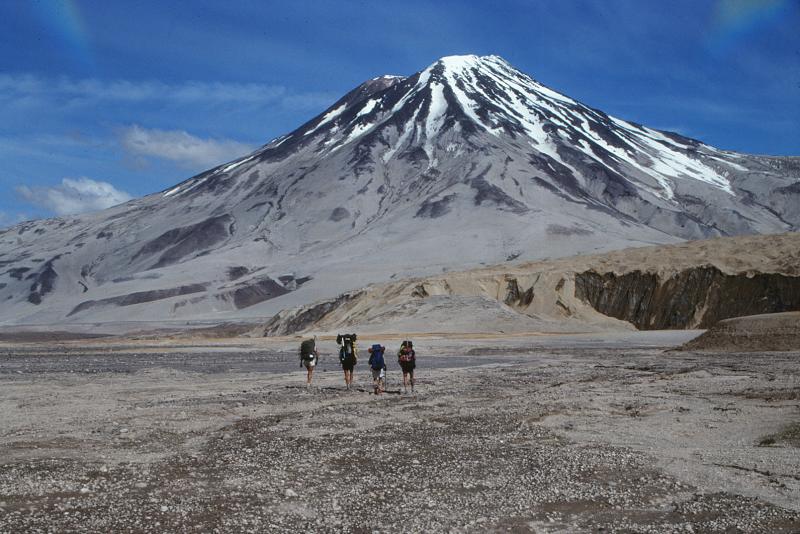
Geologists walk toward 2,317-m (7,602 ft)-high, Mount Griggs volcano from the base of Knife Creek Glacier at the base of the northwest flank of Mount Katmai. Mount Griggs volcano lies 10 km (6 mi) behind the volcanic arc defined by other Katmai group volcanoes. Although no historical eruptions have been reported from Mount Griggs, vigorously active fumaroles persist in a summit crater and along the upper southwest flank. The slopes of Mount Griggs are heavily mantled by gray fallout from the 1912 eruption of Novarupta volcano. View is to the north
Aviation color code and alert level changed to GREEN/NORMAL due to reestabilished communication links to instrumental monitoring data.
KATMAI VOLCANO (VNUM #312170)
58°16’44 » N 154°57’12 » W, Summit Elevation 6716 ft (2047 m)
Current Volcano Alert Level: NORMAL
Current Aviation Color Code: GREEN
Aviation color code and alert level changed to GREEN/NORMAL due to reestabilished communication links to instrumental monitoring data.
SNOWY MOUNTAIN VOLCANO (VNUM #312200)
58°20’1″ N 154°41’9″ W, Summit Elevation 7090 ft (2161 m)
Current Volcano Alert Level: NORMAL
Current Aviation Color Code: GREEN
Aviation color code and alert level changed to GREEN/NORMAL due to reestabilished communication links to instrumental monitoring data.
TRIDENT VOLCANO (VNUM #312160)
58°14’3″ N 155°6’9″ W, Summit Elevation 3599 ft (1097 m)
Current Volcano Alert Level: NORMAL
Current Aviation Color Code: GREEN
Aviation color code and alert level changed to GREEN/NORMAL due to reestabilished communication links to instrumental monitoring data.
MAGEIK VOLCANO (VNUM #312150)
58°11’41 » N 155°15’16 » W, Summit Elevation 7103 ft (2165 m)
Current Volcano Alert Level: NORMAL
Current Aviation Color Code: GREEN
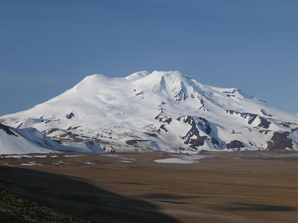
Mount Mageik is a broad cone-shaped volcano that rests on a basement of Jurassic sedimentary rocks at the northeast end of a 12-km-long basement ridge shared by neighboring Mount Martin. The summit area, which is largely ice-covered, consists of a central high peak (elevation 2165 m) and three smaller topographic highs, each a separate vent-cone. A small (<1 km in diameter) phreatic crater on the northeast side of the central peak contains a crater lake and supports vigorous fumarolic activity accompanied by sulfur deposition.
Aviation color code and alert level changed to GREEN/NORMAL due to reestabilished communication links to instrumental monitoring data.
MARTIN VOLCANO (VNUM #312140)
58°10’9″ N 155°21’24 » W, Summit Elevation 6102 ft (1860 m)
Current Volcano Alert Level: NORMAL
Current Aviation Color Code: GREEN
Aviation color code and alert level changed to GREEN/NORMAL due to reestabilished communication links to instrumental monitoring data.
NOVARUPTA VOLCANO (VNUM #312180)
58°15’55 » N 155°9’33 » W, Summit Elevation 2759 ft (841 m)
Current Volcano Alert Level: NORMAL
Current Aviation Color Code: GREEN
Aviation color code and alert level changed to GREEN/NORMAL due to reestabilished communication links to instrumental monitoring data.
Source : AVO.
Photos : McGimsey, R. G. / Alaska Volcano Observatory/U.S. Geological Survey ,
Kamchatka , Bezymianny :
55.97 N, 160.6 E;
Elevation 2882 m (9453 ft)
Aviation Colour Code is ORANGE
The effusive eruption of the volcano continues. Ongoing activity could affect low-flying aircraft.
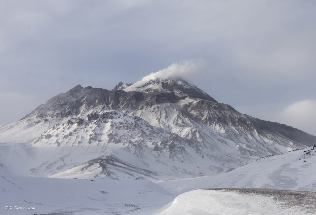
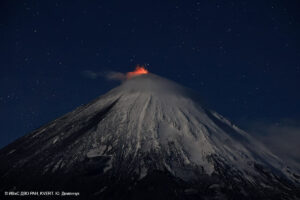
The effusive eruption of the volcano continues, its is accompanied by moderate gas-steam activity, and as well as rare collapses of hot avalanches. According to Tokyo VAAC and KVERT satellite data, the explosive eruption of the volcano began at 15:10 UTC on March 14: a continuous emission of ash up to 6 km a.s.l. was noted; the ash plume extended to the west and southwest of the volcano. Paroxysmal phase of the eruption with the removal of ash up to 12 km a.s.l. began at 12:53 UTC on March 15, and lasted for half an hour. The formation of pyroclastic flows on the western, northern, and southern slopes of the volcano was noted. The eruptive cloud moved more than 1300 km to the northwest and then to the northeast from the volcano on March 15-16. A large thermal anomaly continues to be recorded in the lava dome area.
Source : Kvert.
Photo : A. Gerasimov ( 30/3/2021 ).
Chile , Lonquimay :
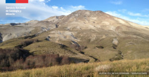
Special Report on Volcanic Activity (REAV), La Araucanía region, Lonquimay volcano, March 18, 2022, 6:30 p.m. local time (mainland Chile).
The National Geology and Mining Service of Chile (Sernageomin) discloses the following information obtained through the monitoring equipment of the National Volcanic Monitoring Network (RNVV), processed and analyzed at the Volcanological Observatory of the Southern Andes (OVDAS) , concerning the recent activity of the Lonquimay volcano:
Seismic monitoring:
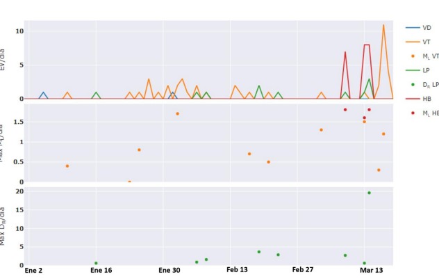
During the current month of March, the recording of unusual volcanic hybrid type (HB) seismicity was noted, accompanied by long period type (LP) seismicity, two signals commonly associated with fluid dynamics at the inside volcanic conduits. To a lesser extent, volcano-tectonic (VT) seismicity was observed, linked to the rupture of rock material in volcanic systems. Although their sizes and magnitudes are small so far, their balance is distinguished by an incisive appearance during the first half of March, especially from March 9 (Fig. 1. upper panel, red line for HB and orange for VT). Due to their low magnitude (Fig. 1, central panel, red dots for HB and orange for VT), only some of the HB and VT earthquakes were located close to the main volcanic edifice, with distances between 2 and 7 km, and depths varying between 4 and 11 km with reference to the summit of the volcano. Compared to LP seismicity (Fig. 1, green), it remained low in occurrence and size.
Figure 1. Multiparameter temporal evolution of the Lonquimay volcano, between January 1 and March 18, 2022. The number of earthquakes per day is represented in the upper panel, as indicated by the colors on the right. The central panel shows the local magnitude (ML) of localized VT (orange) and HB (red) earthquakes. The last panel represents the size of LP earthquakes evaluated from the reduced displacement parameter (DR), being generally small and less than 5 cm2, except
of the last recorded event close to 20 cm2 occurred on March 14
Geodetic monitoring:
Analysis of data from continuous GNSS stations on the ground indicates that variations suggesting deformation of the volcanic edifice are not observed. Indeed, the two monitoring stations show only subtle changes that do not represent any alteration of the main building.
Geochemical monitoring:
No anomalies are reported in the emissions of sulfur dioxide (SO2) into the atmosphere in the area near the volcano, according to data published by the Tropospheric Monitoring Instrument (TROPOMI) and the Ozone Monitoring Instrument (OMI) Sulfur Dioxide Group (http://so2.gsfc.nasa.gov/).
Satellite Thermal Anomaly Monitoring:
No thermal alert is recorded in the area associated with the volcano, according to data processed by the Mid-Infrared Observation of Volcanic Activity (MIROVA) (http://www.mirovaweb.it/). Consequently, no luminance anomaly is detected by the analysis of the Sentinel 2L2A images (last image available on March 16).
Satellite geomorphological monitoring:
Based on satellite monitoring of Sentinel 2L2A (true color) and Planet Scope images, no surface morphological changes attributable to recent volcanic activity within the volcanic complex are identified (latest images available March 16 and 17, respectively ).
Figure 2. Representation of data provided by GNSS stations from September 2020 to March 17, 2022. In top view, the blue line indicates the distance variation (GNSS-Line) in centimeters between the two monitoring stations. The green line (NVDD station) and the lower blue line (SMOKE) [GNSS-Comp], show the variations of the vertical components of the same stations. Read as a stability in the trend of the lines without drastic changes, only with subtle modifications.
In summary, according to the antecedents presented, there is an abnormal but slight increase in the seismic activity of the volcano, in particular associated with the appearance of hybrid seismicity and, to a lesser extent, LP and VT type seismicity. It should be noted that to date, the seismicity is of low energy. Although there is no specific history from which to infer destabilization of the system, the occurrence of this volcanic activity has been anomalous for the historical record since 2010, the year in which instrumental monitoring began. The other monitoring parameters indicated (deformation and analysis by remote sensing) remain without significant variations. Due to the above, the green technical alert is maintained, paying particular attention to the development of the activity
Source et graphiques : Sernageomin .
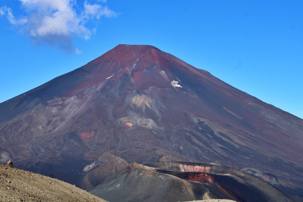
Photo : Jorge Romero, Febrero 2022
Hawaii , Mauna Loa :
19°28’30 » N 155°36’29 » W,
Summit Elevation 13681 ft (4170 m)
Current Volcano Alert Level: ADVISORY
Current Aviation Color Code: YELLOW
Activity Summary:
Mauna Loa volcano is not erupting. Rates of seismicity and CO2 concentrations at Sulphur Cone remain slightly elevated above long-term background levels, but have not changed significantly over the past week. Other Mauna Loa monitoring data streams—ground deformation, all other gas concentrations, visual appearance in webcams—show no significant changes.
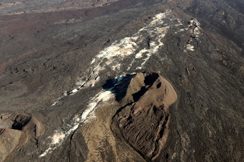
A view of the whole Sulphur Cone area, including a sulphur flow out of one of the cones (yellow bottom of image). The white in the middle of the image is caused by alteration of the rock by volcanic gas.
Observations:
During the past week, HVO seismometers recorded approximately 44 small-magnitude (below M3.0) earthquakes below the summit and upper-elevation flanks of Mauna Loa. The majority of these earthquakes occurred at shallow depths less than 10 kilometers (6 miles) below sea level.
Global Positioning System (GPS) measurements show very low rates of deformation in the summit region continuing through the past week.
Concentrations of sulfur dioxide (SO2) and hydrogen sulfide (H2S), as well as fumarole temperatures, remain stable at both the summit and at Sulphur Cone, on the upper Southwest Rift Zone. Concentrations of carbon dioxide (CO2) are also stable at the summit, but have slowly increased over the past year at Sulphur Cone. The CO2 measured concentrations remain low compared to many other volcanic areas globally.
Webcam views have shown no changes to the volcanic landscape on Mauna Loa over the past week.
Source : HVO.

