March 03 , 2022.
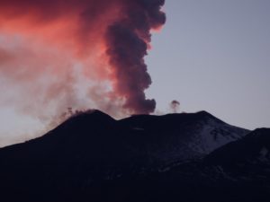
Alaska , Pavlof :
55°25’2″ N 161°53’37 » W,
Summit Elevation 8261 ft (2518 m)
Current Volcano Alert Level: WATCH
Current Aviation Color Code: ORANGE
A high-resolution satellite image yesterday showed steaming from the north and active east crater on Pavlof. Clouds obscured the immediate vicinity of the active vent and flank with recent lava flows, but overnight satellite images did detect elevated surface temperatures consistent with continued lava effusion. Local seismometers and regional infrasound sensors detected ongoing seismic tremor but no explosions.
The small explosions associated with this eruption could happen at any time and may be accompanied by small ash plumes within the immediate vicinity of the volcano. The level of unrest at Pavlof can change quickly and the progression to more significant eruptive activity can occur with little or no warning.
Pavlof is monitored by local seismic and infrasound sensors, satellite data, web cameras, and remote infrasound and lightning networks.
Source : AVO.
Photo : Musselwhite, Levi .
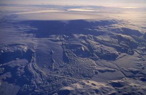
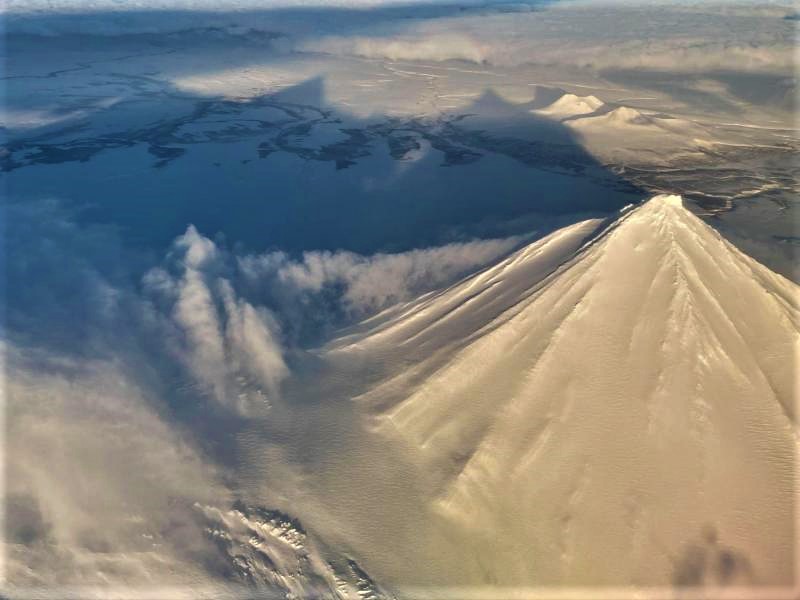
Japan , Ontakesan :
JMA reported that the number of volcanic earthquakes at Ontakesan began increasing at 14h15 on 23 February. Four minutes later a volcanic tremor signal was detected along with uplift on the S flank. At 16h35 JMA raised the Alert Level to 2 (on a scale of 1-5). The report warned the public to stay at least 1 km away from Crater on the SW flank of the Kenga-mine summit. After a peak on 25 February, the number of daily volcanic earthquakes began to decline; there were two volcanic earthquakes recorded on 24 February, a total of 17 on 25 February, 4-5 per day during 26-28 February, and 3 on 1 March. During an overflight on 25 February scientists observed no changes in the fumarolic areas or other morphological changes on the volcano.
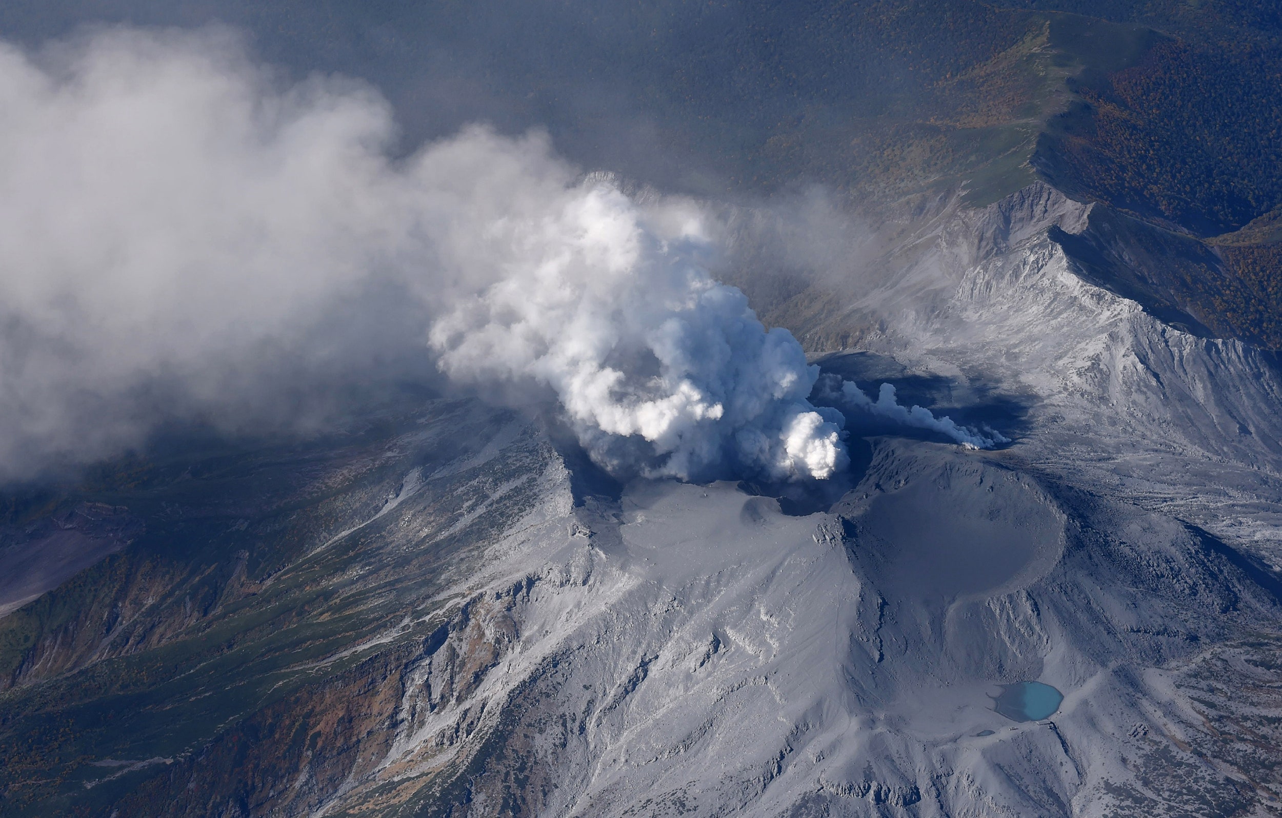
The massive Ontakesan stratovolcano, the second highest volcano in Japan, lies at the southern end of the Northern Japan Alps. Ascending this volcano is one of the major objects of religious pilgrimage in central Japan. It is constructed within a largely buried 4 x 5 km caldera and occupies the southern end of the Norikura volcanic zone, which extends northward to Yakedake volcano. The older volcanic complex consisted of at least four major stratovolcanoes constructed from about 680,000 to about 420,000 years ago, after which Ontakesan was inactive for more than 300,000 years. The broad, elongated summit of the younger edifice is cut by a series of small explosion craters along a NNE-trending line. Several phreatic eruptions post-date the roughly 7300-year-old Akahoya tephra from Kikai caldera. The first historical eruption took place in 1979 from fissures near the summit. A non-eruptive landslide in 1984 produced a debris avalanche and lahar that swept down valleys south and east of the volcano. Very minor phreatic activity caused a dusting of ash near the summit in 1991 and 2007. A significant phreatic explosion in September 2014, when a large number of hikers were at or near the summit, resulted in many fatalities.
Sources: GVP , Japan Meteorological Agency (JMA)
Photo : MASANORI GENKO/AP
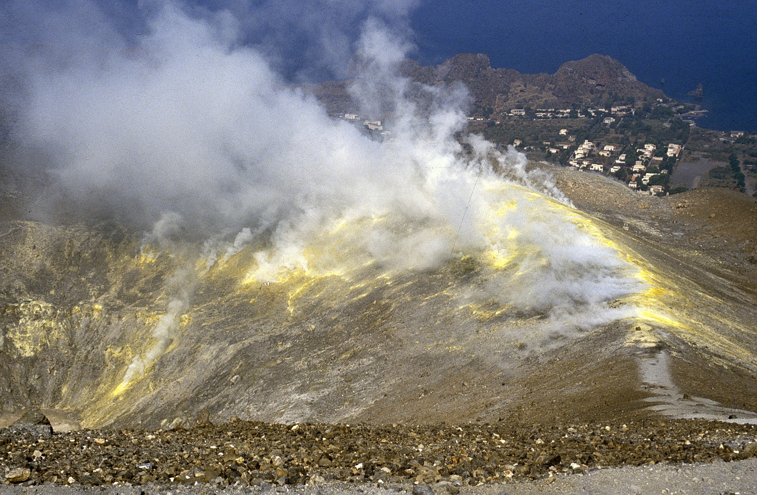
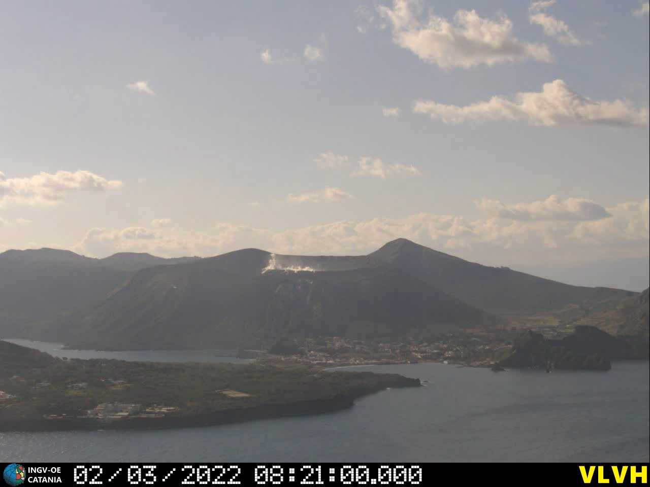
Italy , Vulcano :
WEEKLY BULLETIN, from February 21, 2022 to February 27, 2022. (issue date March 01, 2022)
ACTIVITY STATUS SUMMARY:
In the light of the surveillance data, it is highlighted:
1) Temperature of the crater fumaroles: The updated data of the temperatures recorded on the edge of the crater show stable values and confirm the continuation of the thermal anomaly. On the internal side, the values are always stable at 111°C.
2) CO2 flux in the crater area: The CO2 flux in the crater area remains at high values.
3) SO2 flux in the crater area: SO2 flux at a medium-high level and decreasing
4) Geochemistry of fumarolic gases: No update is available concerning the geochemistry of fumarolic gases.
5) CO2 fluxes at the base of the La Fossa cone and in the Vulcano Porto area: The CO2 fluxes recorded in the Rimessa, C. Sicilia and P4max sites remain at medium-high values; on the Faraglione site they are recorded at values close to the background level.
6) Geochemistry of thermal aquifers: The physico-chemical parameters recorded in the wells of Camping Sicilia and Bambara remain stable at high values, although showing a very slight downward trend.
7) Local seismicity: low occurrence rate of local events, slight increase in the number of VLP type events.
8) Regional seismicity: No earthquake with Ml >= 1.0 was located in the area of the island of Vulcano.
9) Deformations – GNSS: The GNSS monitoring network does not show any significant changes.
10) Deformations – Inclinometry: During the last week, signals from the Vulcano inclination sensor network have not shown any significant variations.
11) Other observations: Mobile GNSS: The mobile GNSS stations do not seem to show significant variations during the period considered.
Gravimetry: During the period considered, no significant change was recorded.
GB-RAR: GB-RAR monitoring results referring to the period from December 14, 2021 to February 28, 2022, show general stability of the area, with deformations along the LOS of less than 1 mm.
CRATER FUMAROLES TEMPERATURE:
The reference sensor for the maximum temperature (F5AT fumarole, channel T1) showed a slight upward trend, reaching 386°C at the end of the observation period. Not far from the T1 sensor, the T2 sensor instead showed a downward trend and greater disturbances of exogenous origin. The temperatures measured on the interior side remain stable at 111-113°C. The temperature recorded at this site never exceeded 113.7°C, suggesting the presence of a liquid phase and a flow influenced by exogenous conditions.
Source : INGV.
Photos : Boris Behncke , INGV .
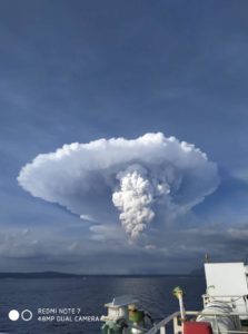
Indonesia , Semeru :
VOLCANO OBSERVATORY NOTICE FOR AVIATION – VONA
Issued : March 02 , 2022
Volcano : Semeru (263300)
Current Aviation Colour Code : ORANGE
Previous Aviation Colour Code : orange
Source : Semeru Volcano Observatory
Notice Number : 2022SMR43
Volcano Location : S 08 deg 06 min 29 sec E 112 deg 55 min 12 sec
Area : East java, Indonesia
Summit Elevation : 11763 FT (3676 M)
Volcanic Activity Summary :
Eruption with volcanic ash cloud at 22h40 UTC (05h40local). Eruption and ash emission is continuing.
Volcanic Cloud Height :
Best estimate of ash-cloud top is around 25126 FT (7852 M) above sea level, may be higher than what can be observed clearly. Source of height data: ground observer.
Other Volcanic Cloud Information :
Ash-cloud moving to vertical
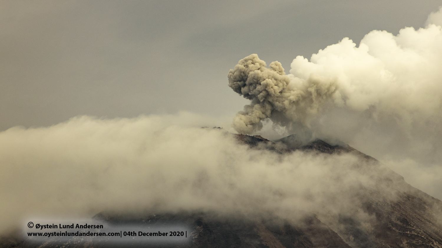
The volcano is clearly visible until it is covered in fog. Smoke from the crater was not observed. The weather is sunny to rainy, the wind is weak in the North-East and in the West. The air temperature is around 21-29°C. Two incandescent lava avalanches were observed at a distance of 200-300 m towards the Kobokan ravine. The eruption was observed at a height of 500 m, the color of white / gray smoke. The dispersion is oriented towards the South-West
Earthquakes are related to magma and tectonic activity. It was recorded:
– 40 earthquakes of eruptions/explosions
– 10 emissions earthquake
– 6 harmonic tremors
– 4 distant tectonic earthquakes.
Sources : Magma Indonésie , PVMBG.
Photo : Oystein Lund Andersen.
Guatemala , Santiaguito :
Atmospheric conditions: Clear weather
Wind: North-East 30 km/h
Precipitation: 0.0 mm
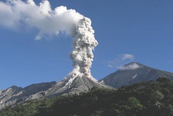
Activity:
The Santiaguito OVSAN volcano observatory reports white degassing 600 meters above the crater which extends to the west and southwest. At night, incandescence was observed in the crater of the Caliente dome and in the lava flows in the west and south-west directions. Weak to moderate block and ash avalanches continue to be recorded on the flanks: West, South-West and South mainly, these avalanches reaching the base of the Caliente Dome. The volcano maintains high activity due to blocky lava extrusion in the dome, with a west-southwest direction as well as unstable material in the crater. There is a likelihood of moderate to strong pyroclastic flows, so do not stay near or in riverbeds near the slopes of the volcano. The recommendations of BESAN bulletin n° 003-2022 are still valid.
Source : Insivumeh.
Photo : La Hora