January 07 , 2022 .
La Réunion Island , Piton de la Fournaise :
Press release of January 07, 2022 – 9:30 a.m.
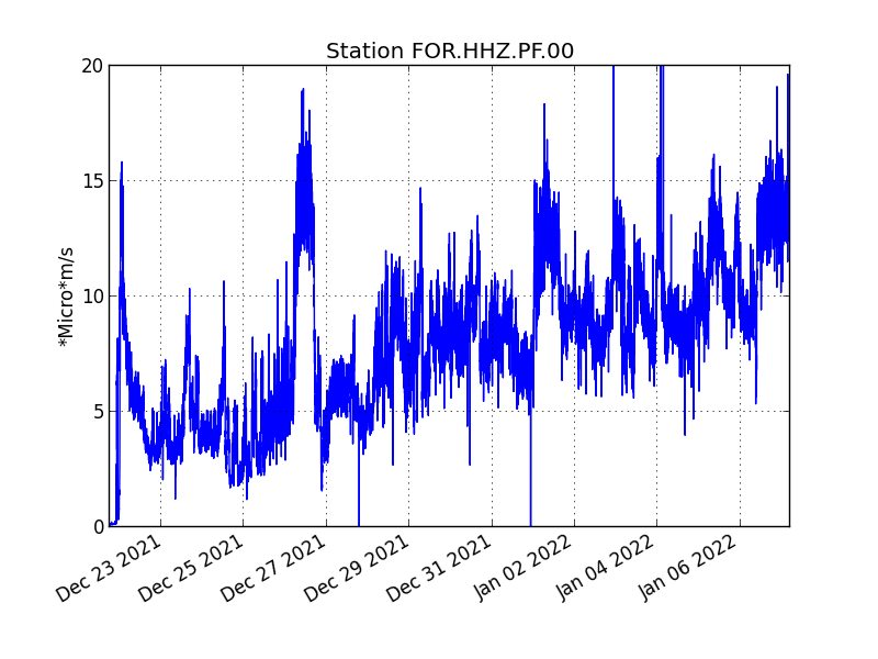
The eruption that began on December 22, 2021 at around 3:30 a.m. local time continues. Over the last 24 hours the amplitude of the eruptive tremor (indicator of an emission of lava on the surface) still shows fluctuations (Figure 1).
The fluctuations observed are partly linked to the level of the lava lake which varies depending on the degassing mode, and the sporadic openings of the tunnels which allow emptying of the cone.
The average amplitude of the tremor is still increasing and is (over the past 24 hours) around its initial amplitude observed at the start of the eruption.
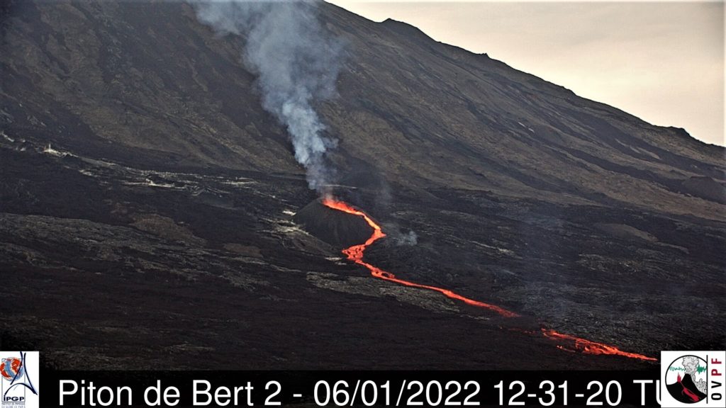
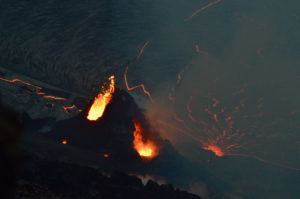
At the beginning of the afternoon during the day yesterday (06/01/2022), a resurgence of activity at the level of the eruptive cone was observed leading to an overflow of the lava lake outside the cone (Figure 2) at the origin of a lava flow coming along the tunnel lava field located downstream of the cone. This morning the overflow was being absorbed and the flow was starting to freeze.
In the absence of overflight, no precise assessment of the position of the flow front could be made. But given the relief with gently sloping slopes in the area, the lava field continues to extend mainly laterally and by thickening at the level of the network of lava tunnels set up on the plateau downstream of the eruptive cone.
Over the last 24 hours:
– A single volcano-tectonic earthquake of low magnitudes (<0.5) was recorded under the summit.
– The surface deformations still show a very slight deflation at the level of the summit zone, linked to the emptying of the magma reservoir located under the summit (at approximately 2-2.5 km from
depth) feeding the eruptive site.
– Lava flows could be estimated by satellite method with the HOTVOLC platform (OPGC – Clermont Auvergne University). They were between 5 and 13 m 3 / sec. These variations are explained by the method, which relies on the infrared radiation of the flow, the perception of which by satellites can be greatly influenced by the weather conditions above the flows as well as the surface conditions of the flows. The particularly bad weather conditions on the eruptive site over the past 24 hours have only allowed the acquisition of three measurements (the measurements being acquired every 15 minutes).
Alert level: Alert 2-1 (eruption in the enclosure)
Source : OVPF
Costa Rica , Rincon de la Vieja :
Activity report of the Rincón de la Vieja volcano, January 05, 2022.
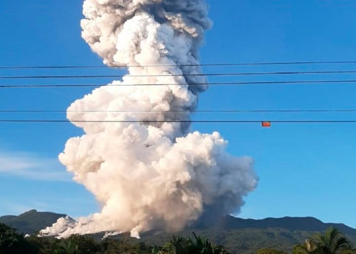
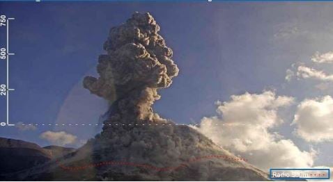
On January 05, 2022 at 6:33 p.m. local time, an eruption was recorded on the Rincón de la Vieja volcano, the height reached by the column is unknown due to the visibility conditions of the site.
Duration of the activity: 2 minutes.
Ash fall reported: No ash fall reported
Sulfur odor reported: No sulfur odor reported
Comments: Update: the eruption released incandescent material that could be observed for 30s at the top of the volcano. A very loud banging noise has been reported and lahars are heard.
After the main event, major lahars descended in the Penjamo, Azufrado, and possibly Azul rivers. In addition, it appears that other small eruptions have occurred unobserved due to their much lower amplitude. The biggest seem to have taken place at 9:08 p.m. and 9:20 p.m., they will be confirmed by the seismograph in the coming days, but there are reports of noise coming from the neighbors of the volcano.
Source : Ovsicori.
Kamchatka , Sheveluch :
VOLCANO OBSERVATORY NOTICE FOR AVIATION (VONA)
Issued: January 7 , 2022
Volcano: Sheveluch (CAVW #300270)
Current aviation colour code: ORANGE
Previous aviation colour code: orange
Source: KVERT
Notice Number: 2022-01
Volcano Location: N 56 deg 38 min E 161 deg 18 min
Area: Kamchatka, Russia
Summit Elevation: 3283 m (10768.24 ft), the dome elevation ~2500 m (8200 ft)
Volcanic Activity Summary:
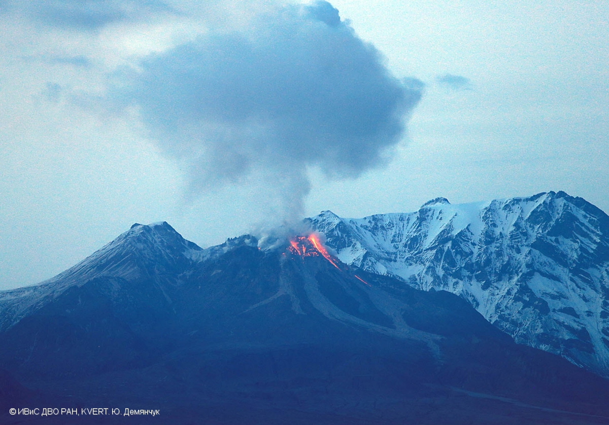
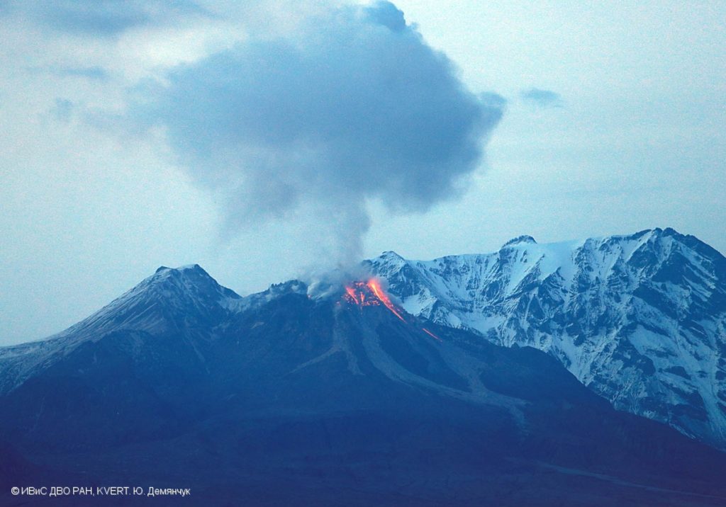
A growth of the lava dome continues, a strong fumarolic activity, and an incandescence of the lava dome, and hot avalanches accompanies this process. Satellite data by KVERT showed a strong gas-steam with some amount of ash is extending for 24 km to the west of the volcano.
The extrusive eruption of the volcano continues. Ash explosions up to 10-15 km (32,800-49,200 ft) a.s.l. could occur at any time. Ongoing activity could affect international and low-flying aircraft.
Volcanic cloud height:
4000-4500 m (13120-14760 ft) AMSL Time and method of ash plume/cloud height determination: 20220107/0010Z – Himawari-8
Other volcanic cloud information:
Distance of ash plume/cloud of the volcano: 24 km (15 mi)
Direction of drift of ash plume/cloud of the volcano: W / azimuth 265 deg
Time and method of ash plume/cloud determination: 20220107/0010Z – Himawari-8
Source : Kvert.
Photo : Yu. Demyanchuk. IVS FEB RAS, KVERT
Indonesia , Merapi :
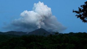
The volcano was clear before it was covered in fog. The observable smoke from the crater is white with a moderate to strong intensity, the height of the smoke is 20 to 50 m above the summit. The weather is sunny to cloudy, the wind is weak to the east and west.
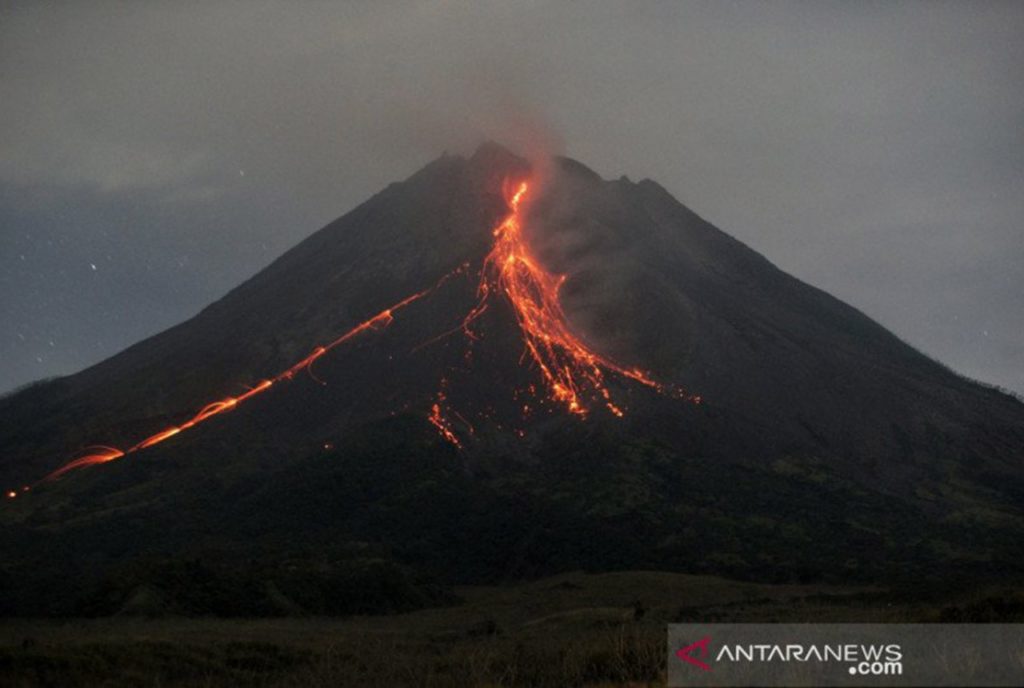
Avalanches of incandescent lava are observed with a maximum sliding distance of 2000 meters to the southwest.
Volcanic seismicity is linked to the activity of magma.
– 131 avalanche earthquakes
– 7 earthquakes of emissions
– 57 hybrid / multi-phase earthquakes
-15 shallow volcanic earthquakes.
Mount Merapi released 14 glowing lava avalanches with a maximum slide distance of 2 kilometers on Friday (7/1).
The head of the Geological Disaster Technology Research and Development Center (BPPTKG) Yogyakarta Hanik Humaida said the glowing lava avalanches were descending towards the southwest.
Volcanic activity was recorded in the observation period from 00:00 to 06:00 WIB.
During this period, there were also 39 earthquakes ranging in magnitude from 4 to 32 mm, lasting from 39.5 to 142.2 seconds.
Source : Magma Indonésie , jogja.genpi.co .
Photo : ANTARA/Andreas Fitri Atmoko/wsj
Italy , Stromboli :
WEEKLY NEWSLETTER from December 27, 2021 to January 03, 2022 (issue date January 04, 2022)
SUMMARY OF ACTIVITY STATUS
In view of the monitoring data, it is highlighted:
1) VOLCANOLOGICAL OBSERVATIONS: Explosive volcanic activity of Strombolian type coupled with splashing activity, with a total frequency of explosions at a low level and an intensity between low and medium in the areas of the North and Center-South crater
2) SEISMOLOGY: The seismological parameters monitored do not show significant variations.
3) SOIL DEFORMATION: The island’s soil deformation monitoring networks did not show any significant changes to report for the period under review
4) GEOCHEMISTRY: SO2 flux at an average level
CO2 fluxes from soils in the summit area at high values.
C / S ratio in the plume on average values.
There is no update on the isotope ratio of Helium in the wells (latest data from 12/14/2021 on high values).
5) SATELLITE OBSERVATIONS: The thermal activity observed by satellite was at a low level.
VOLCANOLOGICAL OBSERVATIONS
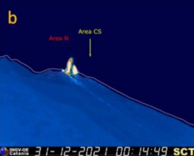
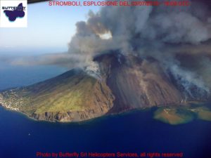
During the observation period, the eruptive activity of Stromboli was characterized by the analysis of the images recorded by the surveillance cameras of the INGV-OE (190 m altitude, Punta Corvi, 400 m altitude and Pizzo). Due to weather conditions, the observation was discontinuous (equal to 70% of the total time). During the period, the eruptive activity was mainly produced by 5 eruptive vents located in the area of the North crater and 2 located in the area of the Center-South crater; all the eruptive vents are located inside the depression which occupies the terrace of the crater.
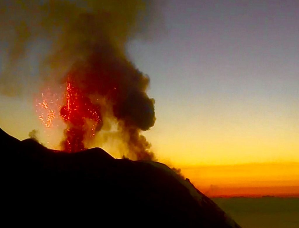
The area of the North crater produced an explosive activity of low frequency (fig 3.3) and of varying intensity from low to medium, emitting mainly coarse matter (lapilli and bombs) mixed with a portion of fine ash with products up to ~ 130 m high on the crater terrace. During the period, the projection activity localized mainly to N2 with variable intensity and episodically producing modest rheomorphic deposits in the upper part of the Sciara del Fuoco continued (eg 1 and 2 January 2022, Fig 3.2 c ).
Regarding the Center-South crater area, the explosive activity was placed on a low frequency level with low to medium intensity with products emitted up to ~ 120 meters on the crater terrace. In detail, the activity was mainly produced by the S2 vent with mainly fine (ash) and secondarily coarse (lapilli / bombs) materials; mouth S1 and sector C showed rare explosive activity coupled with degassing and blowing activity.
Source : INGV.
Photos : Webcam , INGV.
Chile , Nevados de Chillan :
Special Report on Volcanic Activity (REAV), Ñuble Region, Nevados de Chillán Volcanic Complex, January 5, 2022, 09:39 local time (Continental Chile)
The National Service of Geology and Mines of Chile (Sernageomin) publishes the following PRELIMINARY information, obtained thanks to the monitoring equipment of the National Volcanic Monitoring Network (RNVV), processed and analyzed in the Volcanological Observatory of the Southern Andes (Ovdas) :
On Wednesday January 5, at 09:28 local time (12:28 UTC), the monitoring stations installed near the volcanic complex of Nevados de Chillán recorded an earthquake associated with the fracturing of the rock (volcano-tectonic type).
VOLCANIC MONITORING
The Sernageomin monitoring stations installed near the Nevados De Chillan recorded an explosion with a column height of 2,200m on Thursday January 6 at 7.44 p.m.
The characteristics of the earthquake after its analysis are as follows:
ORIGINAL TIME: 09:28 local time (12:28 UTC)
LATITUDE: 36.837 ° S
LENGTH: 71.335 ° W
DEPTH: 3.6 km
LOCAL MAGNITUDE: 3.0 (ML)
OBSERVATIONS:
Since January 3, an increase in the VT (volcano-tectonic) type activity of the northeast (NE) source has been observed. The other evaluation parameters are kept low.
The volcanic technical alert remains at the yellow level.
Source : Sernageomin.

