November 15 , 2021.
Colombia , Nevado del Ruiz :
About the activity presented by the Nevado del Ruiz volcano.
In recent days, the surface activity of the Nevado del Ruiz (VNR) volcano has been notorious, mainly due to the fall of ash and the increase in the height and density of the gas column.
This last period of instability, which has lasted for more than eleven years, was characterized by variable fumarolic activity. There are ash emissions observed thanks to the cameras installed in the area of the Nevado del Ruiz Volcano. The column of gas and ash presented a gray color and reached a maximum height of 2000 m with a northeast direction of dispersion.

On November 9, 10 and 11, 2021, officials of the Colombian Geological Service working at their headquarters of the Volcanological and Seismological Observatory of Manizales moved to the Nevado del Ruiz volcano with the aim of carrying out preventive maintenance and repair of emergency of some of the volcanic monitoring stations affected by the recent ash emissions.
The ashes deposited on the stations cause certain mechanical components of the monitoring equipment to no longer work, but above all prevent the solar panels of the stations from providing the energy necessary for the stations to be operational.
Product of the work carried out, telemetry communication has been reestablished with 6 volcanic monitoring stations that provide real-time data on seismicity, soil deformation and gas emissions from the Nevado del Ruiz volcano.
The Colombian Geological Service is following the evolution of the volcanic phenomenon and will continue to inform in due time about the changes that could occur.
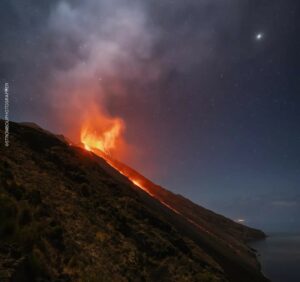
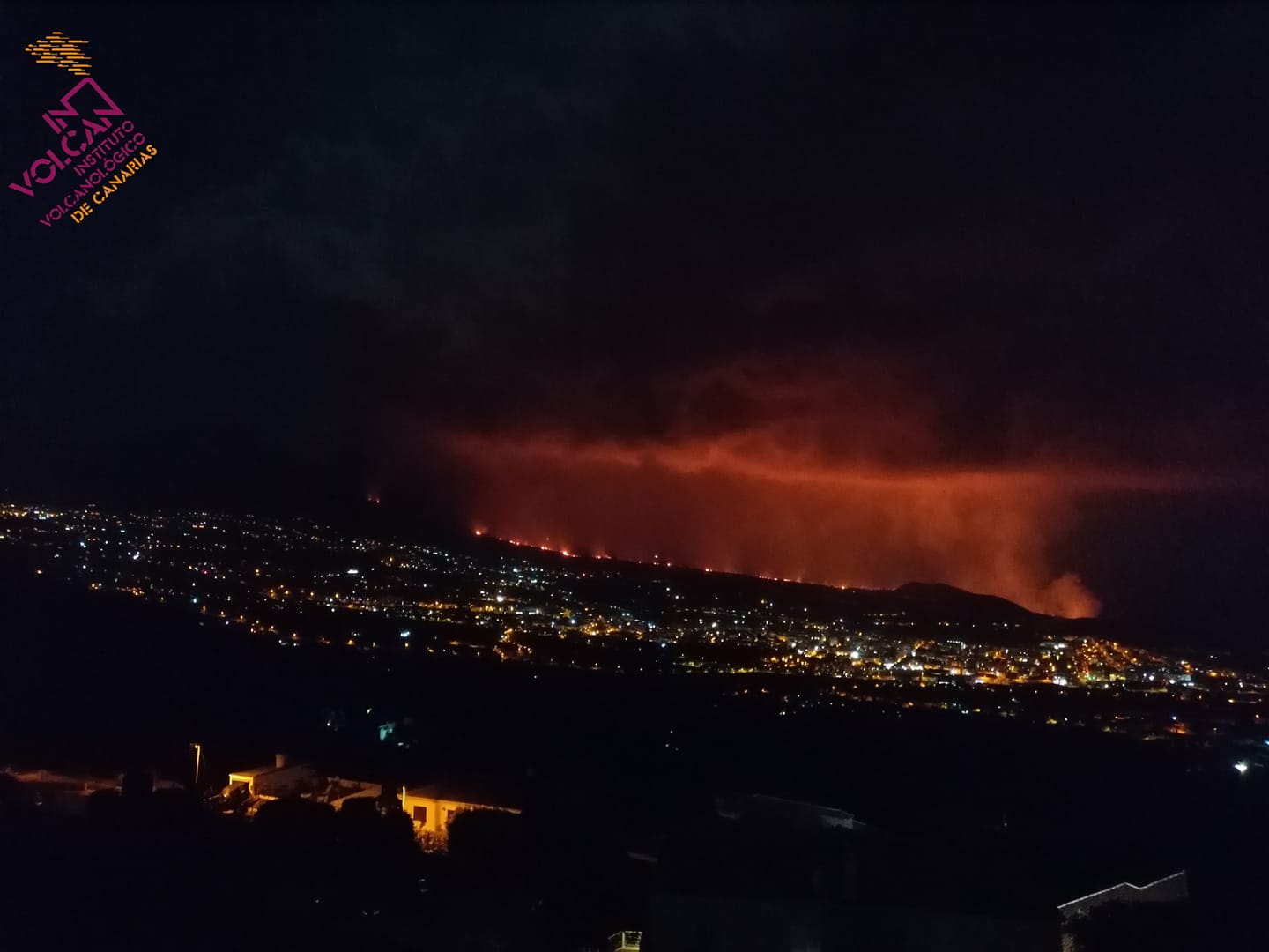
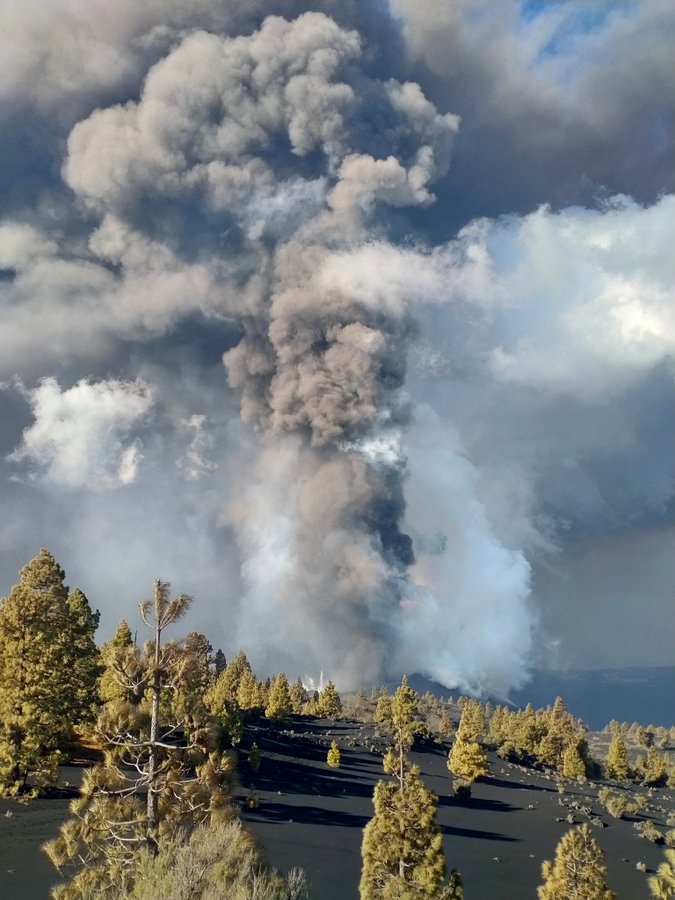
Spain / La Palma , Cumbre Vieja :
November 14, 2021, 10:00 UTC. Eruptive activity continues on La Palma.
Since the last declaration, 34 earthquakes have been located in the area affected by the volcanic reactivation of Cumbre Vieja, most of which have been located at depths greater than 30 km. Only two of the earthquakes were felt by the population during this period.
The largest earthquake was recorded at 5:24 am (UTC) today with a magnitude of 4.7 mbLg and reached a maximum intensity of IV (EMS98) in the epicentral zone.
The tremor signal has suffered a slight decrease in recent hours compared to previous days.
The island’s network of permanent GNSS stations continues to show that after reversing the elevation on days 4 and 5 in station LP03, which is closest to the eruptive centers, it remains at a lower level than previously established . On the other hand, the station continues to record deformations towards the South.
In the rest of the stations, the slight deflation possibly linked to the deep seismicity has moderated.
Based on the calibrated image, a column height of 3,100 m is estimated at 08:45 UTC. The height of the cone is measured by obtaining a value of 1130 m at sea level.
Decreasing levels of sulfur dioxide emanating from the volcano of La Palma and earthquakes at intermediate depth suggest that the volcanic system has less and less energy, according to scientists analyzing the eruption that started in Cumbre Vieja ( La Palma) on September 19. Indeed, sulfur dioxide emissions associated with the volcanic plume fluctuated yesterday Saturday between 2,000 and 4,000 tonnes, far from the more than 50,000 tonnes recorded on September 23, although the scientific spokesperson for the Volcanic Emergency Plan of the Canary Islands (Pevolca), María José Blanco, recalled this Sunday during a press conference that they were still at high values. « It gives the impression that the system has less and less energy and that the levels of intermediate seismicity, tremors, deformation and sulfur dioxide show a stable or declining trend, but we have to wait for that to happen. maintain over time, ”said the science spokesperson. In turn, the technical director of Pevolca, Miguel Ángel Morcuende, clarified that lava continues to flow into the lava delta, which is « very good news » because it does not cause spills and, therefore , does not occupy new territories with what would “do more damage”.
Pevolca officials also praised the lack of surface seismicity, since the earthquakes remain at great depth and in fact the largest magnitude recorded this Sunday, of magnitude 4.7, was located 37 kilometers away and was felt at intensity IV. This deep seismicity is the one that is maintained, and the intermediate one, that is to say between 10 and 15 kilometers, shows a downward trend. As for the diffuse emission of carbon dioxide associated with the Cumbre Vieja ridge, it was yesterday between 1,800 and 2,000 tonnes.
Sources : IGN es , El Pais .
Photos : Involcan , Instituto Geológico y Minero de España .
Iceland , Hekla :
Strong aftershocks in the mountains of Vatnafjöll (south of the Hekla volcano).
This November 13, 2021 at 11:23 UTC, an earthquake with a magnitude of Mw3.4 occurred under the mountain Vatnafjöll south of the volcano Hekla. It looks like a aftershock of the main Mw5.2 magnitude earthquake that occurred on November 11, 2021.

Green star atop an earthquake swarm south of Hekla volcano, showing the strongest earthquake in the current swarm below Vatnafjöll mountain
The copyright of this image is owned by Icelandic Met Office.
This seismic activity may continue for weeks and a stronger earthquake cannot be ruled out.
On November 11 at 1:21 p.m., an M5.2 earthquake occurred in Vatnafjöll in southern Iceland, about 7.5 km south of the Hekla volcano. The earthquake was felt widely across southern Iceland and the capital region. Aftershocks are still recorded in the area on the night of November 13 at 11:23 p.m. with an earthquake of M3.4.
Sources : icelandgeology.net , Vedur is.
Photo : Icelandic Met Office.
Chile , Chaitén :
– 19 earthquakes classified as volcano-tectonic (VT) were recorded, associated with the fracturing of rigid materials; the largest earthquake had a local magnitude (ML) of 1.9 and was located 2.0 km northwest of the center of the dome complex with a depth of 2.1 km.
– Likewise, 1 hybrid type earthquake (HB) was recorded, linked to a compound mechanism (fracturing process of the rigid material and fluid dynamics inside the volcanic building). The earthquake (REAV Región de Los Lagos, October 27, 2021, 6:45 p.m. (local time) had a local magnitude (ML) of 2.0 and a Reduced Displacement equal to 666 cm2; it was located 0.6 km away. West-southwest of the center of the complex of domes with a depth of 2.2 km.
– In addition, 1 earthquake classified as a Long Period (LP) type was recorded, generally linked to the dynamics of the fluids inside the volcanic building and / or to events associated with the glacial dynamics; the earthquake had a size estimated from the reduced displacement parameter (DR), equal to 1.1 cm2.

– The images provided by the fixed cameras installed around the volcano showed episodes of whitish degassing with heights less than 500 meters above the point of emission.
– No anomalies were reported in sulfur dioxide (SO2) emissions into the atmosphere in the area near the volcano, according to data published by the Tropospheric Monitoring Instrument (TROPOMI) and the Ozone Monitoring Instrument (OMI) Sulfur Dioxide Group.
– During the period, 1 thermal alert was recorded in the area associated with the volcanic building, with a very low power <1MW on October 8, according to data processed by Middle Infrared Observation of Volcanic Activity MIROVA.
The occurrence of a hybrid type earthquake of moderate to high energy during the month stands out, however, the rest of the monitoring parameters do not show any changes in the internal behavior of the volcano, suggesting a stability of the volcanic system.
The alert is maintained at the level:
GREEN TECHNICAL ALERT: Active volcano with stable behavior – No immediate risk.
Source : Sernageomin.
Photo : Christian Brown.
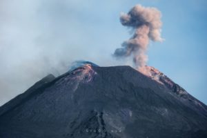
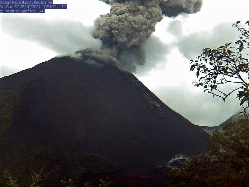
Ecuador , Reventador :
DAILY REPORT OF THE STATE OF THE REVENTADOR VOLCANO, Sunday November 14, 2021.
Information Geophysical Institute – EPN.
Surface activity level: High, Surface trend: No change.
Internal activity level: Moderate, Internal trend: No change.
Seismicity: From November 13, 2021, 11: 00h to November 14, 2021, 11: 00h:
Explosion (EXP) 68
Long Periods (LP) 53
Emission tremor (TREMI) 3
Harmonic Tremor (TRARM) 5.
Rains / Lahars:
Light rains were recorded in the area yesterday afternoon which did not generate lahars.
Emission column / ash:
Over the past 24 hours, several ash emissions have been observed, with directions oscillating between South and West and heights up to 1000 meters above crater level. The Washington VAAC reported 5 ash emission alerts with directions between South and West and elevations up to 988 meters above crater level.
Other monitoring parameters:
MIROVA has recorded 1 moderate thermal alert in the last 24 hours.
Observation:
During the night, an incandescence was observed at the level of the crater.
Alert level: Orange.
Source : IG-EPN.
Photo : IG-EPN. ( archive) .