October 29 , 2021.
Spain / La Palma , Cumbre Vieja :
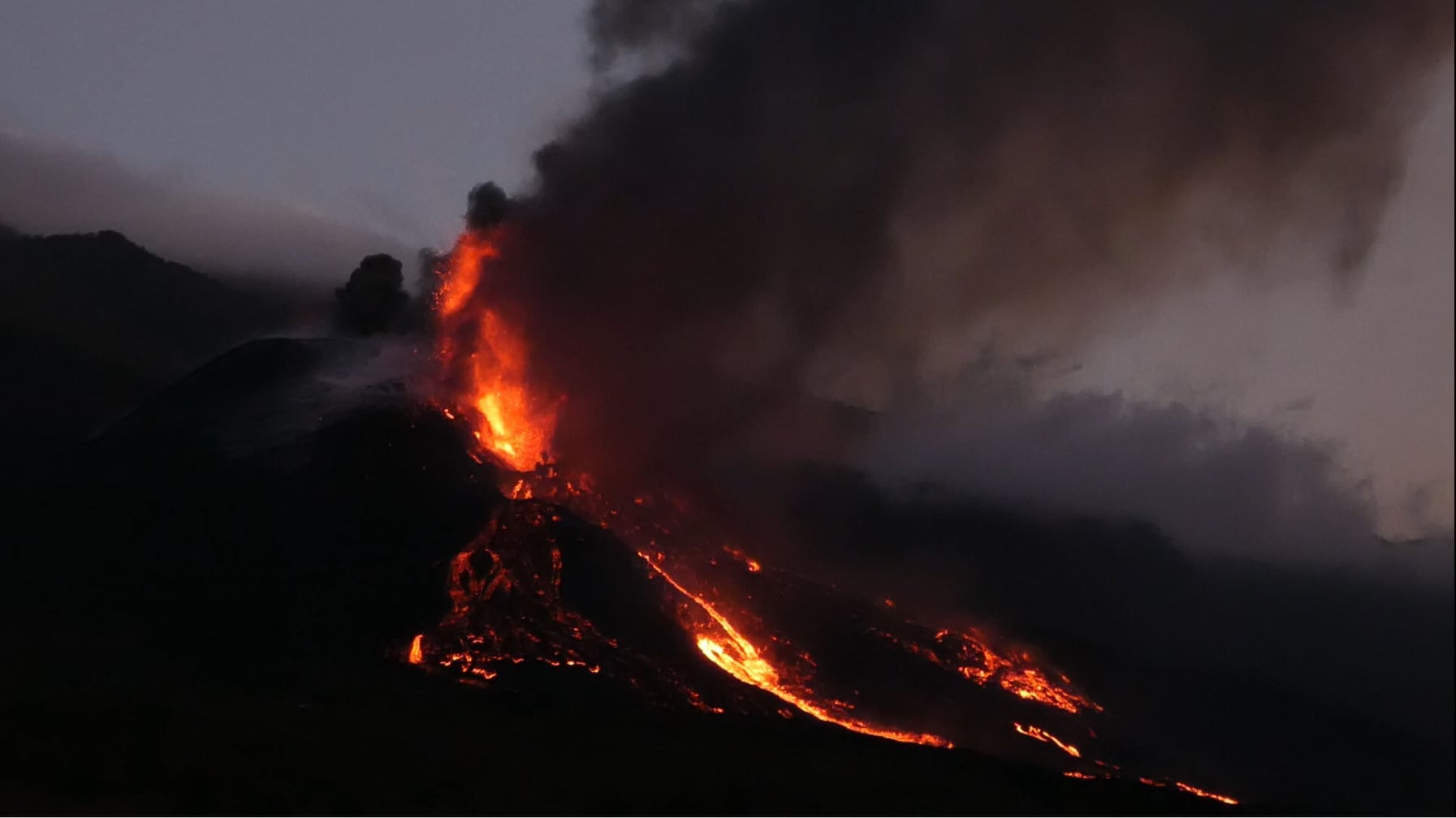
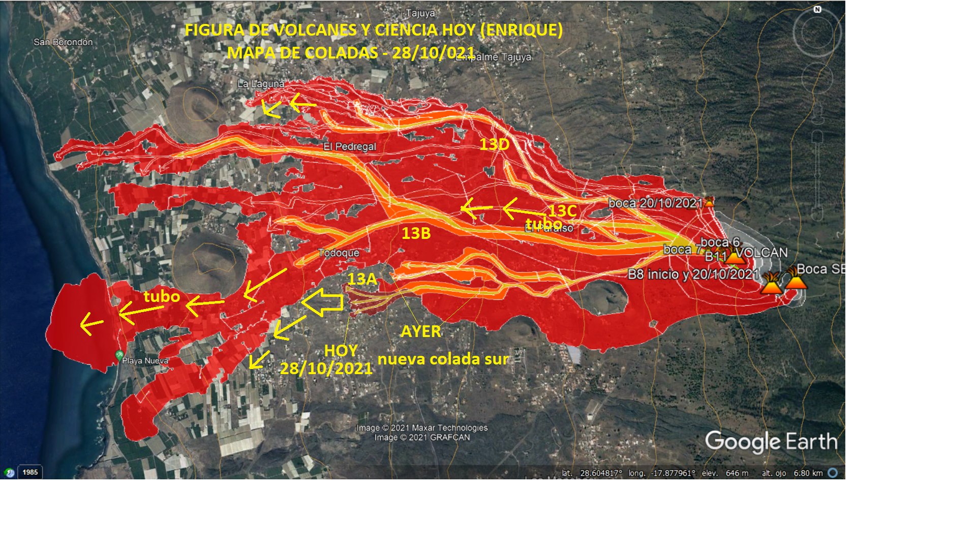
October 28, 2021, 11:00 UTC. Eruptive activity continues on La Palma.
Since the last declaration, 177 earthquakes have been located in the area affected by the volcanic reactivation of Cumbre Vieja, 25 of these earthquakes were felt by the population, having reached maximum intensity in the epicentral zone IV (EMS98 ) for 9 earthquakes.
The biggest earthquake is the one located at 2:21 p.m. on the 27th, with a magnitude of 4.8 mbLg and a depth of 37 km, which was felt with a maximum intensity of IV on the island of La Palma.
Nine earthquakes were located at depths of about 30 km, the rest of the hypocenters of the period are located at a shallower depth of about 12 km.
The amplitude of the volcanic tremor signal was maintained at high average levels, without intensifying pulses.
The island’s network of permanent GNSS stations shows that the elevation recorded on the 25th at station LP03, which is closest to the eruptive centers, has reversed. However, the southern deformation recorded by the station was only partially recovered. At the most remote stations, a slight deflation is maintained, possibly related to deep seismicity.
In view of the calibrated image, we estimate: Height of the emission column: 2600 m altitude, UTC time: 7.45 a.m.
The technical director of the Canary Islands Volcanic Emergency Plan (Pevolca), Miguel Ángel Morcuende, reported on Thursday that lava had covered 20.48 hectares in the past 24 hours, reaching a total of 905.46 hectares.
· A significant influx of lava is recorded in flows 1, 7 and 3. The latter moves at a speed of 20 meters per hour at certain times. It is located in an area that goes down to Puerto Naos, but its speed has been significantly reduced in recent hours. After razing new buildings, it stopped 20 meters from the road to Aniceto and may affect the track that is used to reach Puerto Naos.
· 558 people are staying in hotels, 4 more than yesterday, and 44 dependents are being cared for in social health centers.
· Regarding seismicity, there are no relevant changes from the last few days. The locations continue at medium and high depth. 9 earthquakes greater than magnitude 4 were recorded throughout the day.
· The lower flows are separated by 2,900 meters.
· The distance to the sea of the column advancing towards the coast is 86 meters.
· 1,293 buildings were destroyed by lava, two more than in the last report, according to cadastral data. 1,039 were for residential use, 136 for agricultural use, 64 for industrial use, 29 for recreation and hospitality, 11 for public use and 14 for other uses.
The strong lava flow has not caused excessively large advances in recent hours, allowing the flows to gain height, which reaches 40 meters, according to sources from the scientific committee of the Canary Islands Volcanic Emergency Plan ( Pevolca). Scientists from the Canary Islands Volcanological Institute (Involcan) explain that the total lava height may be higher in various areas where magma has filled hollows.
Source : IGN es , El Pais .
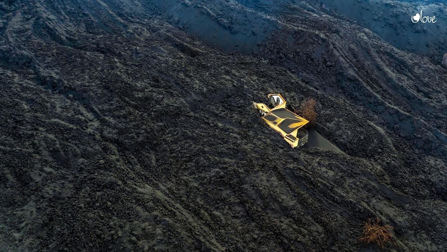
Photos : Micha Fürer. I love the world .
Carte : Volcanes y Ciencia Hoy.
Italy , Vulcano :
WEEKLY NEWSLETTER, from October 18, 2021 to October 24, 2021 (issue date October 26, 2021)
SUMMARY STATEMENT OF ACTIVITY
In view of the monitoring data, it is highlighted:
1) Temperature of the fumaroles of the crater: The temperatures recorded on the F5AT site are stable, while they increase slightly on the internal side (FA site).
2) CO2 fluxes in the crater area: CO2 fluxes in the crater area remain at very high levels
3) SO2 flow in the crater area: SO2 flow occurs at a high level of degassing
4) Geochemistry of fumarolic gases: The last sample was taken on October 12. The next campaign is scheduled for mid-November.
5) CO2 fluxes at the base of the La Fossa cone and in the Vulcano Porto area: The CO2 fluxes show a modest decrease in the sites of Rimessa and C. Sicilia, while in the site of Faraglione, there is a moderate growth in values.

6) Geochemistry of thermal aquifers: The temperature and conductivity values are dropping in the Camping Sicilia well; in the Bambara well the level values decrease, while the conductivity continues to increase.
7) Local seismicity: Levels of activity varying from high (maximum value reached on the 19th) to very low (in the rest of the week), both for VLP type events and for shaking of higher frequency. high.
8) Regional seismicity: Weak fracturing seismicity with Ml> = 1. A single event of local magnitude 2.6 was recorded.
9) Deformations – GNSS: The GNSS data show that after the strong variations recorded between mid-September and mid-October, there were no significant deformations during the last week.
10) Deformations – Inclinometry: The inclinometric network shows that after the variations recorded between September 13 and October 10, there are no significant variations.
11) Other observations: Gravimetry: Slight variations in amplitude (2-3 microGal) in fewer numbers than the previous week.
CO2 FLOWS IN THE CRATER ZONE
The CO2 fluxes recorded in the crater area on the VCS site remain high, with values above 20,000 g / m2 / day, on an order of magnitude higher than the averages recorded over the past 10 years.

Automatic recording of the diffuse flow of CO2 from the soil in the site located to the east of the fumarolic zone (VCS site).
SO2 FLOW INTO THE CRATER ZONE
The total SO2 flux emitted by the Vulcano fumarolic field measured by the FLAME-DOAS network of scanners, since mid-September has indicated values at a high level of ~ 80 t / d with intraday data up to ~ 140 t / d, higher than the degassing of typical Vulcanian SO2 streams (20-30 t / d). Data recorded last week is stable at a high level; From the beginning of October, the flow shows a moderate but gradual upward trend.
Source , photo et graphique : INGV.
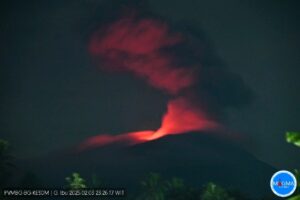
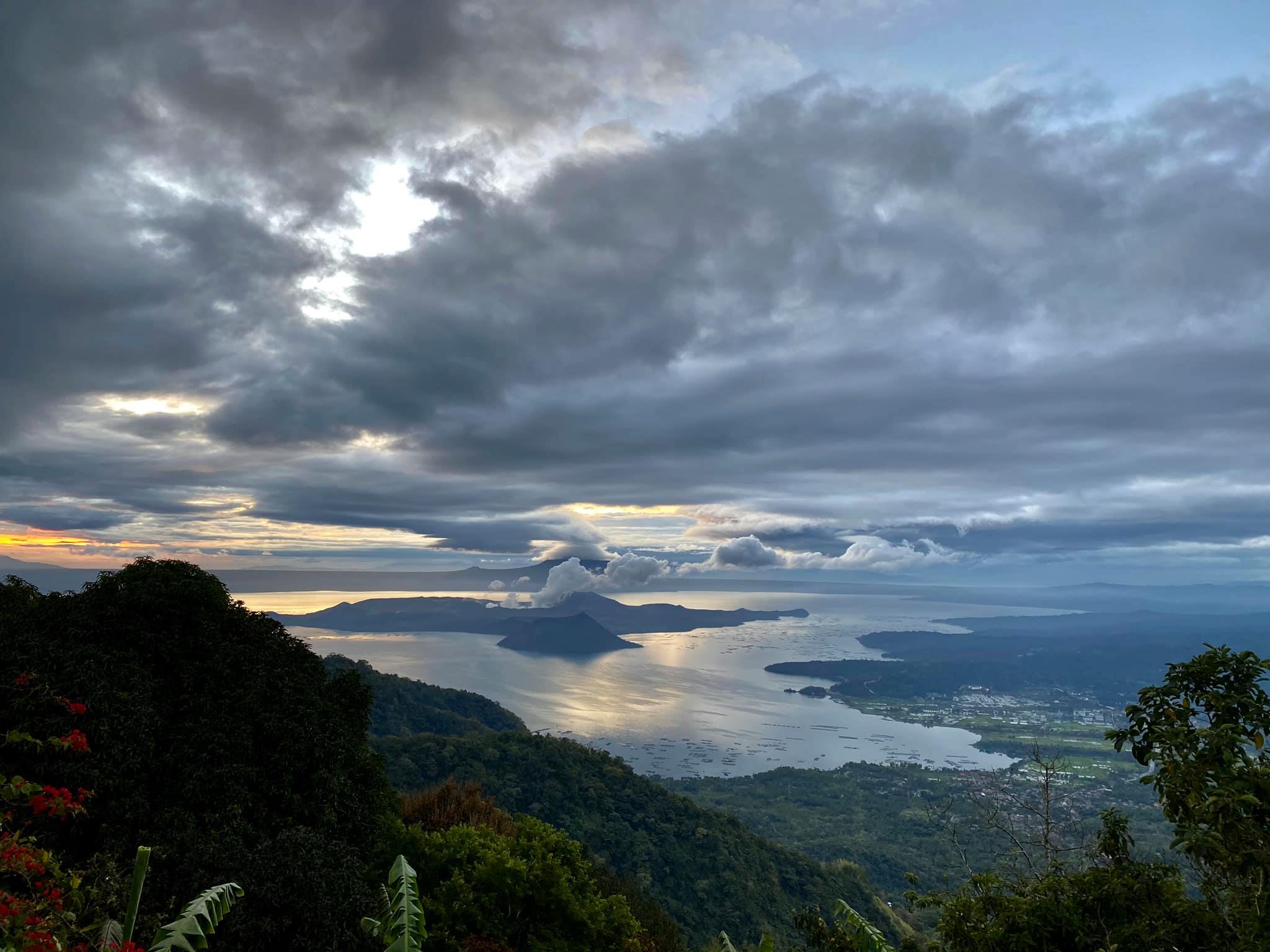
Philippines , Taal :
TAAL VOLCANO BULLETIN 29 October 2021 8:00 AM
In the past 24-hour period, the Taal Volcano Network recorded eighty-five (85) volcanic earthquakes, including thirty-seven (37) volcanic tremor events having durations of one (1) to two (2) minutes, forty-eight (48) low-frequency volcanic earthquakes, and low-level background tremor that has persisted since 7 July 2021. Activity at the Main Crater was dominated by upwelling of hot volcanic fluids in its lake which generated plumes 1,200 meters tall that drifted southwest.
Sulfur dioxide (SO2) emission averaged 8,833 tonnes/day on 28 October 2021. Based on ground deformation parameters from electronic tilt, continuous GPS and InSAR monitoring, Taal Volcano Island has begun inflating in August 2021 while the Taal region continues to undergo very slow extension since 2020.
Alert Level 2 (Increased Unrest) prevails over Taal Volcano. DOST-PHIVOLCS reminds the public that at Alert Level 2, sudden steam- or gas-driven explosions, volcanic earthquakes, minor ashfall, and lethal accumulations or expulsions of volcanic gas can occur and threaten areas within and around TVI.
Source : Phivolcs.
Photo : Raffy Tima .
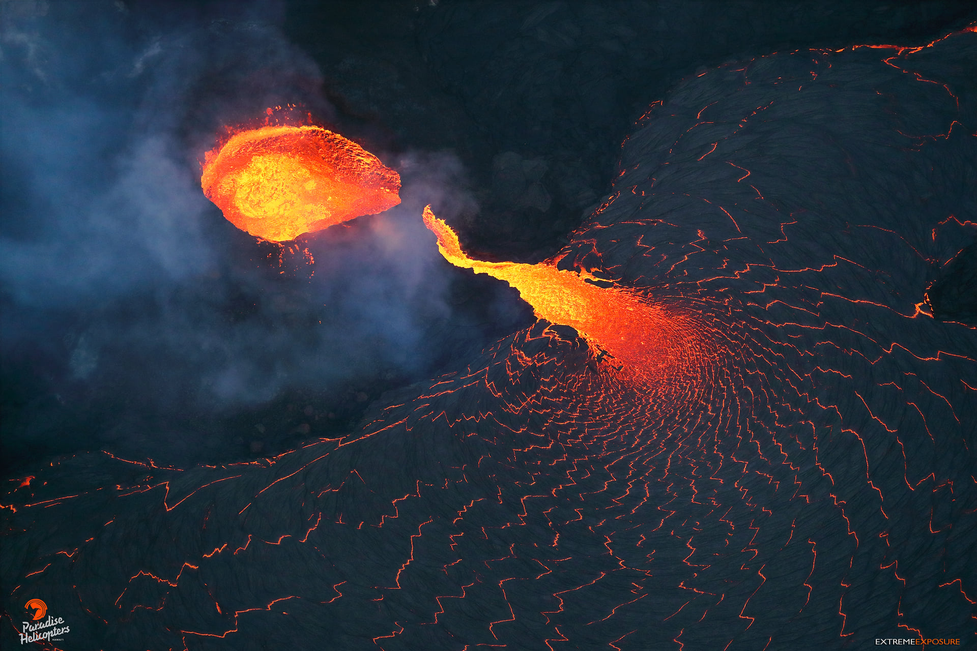
Hawaii , Kilauea :
19°25’16 » N 155°17’13 » W,
Summit Elevation 4091 ft (1247 m)
Current Volcano Alert Level: WATCH
Current Aviation Color Code: ORANGE
Activity Summary:
Kīlauea volcano is erupting. As of this afternoon, October 27, 2021, lava continues to erupt from a single vent in the western wall of Halemaʻumaʻu crater. All lava activity is confined within Halemaʻumaʻu crater in Hawai‘i Volcanoes National Park. Seismic activity and volcanic gas emission rates remain elevated.
Summit Observations:
Sulfur dioxide (SO2) emission rates remain high, with a preliminary emission rate for October 25, 2021, of at least 2,600 tonnes per day. No significant changes seen in summit tilt or GPS observations. Earthquake activity remains below background and volcanic tremor remains elevated since the beginning of the eruption.
This morning we noticed that an arch has formed over the cone’s discharge channel, adding some interesting formation to the ever-changing caldera.
Halemaʻumaʻu Lava Lake Observations:
Lava continues to erupt from a single vent in the western wall of Halemaʻumaʻu crater. The western end of the lake showed a maximum elevation of approximately 794 meters (2605 ft) above sea level by HVO’s permanent laser rangefinder on October 27, 2021, which is 1 m (3 ft) higher than yesterday, and a total increase of about 50 meters (164 ft) since lava emerged on September 29. The total erupted volume since the beginning of the eruption was estimated to be about 19.9 million cubic meters (5.3 billion gallons) on October 15. Fountain heights at the western vent were typically less than 10 m (33 ft) high as observed by field crews on October 27, 2021. The lava lake is not level across its surface due to the location of the vent in the western end. There is about 8 meters (26 feet) elevation difference between the active west and stagnant east part of the lake as measured by field crews on October 25, 2021.
Source : HVO
Photo : Bruce Omori / Paradise Helicopters
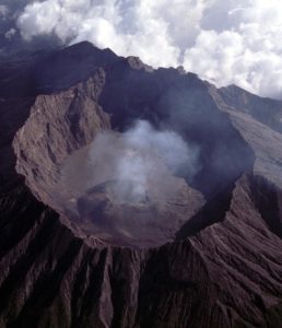
Chile , Chaitén :
Special Report on Volcanic Activity (REAV), Los Lagos area, Chaitén volcano, October 27, 2021, 6:45 p.m. local time (Continental Chile).
The National Service of Geology and Mines of Chile (Sernageomin) publishes the following PRELIMINARY information, obtained thanks to the monitoring equipment of the National Volcanic Monitoring Network (RNVV), processed and analyzed at the Volcanological Observatory of the Southern Andes ( Ovdas):
On Wednesday October 27, 2021, at 5:19 p.m. local time (20:19 UTC), the monitoring stations installed near the Chaitén volcano recorded an earthquake associated with the fracturing of rocks as well as with fluid dynamics (hybrid type) in the system. volcanic.

The characteristics of earthquakes after their analysis are as follows:
TIME OF ORIGIN: 17:19 local time (20:19 UTC)
LATITUDE: 42.843 ° S
LONGITUDE: 72.656 ° W
DEPTH: 1.6 km
REDUCED DISPLACEMENT: 666 (cm2)
LOCAL MAGNITUDE (Ml): 2,0
The characteristics of the surface activity are as follows:
MAXIMUM COLUMN HEIGHT: No columns recorded
OBSERVATIONS:
From the available images, no changes in activity were recorded. Seismic activity is maintained at baseline levels.
The volcanic technical alert remains at Green level.
Source : Sernageomin.
Photo : Christian Brown.