December 17 , 2020.
Kamchatka , Sheveluch :
56.64 N, 161.32 E;
Elevation 10768 ft (3283 m), the dome elevation ~8200 ft (2500 m)
Aviation Colour Code is ORANGE
The extrusive eruption of the volcano continues. Ash explosions up to 32,800-49,200 ft (10-15 km) a.s.l. could occur at any time. Ongoing activity could affect international and low-flying aircraft.
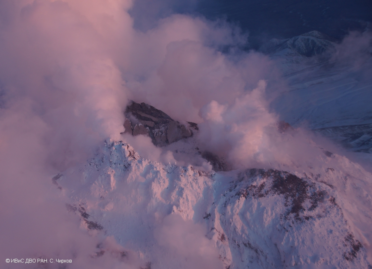
The destroyed lava block Dolphin in the eastern part of the lava dome of Sheveluch volcano in the rays of the setting sun.
A growth of the lava dome continues, a strong fumarolic activity, and an incandescence of the lava dome and hot avalanches accompanie this process. Satellite data showed a thermal anomaly over the lava dome all week.
KVERT reported that a thermal anomaly over Sheveluch was identified in satellite images during 4-11 December. The lava block, named “Dolphin,” which had emerged in the E part of the summit lava dome, was absent in an 8 December photo of the volcano. The Aviation Color Code remained at Orange (the second highest level on a four-color scale).
Source : Kvert , GVP.
Photo : S. Chirkov , 8/12/2020.
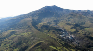
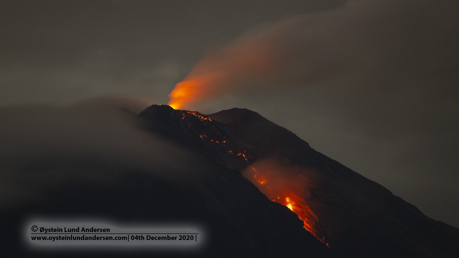
Indonesia , Semeru :
Level of activity level II (WASPADA). G. Semeru (3676 m altitude) is continuously erupting. There are explosive and effusive eruptions, causing lava flows towards the southern and southeastern slopes, as well as explosions which project incandescent rocks around the summit crater.
The volcano was clearly visible until it was covered in fog. The crater emits white smoke of moderate intensity, rising about 100 meters above the summit. The weather is sunny to cloudy, with weak to moderate winds oriented to the North, North-East, and and South.
According to the seismographs of December 16, 2020, it was recorded:
● 19 eruption / explosion earthquakes
● 14 avalanche earthquakes
● 3 earthquakes of emissions
● 9 harmonic tremors
● 1 local tectonic earthquake
● 7 distant tectonic earthquakes.
PVMBG reported that the eruption at Semeru continued during 9-15 December. Incandescent material was ejected 50-100 m above the summit on 9 December and rock avalanches descended the Kobokan drainage 500 m on the SE flank. Explosions were recorded by the seismic network during 10-12 December but they could not be visually confirmed due to weather conditions. On 13 December a pyroclastic flow originating from the end of a lava flow traveled 1.5 km down the Kembar drainage (S flank), reaching a maximum distance of 3.5 km from the crater. The next day a pyroclastic flow traveled 3.5 km down the Kobokan drainage. Rock avalanches from the end of a lava flow traveled 300-1,500 m down both drainages during 14-15 December. The Alert Level remained at 2 (on a scale of 1-4), with a general exclusion zone of 1 km and extensions to 4 km in the SSE sector.
Source : PVMBG, GVP.
Photo : Oystein Lund Andersen .
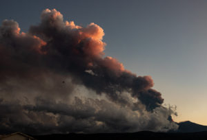
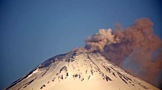
Chile , Villarica :
Special Report on Volcanic Activity (REAV), La Araucanía region, Villarrica volcano, December 16, 2020, 12:45 local time (Continental Chile).
The National Service of Geology and Mines of Chile (Sernageomin), on the basis of information obtained through the monitoring equipment of the National Volcanic Surveillance Network (RNVV), processed and analyzed at the Volcanological Observatory of the Andes of the South ( Ovdas), and in relation to the activity of the Villarrica volcano, reports the following:
On Wednesday, December 16, at 11:46 a.m. local time (2:46 p.m. UTC), the IP cameras installed near the volcano recorded two pulsatile gas emissions with contributions of particulate matter associated with a long period type earthquake, with a reduced displacement value. (DR) of 3.8cm2 for the most important column.
The data obtained are as follows:
MAXIMUM HEIGHT OF THE COLUMN: 160 m with particle emission.
DIRECTION OF DISPERSAL: North-West (NW).
MAXIMUM HEIGHT OF THE COLUMN: 280 m with emission of particles.
DIRECTION OF DISPERSAL: North-East (NE).
A higher concentration of particulate matter was observed in the second emitted pulse, with a direction of dispersion towards the North-East.
The volcanic alert remains at the Yellow level.
Source et photo : Sernageomin .
Japan , Shinmoedake :
JMA noted that no eruption had occurred at Shinmoedake (Shinmoe peak, a stratovolcano of the Kirishimayama volcano group) since 28 June 2018. Volcanic earthquakes with hypocenters just below Shinmoedake had increased around 17 November 2019, fluctuated afterwards, and then began a decreasing trend in mid-October 2020. Sulfur dioxide levels were generally low, deformation data showed no changes, and both fumarolic and geothermal area activity remained stable. The Alert Level was lowered to 1 (on a scale of 1-5) on 11 December.
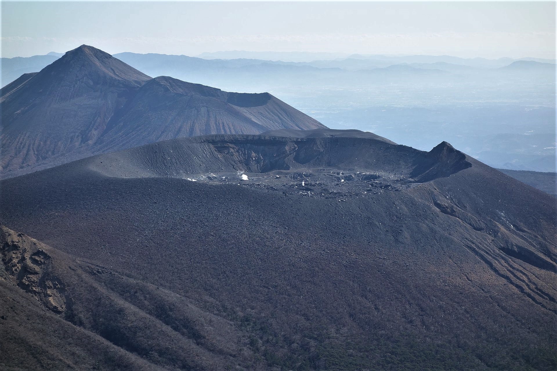
View from Mount Karakuni of Mount Shinmoe (foreground) and Takachihonomine (last plan) in January 2017; under the crater of Mount Shinmohe are visible volcanic fissures on the western flank.
Kirishimayama is a large group of more than 20 Quaternary volcanoes located north of Kagoshima Bay. The late-Pleistocene to Holocene dominantly andesitic group consists of stratovolcanoes, pyroclastic cones, maars, and underlying shield volcanoes located over an area of 20 x 30 km. The larger stratovolcanoes are scattered throughout the field, with the centrally located Karakunidake being the highest. Onamiike and Miike, the two largest maars, are located SW of Karakunidake and at its far eastern end, respectively. Holocene eruptions have been concentrated along an E-W line of vents from Miike to Ohachi, and at Shinmoedake to the NE. Frequent small-to-moderate explosive eruptions have been recorded since the 8th century.
Source: Japan Meteorological Agency (JMA) , GVP.
Photo : Wikipedia ( Motamota).
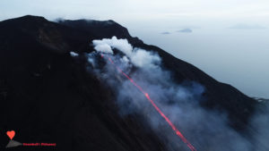
Guatemala , Pacaya :
Activity:
The Pacaya Volcano Observatory reports weak explosions that expel incandescent volcanic material to heights of up to 125 meters above the crater of the Mackenney Cone, as well as sporadically small exhalations of ash. Locomotive sounds are heard, no loud explosion or rumble is heard. The degassing is weak and produces a weak white column which rises 400 meters above the crater and moves east. The PCG and PCG5 stations recorded weak explosions and tremors due to the rise of magma and gases towards the surface. Lava flows to the southwest in the middle and to the northwest on the plateau in front of Cerro Chino remained active last night. The two areas of lava flows are likely to generate avalanches and ash plumes due to the collapse of the flows. It is not excluded that new lava flows appear on other flanks. The recommendations of the BEPAC special bulletin n ° 119-2020 remain valid.
INSIVUMEH reported that on 9 December a new lava flow emerged from a vent S of Cerro Chino, NNW of Pacaya’s summit, and traveled as far as 250 m WSW. The branched lava flow which had opened in October on the WSW flank was active, with lengths between 400 and 600 m. Avalanches of material from the new flow and the SW-flank lava flows descended 100 m. Strombolian explosions from the cone in Mackenney Crater were visible on most days during 9-15 December and ejected material as high as 150 m above the vent. Gray ash plumes were occasionally visible drifting S, SW, and W at generally low altitudes. On 12 December strong winds picked up ash deposits and created ash curtains that drifted 1.5 km away and dispersed. Lava flows on the SW flank varied in length between 500 m and 1,000 m. The NW-flank lava flow ceased effusing by 13 December.
Source : Insivumeh , GVP.