July 17 , 2020.
Indonesia , Raung :
Press release on the activities of Gunung Raung – East Java, July 16, 2020.
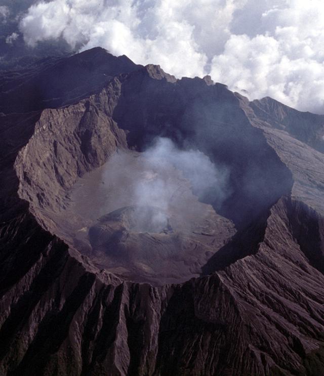
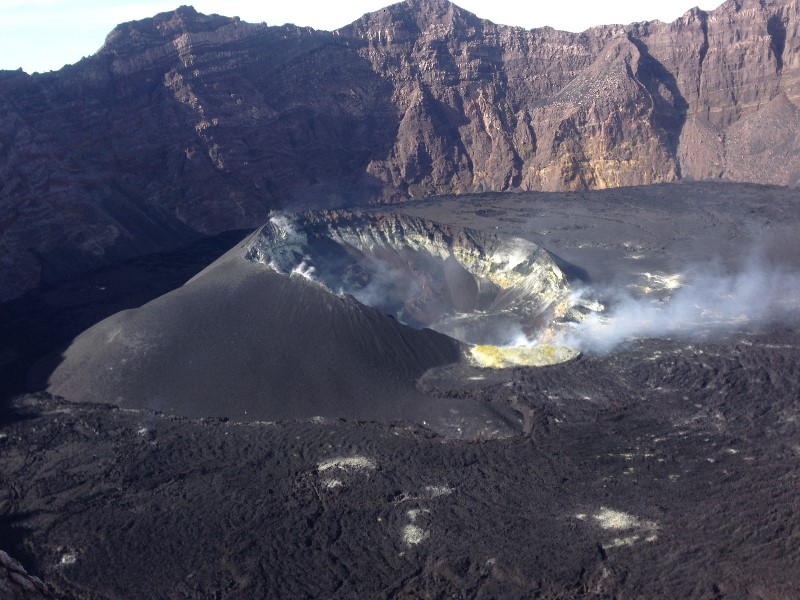
The G. Raung (other name: Rawon) is one of the active volcanoes of East Java, with a maximum height reaching 3332 meters above sea level. This volcano is a stratovolcano with a main crater in the Raung caldera and other craters, namely Tegal Alun-alun and Tegal Brungbung. The Raung caldera has an elliptical shape with a size of 1750 x 2250 m, a depth of 400 to 550 m from the edge of the mountain.
The activity level of G. Raung has been at level I (normal) since October 24, 2016.
Monitoring data:
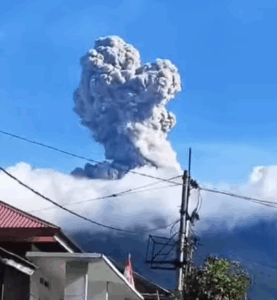
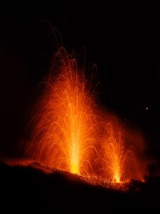
Visual: From January 1 to July 16, 2020 at. 07.52 WIB, the volcano was clearly visible until it was covered with fog. The smoke from the crater is white with a high intensity about 50 meters above the summit. On July 16, 2020 at 10:52 a.m. EDT, we observed an increase in the height of the smoke, emitted 100 m above the summit of the peak accompanied by a change in color to brownish white. At 1:56 p.m. Western Indonesia time, the color of the emission column changed, which turned white and gray, with a height of 100 m above the top of the peak.
Seismicity: The number and type of earthquakes recorded between January 1 and July 16, 2020 were dominated by the distant tectonic earthquake, local tectonics and an earthquake felt on March 19, 2020. July 13, 2020 , there was a swarm of gesture earthquakes with a total of 5 events on July 13, 2020, 10 events on July 14 and 14 events on July 15, 2020.
Analysis: The height of the gas / ash emission column and the color of the emission column began to change on July 16, 2020. The color of the emission column indicates the presence of ash brought to the surface.
The number of burst earthquakes increased slightly but was not followed by the appearance of other types of volcanic earthquakes (shallow volcanic earthquakes, deep volcanic earthquakes or tremors), so that ‘there is no indication of the existence of a supply of magma from the depths under the summit crater of G. Raung.
Potential danger: The distribution of materials from the ash emission of July 16, 2020 was concentrated around the crater / peak of Mount Raung, which is an area prone to disasters. However, the scattering of ash can be spread to more distant areas depending on the wind direction and speed.
Conclusion: The volcanic activity of G. Raung, both in terms of visual observation data and seismicity, started to show a slight increase, but there was no change in the danger potential. The level of volcanic activity of Mount Raung is still at level I (normal).
Recommendation: The communities around G. Raung and visitors / tourists must not approach the edge of the crater or descend into the crater, do not camp around the peak / crater of Raung to avoid emissions of volcanic gases harmful to the human life.
VOLCANO OBSERVATORY NOTICE FOR AVIATION – VONA .
Issued : July 16 , 2020
Volcano : Raung (263340)
Current Aviation Colour Code : ORANGE
Previous Aviation Colour Code : orange
Source : Raung Volcano Observatory
Notice Number : 2020RAU02
Volcano Location : S 08 deg 07 min 30 sec E 114 deg 02 min 31 sec
Area : East java, Indonesia
Summit Elevation : 10662 FT (3332 M)
Volcanic Activity Summary :
Eruption with volcanic ash cloud at 08h37 UTC (15h37 local)
Volcanic Cloud Height :
Best estimate of ash-cloud top is around 11302 FT (3532 M) above sea level, may be higher than what can be observed clearly. Source of height data: ground observer.
Other Volcanic Cloud Information :
Ash-cloud moving to north
Remarks :
Ash emission is continuing. Seismic activity is characterized by Emission quake
Source : PVMBG. Magma Indonesie.
Photos : Auteur inconnu , GVP , Wikimapia .
Philippines , Mayon :
MAYON VOLCANO BULLETIN: 17 July 2020 09:30 A.M.
This serves as a notice for the lowering of the alert status of Mayon from Alert Level 2 (moderate level of unrest) to Alert Level 1 (low level of unrest).
Since the lowering of alert status from Alert Level 3 to Alert Level 2 on 29 March 2018, there has been a continued decline in the monitored parameters of Mayon Volcano. This is supported by the following observations;
1. Volcanic Earthquake Activity:
For the past six months, seismic activity has declined to a daily average of one (1) volcanic earthquake typically attributed to rock fracturing beneath the edifice and occasional rockfall. Rockfall events were likely initiated by intense rainfall or extreme winds over the volcano summit rather than lava extrusion. The overall low-level seismicity indicates that there is currently no active transport of eruptible magma to the shallow levels of the volcano.
2. Volcanic Gas Output:
Sulfur Dioxide emission or SO2 flux from Mayon crater based on continuous gas spectrometry has stabilized between 300-700 tonnes/day since January 2020. The latest flux was measured at 229 t/d on 30 June 2020, considerably below the baseline of 500 t/d. The relatively low levels of SO2 flux indicate that passive degassing of stalled magma beneath the edifice has been transpiring.
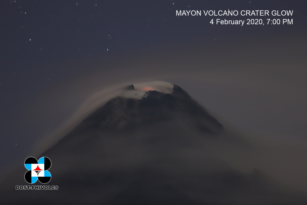
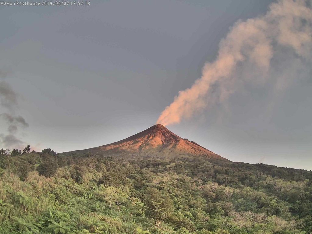
3. Visual Observation of the Summit: Steaming activity from the crater has ranged from weak to moderate. A lava-dome presently occupies the crater but has not exhibited significant changes in configuration this year. Crater glow or incandescence associated with superheated gas escaping the summit vent has been faint and only visible through the aid of a telescope. The faint crater glow and stable lava dome are consistent with the presence of remnant magma from the 2018 eruption and the absence of magma re-supply to the shallow levels of the edifice.
4. Ground Deformation:
In contrast to the above parameters, ground deformation measurements on Mayon remain anomalous. Geodetic data from continuous Global Positioning Systems (GPS) and electronic tiltmeters and campaign Electronic Distance Meter (EDM) and Precise Leveling indicate a cycle of inflation or swelling of the edifice since the beginning of 2020. Moreover, inflation is slightly more prominent on the lower to middle slopes but is slight to negligible on the upper slopes, consistent with deep-seated magma that has yet to ascend the edifice. This agrees with the above observations of stable lava dome, faint crater glow and low gas emission since the beginning of 2020, all of which signify the cessation of magmatic activity.
In view of the above, PHIVOLCS-DOST is now lowering the alert status of Mayon from Alert Level 2 to Alert Level 1. This means that the likelihood of an eruption occurring within the immediate future has diminished. However, the lowering of the alert status should not be interpreted that the volcano’s unrest has ceased, considering that eruptible magma has already accumulated beneath the edifice. In the event of a renewed increase in any one or combination of the above monitoring parameters, the alert status may step up once again to Alert Level 2. On the other hand, if there is a noticeable return to baseline levels of ground deformation and sustained low levels of other monitoring parameters, then the Alert Level may further step down. The public is still reminded to avoid entry into the 6-km Permanent Danger Zone or PDZ due to perennial hazards of rockfall, avalanche, ash puff and sudden steam-driven or phreatic eruption at the summit area. Furthermore, people living in valleys and active river channels are cautioned to remain vigilant against sediment-laden streamflows and lahars in the event of prolonged and heavy rainfall brought about by the advent of the rainy season. PHIVOLCS-DOST is closely monitoring Mayon Volcano’s activity and any new development will be immediately communicated to all concerned.
Source : DOST-PHIVOLCS.
Photos : Phivolcs , volcanodiscovery
Hawaii , Mauna Loa :
Thursday, July 16, 2020, 10:04 AM HST (Thursday, July 16, 2020, 20:04 UTC)
19°28’30 » N 155°36’29 » W,
Summit Elevation 13681 ft (4170 m)
Current Volcano Alert Level: ADVISORY
Current Aviation Color Code: YELLOW
Activity Summary:
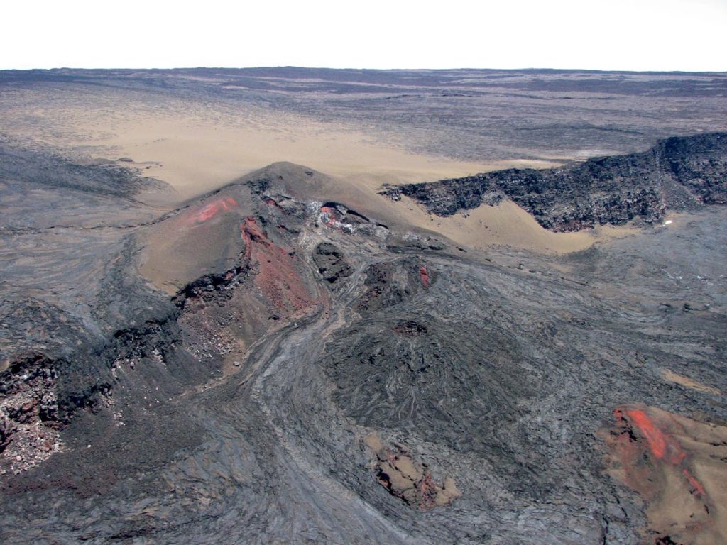
Mauna Loa Volcano is not erupting. Rates of deformation and seismicity have not changed significantly over the past week and remain above long-term background levels.
Observations:
During the past week, HVO seismometers recorded 63 small-magnitude earthquakes on the volcano. Most of these earthquakes occurred at shallow depths of less than 8 kilometers (~5 miles) below sea level.
Global Positioning System (GPS) measurements show long-term slowly increasing summit inflation, consistent with magma supply to the volcano’s shallow storage system.
Gas concentrations and fumarole temperatures at both the summit and the Sulphur Cone on the Southwest Rift Zone remain stable and below 2 ppm SO2 and ~98 C (206 F).
Webcams show no changes to the landscape.
Source et photo : HVO.
Nicaragua , Momotombo :
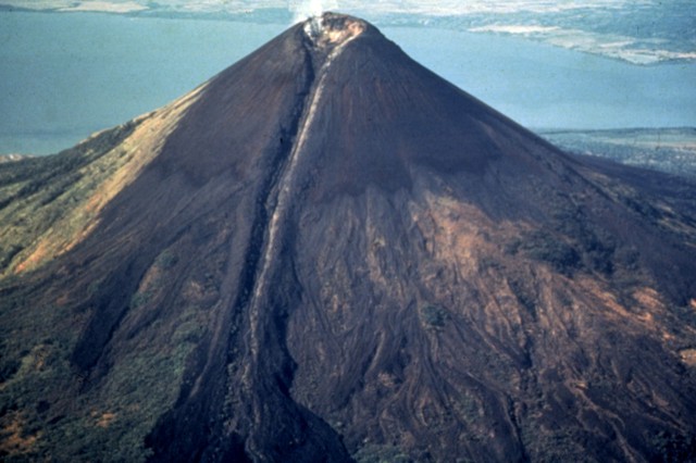
Rosario Murillo, Vice President of Nicaragua, referred on Tuesday to the seismic swarm detected on Monday July 6, which according to the Nicaraguan Institute for Territorial Studies (Ineter) was located southeast of the Momotombo volcano and which continues to » increase its activity with earthquakes that are more and more intense and less and less deep.
According to Ineter since the first movement of the seismic swarm was detected Monday at 6:57 am, 51 tremors have already been recorded. And he assured that yesterday, the greatest magnitude was 2.9 degrees and that today, in the last few hours, the same magnitude was recorded only three kilometers deep.
« The largest earthquake is 2.9 with a depth of three kilometers, nine kilometers southeast of the Momotombito volcano and occurred at 2:38 am today »; details Murillo.
Source : 100noticias.com.ni
Photo : Jaime Incer, 1991.

