May 26 , 2020.
New Zealand , Ruapehu :
Mt Ruapehu: Activity and Crater Lake temperature update
Published: Tue May 26 2020 9:00 AM
Volcanic Alert BulletinRUA – 2020/06
Volcanic Alert Level remains at 1
Aviation Colour Code remains at Green
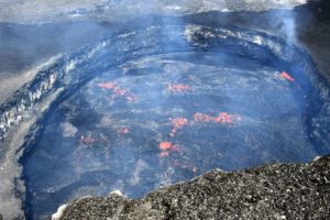
After a recent heating cycle, we anticipated that Crater Lake (Te Wai ā-moe) would begin cooling to lower temperatures seen earlier this year. The lake reached a peak temperature of 42°C in early April and cooled to around 35°C shortly after. Recent monitoring indicates continuous gas flux which has kept the temperature around 35°C through May.
Activity at Crater Lake (Te Wai ā-moe) is often dominated by a heating-cooling cycle. These cycles last weeks-to-months. After peaking in April at 42°C, the lake cooled to 35°C by early May and has remained around that temperature all month. The further slow cooling that we expected at the beginning of May has not happened.
GNS Science volcanologists have continued to monitor Mt Ruapehu, and as lockdown restrictions have allowed we have visited the lake to collect water and gas samples and make a gas flight. We detected an increase in CO2 gas (carbon dioxide) input while SO2 gas (sulphur dioxide) remains steady. This is consistent with our energy input modelling which points to a low-level, but continued flow of heat into the lake.

It further indicates that the underlying vent area is open to upflows of volcanic gases and hydrothermal fluids, and so is currently preventing the lake from cooling further. Other signs that point to an open vent status are visible upwellings and sulphur slicks on the lake surface. None of these observations are unusual for Mt Ruapehu.
The level of volcanic tremor intensity remains variable but weak, as it has been during the past month.
The Volcanic Alert Level remains at Level 1. The Volcanic Alert Level reflects the current level of volcanic activity and is not a forecast of future activity. Mt Ruapehu is an active volcano and has the potential to erupt with little or no warning when in a state of volcanic unrest. There is no change in the Aviation Colour Code from Green.
Source : Geonet / Yannik Behr / Duty Volcanologist.
Photos : Photovolcanica , Bradd Scott / Geonet.
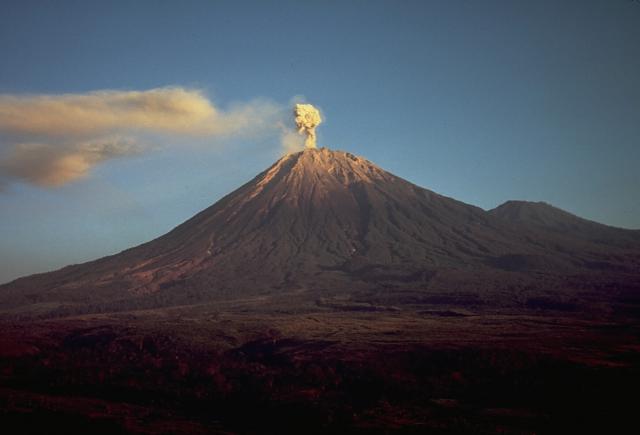
Indonesia , Semeru :
VOLCANO OBSERVATORY NOTICE FOR AVIATION – VONA.
Issued: May 25 ,2020.
Volcano: Semeru (263300)
Current Aviation Colour Code: ORANGE
Previous Aviation Colour Code: orange
Source: Semeru Volcano Observatory
Notice Number: 2020SMR50
Volcano Location: S 08 deg 06 min 29 sec E 112 deg 55 min 12 sec
Area: East java, Indonesia
Summit Elevation: 11763 FT (3676 M)
Volcanic Activity Summary:
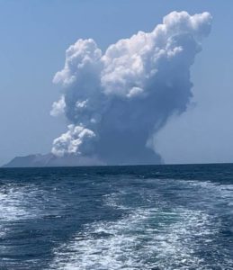
Eruption with volcanic ash cloud at 22h58 UTC (05h58 local).
Volcanic Cloud Height:
Best estimate of ash-cloud top is around 12723 FT (3976 M) above sea level, may be higher than what can be observed clearly. Source of height data: ground observer.
Other Volcanic Cloud Information:
Ash cloud moving to north
Remarks:
Seismic activity is characterized by eruption, avalanche and gas emission earthquakes
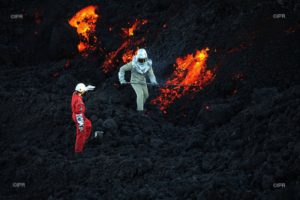
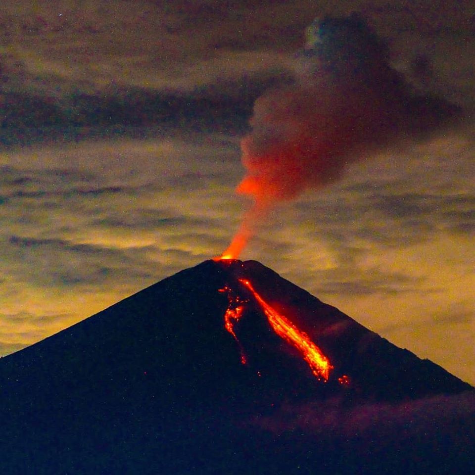
Level of activity at level II (WASPADA). The Semeru volcano (3676 m above sea level) is experiencing a continuous eruption. Explosive and effusive eruptions have been recorded, causing lava flows to the south and southeast slopes, and glowing rock emissions around the summit crater.
The volcano is clearly visible then in the fog. We don’t see any smoke from the crater. The weather was sunny, the winds light towards the North, the North-East, the East, the South and the West. An eruption was observed, with thick white smoke, 400 m high towards the North, 1 avalanche with a sliding distance of approximately 700 m towards Besuk Kembar.
According to seismographs, on May 25, 2020, it was recorded:
44 eruption / explosion earthquakes
18 emission earthquakes
4 avalanche earthquakes.
1 harmonic tremor (amplitude 3 mm, duration 521 seconds)
Source : Magma Indonésie , PVMBG.
Photos : Thomas J. Casadevall, USGS , @visit.pronojiwo .
Peru , Sabancaya :
Analysis period: May 18 to 24, 2020 Arequipa, May 25, 2020
Alert level: ORANGE
The Peruvian Geophysical Institute (IGP) reports that the eruptive activity of the Sabancaya volcano remains at moderate levels; that is to say with the continuous recording of explosions with columns reaching 3 km high above the summit of the volcano and consequent emissions of ash and gas. Consequently, for the following days, no significant change is expected regarding the activity.

During the period from May 18 to 24, the IGP recorded and analyzed the occurrence of approximately 525 earthquakes of volcanic origin, associated with the circulation of fluids (magma, gas, etc.) at the interior of the volcano. In addition, on average 6 explosions of low to medium intensity were recorded daily. The monitoring of the deformation of the volcanic structure, using GNSS data (processed with fast orbits), does not present any significant anomalies. Visual surveillance identified columns of gas and ash up to 3 km high above the summit of the volcano, which were scattered towards the northeast, east and southeast sectors of the Sabancaya. Satellite surveillance identified the presence of 5 thermal anomalies with values between 2 MW and 15 MW, associated with the presence of a body of lava on the surface of the crater of the volcano.
RECOMMENDATIONS
• Keep the orange volcanic alert level.
• Do not approach within a radius of less than 12 km around the crater. In case of ash fall, cover your nose and mouth with rags or wet masks.
Keep doors and windows of houses closed.
Source : IGP Peru.
Photo : IGP.
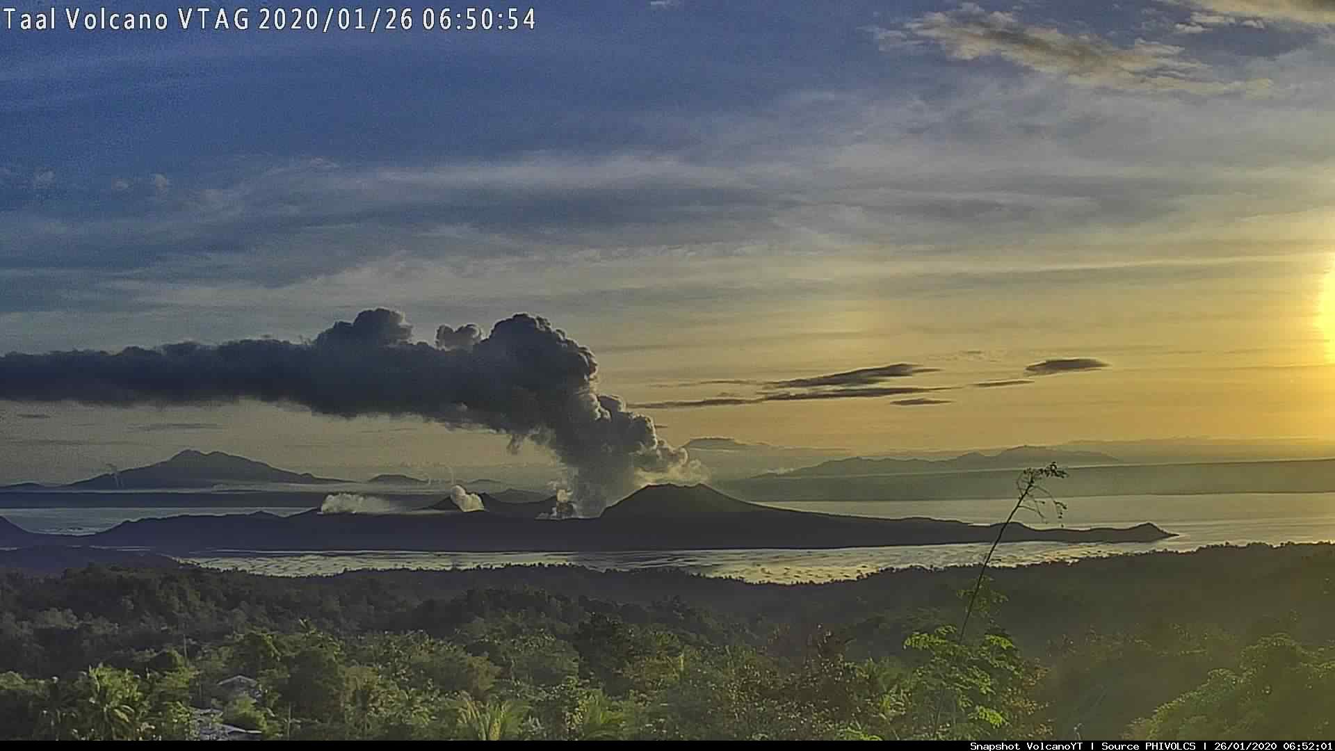
Philippines , Taal :
TAAL VOLCANO BULLETIN 25 May 2020 08:00 A.M.
In the past 24-hour period, the Taal Volcano Network recorded five (5) volcanic earthquakes that are associated mainly with rock-fracturing processes beneath and around the edifice. Weak steaming or fumarolic activity was observed from fissure vents along the Daang Kastila Trail.
Alert Level 1 (Abnormal) is maintained over Taal Volcano. DOST-PHIVOLCS reminds the public that at Alert Level 1, sudden steam-driven or phreatic explosions, volcanic earthquakes, minor ashfall and lethal accumulations or expulsions of volcanic gas can occur and threaten areas within the Taal Volcano Island (TVI). DOST-PHIVOLCS strongly recommends that entry into TVI, Taal’s Permanent Danger Zone or PDZ, especially the vicinities of the Main Crater and the Daang Kastila fissure, must remain strictly prohibited. Local government units are advised to continuously assess previously evacuated barangays around Taal Lake for damages and road accessibilities and to strengthen preparedness, contingency and communication measures in case of renewed unrest. People are also advised to observe precautions due to ground displacement across fissures, possible ashfall and minor earthquakes. Civil aviation authorities must advise pilots to avoid flying close to the volcano as airborne ash and ballistic fragments from sudden explosions and wind-remobilized ash may pose hazards to aircraft.
DOST-PHIVOLCS is closely monitoring Taal Volcano’s activity and any new significant development will be immediately communicated to all stakeholders.
Source : Phivolcs .
Photo : Webcam.