May 15 , 2020.
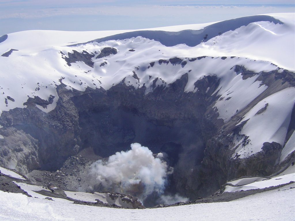
Colombia , Nevado del Ruiz :
Weekly activity bulletin of the Nevado del Ruiz volcano
The level of activity continues at the level of activity yellow or (III): changes in the behavior of volcanic activity.
Regarding the monitoring of the activity of the Nevado del Ruiz volcano, the COLOMBIAN GEOLOGICAL SERVICE reports that:
According to the results obtained from the monitoring of the activity, through the various parameters evaluated, the Nevado del Ruiz volcano continued to exhibit an instability of its behavior during the last week. An acceleration of the volcanic process and therefore changes in the level of activity of the volcano are not excluded.
The seismicity generated by the fracturing of the rocks showed a slight decrease in the number of earthquakes and the seismic energy released, compared to the previous week. This type of seismicity was mainly located in the South-East, South-South-East, North-East of the volcano and in the Arenas crater, at depths varying between 0.4 and 5.9 km. The maximum magnitude recorded during the week was 1.0 ML (local magnitude) corresponding to the earthquake recorded on May 10 at 9:15 a.m. (local time) located in the Arenas crater, 1.6 km deep.
Seismicity related to fluid dynamics inside volcanic conduits showed a slight decrease in both the number of events recorded and the seismic energy released, compared to the previous week. This seismic activity was characterized by the occurrence of continuous volcanic tremors, tremor pulses, earthquakes of the long period type and of the very long period type. These seismic events presented varying energy levels and spectral contents. Some of these signs were associated with small emissions of gas and ash, which were confirmed by cameras installed in the area of the volcano and by reports from officials of the Los Nevados National Natural Park.
The deformation of the volcanic surface, measured from GNSS (Global Navigation Satellite System) stations, showed some minor changes associated with volcanic activity. Over the past week, the Mirova and NASA FIRMS web portals have not reported any thermal anomalies at the volcano.
The Nevado del Ruiz volcano continues at a yellow activity level.
Source et photo : SGC.
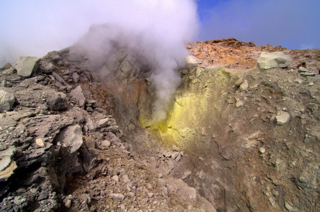
La Guadeloupe , La Soufrière :
Since the beginning of 2018 we have been witnessing a cyclic process of injecting deep magmatic gases at the base of the hydrothermal system at a depth between 2 and 3 km below the summit. This generates a recurrent process of overheating and overpressure of the hydrothermal system which results in:
1) disturbances in the circulation of hydrothermal fluids;
2) the evolution of the activity of fumaroles at the summit, one of which shows the projection of hot, acid mud over a few meters;
3) an increase in the swarm volcanic seismicity;
4) some volcanic earthquakes felt (four between February and April 2018) including an earthquake of magnitude M4.1 on April 27, 2018, the strongest since 1976;
5) deformations of small amplitude and limited to the dome of La Soufrière of the order of 3-7 mm / year and the continued opening of the summit fractures;
6) the fluctuation in the flow rates of fumarolic gas from a pressurized hydrothermal reservoir;
7) an increase in thermal anomalies in the soil at the top of La Soufrière.
While these phenomena prompt the observatory for instrumental vigilance, they are not yet clearly associated with an anomaly in the other monitoring parameters which could indicate a possible rise in magma. The latter would typically, but not systematically manifest itself by numerous deep and / or felt earthquakes, large-scale deformations beyond the dome, and the emission of sulfur gases at high temperature (> 150 ° C). Based on the observations of the OVSG-IPGP recorded during the month of April 2020 and summarized in this bulletin, and in accordance with the provisions provided by the authorities, the level of volcanic alert remains:
The likelihood of short-term eruptive activity remains low. However, given the renewed seismic and fumarolic activity recorded since February 2018, a change in the regime of the volcano has been noted such that an intensification of the phenomena in the future cannot be excluded. Consequently, the OVSG-IPGP is in a state of heightened vigilance. The gaseous fumes around and downwind of the main fumaroles of the summit (notably the South Crater, the Tarissan, and the Gouffre 1956) have, since 1998, proven risks of irritation and burns (eyes, skin, respiratory tract) .
Taking into account the development described above and other observations on the activity, the OVSGIPGP considers that it is important to keep, as a precaution, a distance of at least 50 m radius around the main centers of emission of fumarolic gas (Crater South, Crater South Central, Crater South North, Napoleon North, Napoleon East, Gouffre 1956, Gouffre Tarissan). In consideration of the evolution of the anomaly zone at the top (with the propagation of heat on the ground; the resurgence of the activity of fumaroles, accompanied by the appearance over time of new emission and projection centers of mud and fragments; indications of the impact on the ground and on vegetation of sulfur and acid gases) and therefore of a general increase in areas of instability, the Prefecture of Guadeloupe with Order No. 2019/001 CAB SIDPC of January 14, 2019 instituted regulated access to the summit of the Soufriere volcano, based on the identification of a security perimeter and on the prohibition of any unauthorized person from crossing it.
Source : IPGP.
Read the whole article : http://volcano.ipgp.fr/guadeloupe/Bulletins/last_bulletins.pdf
Photos : A.-Brusini-hemis-fr , F. BEAUDUCEL/IPGP 2010 .
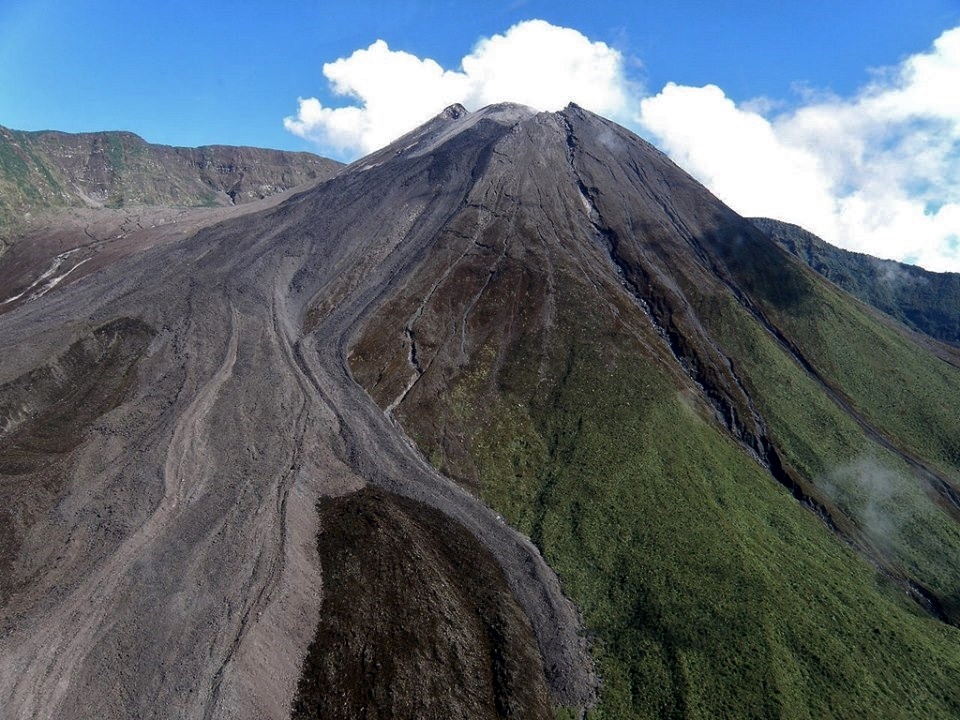
Ecuador , Reventador :
DAILY REPORT OF THE STATE OF THE VOLCANO REVENTADOR, Thursday May 14, 2020.
Information Geophysical Institute – EPN.
Surface activity level: High, Surface trend: No change.
Internal activity level: High, Internal trend: No change.
Seismicity: From May 13, 2020, 11:00 a.m. to May 14, 2020, 11:00 a.m.
Long Period Type (LP): 19 events
Explosions (EXP): 22 events
Emission tremors: (TE): 6.
Harmonic tremors: (TA): 2.
Rains / lahars: Not recorded.
Emission / ash column: Emissions of vapor, gas and ash were observed in a western direction, which exceeded 1000 m above the level of the crater. In the satellite images shared by the VAAC, 3 emission alerts were reported in a west direction, with a maximum height of 2538 m above the summit
Other monitoring parameters: no change.
Observations: Emissions of gas and ash at night and in the morning, signaled by VAAC alerts and visual cameras. During the night, an incandescence was observed at the level of the summit, accompanied by the descent of incandescent blocks on the south-eastern flank 300 m below the crater. Cloudy area at the moment.
Alert level: Orange.
Source : IGEPN.
Photo : alex-steele-via-fb
Costa Rica , Turrialba / Poas / Rincon de la Vieja :
Weekly bulletin from the volcanic monitoring program, May 11, 2020.
Turrialba volcano:
Lat: 10.025 ° N; Long: 83,767 ° W;
Altitude: 3340 m above sea level
Current activity level: 2 (active volcano)
Potentially associated hazards: gas, ash emission, proximal ballistic projections.
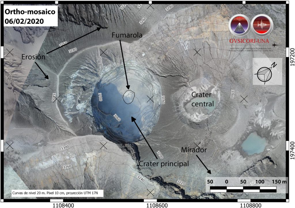
Orthophotography of the Turrialba volcano, result of the flight with drone of February 6, 2020, carried out by Cyrill Muller and Mario Angarita from the geodesy department of OVSICORI-UNA.
An orthophotograph is obtained by a set of aerial images, which have been corrected to represent an orthogonal projection without perspective effect, and in which it is therefore possible to take precise measurements.
No ash emission was detected. Seismicity remains stable. The trend towards contraction and collapse of the Turrialba-Irazú massif continues, in particular towards Irazú and the summit of Turrialba. The CO 2 / SO 2 and H 2 S / SO 2 ratios have continued to increase since mid-March, the flow of SO 2 remains stable.
Poas Volcano:
Lat: 10.2 ° N; Long: 84.233 ° W;
Altitude: 2780 m above sea level
Current activity level: 2 (active volcano)
Potentially associated hazards: gas, groundwater eruptions, proximal ballistic projections.
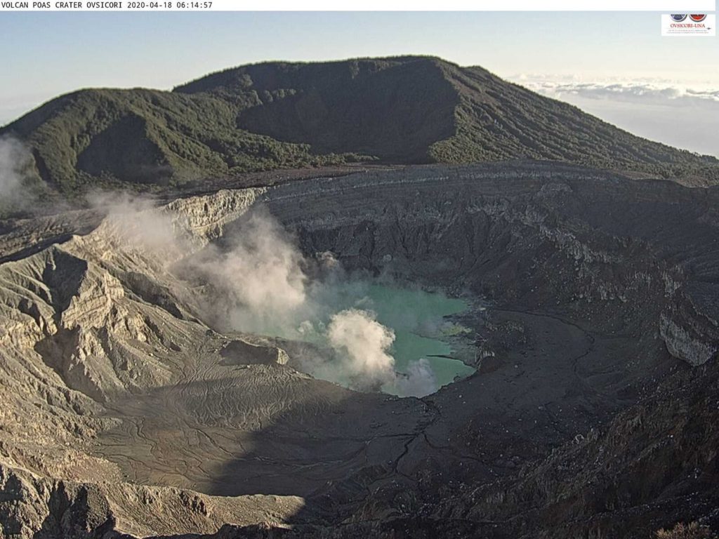
No eruption was detected. Incandescent episodes were observed on May 6 (4:00 am – 6:00 am local time) in the fumarole south of Boca A, possibly associated with spontaneous combustion of sulfur. Seismic activity remains stable around 200 to 300 daily events. Short superficial tremors of variable frequency, without periodicity, possibly associated with fumarolic activity, are recorded. Deformation monitoring shows a slight sag without significant horizontal movements. The SO 2 / CO 2 ratio is unstable with a slight downward trend, the H 2 S / SO 2 ratio remains stable with sporadic peaks. The flow of SO 2 is stable. Few peaks (up to 8 ppm) of SO 2 concentrations have been recorded at the national park level. The level of the lake seems stable.
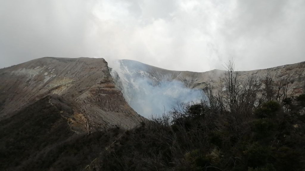
Rincon de la Vieja volcano:
Lat: 10.83 ° N; Long: 85.324 ° W;
Altitude: 1895 m above sea level
Current activity level: 3 (erupting volcano)
Potentially associated hazards: gas, phreatic eruptions, proximal ballistic projections, lahars.
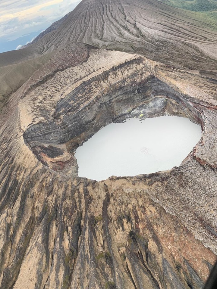
he activity of the volcano was maintained with frequent eruptions (seismic signal and infrasound) and exhalations (only infrasound signal) of variable amplitude. The eruptions were not large enough to generate lahars. The tremor is kept alternating between continuous and fragmented with sudden changes linked to the most important eruptions. LP type events and some VT type events continue to occur under the crater. There are 2 types of eruptive events: surface events and events with a deep explosion 30 to 120 seconds before the eruption. This activity has been stable since April 20. Geodetic measurements do not show significant deformation.
Activity report of the Rincón de la Vieja volcano, May 14, 2020.
On May 14, 2020 at 5:24 local time, an eruption was recorded on the Rincón de la Vieja volcano, with a column which rose 500 meters above the height of the crater and 2416 meters above from sea level. (7,924.48 ft).
Duration of activity: 1 minute.
No ash fall or sulfur odor reported
Comments: Small phreatic eruption observed by webcam.
Source : Ovsicori.
Photos : RSN , Cyrill Muller et Mario Angarita , Theresa Lopez , Christopher Allen, Sunquest Helitours.


