January 28 , 2020 .
Philippines , Taal :
TAAL VOLCANO BULLETIN 28 January 2020 8:00 A.M.
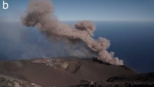
Activity in the Main Crater in the past 24 hours has been characterized by weak to voluminous emission of white to dirty white steam-laden plumes 100 – 800 meters tall that drifted southwest. Sulfur dioxide (SO2) emission was below instrumental detection.
The Philippine Seismic Network (PSN) plotted a total of seven hundred fifty-five (755) volcanic earthquakes since 1:00 PM, January 12, 2020. One hundred seventy-six (176) of these registered at magnitudes M1.2-M4.1 and were felt at Intensities I-V. Since 5:00 AM on January 27, 2020 until 5:00 AM today, there were three (3) volcanic earthquakes plotted that registered at magnitudes M1.5-M2.2 with no felt event.
For the past 24 hours, the Taal Volcano Network, which can record small earthquakes undetectable by the PSN, recorded ninety-two (92) volcanic earthquakes including four (4) low-frequency events. These earthquakes signify magmatic activity beneath the Taal edifice that could lead to eruptive activity at the Main Crater.
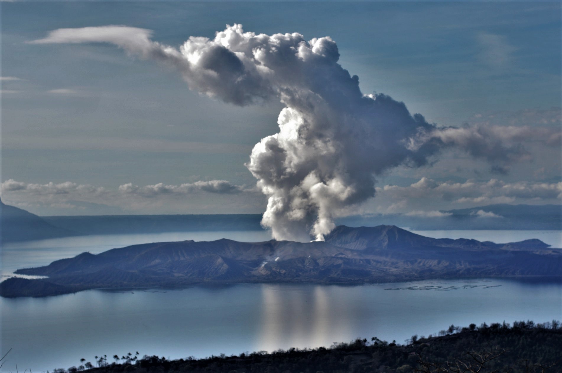
Alert Level 3 is maintained over Taal Volcano. DOST-PHIVOLCS reminds the public that sudden steam-driven and even weak phreatomagmatic explosions, volcanic earthquakes, ashfall, and lethal volcanic gas expulsions can still occur and threaten areas within Taal Volcano Island and nearby lakeshores. DOST-PHIVOLCS recommends that entry into the Taal Volcano Island as well as into areas over Taal Lake and communities west of the island within a seven (7) km radius from the Main Crater must be strictly prohibited. Local government units are advised to assess areas outside the seven-kilometer radius for damages and road accessibilities and to strengthen preparedness, contingency and communication measures in case of renewed unrest. People are also advised to observe precautions due to ground displacement across fissures, frequent ashfall and minor earthquakes. Communities beside active river channels particularly where ash from the main eruption phase has been thickly deposited should increase vigilance when there is heavy and prolonged rainfall since the ash can be washed away and form lahars along the channels. Civil aviation authorities must advise pilots to avoid flying close to the volcano as airborne ash and ballistic fragments from sudden explosions and wind-remobilized ash may pose hazards to aircrafts.
DOST-PHIVOLCS is closely monitoring Taal Volcano’s activity and any new significant development will be immediately communicated to all stakeholders.
Source : Phivolcs.
Photo : Richard Langford
Peru , Ubinas :
Analysis period: January 20 to 26, 2020. Arequipa, January 27, 2020
Alert level: ORANGE
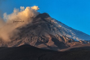
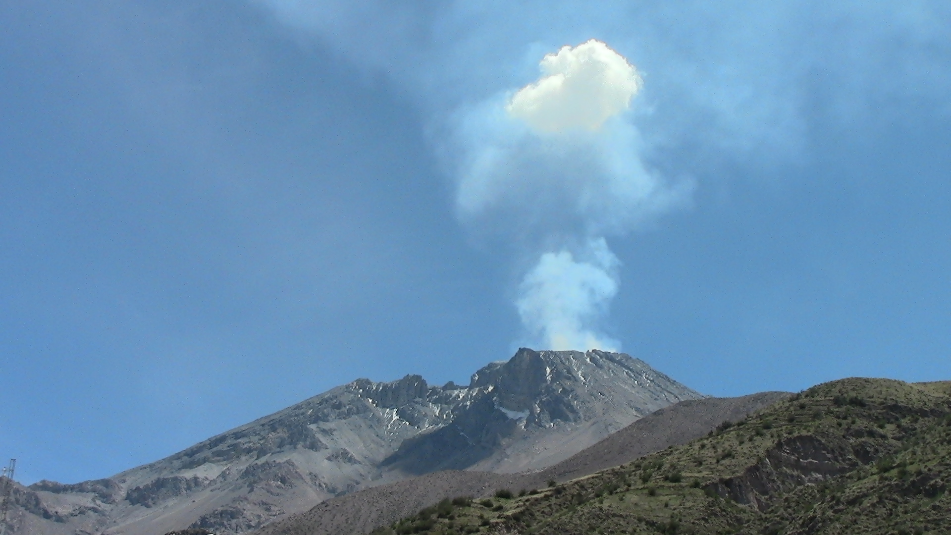
The Geophysical Institute of Peru (IGP) reports that the eruptive activity of the Ubinas volcano remains at low levels. To date, the energy of earthquakes associated with the rise of magma to the surface has considerably decreased, and there are small and sporadic emissions of blue gases (of magmatic origin) and water vapor. According to this scenario, the possibility of volcanic explosions and / or ash emissions is low.
During the period from January 20 to 26, 2020, the IGP recorded and analyzed a total of 94 seismic events associated with the dynamic behavior of the Ubinas volcano, with the predominance of seismic signals of the Volcano-Tectonic type (VT), related to the fracturing of rocks inside the volcano which, on average, recorded 8 earthquakes per day, all with magnitudes less than M2.4. The seismic signals linked to the rise of magma (hybrid type) have decreased, both in number of events (2 daily earthquakes) and in energy.
Visual surveillance, although limited by cloud cover at this time of the year, records slight emissions of volcanic gases and water vapor. Monitoring the deformation of the volcanic structure, using GNSS data (processed with fast orbits), does not record any anomalies. MIROVA satellite surveillance also did not record thermal anomalies on the volcano.
Source : IGP.
Photo : Auteur inconnu.
Indonesia , Slamet :
VOLCANO OBSERVATORY NOTICE FOR AVIATION – VONA.
Issued: January 28 , 2020
Volcano: Slamet (263180)
Current Aviation Colour Code: YELLOW
Previous Aviation Colour Code: unassigned
Source: Slamet Volcano Observatory
Notice Number: 2020SLA01
Volcano Location: S 07 deg 14 min 31 sec E 109 deg 12 min 29 sec
Area: Central Java, Indonesia
Summit Elevation: 10970 FT (3428 M)
Volcanic Activity Summary:
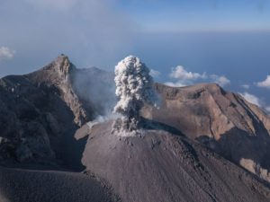
On 27 January 2020, observed thick white gas emission at 23:14 UTC (06:14 Local Time, January 28).
Volcanic Cloud Height:
Best estimate of ash-cloud top is around 11290 FT (3528 M) above sea level, may be higher than what can be observed clearly. Source of height data: ground observer.
Other Volcanic Cloud Information:
Gas emission moving to south
Remarks:
Seismicity is characterized by Emission Earthquakes and continuous Volcanic Tremor.
Level II activity (Waspada). Seismic and deformation records detected an increase in activity in June 2019.
The volcano is clearly visible until it is covered with fog. The weather is sunny to cloudy, the winds are weak, oriented to the West. The temperature is around 22 to 27.2 ° C. The smoke from the crater is observed with a weak intensity, white, thick about 50-100 meters above the summit.
According to the seismographs of January 27, 2020, it was recorded:
407 emission earthquake.
Continuous tremor, amplitude 0.5-3 mm (dominant value of 2 mm)
Recommendation: People and visitors / tourists should not be active within a radius of 2 km around the summit crater of G. Slamet.
Source : Magma Indonésie . PVMBG
Photo : Vinchel Budihardjo .
Mexico , Popocatepetl :
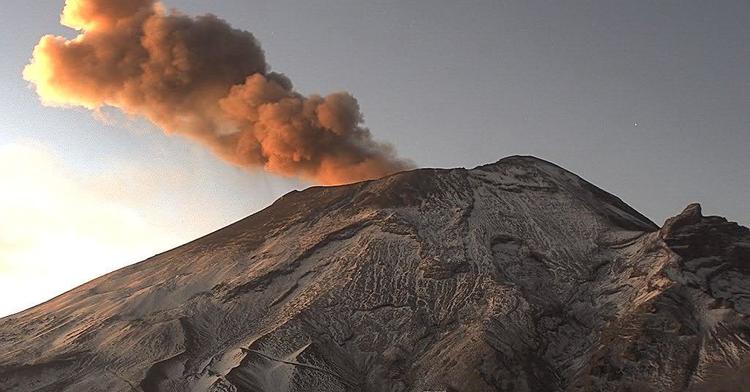
January 27, 11:00 a.m. (January 27, 5:00 p.m. GMT)
According to the monitoring systems of the Popocatepetl volcano, 73 exhalations composed of water vapor, volcanic gases and low ash content have been identified. In addition, 357 minutes of tremoes were recorded, little glow was observed at night.
From today morning until the time of this report, emissions of steam, volcanic gases with a low ash content have been observed, which the wind disperses preferentially towards the East-North-East.
CENAPRED urges NOT to APPROACH the volcano and especially the crater, because of the danger of falling ballistic fragments, and in case of heavy rain stay away from the bottom of the ravines because of the danger of mudslides and debris.
The Popocatépetl volcanic signaling light is in YELLOW PHASE 2.
Source et photo : Cenapred .
Russia / Kuriles Islands , Ebeko :
VOLCANO OBSERVATORY NOTICE FOR AVIATION (VONA).
Issued: January 27 , 2020
Volcano: Ebeko (CAVW #290380)
Current aviation colour code: ORANGE
Previous aviation colour code: orange
Source: KVERT
Notice Number: 2020-13
Volcano Location: N 50 deg 41 min E 156 deg 0 min
Area: Northern Kuriles, Russia
Summit Elevation: 3791.68 ft (1156 m)
Volcanic Activity Summary:
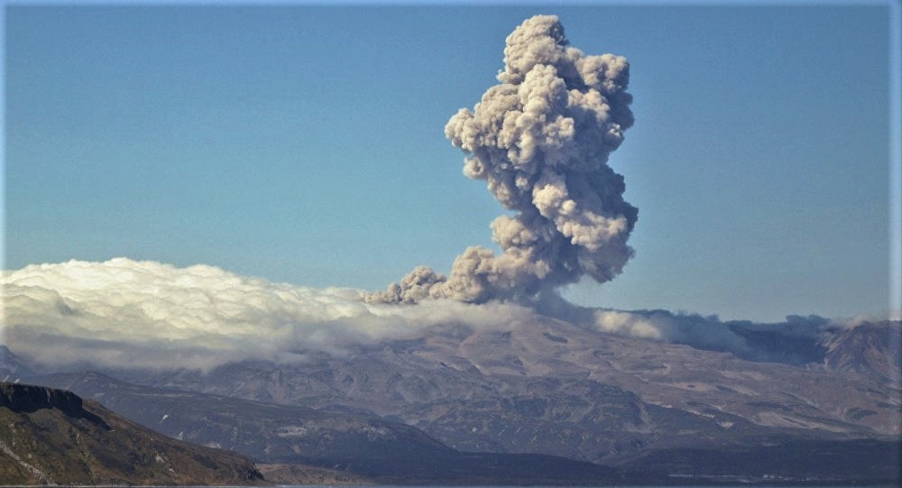
A moderate eruptive activity of the volcano continues. According to visual data by volcanologists from Severo-Kurilsk, explosion sent ash up to 2.6 km a.s.l., an ash cloud is drifting to the south-east from the volcano.
This eruptive activity continues. Ash explosions up to 19,700 ft (6 km) a.s.l. could occur at any time. Ongoing activity could affect low-flying aircraft and airport of Severo-Kurilsk.
Volcanic cloud height:
8200-8528 ft (2500-2600 m) AMSL Time and method of ash plume/cloud height determination: 20200127/2239Z – Visual data
Other volcanic cloud information:
Distance of ash plume/cloud of the volcano: 2 mi (3 km)
Direction of drift of ash plume/cloud of the volcano: SE
Time and method of ash plume/cloud determination: 20200127/2239Z – Visual data
Source : Kvert .
Photo : Amanda / Sputniknews.