October 09 , 2019.
Colombia , Chiles / Cerro Negro :
Weekly activity bulletin of Chiles and Cerro Negro volcanoes
The activity level of the volcanoes continues at the level: YELLOW LEVEL ■ (III): CHANGES IN THE BEHAVIOR OF THE VOLCANIC ACTIVITY.
Following the activity of the VOLCANS CHILES AND CERRO NEGRO, the COLOMBIAN GEOLOGICAL SERVICE (SGC) reports that:
For the period evaluated between October 1st and 7th, 2019, seismic activity in the Chiles – Cerro Negro volcanoes region decreased in frequency and energy compared to the previous week, from 1292 to 840 earthquakes classified in the category. volcano-tectonics, which are associated with fractures of rock materials in the volcanic building. The earthquakes were located in two epicentral areas, one towards the southern sector of the Chiles volcano, less than 3.5 km from the volcanic center, and the second in the vicinity of the Cerro Negro volcano, less than 1.5 km away. from its summit. The depths of the earthquakes were between 3 and 6 km below the summit of the Chiles volcano (4,700 meters above sea level). The magnitude of the earthquakes was less than 3.2 on the Richter scale. For this period, no felt earthquakes were reported.
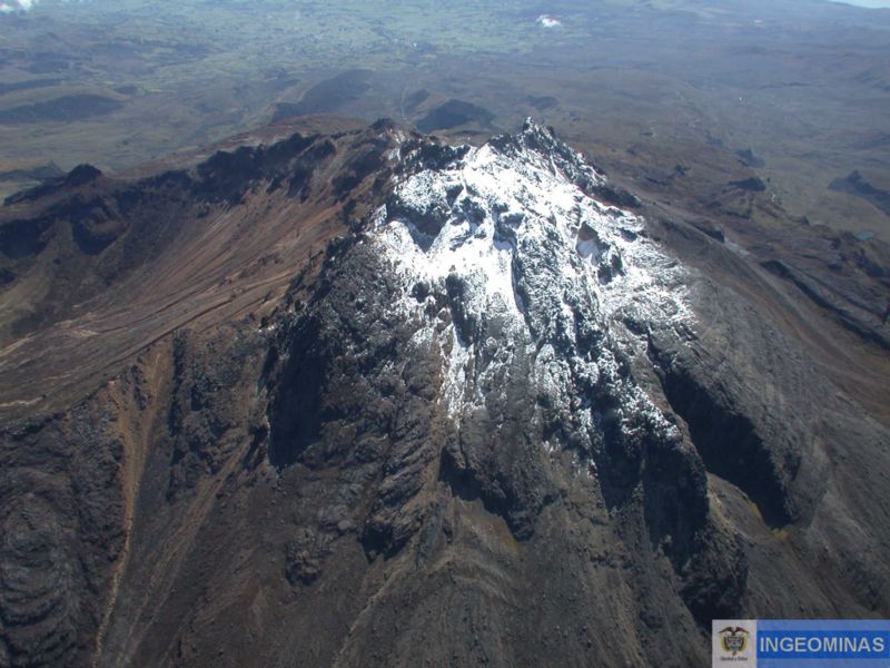
The Colombian Geological Service and the Institute of Geophysics of the National Polytechnic School of Ecuador are attentive to the evolution of the volcanic phenomenon and inform in a timely manner the observed changes. Due to the fluctuating and permanent development of seismic activity in the region of these volcanoes, the possibility of occurrence of earthquakes with higher energy levels than those reported can not be ruled out.
Source et photo : Ingeominas.
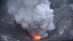
Peru , Sabancaya :
Period of analysis: from September 30 to October 6, 2019. Arequipa, October 7, 2019.
Alert level: ORANGE
The Geophysical Institute of Peru (IGP) reports that the eruptive activity of the Sabancaya volcano has remained at moderate levels; that is, with the recording of continuous moderate explosions and the resulting ash emission. Therefore, for the following days, no significant change is expected.
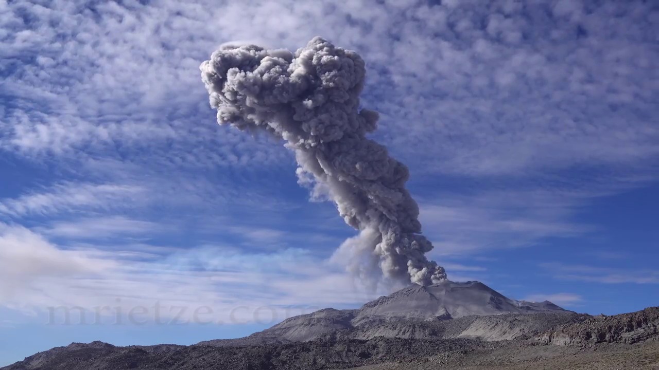
The analysis of records obtained from the seismic network of the Sabancaya volcano for the period from September 30 to October 6, 2019 allowed the identification of the presence of about 1712 earthquakes of volcanic origin, the highest percentage being is associated with the movements of magmatic fluids. During this week, 32 explosions per day of average to low intensity were observed on average.
The monitoring of the deformation of the volcanic structure, using GNSS data (processed with fast orbits), does not present significant anomalies. Visual surveillance, using surveillance cameras, allowed us to identify the appearance of columns of gas and ash up to 2.9 km high above the top of the volcano, which dispersed into South, South-East and South-West of Sabancaya. Satellite monitoring identified 6 volcanic anomalies on the volcano with values between 1 and 14 MW, associated with the presence of a hot body inside the crater of the volcano.
Source : IGP Pérou.
Photo : Martin Rietze .
Italy , Vésuvius :
Surveillance Bulletin, SEPTEMBER 2019.
Seismology:
In September 2019, 81 earthquakes were recorded on Vesuvius. The maximum magnitude was Md = 1.7 (08/09 event at 07:52 UTC). It was possible to determine the hypocentral parameters of 74 recorded events.
There is no significant trend in the seismological parameters.
From this figure, it can be seen that the increase in the number of events recorded in recent years is mainly related to a low-energy seismicity confined in the crater area and detectable at the OVO station (Vesuvian Observatory) on certain occasions only.

Deformation of the soil:
There is no evidence of soil deformation due to volcanic phenomena. The only GPS stations located in the upper part of the volcanic building show significant subsidence and horizontal displacements consistent with a contraction phase of the Great Cone, probably due to gravitational effects and compaction processes and / or landslide. steep and inconsistent slopes.
Source : INGV.
Read the full article: http://www.ov.ingv.it/ov/bollettini-mensili-campania/Bollettino_Mensile_Vesuvio_2019_09.pdf
Photo : Par I, Pastorius, CC BY 2.5, https://commons.wikimedia.org/w/index.php?curid=2530370.
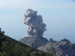
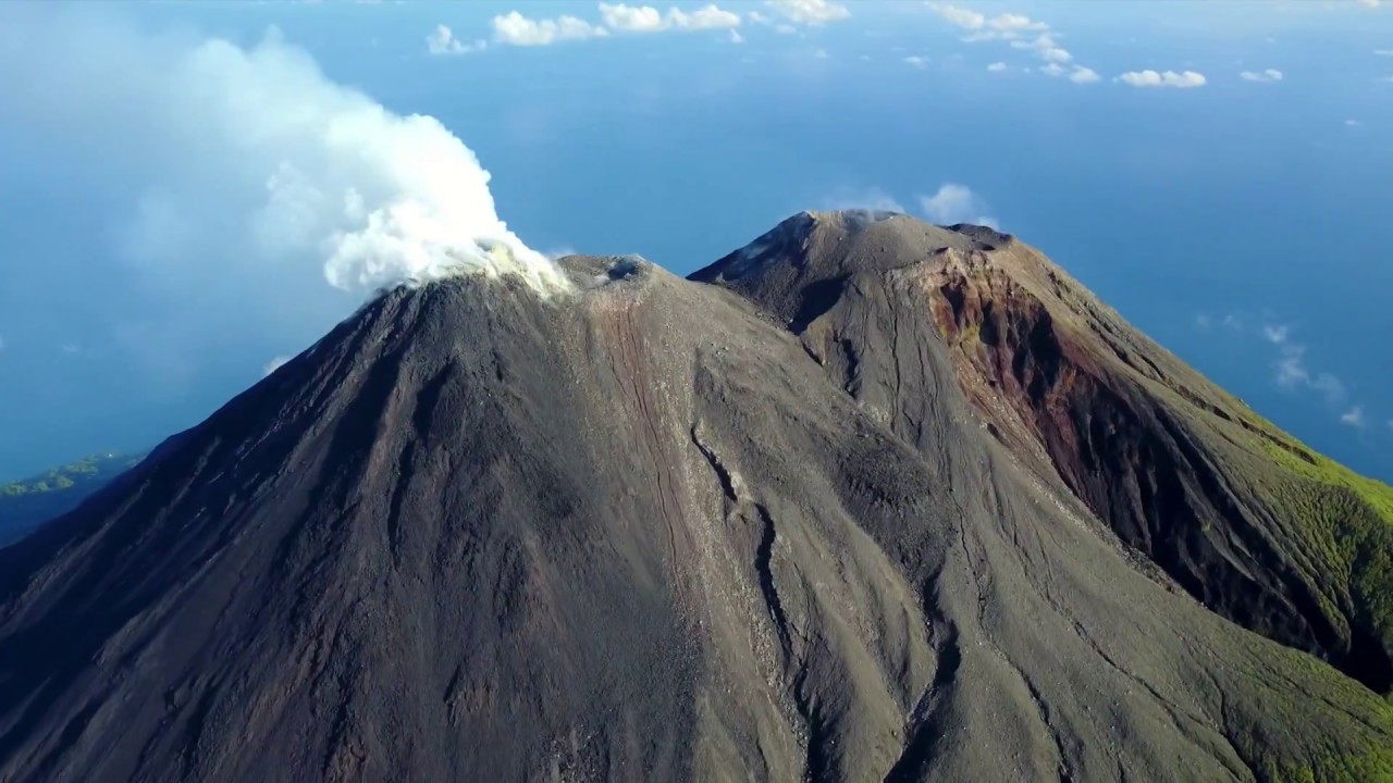
Indonesia , Karangetang :
Level of activity at Level III (SIAGA). G. Karangetang (1,784 m above sea level) has been re-erupted since November 25, 2018.
Sunny to cloudy, weak winds to North and Northwest. The temperature is around 24 to 32 ° C. The volcano is clearly visible until it is covered with fog. The smoke from the crater is observed to be white, with a strong, thick intensity, about 400 meters above the summit.
The lava flow from the main crater slides towards the Pangi, Sense and Nanitu rivers over a distance of 1000 to 1500 m.
The seismographs, October 8, 2019, recorded:
123 avalanche earthquakes
11 earthquake explosions
4 hybrid earthquakes
3 distant tectonic earthquakes
Continuous tremor with amplitude of 0.5 to 2 mm, dominant value of 1 mm
Recommendation:
The public and visitors / tourists are advised not to travel within 2.5 km of the main crater (South) and crater II (North), as well as in the sectoral expansion zone of Crater II. northwest 4 km and from the main crater west up to 3 km.
Communities living around the rivers that rise at the top of Mount Karangetang need to be prepared for the potential threat of lahars and sudden floods that can spread to the coast.
VONA:
The latest VONA code was YELLOW, published November 25, 2018 at 13:32 WITA, related to the volcanic ash emission from a height of approximately 2,284 meters above sea level or approximately 500 meters above the summit, the wind was blowing in the East.
Source : PVMBG.
Photo : hshdude