August 13 , 2019.
La Réunion , Piton de la Fournaise . Update 10h30 .
Activity Bulletin from Tuesday, August 13, 2019 to 11:00 (local time).
Alert level: Alert 2-2
The eruption started on August 11, 2019 around 16:20 (local time) continues. After a drop in the late afternoon on the day yesterday, the intensity of the eruptive tremor (witnessing the intensity of the eruption) is relatively constant since 21:00 local time (17:00 UT, Figure 1).
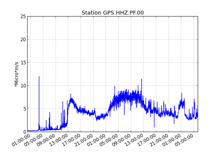
Figure 1: Evolution of the RSAM (indicator of the volcanic tremor and the intensity of the eruption) between 04:00 (00:00 UT) on August 11 and 10:30 (6:30 UTC) on August 13, 2019 on the GPS seismic station, the most close to the eruptive site (© OVPF-IPGP).
An aerial reconnaissance was conducted this morning with the help of SAG and PGHM. In total there are two eruptive cracks, distant from each other of about 1400 m, which opened on August 11, 2019 in the eastern sector, southeast of the upper part of the Great Slopes at 1700 and 1500 m from altitude (Figure 2).
This morning at 09:30 (local time), only the lowest elevation crack was active (crack 2 in Figure 2), on which three distinct cones formed by accumulation of lava fountain deposits (Figures 3 and 4) .
A fumarole zone not related to an eruptive crack or a lava flow was observed between the two cracks at about 1100 m altitude.
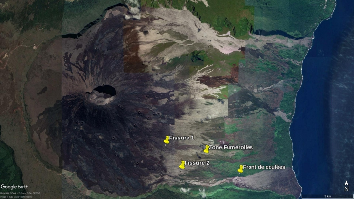
Figure 2: Location of eruptive fissures that opened on 11/08/2019. This day, the 13/08/2019, only the crack 2 remained active. The locations of a zone of fumaroles observed that day as well as the casting front at 09:30 this morning are also reported (© OVPF-IPGP).
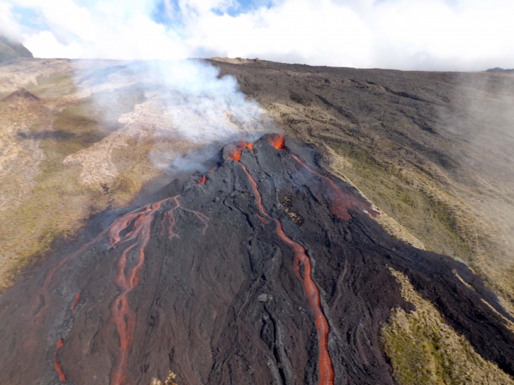
Figure 3: Shooting of the eruptive site around 09:30 local time on 13/08/2019 (© OVPF-IPGP).
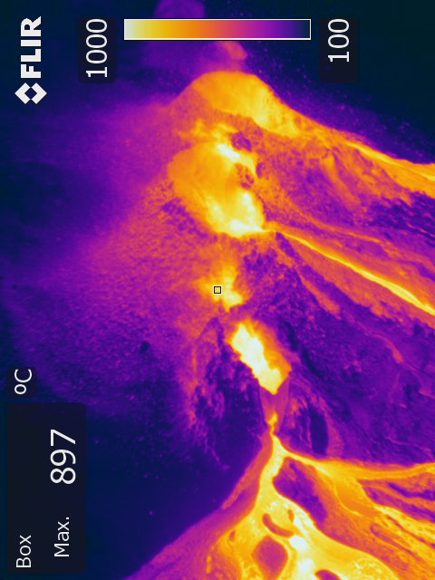
Figure 4: Shooting of the eruptive site in thermal imaging around 09:30 local time on 13/08/2019 (© OVPF-IPGP).
The three active flows from these cones joined in a single channel whose front was this morning at 09:30 to 665 m altitude (near the Piton Tremblet), about 2.1 km from the road (Figures 2 and 5).
Small fires were observed all along the lower part of the stream, due to its entry into a highly vegetated area.
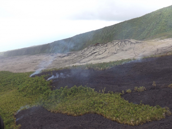
Figure 5: Shooting of the flow front at 09:30 local time on 13/08/2019 (© OVPF-IPGP).
The estimated surface flows, from the satellite data via the HOTVOLC platform (OPGC – University of Auvergne), are of the order of 2 to 9 m3 / s at the beginning of eruption.
Source : OVPF.
Read the article: http://www.ipgp.fr/fr/ovpf/bulletin-dactivite-mardi-13-aout-2019-a-11h00-heure-locale