July 19 , 2019.
Italy , Stromboli :
LATEST COMMUNIQUE ON THE ACTIVITY OF STROMBOLI, 18 JULY 2019, 08:31 h UTC (10:31 local time)
The Istituto Nazionale di Geofisica e Vulcanologia, Osservatorio Etneo, reports that based on observations made with the surveillance cameras at 400 m elevation on the north rim of the Sciara del Fuoco and by INGV staff in the field on the island indicate that explosive activity is continuing much in the same manner as yesterday. No significant variations have been observed in the frequency and intensity of the explosions. Lava continues to overflow from the Central-Southern crater area, feeding flows onto the middle and upper slope of the Sciara, which during the night have increased in volume. The active flow fronts are spawning hot material onto the slope of the Sciara del Fuoco, which periodically reach the coastline at the base of the slope.
As for the seismic activity, variations in the amplitude of the explosive events have been similar to those of the previous days. Likewise, the mean volcanic tremor amplitude has not shown significant variations and remains at median to high values.
Vidéo : The images above were recorded during a drone flight on Stromboli on July 12, 2019 driven by Dr. Francesco Paolo La Monica (LabVulc – DiSTeM – University of Palermo) for the Laboratory of Experimental Geophysics (LGS) – Department of Earth Science – University of Florence
Source : INGV Vulcani .
Italy / Sicily , Etna :
LATEST COMMUNIQUE ON THE ACTIVITY OF ETNA, 18 JULY 2019, 09:51 h UTC (11:51 local time)
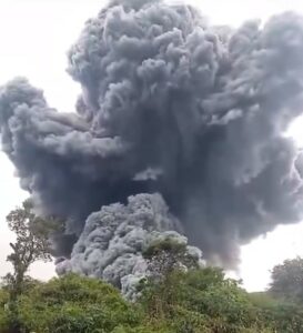
The Istituto Nazionale di Geofisica e Vulcanologia, Osservatorio Etneo, reports that the mild eruptive activity, which started on 14 July at the New Southeast Crater (NSEC) is continuing, and has shown a gradual intensification. Yesterday 17 July, there were frequent ash emissions, which produced only minor anomalies in images recorded by the thermal surveillance cameras. Since the early morning, however, the activity consists of Strombolian explosions, which occurred at a frequency of one every 1-2 minutes, but during the late forenoon were occurring every 20-30 seconds. The explosions ejected incandescent pyroclastics to a few tens of meters above the vent, which lies in the eastern part of the NSEC. Ejecta frequently fell onto the upper flanks of the cone.
Furthermore, at 05:48 UTC, an emission of ash occurred at the Northeast Crater, which produced a plume that rapidly dissipated in the atmosphere. The first emission was followed by other, smaller emissions that continued at the time of the production of this report [but ceased sometime thereafter]. Differently from the activity at the NSEC, the ash emissions of the Northeast Crater have not produced any anomalous signal in the images recorded by the thermal surveillance cameras
As for the volcanic tremor, since 20:30 UTC yesterday, a progressive increase in the mean amplitude of the volcanic tremor has been recorded, which rose from low to median levels. This has been accompanied by a migration and superficialization of the volcanic tremor source toward the NSEC area, as well as by an increase in the frequency of infrasonic events.
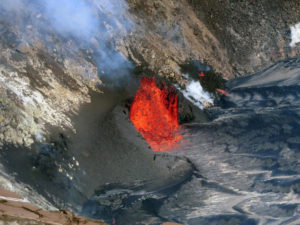
Above: 1 /: Strombolian activity at the New Southeast Crater (NSEC) releases incandescent pyroclastic materials up to a few tens of meters above the eruptive vent. This mouth is located on the east side of the New Southeast Crater and the products often fall on the sides of the cone.
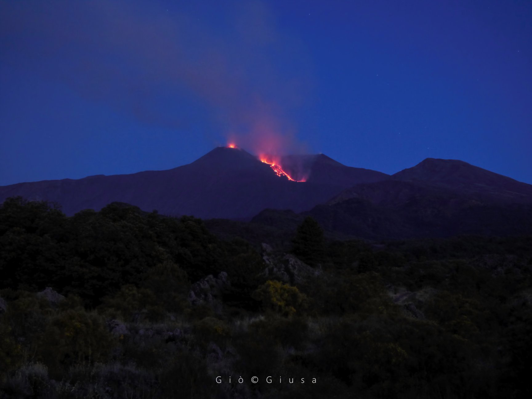
2 / Etna in the morning of July 19, 2019. Apparently, an eruption is in progress. More news as soon as the INGV is published.
Source et vidéo : INGV Vulcani.
Photo : Etna e dintorni in foto / Gio Giusa.
Alaska , Semisopochnoi :
AVO/USGS Volcanic Activity Notice
Current Volcano Alert Level: WATCH
Previous Volcano Alert Level: ADVISORY
Current Aviation Color Code: ORANGE
Previous Aviation Color Code: YELLOW
Issued: Thursday, July 18, 2019, 10:38 AM AKDT
Source: Alaska Volcano Observatory
Location: N 51 deg 55 min E 179 deg 35 min
Elevation: 2625 ft (800 m)
Area: Aleutians
Volcanic Activity Summary:
Elevated seismicity that began yesterday has increased overnight. A stronger tremor signal recorded at 23:39 AKDT / 07:39 UTC also produced an infrasound signal on an infrasound array 260 km (161 miles) east on Adak island. This event likely produced ash emissions, and at the current level of continued unrest similar events could occur with little to no warning. The meteorological cloud deck has been around 10,000′ (3000 m) asl over Semisopochnoi and no ash signals have been detected above this height. A small plume extending 18 km (11 miles) from the Cerberus vent was visible in satellite data from yesterday, but did not contain an ash signal.
Nothing has been detected in lightning data.
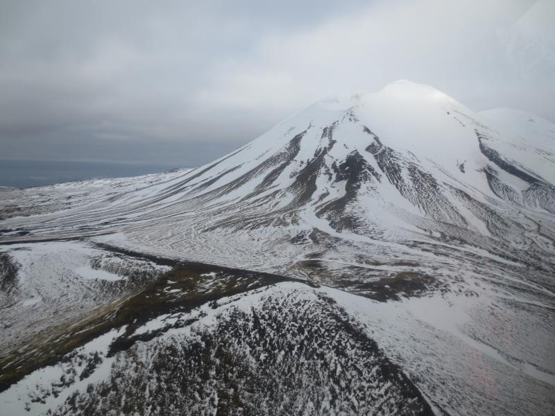
Mt Cerberus from the east. AVO seismic station CERB is on the triangular hilltop in the lower left. Photos of Semisopochnoi Island taken in May 2017 during AVO station maintenance activities and supported by U.S. Coast Guard.
Recent Observations:
[Volcanic cloud height] No cloud observed
[Other volcanic cloud information] No cloud observed
Remarks:
Semisopochnoi is monitored with an on-island seismic network, and remotely by satellite and lightning sensors. An infrasound array on Adak Island could detect explosive emissions from Semisopochnoi with a 13 minute delay if atmospheric conditions permit.
19/07/2019. Seismic activity levels have continued to increase at Semisopochnoi, prompting a change in the color code/activity level to ORANGE/WATCH. An strong burst of tremor overnight at 07:39 UTC / 23:39 AKDT generated an airwave detected on the Adak array 260 km (161 miles) to the east. A low-level plume has been observed intermittently in mostly cloudy satellite images over the past 24 hours. It extended west-southwest from the area of the Cerberus vent up to 80 km (50 miles); however, no ash signatures have been detected. The meteorological cloud deck has been around 10,000′ asl (3000 m) over Semisopochnoi, and thus far no volcanic plumes have been observed above the weather clouds. No lightning from the eruption has been detected.
Source : AVO.
Photo : Kaufman, Max.
Hawaii , Mauna Loa :
19°28’30 » N 155°36’29 » W,
Summit Elevation 13681 ft (4170 m)
Current Volcano Alert Level: ADVISORY
Current Aviation Color Code: YELLOW
Activity Summary:
Mauna Loa Volcano is not erupting. Rates of deformation and seismicity remained slightly elevated over the past week.
Observations:
During the past week, approximately 43 small-magnitude earthquakes (most less than M2.0) occurred beneath the summit and upper Southwest Rift Zone, compared to ~80 earthquakes in this region the week before. Most earthquakes occurred at depths of less than 5 km (3 miles).
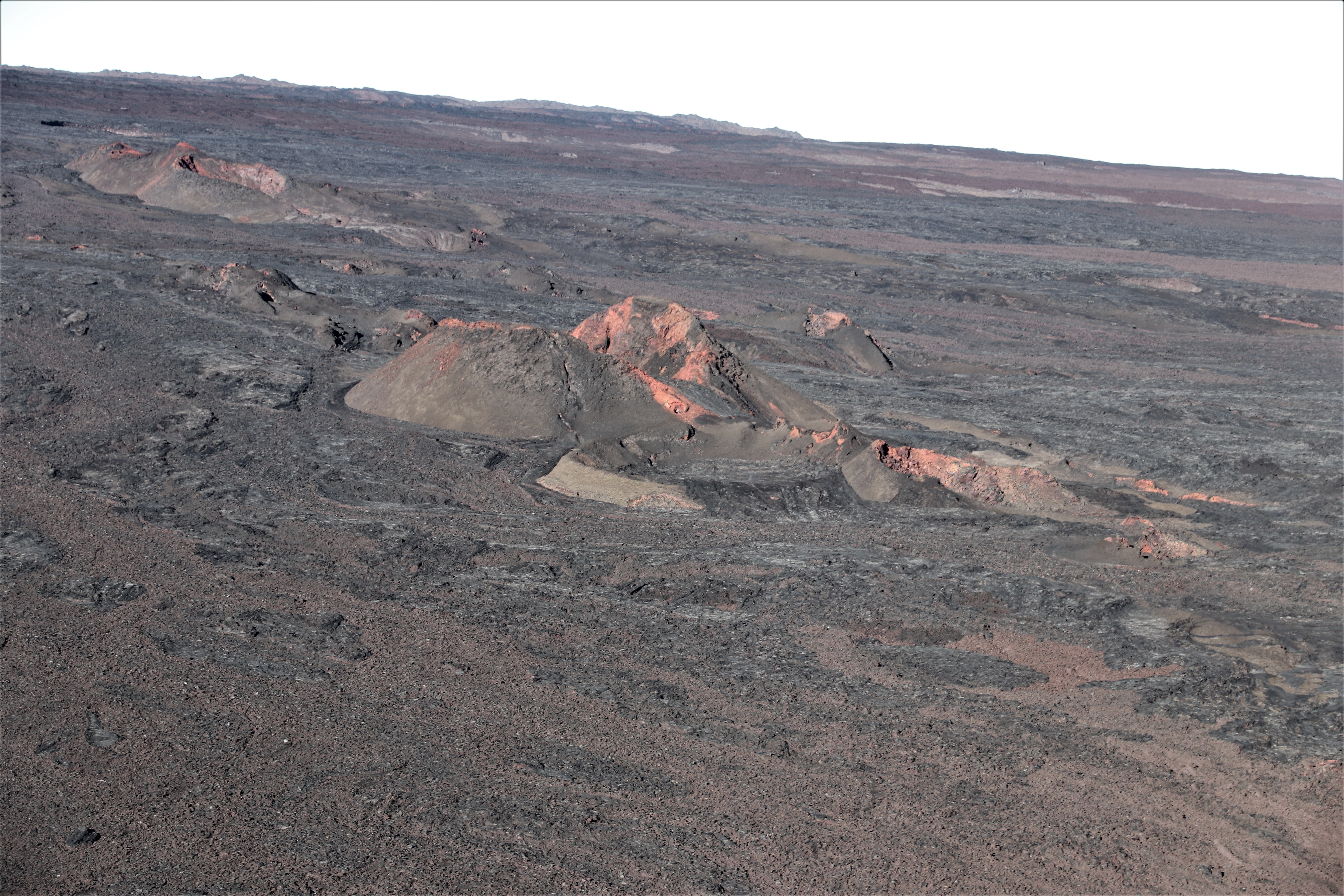
This aerial view, looking to the northwest, shows Pu‘u Pohaku‘ohanalei on Mauna Loa. This cone is near the 1984 fissure on the volcano’s Northeast Rift Zone.
Global Positioning System (GPS) and Interferometric Synthetic Aperture Radar (InSAR) measurements show continued summit inflation, suggestive of recharge of the volcano’s shallow magma storage system.
No significant changes in volcanic gas release at Sulphur Cone on the Southwest Rift Zone were measured. Fumarole temperatures at both Sulphur Cone and at the summit remain unchanged.
Updates on the status of Mauna Loa Volcano will be issued each week on Thursdays until further notice.
Source : HVO.
Mexico , Popocatepetl :
July 18, 11:00 am (July 18, 16:00 GMT).
During the last 24 hours, through the monitoring systems of the Popocatépetl volcano, 165 exhalations have been identified, accompanied by water vapor, gas and light amounts of ash. A moderate explosion was also recorded today at 03:05, as well as a minor explosion today at 6:23.
In addition, 424 minutes of low to medium amplitude tremor and a volcano – tectonic earthquake yesterday at 10:43 h with a magnitude of M1.2 were recorded.
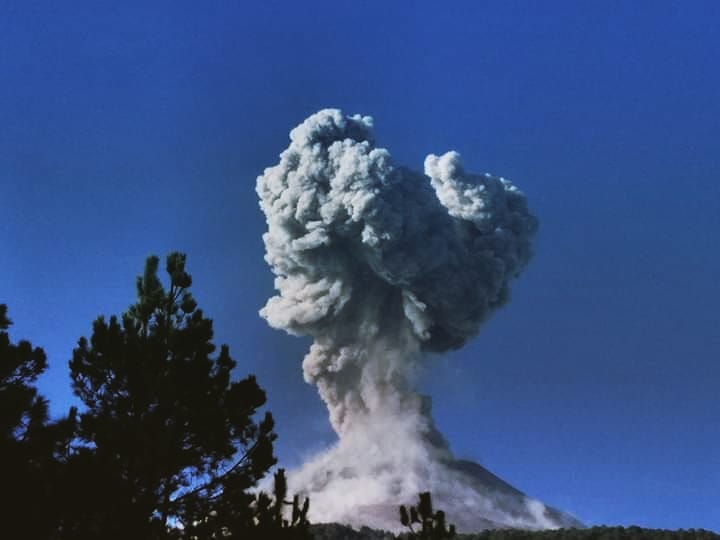
At the time of this report, it is possible to see an emission of water vapor and gas containing small amounts of ash towards West-South-West.
CENAPRED urges DO NOT APPROACH the volcano and especially the crater, because of the risk of falling ballistic fragments, and in case of heavy rain to move away from the bottom of the ravines because of the risk of mudslide and debris .
The Popocatepetl warning light is located at YELLOW PHASE 2.
Source : Cenapred.
Photo : Volcán Popocatépetl / FB.