July 11 , 2019.
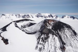
Papua New Guinea , Ulawun :
5.05°S, 151.33°E
Elevation 2334 m
RVO reported that diffuse white plumes rose from Ulawun’s summit crater and the North Valley vent during 1-4 July, and from the summit only during 5-9 July. The seismic station located 11 km NW of the volcano recorded three volcanic earthquakes and some sporadic, short-duration, volcanic tremors during 1-3 July. The seismic station 2.9 km W of the volcano was restored on 4 July and recorded small sub-continuous tremors. Some discrete high-frequency volcanic earthquakes were also recorded on most days. Sulfur dioxide emissions were 100 tonnes per day on 4 July. According to the United Nations in Papua New Guinea 7,318 people remained displaced within seven sites because of the 26 June eruption.
Ulawun with Bamus back to the right.
The symmetrical basaltic-to-andesitic Ulawun stratovolcano is the highest volcano of the Bismarck arc, and one of Papua New Guinea’s most frequently active. The volcano, also known as the Father, rises above the north coast of the island of New Britain across a low saddle NE of Bamus volcano, the South Son. The upper 1000 m is unvegetated. A prominent E-W escarpment on the south may be the result of large-scale slumping. Satellitic cones occupy the NW and E flanks. A steep-walled valley cuts the NW side, and a flank lava-flow complex lies to the south of this valley. Historical eruptions date back to the beginning of the 18th century. Twentieth-century eruptions were mildly explosive until 1967, but after 1970 several larger eruptions produced lava flows and basaltic pyroclastic flows, greatly modifying the summit crater.
Source : GVP.
Photo : Dandees, via Panoramio.
Colombia , Cumbal :
Weekly Activity Bulletin of the Cumbal Volcanic Complex
The level of activity continues at the level: LEVEL YELLOW ■ (III): CHANGES IN THE BEHAVIOR OF THE VOLCANIC ACTIVITY.
Following the activity of the CUMBAL VOLCANIC COMPLEX, the COLOMBIAN GEOLOGICAL SERVICE (SGC) reports that:
For the period evaluated, between July 2 and July 8, 2019, the seismic activity in the region of influence of the Cumbal Volcanic Complex recorded a slight decrease both in number and in released energy compared to the previous period. The predominance of seismicity associated with fractures inside the volcanic building is noted, followed by events related to the movement of fluids within the volcano.
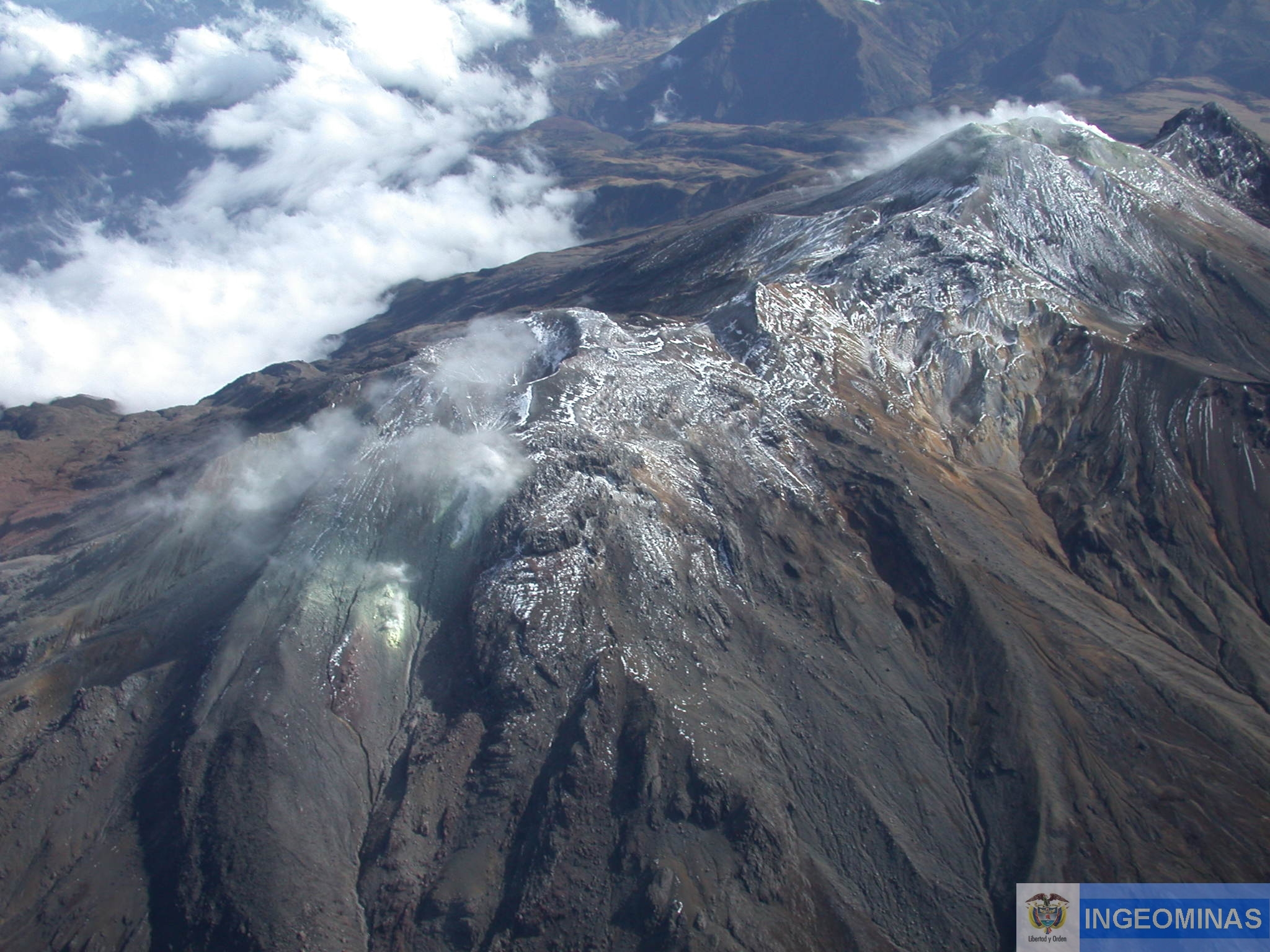
For most of the period evaluated, favorable weather conditions at the summit revealed gas emissions mainly from the El Verde fumarol field north-northeast of the volcanic complex; the emission columns have been observed in white color, and of variable height and direction depending on the action of the winds.
Other geophysical and geochemical parameters of volcanic monitoring did not show significant variations.
The COLOMBIAN GEOLOGICAL SERVICE is attentive to the evolution of the volcanic phenomenon and will continue to inform in a timely manner of the observed changes.
Source : SGC.
Photo : Ingeominas.
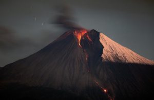
Japan , Aira ( Sakurajima ) :
31.593°N, 130.657°E
Elevation 1117 m
JMA reported that at 1044 on 4 July an explosion at Minamidake crater (at Aira Caldera’s Sakurajima volcano) generated an ash plume that rose 3.2 km above the crater rim and ejected material 1.1 km from the vent. The Alert Level remained at 3 (on a 5-level scale).
https://www.facebook.com/masatoshi.nakamura.5/videos/2414427275307776/
The Aira caldera in the northern half of Kagoshima Bay contains the post-caldera Sakurajima volcano, one of Japan’s most active. Eruption of the voluminous Ito pyroclastic flow accompanied formation of the 17 x 23 km caldera about 22,000 years ago. The smaller Wakamiko caldera was formed during the early Holocene in the NE corner of the Aira caldera, along with several post-caldera cones. The construction of Sakurajima began about 13,000 years ago on the southern rim of Aira caldera and built an island that was finally joined to the Osumi Peninsula during the major explosive and effusive eruption of 1914. Activity at the Kitadake summit cone ended about 4850 years ago, after which eruptions took place at Minamidake. Frequent historical eruptions, recorded since the 8th century, have deposited ash on Kagoshima, one of Kyushu’s largest cities, located across Kagoshima Bay only 8 km from the summit. The largest historical eruption took place during 1471-76.
Source: Japan Meteorological Agency (JMA) , GVP.
Video: Masatoshi Nakamura.
La Guadeloupe , La Soufrière :
Wednesday, July 10, 2019 at 16:00.
Sequence of earthquakes in La Soufrière area of Guadeloupe – Basse Terre
The sequence of volcanic earthquakes that began in the area of La Soufrière volcano on July 5, 2019 at 6:04 am local time (July 5, 2019 10h04 universal time TU *) ended on Tuesday, July 9 at 23:59 UTC. During this sequence 172 earthquakes were recorded.
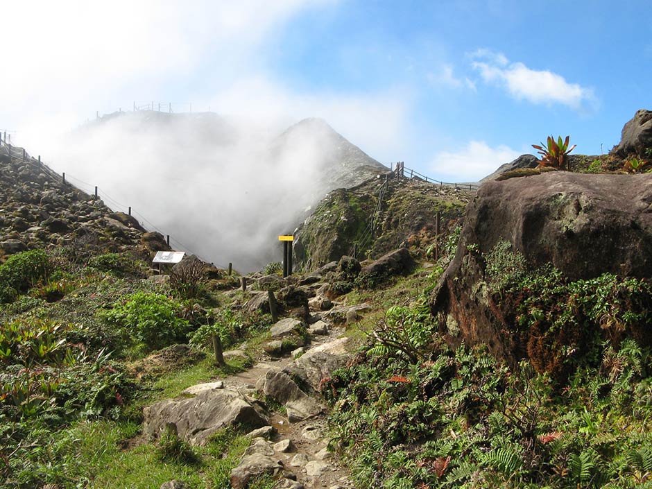
The earthquakes were of very small magnitude (M <1). The events are located at a depth of <2.5 km under the summit of the dome of La Soufrière. No earthquakes were reported felt by the population.
The alert level remains: yellow, vigilance
Source : Direction de l’OVSG-IPGP.
Photo : pp.aircaraibes.com
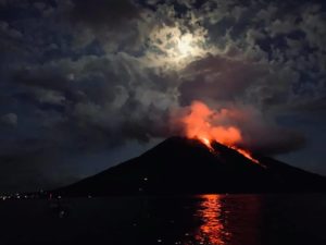
Philippines , Mayon :
MAYON VOLCANO BULLETIN 11 July 2019 08:00 A.M.
Mayon Volcano’s seismic monitoring network recorded one (1) volcanic earthquake during the 24-hour observation period. Moderate emission of white steam-laden plumes that crept downslope before drifting north-northwest was observed. Faint crater glow from the summit could be observed at night. Sulfur dioxide (SO2) emission was measured at an average of 666 tonnes/day on 03 July 2019. Precise leveling data obtained on 09 – 17 April 2019 indicate a slight inflation of the edifice relative to 20 – 26 March 2019. This is consistent with continuous GPS data showing that the edifice is still inflated since June 2018.
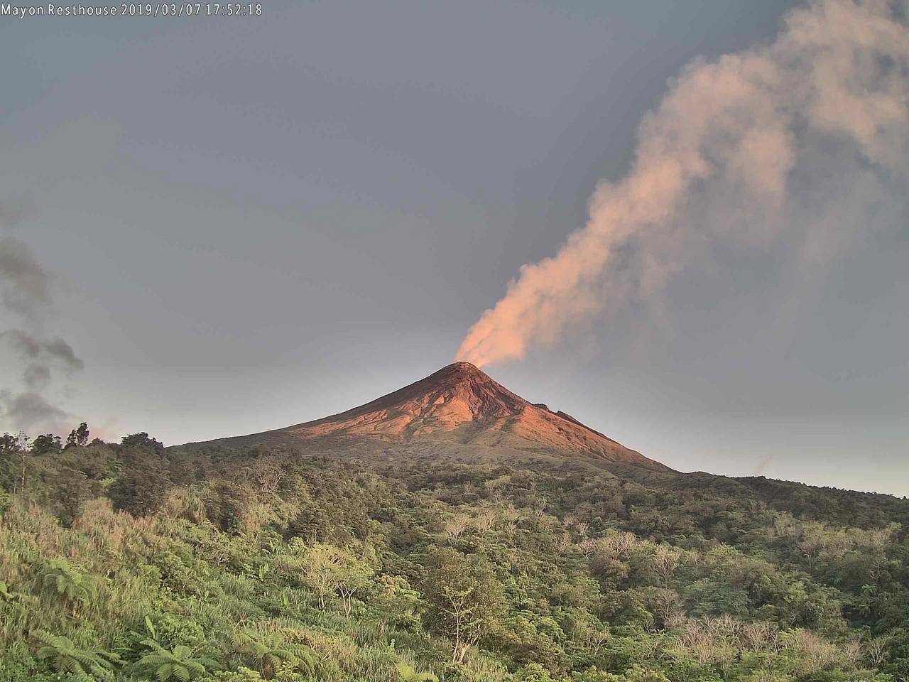
Alert Level 2 currently prevails over Mayon Volcano. This means that Mayon is at a moderate level of unrest. DOST-PHIVOLCS reminds the public that sudden explosions, lava collapses, pyroclastic density currents or PDCs and ashfall can still occur and threaten areas in the upper to middle slopes of Mayon. DOST-PHIVOLCS recommends that entry into the six kilometer-radius Permanent Danger Zone or PDZ and a precautionary seven kilometer-radius Extended Danger Zone or EDZ in the south-southwest to east-northeast sector, stretching from Anoling, Camalig to Sta. Misericordia, Sto. Domingo must be strictly prohibited. People residing close to these danger areas are also advised to observe precautions associated with rockfalls, PDCs and ashfall. Active stream/river channels and those identified as perennially lahar-prone areas on all sectors of the volcano should also be avoided especially during extreme weather conditions when there is heavy and prolonged rainfall. Civil aviation authorities must advise pilots to avoid flying close to the volcano’s summit as airborne ash and ballistic fragments from sudden explosions and PDCs may pose hazards to aircrafts.
Source : Phivolcs
Photo : volcanodiscovery