May 21 , 2019.
Finally i’m back . I thank the pirates who ransacked my work. I’m sure there must be other sites that are more interesting than a poor site on volcanic news.
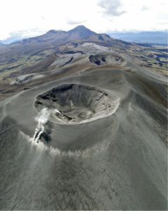
Mexico , Colima :
Weekly Technical Bulletin of the Colima Volcano
Seismic activity:
Last week, 60 high-frequency (HF) events, 16 landslides, 14 low-amplitude explosions and 21.9 min of low-amplitude trenches were recorded automatically. An explosion was recorded on May 11 at 12:35 pm (5:35 pm) at the INCA station located 1.9 km from the volcano crater.
Visual observations:
During the reporting period, it was possible to observe the May 11 explosion from several monitoring stations. During the week, other explosions also occurred with very little gas emission.

The fixed thermal camera located south of the volcano recorded thermal anomalies related to explosions and intermittent fumarolic activity. During the May 11th explosion, which began at 12:35 pm, a maximum apparent temperature of 19.8 ° C was reached, suggesting that this event was mainly a release of water vapor and gas
Geochemistry:
No SO2 flow measurements were performed during the last week.
Remote perception:
No thermal anomalies detected by the MIROVA satellite system were observed during the last week.
Source : portal.ucol.mx .
Photo : Radio Nacional .
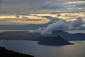
Philippines , Taal :
TAAL VOLCANO BULLETIN 21 May 2019 8:00 A.M.
Taal Volcano’s seismic monitoring network recorded fourteen (14) volcanic earthquakes during the 24-hour observation period. Field measurements on 16 May 2019 at the western sector of the Main Crater Lake yielded an increase in water temperature from 32.2°C to 33°C, a decrease in water level from 0.18 meter to 0.08 meter and decrease in pH from 2.87 to 2.83. Ground deformation measurements through precise leveling surveys from 18 – 27 March 2019 indicated slight inflation of the edifice consistent with recent results from continuous GPS data.
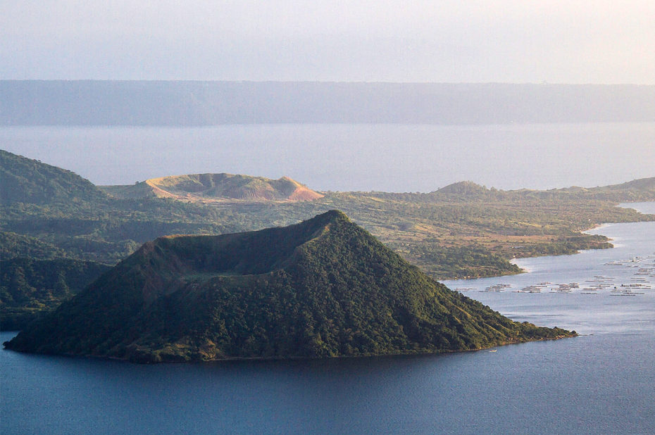
Alert Level 1 remains in effect over Taal Volcano. This means that hazardous eruption is not imminent. The public, however, is reminded that the Main Crater should be strictly off-limits because sudden steam explosions may occur and high concentrations of toxic gases may accumulate. The northern portion of the Main Crater rim, in the vicinity of Daang Kastila Trail, may also become hazardous when steam emission along existing fissures suddenly increases. Furthermore, the public is also reminded that the entire Volcano Island is a Permanent Danger Zone (PDZ), and permanent settlement in the island is strongly not recommended.
Source : Phivolcs .
Photo : Topexpos Voyages.
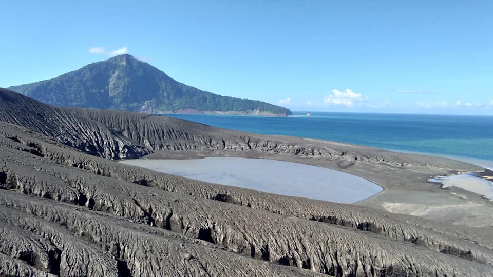
Indonesia , Anak Krakatau :
Level of activity at level II (Waspada), since March 25, 2019. G. Anak Krakatau (157 m altitude) has increased its volcanic activity since June 18, 2018, which was followed by a series of eruptions from September 2018 to February 2019. In May 2019, eruptions still occur but of decreasing intensity.
Since yesterday and until this morning, the volcano was covered with fog. The smoke from the crater is not observed.
Through the seismographs dated May 20, 2019, it was recorded:
2 earthquakes of eruption
7 earthquake emission
1 low frequency earthquake
3 shallow volcanic earthquakes
1 volcanic earthquake
11 harmonic earthquakes
Tremor continuous with a dominant amplitude of 1 mm
Recommendation:
People / tourists are not allowed to approach the crater within 2 km.
VOLCANO OBSERVATORY NOTICE FOR AVIATION – VONA.
Issued: May 2 , 2019 .
Volcano: Anak Krakatau (262000)
Current Aviation Colour Code: ORANGE
Previous Aviation Colour Code: orange
Source: Anak Krakatau Volcano Observatory
Notice Number: 2019KRA93
Volcano Location: S 06 deg 06 min 07 sec E 105 deg 25 min 23 sec
Area: Lampung, Indonesia
Summit Elevation: 502 FT (157 M)
Volcanic Activity Summary:
Eruption with volcanic ash cloud at 12h50 UTC (19h50 local).
Volcanic Cloud Height:
Ash-cloud is not visible
Other Volcanic Cloud Information:
Anak Krakatau volcano is not clear.
Remarks:
Eruption recorded on seismogram with maximum amplitude 45mm and duration 45 second.
Source : PVMBG , Magma Indonésie .
Photo : Yohannes Tyas Galih Jati , Mai 2019.
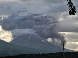
Guatemala , Fuego :
SPECIAL BEFGO VOLCANOLOGICAL BULLETIN # 19-2019 Moderate lahars in GULLS LAS CANTIZA, EL JUTE AND LAJAS, Guatemala 20 May 2019 at 16:40 (local time).
Type of activity: Vulcanian
Morphology: Composite Stratovolcano
Geographical location: 14 ° 28 ’54 ° Latitude N; 90 ° 52’54˝Longitude W.
Height: 3,763msnm.
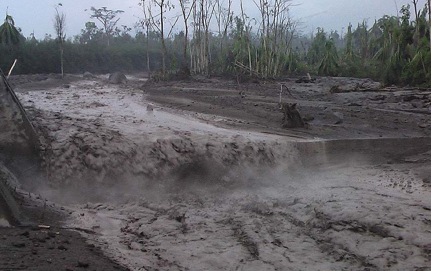
According to the climatic conditions, the presence of rain on the volcanic chain is recorded, mainly on the Fuego volcano, in addition to the humidity conditions recorded these days, we note the descent of moderate lahars by the Ceniza, El Jute and Las Barrancas Lajas. It is not excluded that they can increase and become strong in their descent downstream. These lahars have the following characteristics: they come down hot, giving off a smell of sulfur, lead to volcanic materials such as ashes, sand and blocks 1, 2 and 3 meters in diameter that vibrate the ground, generate sounds of rock shock. The trailed material has been deposited by constant eruptive activity and it is expected that similar events will continue.
As the rains continue, the probability that lahars can be generated at night by the different ravines of the Fuego volcano can not be ruled out.
Source : Insivumeh.
Photo : Caroline Sarrazin , Rés-EAUx .