March 01 , 2024.
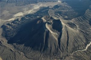
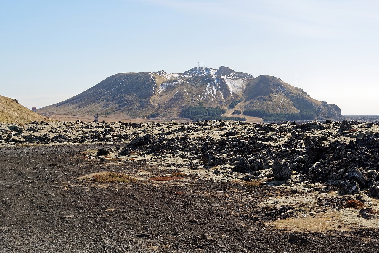
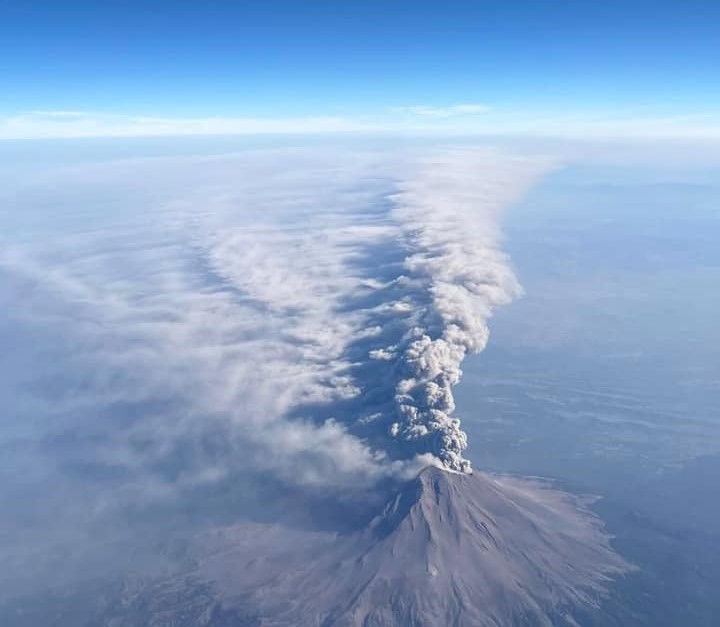
Iceland : Reykjanes Peninsula :
Increased likelihood of a volcanic eruption in the coming days . Activity has continued at a constant rate
Updated 29. February at 12:30 UTC
An eruption could start with very little warning time, even less than 30 minutes.
Eruption location is most likely in the area between Mt. Stóra-Skógfell and Mt. Hagafell.
The hazard assessment does not account for weather conditions or other factors that may affect the risk of being within the hazard zones.
It is possible that a dike intrusion occurs without resulting in a volcanic eruption.
Model calculations suggest that as of today, about 8.5-9 million cubic metres of magma has accumulated beneath Svartsengi. The rate of the inflation has been fairly constant for the past days. In previous developments, the rate of inflation has decreased shortly before an eruption starts.
According to model calculations, approximately 0.5 million cubic metres of magma is accumulated in the Svartsengi reservoir every 24 hours.
Considering precursors of previous volcanic eruption in the Sundhnúkar crater row, likelihood of a volcanic eruption increases once the volume of magma reaches 8 – 13 million cubic metres. If magma accumulation continues at the same rate, the amount should reach the upper limit next week.
There remains an increased likelihood of a volcanic eruption in the coming days. The most likely scenario is that a volcanic fissure opens in the area between mt. Stóra-Skógfell and Mt. Hagafell which could occur with a very short warning time.
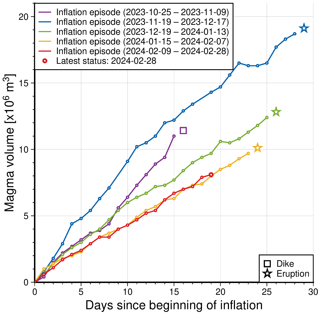
The graph shows a comparison of volume of magma accumulated beneath Svartsengi before it propagates towards Sundhnúkur crater row. The status of the magma volume at 28th of February is indicated with red colour. The amount is derived through model calculations based on GPS data and subject to uncertainties. Changes can vary from day to day, from being small to more prominent changes. The purple line shows the magma volume accumulated prior to the large diking event beneath Grindavík formed on the 10th of November 2023.
A new hazard assessment map from IMO was published today and remains unchanged from the previous one. The hazard assessment map is valid until 5th of March unless developments in activity call for a re-evaluation. Likely scenarios presented earlier this week also remain unchanged (see news from 26th of February).
Source : IMO
Photos : Þorbjörn, Jakub Hałun /wikipedia , IMO.
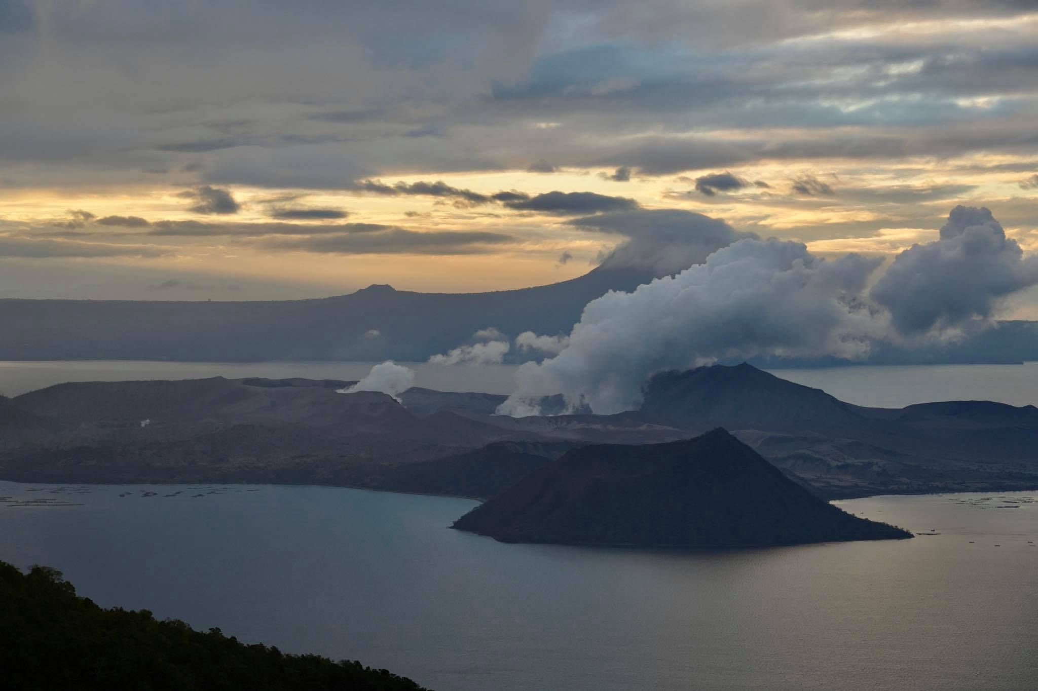
Philippines , Taal :
TAAL VOLCANO ADVISORY , 29 February 2024 , 6:00 PM
This is a notice of elevated sulfur dioxide degassing from Taal Volcano.
A total of 14,558 tonnes/day of volcanic sulfur dioxide or SO2 gas emission from the Taal Main Crater was measured today, 29 February 2024, the second highest flux recorded this year. Taal has averaged approximately 9,450 tonnes/day for the month of February 2024 and has been continuously degassing voluminous concentrations of SO2 since 2021. Moderate winds have prevented the accumulation of SO2 and no volcanic smog or vog over Taal Caldera was thus observed by visual monitors throughout the day. Volcanic earthquake activity has remained within baseline levels with only three volcanic earthquakes being recorded this month.

DOST-PHIVOLCS reminds the public that Alert Level 1 prevails over Taal Volcano, which means that it is still in abnormal condition and should not be interpreted to have ceased unrest nor ceased the threat of eruptive activity. At Alert Level 1, sudden steam-driven or phreatic explosions, volcanic earthquakes, minor ashfall and lethal accumulations or expulsions of volcanic gas can occur and threaten areas within Taal Volcano Island or TVI. Furthermore, degassing of high concentrations of volcanic SO2 continues to pose the threat of potential long-term health impacts to communities around Taal Caldera that are frequently exposed to volcanic gas. DOST-PHIVOLCS strongly recommends that entry into TVI, Taal’s Permanent Danger Zone or PDZ, especially the vicinities of the Main Crater and the Daang Kastila fissure, must remain strictly prohibited. Local government units are advised to continuously monitor and assess volcanic SO2 exposure of, and potential impacts on, their communities and undertake appropriate response measures to mitigate these hazards.
DOST-PHIVOLCS is closely monitoring Taal Volcano’s activity and any new significant development will be immediately communicated to all stakeholders.
Source : Phivolcs
Photo : Raffy Tima
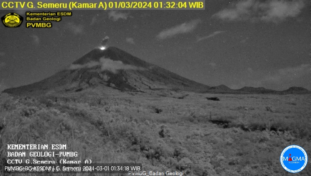
Indonesia , Semeru :
Mount Semeru exhibited an eruption on Thursday, February 29, 2024 at 11:48 p.m. WIB with the height of the ash column observed at ± 600 m above the summit (± 4276 m above sea level). The ash column was observed to be white to gray in color with thick intensity, oriented towards the North. This eruption was recorded on a seismograph with a maximum amplitude of 22 mm and a duration of 144 seconds.
VOLCANO OBSERVATORY NOTICE FOR AVIATION – VONA
Issued : February 29 , 2024
Volcano : Semeru (263300)
Current Aviation Colour Code : ORANGE
Previous Aviation Colour Code : orange
Source : Semeru Volcano Observatory
Notice Number : 2024SMR152
Volcano Location : S 08 deg 06 min 29 sec E 112 deg 55 min 12 sec
Area : East java, Indonesia
Summit Elevation : 11763 FT (3676 M)
Volcanic Activity Summary :
Eruption with volcanic ash cloud at 16h48 UTC (23h48 local).
Volcanic Cloud Height :
Best estimate of ash-cloud top is around 13683 FT (4276 M) above sea level or 1920 FT (600 M) above summit. May be higher than what can be observed clearly. Source of height data: ground observer.
Other Volcanic Cloud Information :
Ash cloud moving to north. Volcanic ash is observed to be white to gray. The intensity of volcanic ash is observed to be thick.
Remarks :
Eruption recorded on seismogram with maximum amplitude 22 mm and maximum duration 144 second.
Source et photo : Magma Indonésie.
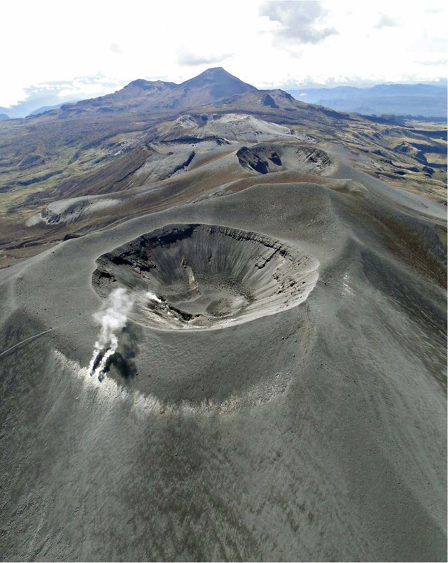
Colombia , Puracé – Chaîne volcanique Los Coconucos :
Weekly bulletin of the activity of the Puracé volcano – Los Coconucos volcanic chain
From the monitoring of the activity of the VOLCANIC CHAIN PURACE VOLCANO – LOS COCONUCOS, the MINISTRY OF MINES AND ENERGY, through the COLOMBIAN GEOLOGICAL SERVICE (SGC), reports that:
During the week of February 20 to 26, 2024, seismic activity presented levels similar to those of previous weeks, both in energy and in the number of events. The fracture earthquakes recorded were located mainly under the Puracé volcano building, with depths less than 5 km and magnitudes less than 1.0 ML; while the earthquakes associated with the fluids were located in two areas, one under the crater of the volcano, at depths less than 1 km and another to the South-East of it, at depths between 1, 5 and 5 km.
During the period evaluated, localized deformations continued to be recorded between the Puracé and Curiquinga volcanoes. Likewise, the concentration of carbon dioxide (CO2) has continued to fluctuate and remains stable, above reference values on this volcano. On the other hand, an increase in the flow of sulfur dioxide (SO2) was recorded, compared to the values recorded in recent weeks.
Images obtained using installed cameras show that significant degassing of the volcanic system continues.
The other parameters measured and used for the diagnosis of volcanic activity showed no notable changes during the period evaluated.
The alert status for volcanic activity remains at: YELLOW ALERT: ACTIVE VOLCANO WITH CHANGES IN THE BEHAVIOR OF THE BASE LEVEL OF MONITORED PARAMETERS AND OTHER MANIFESTATIONS.
Source et photo : SGC
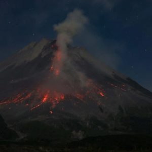
Mexico , Popocatepetl :
Summary of the last 24 hours. February 29, 11:00 a.m. (February 29, 5:00 p.m. GMT)
148 exhalations accompanied by water vapor, volcanic gases and ash were detected. Additionally, 1,034 minutes of high-frequency, low-amplitude tremors (17.23 h) were identified.
CENACOM (National Center for Communication and Civil Protection Operations) reported light ash falls in the municipality of Yecapixtla, Morelos; in Ixtacuixtla, Panotla, Tepetitla, Nativitas, Zacatelco, Santa Apolonia Teacalco, San Damián Texóloc, Tetlahuaca, Zacatelco, Xicohtzingo, Paplotla, Tenancingo, Santa Catarina Ayometla, Magdalena Tlaltelulco, San Francisco Tetlanohcan and Teolocholco, Tlaxcala; in San Matías Tlalancaleca, San Martín Texmelucan, Santa Rita Tlahuapan, Nealtican, Domingo Arenas, San Salvador El Verde and Huejotzingo, Puebla; and finally to Temamatla, Tenango and Atlautla, State of Mexico.
We see that activity today is less than in 2023.
During the morning and at the time of this report, a continuous emission of volcanic gases and ash is observed, with dispersion towards the North-East (NE).
The Popocatépetl volcanic warning fire is in yellow phase 2.
The scenarios planned for this phase are:
A few small to moderate explosions
Appearance of tremors of variable amplitude
Light to moderate ash rain in surrounding towns and some more distant towns
Ejection of incandescent fragments within the exclusion radius of 12 kilometers
Lahars flowing down ravines can be expected, due to the accumulation of ash on the slopes and their interaction in the event of heavy rains or thaws.
Possibility of pyroclastic flows not reaching populations
The report is published daily at 11 a.m., here the activity recorded over the last 24 hours is summarized; i.e. from 10 a.m. of the previous day to 10 a.m. of the current day. If an extraordinary event occurs, it will be reported immediately.
Source : Cenapred
Photo : Miembro Distinguido / FB