April 11, 2019.
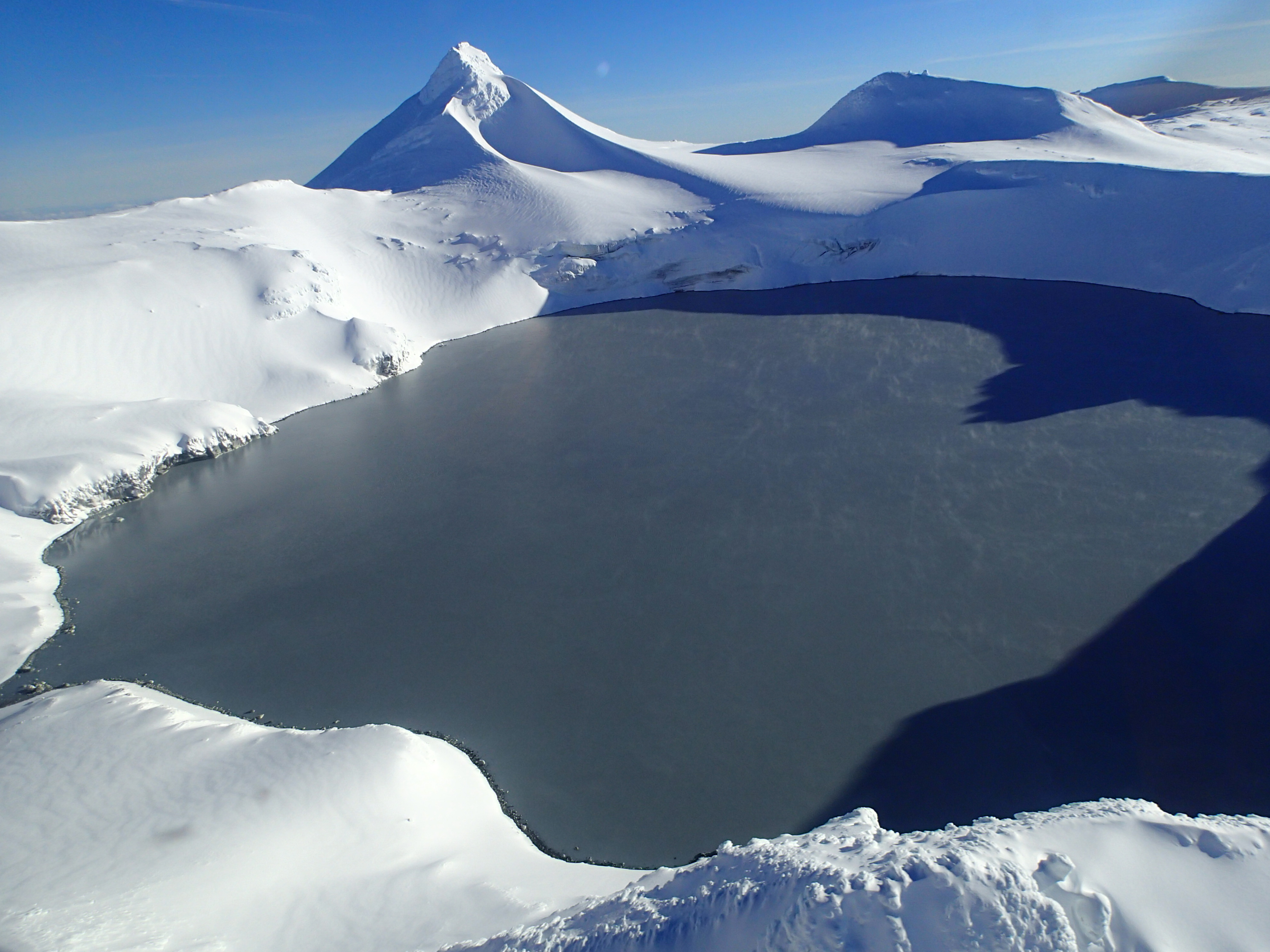
New Zealand , Ruapehu :
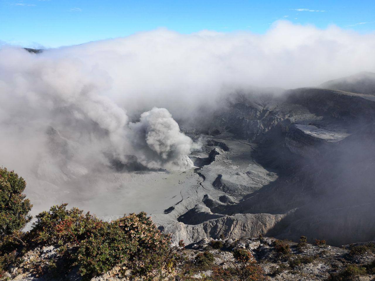
Te Wai ā-moe, Mt Ruapehu: Increases in lake temperature and seismic activity .
Published: Wed Apr 10 2019 3:30 PM
Volcanic Alert BulletinRUA– 2019/01
Wed Apr 10 2019 3:30 PM; Ruapehu Volcano
Volcanic Alert Level remains at 1
Aviation Colour Code remains at Green
We are recording another phase of high lake temperatures at Te Wai ā-moe (Crater Lake), Mt Ruapehu along with moderate levels of volcanic tremor. The Volcanic Alert Level remains at 1.
Since 2009, we have continuously recorded the temperature of Te Wai ā-moe. Over this time, the temperature has often cycled between ~ 15 and 45°C over a period of about 12 months. However, in September 2018 we recorded a departure from this, and for the following 6 months the lake temperature remained elevated (at ~ 30°C). Over the last two weeks, the lake temperature has risen further, at a rate of around 0.5°C per day, to 42°C on April 9. To put this in context, only 1 per cent of post-2009 temperatures have exceeded 42°C and a similar temperature last occurred in May 2016.
The level of volcanic tremor typically also increases when the lake temperature rises, and this has been the case in the last 2 weeks. The current tremor intensity is moderate. In previous heating cycles, this increased tremor lasted for a few days to several weeks.
In the past, eruptions at Ruapehu have occurred more often when the lake exceeded 45°C. However, a temperature of 46°C was recorded in 2016 with no eruption.
Volcanic Alert Level 1 corresponds to minor unrest. While this is the case, it is a useful reminder that eruptions can occur with little or no warning. GNS Science continues to closely monitor Mt Ruapehu and our other active volcanoes.
Source : Geonet , Agnes Mazot , Volcanologiste de service .
Photo : Geonet
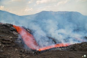
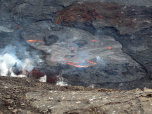
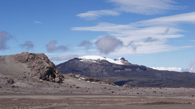
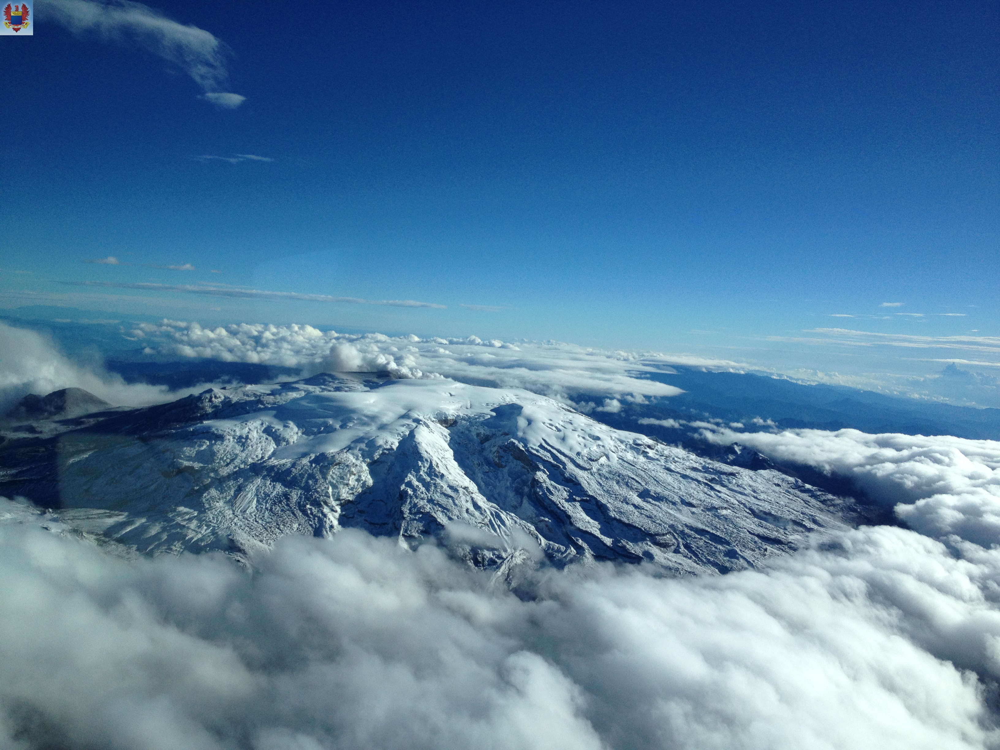
Colombia , Nevado del Ruiz :
Weekly activity bulletin of the Nevado del Ruiz volcano
The level of activity continues at the level: Yellow activity level or (III): Modifications of the behavior of the volcanic activity.
With regard to monitoring the activity of the Nevado del Ruiz volcano, the COLOMBIAN GEOLOGICAL SERVICE announces that:
During the last week, the seismicity caused by rock fracturing showed a slight increase in the number of earthquakes and released seismic energy, compared to the previous week. The earthquakes were located mainly in the north of the volcano, in the southwest sectors and the Arenas crater at depths between 1.2 and 5.4 km. The maximum magnitude recorded during the week was 1.8 ML (local magnitude) for the earthquake that occurred on April 05 at 12:34 (local time), located in the Arenas crater at a depth of 4.4 km.
The seismicity related to fluid dynamics in the channels of the volcanic structure has seen an increase in the number of earthquakes and released seismic energy compared to the previous week. This type of seismic activity has been characterized by the appearance of earthquakes with variable levels of energy, usually low, long-period type (LP), very long period (VLP), pulses of volcanic tremors and volcanic tremors continuous. The earthquakes were mainly located in the crater Arenas and its surroundings. Some of these signals were associated with small ash emissions.
Volcanic deformation, measured from electronic inclinometers, has not recorded any significant changes over the past week.
The volcano continues to emit water vapor and gases into the atmosphere, among which is the sulfur dioxide (SO2), as evidenced by the values obtained by the SCANDOAS stations installed in the region of the volcano. satellite image analysis. During the week, the NASA FIRMS portal reported several low-energy thermal anomalies.
The column of gas and steam reached a maximum height of 1400 m, measured at the top of the volcano on April 6th. The direction of dispersion of the column was governed by the direction of the wind in the region, which prevailed towards the northwest of the volcano.
The Nevado del Ruiz volcano continues at the level of yellow activity.
Source : SGC.
Photos : Auteurs inconnus
Costa Rica , Turrialba / Rincon de la Vieja / Poas :
Daily report of the state of volcanoes. OVSICORI-UNA, Date: April 10, 2019, Updated at: 11:19:00 AM.
Turrialba Volcano:
No eruption is reported.
The seismic activity is more important compared to the day yesterday.
At the time of this report, the winds are blowing east.
The network of seismometers of the volcano Turrialba that the OVSICORI-UNA administers has recorded during the last 24 hours a certain number of long-period, low-amplitude LP-type earthquakes attributed to the transport of fluids (water, gas) in ducts and cracks of the volcanic building.
Degassing continues persistently, but with a relatively low gas and heat flux, compared to what was observed during the 2014-2016 period. The plume has a low content of fine aerosols. No significant emissions of ash or incandescence were observed. Since mid-June 2017, the OVSICORI-UNA gas and aerosol monitoring station located in Coronado (San José) has recorded concentrations of SO2 in Coronado ambient air equal to or less than 3 ppm. which indicates a marked decrease in the magmatic gas flow through the craters of the Turrialba and Poás volcanoes.
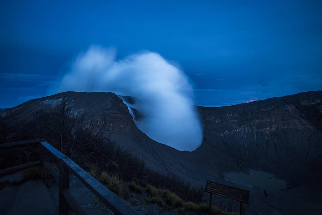
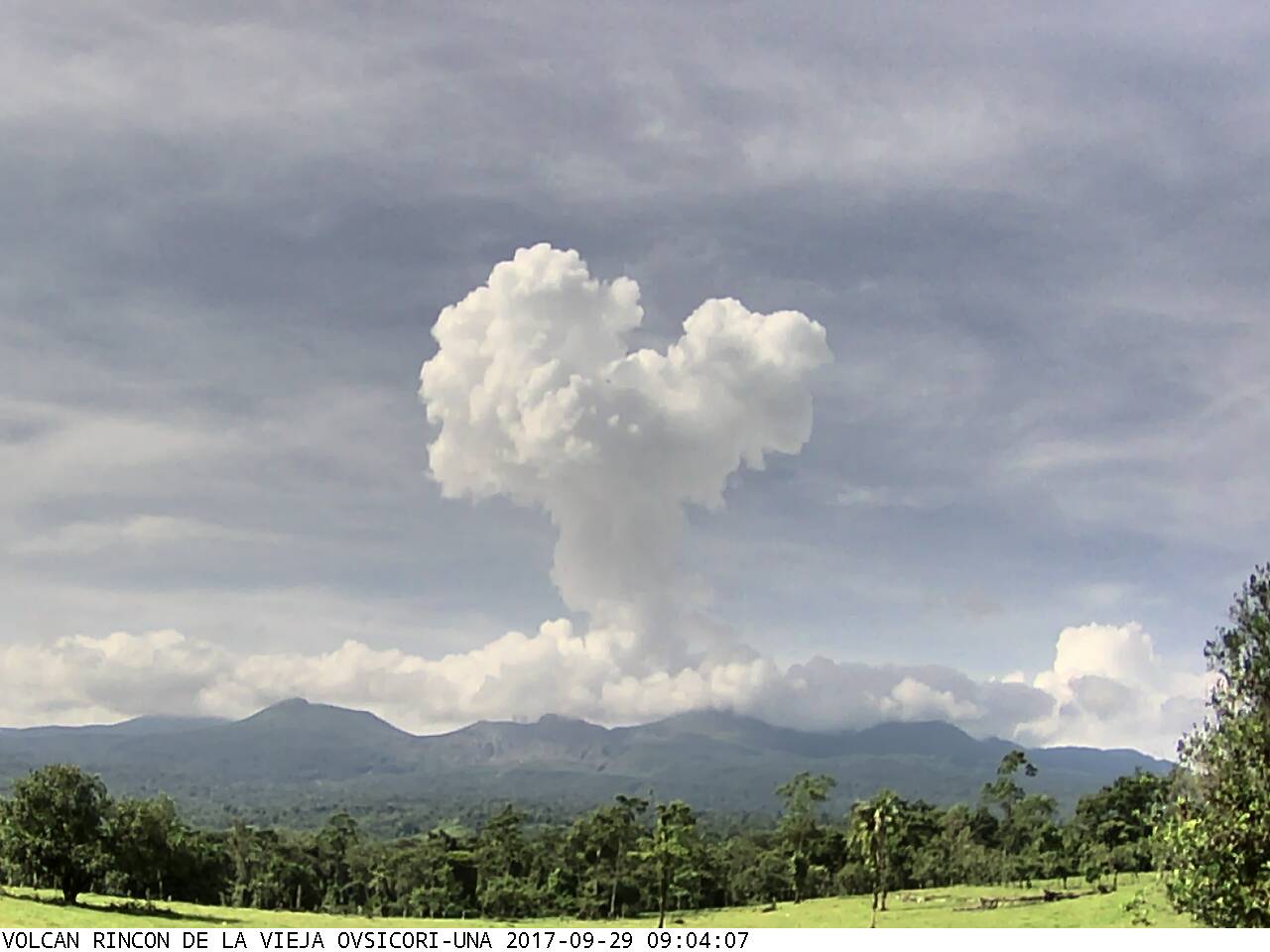
Rincon de la Vieja Volcano:
On April 10, 2019, at 18:17 local time, there was an eruption on the Rincon de la Vieja volcano, with an emission column that culminated at 1,000 meters above crater height and 2,916 meters at above sea level (9564.48 ft).
Duration of the activity: 2 minutes.
The seismic activity is more important compared to the day yesterday.
At the time of this report, the winds blow from the Southeast.
The seismographs have recorded during the last 24 hours a considerable number of volcanic tremors of short duration and low amplitude. Today, April 10, at 6:17 am, a seismic signal associated with the moderate expiration of a plume of water vapor and gas was recorded, which amounted to a height of approximately 1,000 m above main crater. This plume was observed and reported by the inhabitants of the northern sector of the volcano and Curubande. Yesterday, April 9 at 20:34, a seismic signal corresponding to a small phreatic eruption was recorded.
Poas Volcano:
No eruption is reported.
The seismic activity is more important compared to the day yesterday.
At the time of this report, the winds are blowing east.
The OVSICORI-UNA seismograph network has sporadically recorded long-lived LP-type earthquakes related to the transport of fluids (water, gas) in ducts and cracks inside the volcano.
The plume of gas, steam and fine aerosols is about 500 meters from the bottom of the main crater. The concentration of gas in the ambient air surrounding the interior of the crater is only 0.4 ppm SO2 with traces of H2S gas. The presence of few SO2 and H2S indicates that the activity of the volcano is mainly governed by the boiling water of the hydrothermal system and by the generation of fumaroles at low temperature (about or less than 300 degrees Celsius) and by signs of magma degassing not very important. The magma that rose and was emitted in the first half of 2017 cooled and became depleted of volatile substances.
Source : Ovsicori
Photos : Dr. Paulo Ruiz Cubillo 06/2017 , Archive Ovsicori , RSN.
Guatemala , Fuego :
VOLCANOLOGICAL SPECIAL BULLETIN BEFGO # 07-2019, Guatemala April 9, 2019 at 18:00 (local time)
LAHARES MODERES A FORTS IN THE RAVINS LAS LAJAS AND JUTE OF THE VOLCÁN DE FUEGO (1402-09)
Type of activity: Vulcanian
Morphology: Composite Stratovolcano
Geographical location: 14 ° 28’54˝Latitude N; 90 ° 52’54˝Longitude W.
Height: 3,763msnm.
Rainfall this afternoon in the Fuego Volcano region is currently generating descent from moderate to strong lahars in the ravines of Las Lajas (tributary of the Guacalate River) and El Jute (tributary of the Achiguate River).
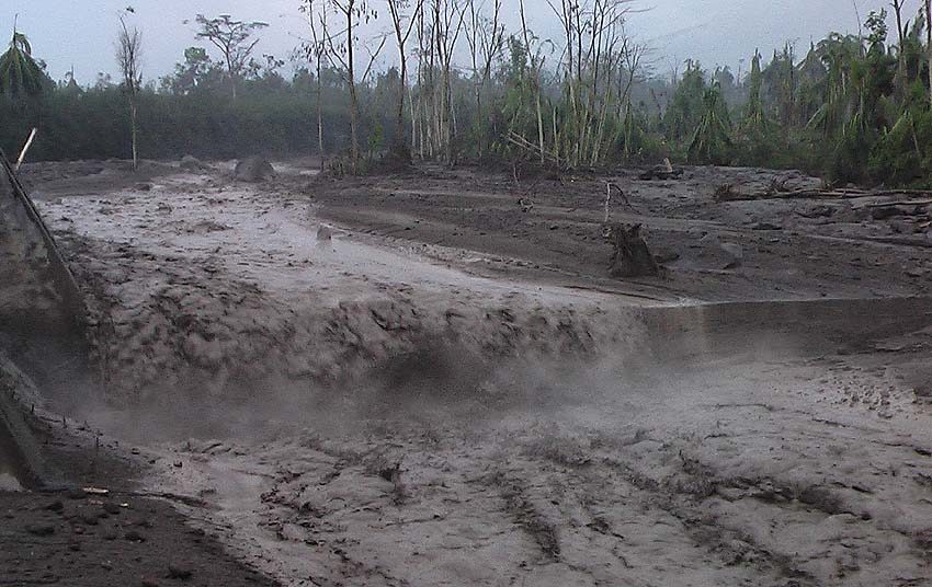
These lahars have characteristics at the beginning of pasty materials, with blocks from a few centimeters to two meters in diameter, they carry branches and trunks of trees, some descend hot to form steam columns.
Because of the rains that can be generated in the afternoon and evening around the volcano, the possibility of lahars in one of the main ravines is not excluded.
Source : INSIVUMEH
Photo : Caroline Sarrazin , Rés-EAUx .