February 16 , 2019.
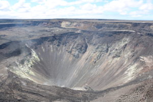
La Réunion , Piton de la Fournaise :
Since the end of January, the Volcanological Observatory of the Piton de la Fournaise (OVPF) has observed a swelling of the base and the top of the volcano building, synonymous with a pressurization of the superficial magmatic reservoir. Since Wednesday, the number of earthquakes has significantly increased from 5 to 29 for the day of Thursday. A number and a significant magnitude for the volcano.
« For the moment, there is no major change concerning the recovery of activity of the Piton de la Fournaise.The pressurization of the magmatic reservoir observed since the beginning of the month continues, but it can last several days, even several This activity can accelerate or stop completely without causing an eruption, « says Aline Peltier, Director of the OVPF.
Since the end of the last eruption, the status is still « Volcanic Vigilance », the first alert level of the device ORSEC volcano. Access to the paddock is permitted, however, and hikers must remain on authorized trails marked by the ONF for safety reasons.
As a reminder, the volcano erupted earlier on September 15th. An eruption that had still reached 47 days.
Source : Clicanoo.
Photo : G Vitton
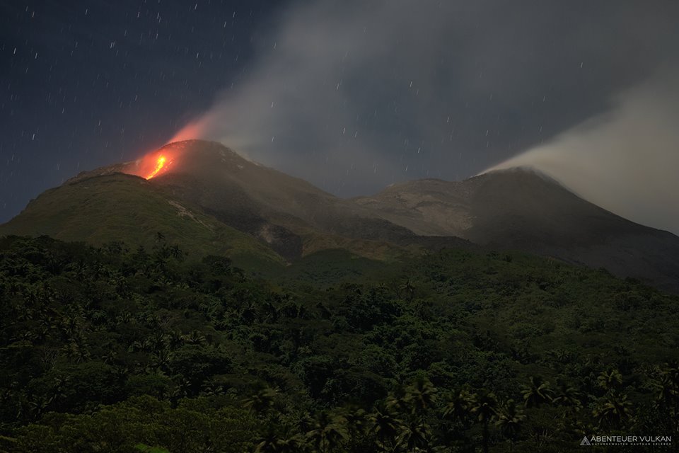
Indonesia , Karangetang :
Activity Level at Level III (SIAGA). The Karangetang (1827 m altitude) is reinstated in a period of eruption since November 25, 2018.
Since yesterday and until this morning, the volcano was clearly visible then covered with fog. Smoke from the main crater is white in color, up to 400 m thick. The smoke emitted from crater II was white / bluish at 50 – 150 m above the summit. The wind was blowing weakly in the South and North-West. A low to fairly loud rumble has arrived at the PGA monitoring station.
The seismographs dated February 14, 2019 recorded:
27 avalanche earthquakes
30 emissions earthquake.
2 shallow earthquakes
3 deep volcanic earthquakes
9 distant tectonic earthquake
2 hybrid earthquakes
Continuous tremor with an amplitude of 0.25 mm, dominant value of 0.25 mm
Recommendation:
People around Karangetang and visitors / tourists should not approach, climb or move in the danger zone located 2.5 km from the summit of Kawah Dua (North crater) and the main crater (South) and from the sectoral expansion zone from Dua Crater west-northwest 3 km and north-north-east 4 km.
Communities around Karangetang in the northwestern Kawah Dua region, including Niambangeng village, Beba village and Batubulan village, should be evacuated to a place protected from the threat of lava flows or hot clouds, outside the danger zone
People living around rivers from the summit of Mount Karangetang must be prepared for the potential threat of lahars and sudden floods that can spread to the coast.
It is recommended that the community around Mount Karangetang prepare a mask for the nose and mouth to prevent the risk of airway disruption in case of ash rain.
VONA: The last VONA code was last sent with the YELLOW color code, published on November 25, 2018 at 13:32 WITA, relating to the emission of volcanic ash at an altitude of about 2284 m above the sea level or about 500 m above the summit, the wind blowing to the east.
Source : PVMBG
Photo : andi volcanist / abenteuervulkan
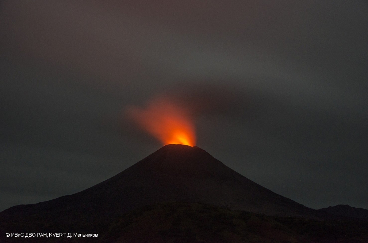
Kamchatka , Karymsky :
VOLCANO OBSERVATORY NOTICE FOR AVIATION (VONA).
Issued:20190216/0336Z
Volcano:Karymsky (CAVW #300130)
Current aviation colour code:ORANGE
Previous aviation colour code:yellow
Source:KVERT
Notice Number:2019-35
Volcano Location:N 54 deg 2 min E 159 deg 26 min
Area:Kamchatka, Russia
Summit Elevation:4874.08 ft (1486 m)
Volcanic Activity Summary:
Satellite data shows an ash plume is extending for about 55 km to the south-east from Karymsky volcano.
A moderate eruptive activity of the volcano continues. Ash explosions up to 13,100-19,700 ft (4-6 km) a.s.l. could occur at any time. Ongoing activity could affect low-flying aircrafts.
Volcanic cloud height:
8200-9840 ft (2500-3000 m) AMSL Time and method of ash plume/cloud height determination: 20190216/0227Z – JPSS-1 (14m15)
Other volcanic cloud information:
Distance of ash plume/cloud of the volcano: 34 mi (55 km)
Direction of drift of ash plume/cloud of the volcano: SE / azimuth 126 deg
Time and method of ash plume/cloud determination: 20190216/0227Z – JPSS-1 (14m15)
Karymsky, the most active volcano of Kamchatka’s eastern volcanic zone, is a symmetrical stratovolcano constructed within a 5-km-wide caldera that formed during the early Holocene. The caldera cuts the south side of the Pleistocene Dvor volcano and is located outside the north margin of the large mid-Pleistocene Polovinka caldera, which contains the smaller Akademia Nauk and Odnoboky calderas. Most seismicity preceding Karymsky eruptions originated beneath Akademia Nauk caldera, located immediately south. The caldera enclosing Karymsky formed about 7600-7700 radiocarbon years ago; construction of the stratovolcano began about 2000 years later. The latest eruptive period began about 500 years ago, following a 2300-year quiescence. Much of the cone is mantled by lava flows less than 200 years old. Historical eruptions have been vulcanian or vulcanian-strombolian with moderate explosive activity and occasional lava flows from the summit crater.
Source : Kvert , GVP
Photo : D. Melnikov, IVS FEB RAS, KVERT , 12/9/2018 .
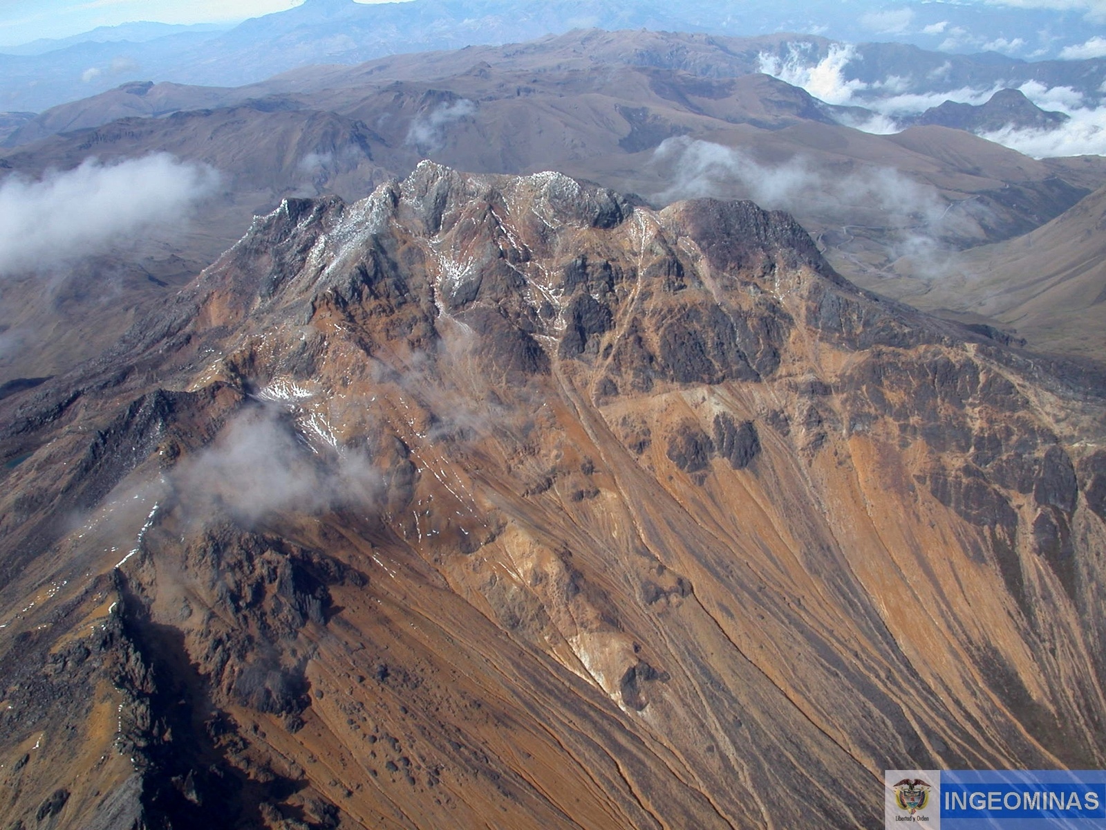
Colombia , Chiles / Cerro Negro :
Chiles / Cerro Negro Volcanoes Extraordinary Activity Bulletin
The activity level of the volcanoes is maintained at the level: YELLOW LEVEL ■ (III): CHANGES IN THE BEHAVIOR OF THE VOLCANIC ACTIVITY
Following the activity of VOLCÁN CHILES, the COLOMBIAN GEOLOGICAL SERVICE (SGC) informs that:
With regard to the volcano – tectonic seismic (VT) swarm underway in the Chiles and Cerro Negro volcanoes, an update is carried out at 11 am with 1560 earthquakes with low energy levels, of which 15 have reaches magnitudes greater than 2.0 on the Richter scale. Most of these events are located southeast of the summit of Chiles volcano, at epicentral distances of up to 13 km and depths of less than 11 km from the summit of Chiles volcano (4700 m altitude), which have released an energy of 5, 5×10¹⁷ ergs. So far, the main earthquake occurred at 1:24 am, with a magnitude of 4.6, which has been reported as felt in Tulcán, Ipiales, Córdoba, Potosí and Puerres.
According to the behavior recorded by this seismicity since 2013, it can not be excluded that earthquakes of high energy levels can be felt by the inhabitants of the region of the epicenter.
The SGC-OVSP and the IGEPN closely monitor the evolution of the volcanic phenomenon and inform appropriately on the detected changes.
Source : SGC
Photo : Ingeominas.
Indonesia , Merapi :
REPORT ON THE ACTIVITIES OF MERAPI , February 8-14, 2019
I. RESULTS OF OBSERVATION
Visual
The weather is sunny in the morning and the afternoon and evening misty. The observed smoke is white, thick, with low gas pressure. The maximum height of 150 m is observed from the observation post of Merapi at Babadan on February 8, 2019.
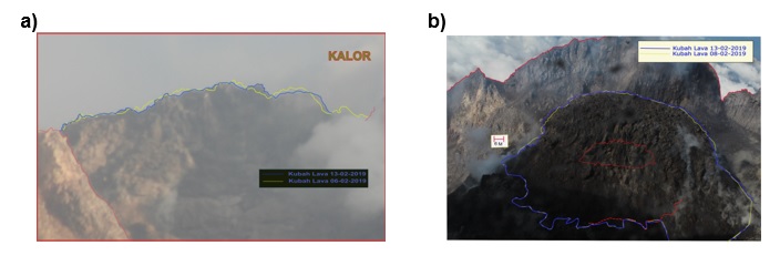
Morphological analysis based on photographs of the Southeast sector revealed no morphological changes. Appendix 1.a presents the peak morphological analysis performed by the Kalitengah Lor camera station.
The volume of the lava dome was relatively fixed compared to the previous week’s data. Most of the lava extrusion that occurs immediately falls in the upper part of the Kali Gendol. Annex 1.b shows the lava dome of the Puncak camera station.
It was observed that hot avalanches occurred on February 11, 2019 towards Kali Gendol. These avalanches occurred at 0858, with a sliding distance of 400 m, an amplitude of 70 mm and a duration of 106 seconds.
Seismicity
This week, the seismicity of Mount Merapi recorded:
1 hot cloud earthquake (PF),
16 earthquake (DG),
4 superficial volcanic earthquakes (VTB),
14 multiple phase earthquakes (MPs),
316 avalanche earthquakes (RF),
10 low frequency earthquakes (FL)
12 tectonic earthquakes (TT).
The VTB and MP earthquakes this week were larger than the previous week.
Deformation
The deformation of G. Merapi that was monitored by EDM and GPS this week did not show any significant change.

SO2 emissions
The DOAS (Differential Optical Absorption Spectroscopy) measurement up to January 12, 2019, gave an average value of maximum SO2 emissions from Mount Merapi at 89.57 tonnes / day, still within normal limits.
Rain and lahars
This week, there was rain at the Mount Merapi observation post, with a rain intensity of 41 mm / hour for 16 minutes at Kaliurang Station on February 11, 2019. No cases of lahar or increase in flow in rivers downstream of Merapi have been reported.
The volcanic activity of Mount Merapi is still quite high and is at the level of the activity « WASPADA »
Source : BPPTKG
Photo : galih Jati / volcanodiscovery