
July 24 , 2019.
Hawaii , Kilauea :
19°25’16 » N 155°17’13 » W,
Summit Elevation 4091 ft (1247 m)
Current Volcano Alert Level: NORMAL
Current Aviation Color Code: GREEN
Activity Summary:
Kīlauea Volcano is not erupting. Monitoring data continue to show steady rates of seismicity and ground deformation, low rates of sulfur dioxide emission, and only minor geologic changes since the end of eruptive activity in September 2018.
As of June 25, Kīlauea Volcano has been at NORMAL/GREEN.
Kīlauea remains an active volcano, and it will erupt again. Although we expect clear signs prior to the next eruption, the time frame of warning may be short.
Although not currently erupting, at and uprift of the 2018 lower East Rift Zone eruptive fissures, there are areas of persistently elevated ground temperatures and minor release of gases. These include steam (water), very small amounts of hydrogen sulfide, and carbon dioxide. These conditions are expected to be long-term. Similar conditions following the 1955 eruption continued for years to decades after the end of activity.
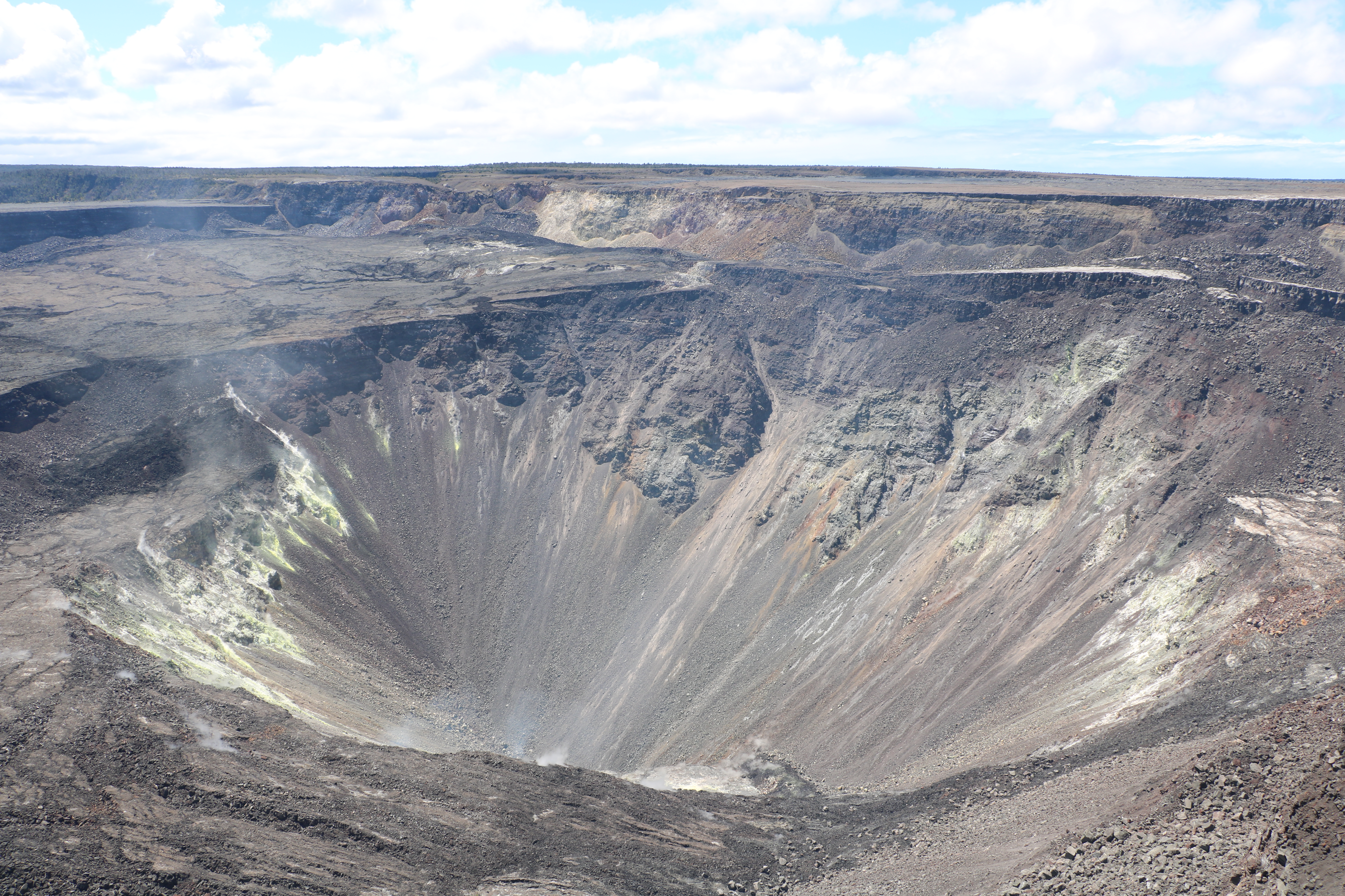
The weather was warm and sunny during a routine visit to the Halema‘uma‘u webcam. No significant changes were observed, and no rockfalls were heard.
Observations:
Monitoring data have shown no significant changes in volcanic activity over the past week. Rates of earthquake activity or seismicity across the volcano remain low. Sulfur dioxide emission rates are low at the summit and are below detection limits at Puʻu ʻŌʻō and the Lower East Rift Zone.
Since early March, GPS stations and tiltmeters at the Kīlauea summit have recorded deformation consistent with slow magma accumulation within the shallow portion of the Kīlauea summit magma system (1-2 km or approximately 1 mile below ground level). However, gas measurements have yet to indicate significant shallowing of magma. HVO continues to carefully monitor all data streams at the Kīlauea summit for important changes.
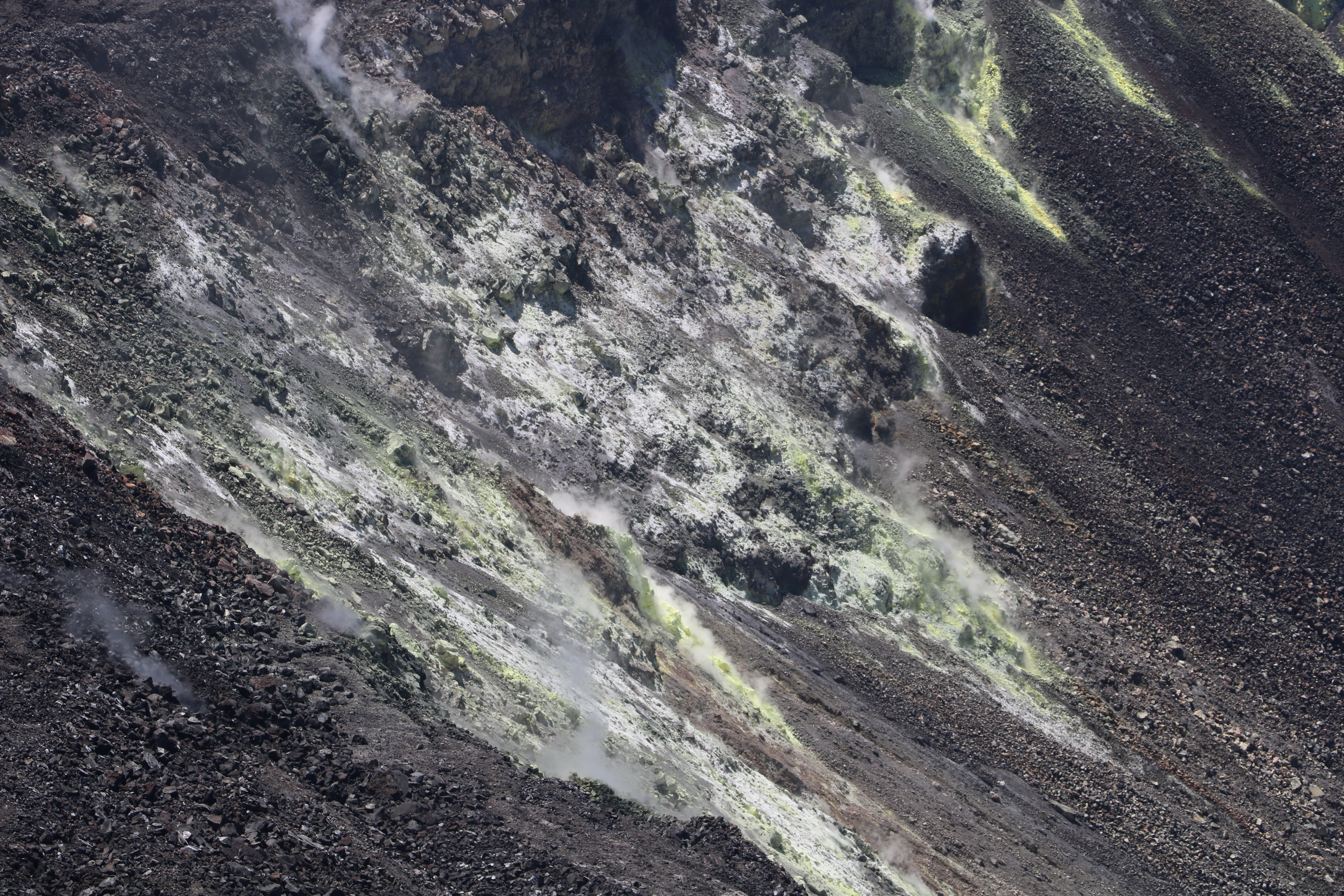
A close-up of the active fumarole field on the north wall of the pit.
Further east, GPS stations and tiltmeters continue to show motions consistent with slowed refilling of the deep East Rift Zone magmatic reservoir in the broad region between Puʻu ʻŌʻō and Highway 130. While the significance of this pattern is unclear, monitoring data do not suggest any imminent change in volcanic hazard for this area. In addition to motion along the East Rift Zone, the south flank of Kīlauea continues to creep seaward at elevated rates following the May 4, 2018 M6.9 earthquake near Kalapana. HVO continues to carefully monitor all data streams along the Kīlauea East Rift Zone and south flank for important changes.
Source : HVO.
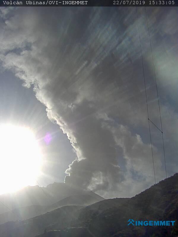
Peru , Ubinas :
VOLCANIC ACTIVITY REPORT, Update of July 23, 2019
Alert level: orange
The Geophysical Institute of Peru (IGP) reports that the Ubinas volcano has anomalies on various geophysical parameters associated with the rise of the magma and the increase of seismic energy (type LP and Hybrid). Those if are consistent with the scenario recorded before the explosion occurred yesterday at 23h25. Currently, it is planned the continuation of the activity, with the occurrence of explosions with the expulsion of fragments of rocks and ashes.
Last 6 hours:
Explosions: 0
Earthquakes: 63
Ash emissions: continuous, scattered to the south-east of the volcano (Ubinas district), with moderate to strong winds, over 60km / h. After a new explosion, the winds are oriented towards the east, with a speed higher than 100 km / h (districts of Chojata and Lloque).
Deformation: Without.
Thermal anomalies: 0
Recommendations:
Keep the alert level in orange. Do not approach a radius of less than 15 km from the crater. In case of ash fall, cover your nose and mouth with damp cloths or masks. Keep the doors and windows of the houses closed. Given the probability of precipitation, stay away from the riverbed and streams. Implement prevention and mitigation actions in response to increased volcanic activity. The increase in volcanic activity is expected in the coming days, with the development of explosions and ash emissions of similar height and volume.
outlook:
The increase in volcanic activity is expected in the coming days, with the development of explosions and ash emissions of similar height and volume.
Source : IGP Pérou .
Colombia , Chiles / Cerro Negro :
Weekly activity bulletin of Chiles and Cerro Negro volcanoes
The activity level of volcanoes continues at the level: YELLOW LEVEL ■ (III): CHANGES IN THE BEHAVIOR OF THE VOLCANIC ACTIVITY.
Following the activities of VOLCANS CHILES AND CERRO NEGRO, the COLOMBIAN GEOLOGICAL SERVICE (SGC) reports that:
For the period evaluated between July 16 and July 22, 2019, a decrease in seismic occurrence was observed, from 2622 earthquakes the previous week to 934 during this period, mainly related to the fracture of the rock to the interior of the volcanic building.
The released seismic energy was multiplied by 7 compared to the previous week. The seismicity was mainly located in the southern sector of the Chiles volcano, at distances of less than 7.5 km and at depths of less than 8 km below the summit (4,700 meters above sea level). The maximum local magnitude was M3.2, corresponding to the earthquake recorded on June 16 at 21:13, reported as felt by the inhabitants of the Chiles Native Council.
Other geophysical and geochemical parameters of volcanic monitoring did not show significant variations.
The Colombian geological service and the Institute of Geophysics of the National Polytechnic School of Ecuador are attentive to the evolution of the volcanic phenomenon and inform in good time on the observed changes.
Source : SGC.
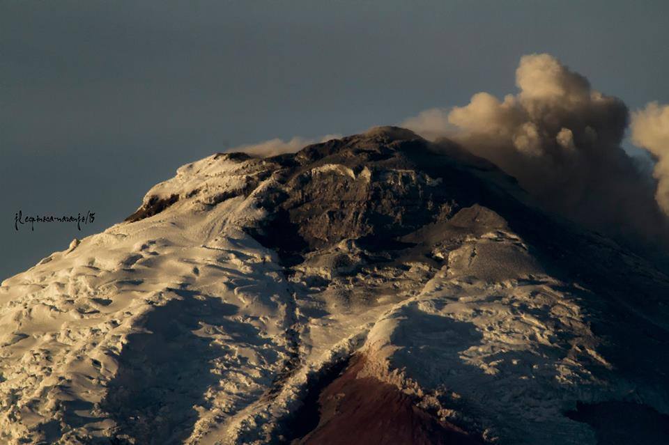
Ecuador , Cotopaxi :
DAILY REPORT OF THE STATE OF COTOPAXI VOLCANO N ° 2019-204 TUESDAY, JULY 23, 2019
Information Geophysical Institute – EPN
Surface activity level: Low
Surface trend: No change
Internal activity level: low
Internal trend: no change.
Seismicity (events):
From July 22, 2019, 11:00 to 23 July 2019, 11:00.
Long period type events (LP): 9
Gas flow (SO2) (tonnes / day): 443.0 +/- 132.0 Number of measures validated: 15
Rains / Lahars: The rains were recorded at night, but no lahars were generated.
Emission column / ash: yesterday afternoon, the view was clear but no surface activity was observed.
Other monitoring parameters: No change.
Observations: From this morning, the volcano remains cloudy.
Source : IGEPN.
Photo : JL Espinosa Naranjo.
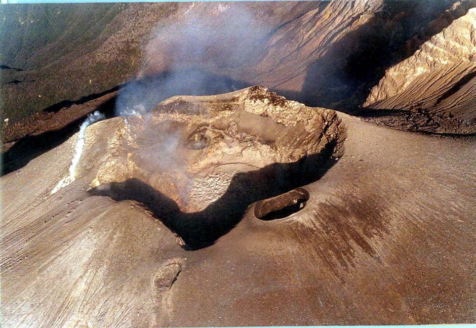
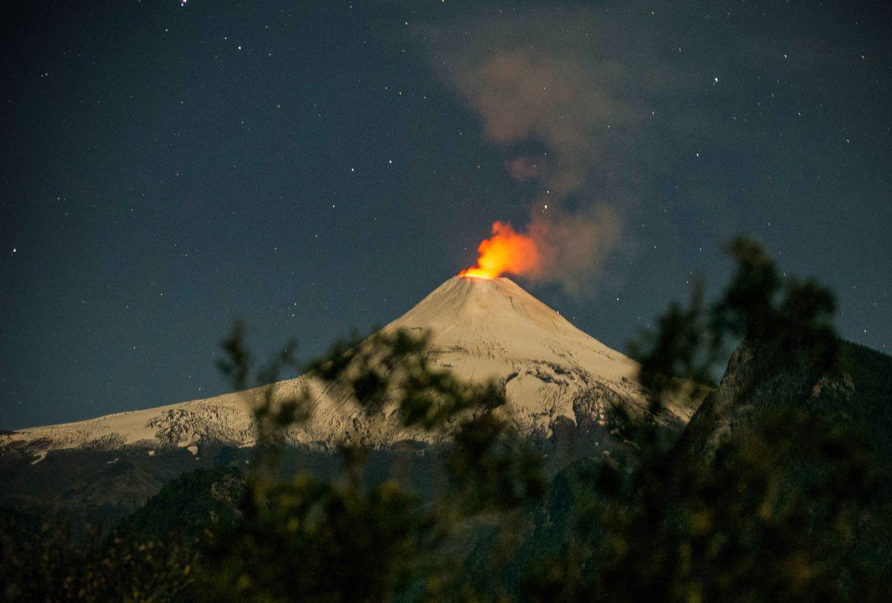
Chile , Villarica :
Villarrica Volcano – July 23rd
There is unstable behavior. Sporadic Strombolian explosions reach up to 200 m in diameter, impacting the edges of the crater and upper flanks. Most important event of the year 2019. In development. (Werner Keller / POVI).

Special report of volcanic activity (REAV).
Region Of Auracania and Los Rios, Volcan Villarica, July 23, 2019, 19:00 local time (continental Chile).
The National Geological and Mining Service of Chile (Sernageomin) publishes the following PRELIMINARY information, obtained from monitoring equipment of the National Volcanic Monitoring Network (RNVV), processed and analyzed at the Volcanological Observatory of the Southern Andes (OVDAS) :
From Saturday, July 20, 2019 at 05:30 local time (09:30 UTC), monitoring stations installed near the Villarica volcano have recorded variations in the behavior of volcanic activity in relation to a change in seismicity long period type : Cessation of the occurrence of long period type earthquakes (LP) and appearance of discrete tremor type (TR) signals, with a frequency of two events per hour, and reduced displacement values (DRC) of not more than 6 , 4 cm2, with dominant frequencies concentrated around 1.8 to 4.6 Hz. In addition, the fixed cameras recorded a higher incandescence, highlighting a more intense surface activity, attributed to the presence of a lake of lava closer to the surface, which generates explosions with projection of incandescent materials on the contour of the crater.
The recorded tremor-type signal although of low energy correlates temporally with the changes of superficial activity observed in the crater
It is noted that the dynamics of the lava lake located in the main crater of the volcano is fluctuating and that it continues to be located near the surface, so the occurrence of minor explosions affecting the environment of the crater is not excluded.
Therefore, the alert level is maintained at the level: GREEN LEVEL.
Observation: Due to the fluctuating dynamics of the lava lake, it is recommended to apply precautionary access restrictions to an area close to the crater with a radius of 500 m.
Sources : POVI / Werner Keller , Sernageomin.
Photos : POVI , Auteur inconnu.


No comment yet, add your voice below!