December 06 , 2018.
Japan , Kirishimayama :
31.934°N, 130.862°E
Elevation 1700 m
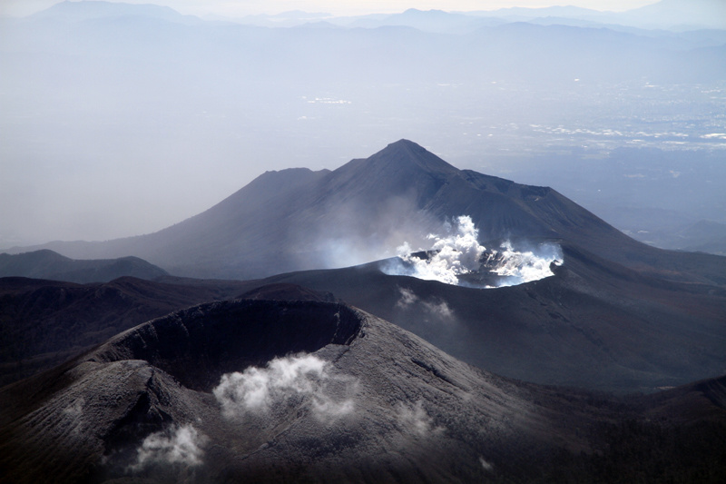
JMA reported that vigorous fumarolic activity on the S side of Iwo-yama (also called Ioyama), on the NW flank of the Karakuni-dake stratovolcano in the Kirishimayama volcano group, continued during 30 November-3 December. Fumarolic plumes rose 100 m above the vent, and hot mud was ejected from the vent. A hot pool of water persisted on the S side of the area. Fumarolic plumes rose 50 m above a vent 500 m W of Iwo-yama. The Alert Level remained at 2 (the second lowest level on a scale of 1-5).
Kirishimayama is a large group of more than 20 Quaternary volcanoes located north of Kagoshima Bay. The late-Pleistocene to Holocene dominantly andesitic group consists of stratovolcanoes, pyroclastic cones, maars, and underlying shield volcanoes located over an area of 20 x 30 km. The larger stratovolcanoes are scattered throughout the field, with the centrally located, 1700-m-high Karakunidake being the highest. Onamiike and Miike, the two largest maars, are located SW of Karakunidake and at its far eastern end, respectively. Holocene eruptions have been concentrated along an E-W line of vents from Miike to Ohachi, and at Shinmoedake to the NE. Frequent small-to-moderate explosive eruptions have been recorded since the 8th century.
Source: Agence météorologique japonaise (JMA) , GVP.
Photo : S. Nakano 08.03.2011 / Geological survey of Japan.
Papua New Guinea , Kadovar :
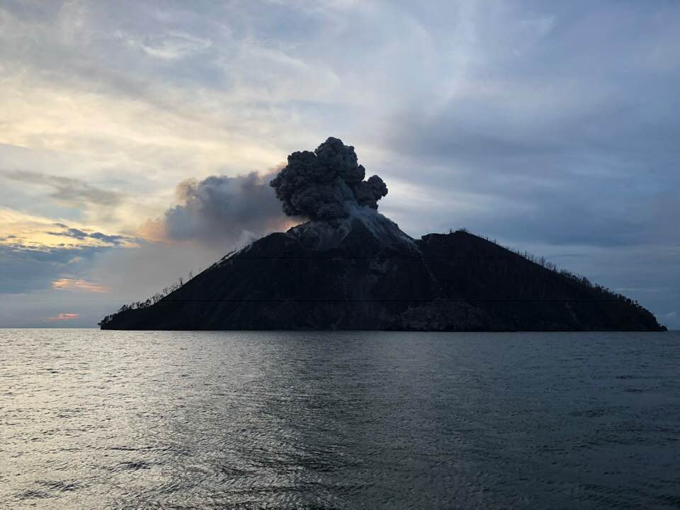
Based on satellite data and wind model data, the Darwin VAAC reported that during 27-28 November ash plumes from Kadovar rose to an altitude of 0.9 km (3,000 ft) a.s.l. and drifted SE and E. On 2 December ash plumes rose to 1.2 km (4,000 ft) a.s.l. and drifted WSW and W.
The 2-km-wide island of Kadovar is the emergent summit of a Bismarck Sea stratovolcano of Holocene age. Kadovar is part of the Schouten Islands, and lies off the coast of New Guinea, about 25 km N of the mouth of the Sepik River. The village of Gewai is perched on the crater rim. A 365-m-high lava dome forming the high point of the andesitic volcano fills an arcuate landslide scarp that is open to the south, and submarine debris-avalanche deposits occur in that direction. Thick lava flows with columnar jointing forms low cliffs along the coast. The youthful island lacks fringing or offshore reefs. No certain historical eruptions are known; the latest activity was a period of heightened thermal phenomena in 1976. The first confirmed historical eruption at Kadovar began around mid-day local time on 5 January 2018.
Source: : Darwin Volcanic Ash Advisory Centre (VAAC)
Photo : Philip Stern via Sherine France.
Guatemala , Fuego :
Type of activity: Vulcanian
Morphology: Composite Stratovolcano
Geographical location: 14 ° 28’54˝ N Latitude; 90 ° 52’54˝ Longitude O.
Height: 3,763msnm
Weather conditions: Clear weather
Wind: North East 8 km / h
Precipitation: 8.3 mm
Activity:
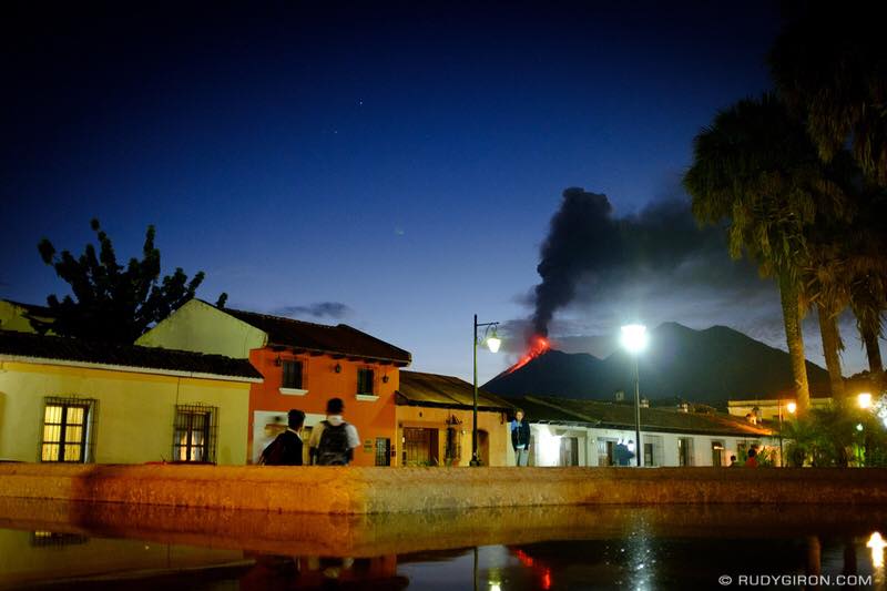
White degassing fumaroles are observed at a height of approximately 4,500 m above sea level, dispersing to the west and southwest. We report 5 to 12 weak, moderate, and strong explosions per hour, ejecting columns of gray ash at an approximate height of 4500 to 5000 m (14764 to 16404 ft) that are dispersed to the west and southwest over a distance of about 20 km to 25 kilometers. Rumblings with weak shock waves generate vibrations in homes near the volcano. Incandescent impulses at an approximate height of 150 to 200 meters above the crater generate weak avalanches along the crater contour and towards the Seca, Taniluya, Ceniza, Trinidad, Las Lajas and Honda ravines. Ash falls are reported in the communities of Panimache I and II, Morelia, Santa Sofia, El Porvenir, Finca Palo Verde, Sangre de Cristo, Yepocapa and others located in this direction. Due to the wind acceleration, fine materials are observed moving west, south and southwest over a distance of 15 to 20 kilometers.
Source : Insivumeh.
Photo : Rudy Giron
Alaska , Veniaminof :
56°11’52 » N 159°23’35 » W,
Summit Elevation 8225 ft (2507 m)
Current Volcano Alert Level: WATCH
Current Aviation Color Code: ORANGE
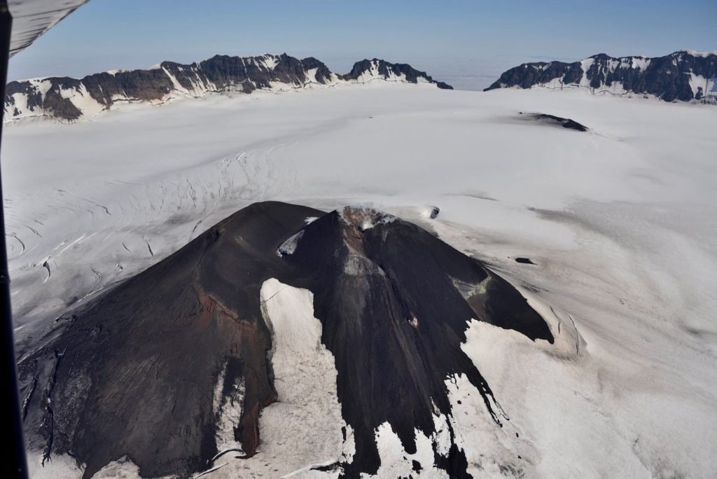
Veniaminof volcano continues to erupt lava from the cone within its ice-filled summit caldera. Satellite views of the volcano over the past day have been obscured by clouds. A high-resolution satellite image acquired on December 2, 2018 shows a third lobe of lava extending a short distance down the southeast flank of the intracaldera cone and onto the snow and ice. No acoustic signals have been recorded by regional infrasound sensors over the past 24 hours. Steady, low-level tremor has been detected in seismic data over the past day.
Source : AVO
Photo : Thomas Jøhnk

