November 21 , 2018.
Italy / Sicily , Etna :
Seismic swarm on the west side of Mount Etna – November 20, 2018, by Boris Behncke, Maddalena De Lucia, Marco Neri and Maurizio Pignone.
A seismic swarm hit the western part of Etna between 20h55 and 15h21 (local time) today 20 November 2018. The monitoring networks of the INGV-Osservatorio Etneo have recorded more than 40 seismic events. with magnitudes M1 between 1.6 and 3.5 (Figure 1).
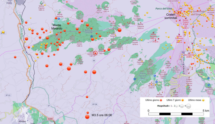
Figure 1 – Map of the epicentres of the earthquake swarm of November 20, 2018 on the western slope of Etna. Source: Etneo Observatory Analyst Group, Catania (Sismoweb) http://sismoweb.ct.ingv.it/index.php
The earthquake of greater magnitude (M1 = 3.5) occurred at 6:06 am and was located approximately 5 km northeast of the municipality of Adrano at a depth of approximately 22 km (Figure 2).
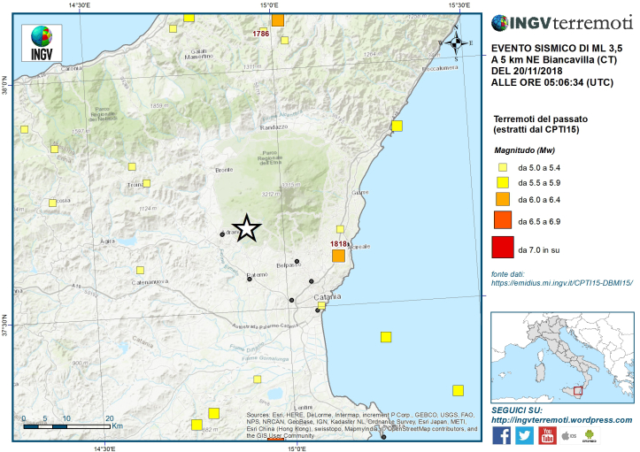
Figure 2 – Location of the seismic event (white star) of magnitude Ml 3.5 superimposed on the parametric catalog of Italian earthquakes from the year 1000 to 2014 (CPTI 15).
The epicentres of the recorded seismic events are all located on the west flank of the volcano, upstream from the municipalities of Bronte, Adrano and Biancavilla, mainly in the Monte Minardo region. The depth of the hypocentres varies between 15 and 27 km. This is an area where seismic swarms have already occurred (Figure 3).
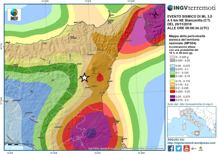
Location of the seismic event (white star) of magnitude ML 3.5 superimposed on the seismic risk map of the national territory.
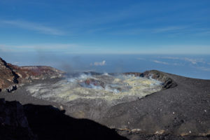
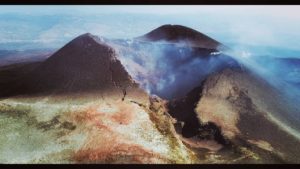
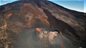
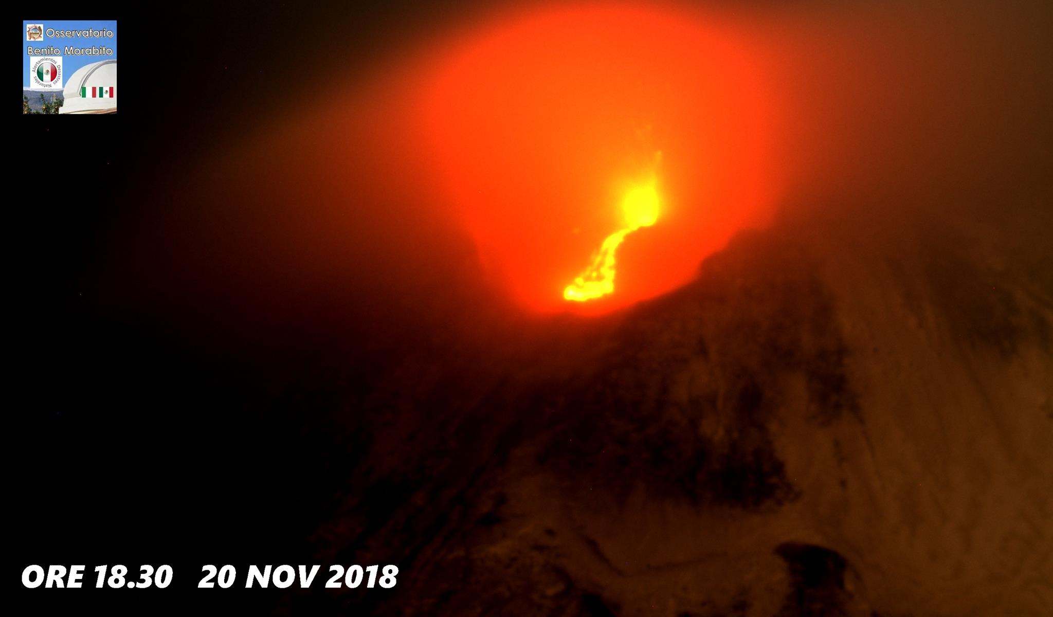
Although the seismic swarm was declared complete in the afternoon, isolated seismic shocks continue to occur in the western region of Etna. Meanwhile, a modest Strombolian activity continues at the top, in the craters of Bocca Nuova, the Northeast Crater and the New Southeast Crater, which has been going on for several weeks. In particular, the small cone of slag present in the eastern mouth of the New Southeast Crater (NCSE) also emitted, on the evening of November 20, a small lava flow that remained however confined in the mouth of the East New Southeast Crater (NCSE).
Source : INGV Vulcani . ( https://ingvvulcani.wordpress.com/2018/11/20/sciame-sismico-sul-versante-occidentale-delletna-20-novembre-2018/?fbclid=IwAR26UOSt_1fgNpPDOYp1MLuwot5VuzH8zRHgKsRwIa_mIWOSumtSJQ92o4U )
Photo : Benito Morabito ( http://youtu.be/e0u9LKVKsg8 ).
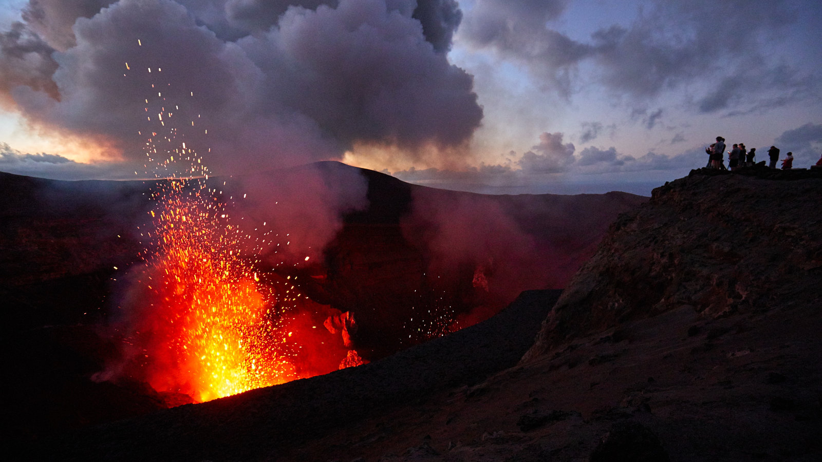
Colombia , Chiles / Cerro Negro :
Weekly activity bulletin of volcanoes Chiles and Cerro Negro.
The activity level of the volcanoes is maintained at the level: YELLOW LEVEL ■ (III): CHANGES IN THE BEHAVIOR OF THE VOLCANIC ACTIVITY
Following the activity of the CHILE volcanoes and CERRO NEGRO, the COLOMBIAN GEOLOGICAL SERVICE (SGC) reports that:
Between November 13 and 19, 2018, seismic activity in the Chile – Cerro Negro volcano region recorded a decrease in seismic occurrence, from 1,400 earthquakes to about 570 events. The seismic energy also decreased by two orders of magnitude compared to that reported the previous week. The predominance of seismicity related to the fracturing of the rock inside the volcanic building (volcano-tectonic earthquakes) with a local magnitude of up to 1.5 M continues.
It was located in two areas: one closest to the south-west of the Chiles volcano, at a maximum distance of 6 km, at depths between 2.5 and 6 km from the summit (4700 m altitude); and another source a little further south-east of Chiles volcano, up to 12 km, at depths between 7.5 and 13 km.
Temperatures in hot springs continue to show values similar to those measured in recent weeks.
The Colombian Geological Service and the Institute of Geology of the National Polytechnic School of Ecuador closely monitor the evolution of this seismic activity and the volcanic phenomenon and inform in a timely manner on the detected changes.
Source : SGC.
Photo : P Ramon ( IGEPN).
Vanuatu Archipelago , Yasur :
19°32’0”S 169°26’30”E
Summit 1184ft (361m)
Current Vanuatu Volcano Alert Level: Level 2
Yasur volcano is continuing in the level of major unrest state. The Volcanic Alert Level remains at Level 2 .
The volcanic unrest continues at Yasur. The volcanic activity is likely to continue at similar levels, consistent with Volcanic Alert Level 2; The Danger Zone for life safety is limited in the Permanent Exclusion Zone which is always closed (Shouldn’t be Access) and about 395 m around the eruptive vents .
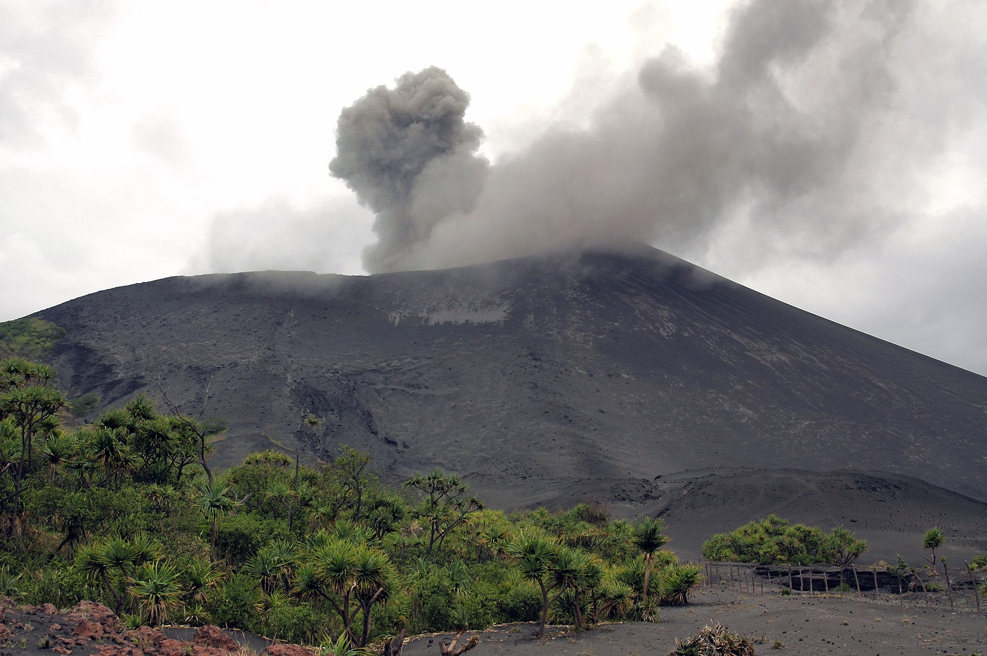
Observations and seismic data analysis in October and November 2018 confirm a continuous volcanic activity in the level of major unrest state and is confined in the crater. The activity consists of ongoing explosions. Some explosions remain strong and volcanic bombs may fall in and/or around the crater. Eruptive vents may emit volcanic gases and ashes cloud. Gas will be continue to be smelt while approaching the caldera and crater.
Alert Level for Yasur has been at the Level 2 since 18th October 2016. The current observations are consistent with the Alert Level 2 activity. Level 2 indicates ‘Major Unrest; Danger Zone is at 395 m around the eruptive vents ’ .
Yasur is the best known and most frequently visited of the Vanuatu volcanoes. It has been in more-or-less continuous Strombolian activity since Captain Cook observed ash eruptions in 1774. This type of activity may have continued since ages. The active cone is largely contained within the small Yenkahe caldera, and is one of the youngest Holocenes volcano (11 700 years to present) of Vanuatu.
All tourism agencies, visitors, local authorities, people from Tanna Island and general public are reminded not to access the Permanent Exclusion Zone which is about 395 m around the eruptive vents. In this area, volcanic bombs, ashes and gases will always be expected .
Villages located close to the volcano may be impacted by ash falls and volcanic gases, especially those exposed to prevailing trade winds direction.
The Department of Meteorology and Geohazards will continue to closely monitor this volcano activity. More information will be provided when necessary.
Source : Geohazards.
Photos : Rolf Cosar ( Wikipédia ) , mato-grosso-do-sul.net.
Guatemala , Pacaya :
Type of activity: Strombolian
Morphology: Composite Stratovolcan
Geographical location: 14 ° 22’50˝ Latitude N; 90 ° 36’00˝ Longitude O.
Height: 2,552msnm.
Weather conditions: partly cloudy
Wind: south
Precipitation: 0.0 mm
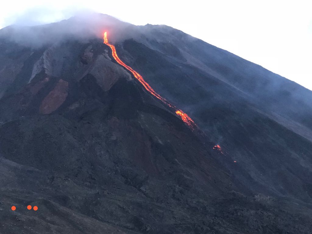
Activity:
Few white and blue degassing fumaroles at a height of approximately 2,600 meters (8,530 feet) are dispersed to the south. The seismic station records the internal tremors associated with degassing and constant Strombolian explosions. These lift materials at a height of approximately 5 to 15 meters above the crater. At night and early in the morning, glow was observed in the Mackenney crater and a northwesterly lava flow of 250 m in length is present.
Source : Insivumeh.
Photo : tn8.tv