October 21 , 218.
Italy , Vesuvius :
Vesuvius, 41 shocks in a few hours. The Observatory: « It’s normal »
Naples – Yesterday afternoon, there were 41 small tremors with the epicenter under the crater of Vesuvius. The observatory of Vesuvius indicates that it is a normal activity for an active volcano. The alert level remains green, so everything is calm and everything is under control.
The seismic swarm occurred between 16:04 and 23:44 last night. The shakes are between magnitudes 0.4 and 1.1, so very light
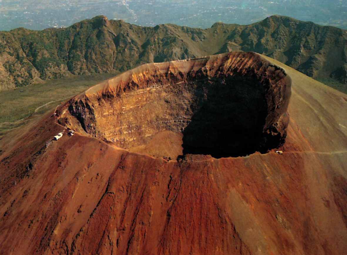
As already mentioned above, this is the normal activity of Vesuvius. Such shocks are not of concern. As always, the updates will be quickly communicated to the population, which has no reason to be alarmed.
Source : vesuviolive.it
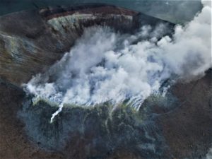
Chile , Guallatiri :
Special Report on Volcanic Activity (REAV)
Arica and Parinacota Region, Guallatiri Volcano, 19 October 2018, 14:17 local time (Continental Chile)
The National Geological and Mining Service of Chile (Sernageomin) publishes the following PRELIMINARY information, obtained from monitoring equipment of the National Volcanic Monitoring Network (NVRN), processed and analyzed at the Volcanological Observatory of the Southern Andes (OVDAS) :
On Friday 19 October 2018 at 13:31 local time (16:31 UTC), the monitoring stations installed near the Guallatiri volcano recorded an earthquake associated with a fracturing mechanism of the rocks (volcano-tectonic type) inside the volcanic building

The characteristics of the earthquake after its analysis are as follows:
TIME OF ORIGIN: 13h31 Local time (16h31 UTC)
LATITUDE: 18.435 ° S
LONGITUDE: 69,111 ° W
DEPTH: 9.8 KM
LOCAL MAGNITUDE: 3.4 (Ml)
OBSERVATIONS:
After recording the seismic event, 17 other seismic events of lower magnitude (M 2,3) were recorded. There is no information from authorities or populations about the perception of these events in the surrounding areas.
The level of volcanic technical alert remains at the level: GREEN.
Sernageomin continues online monitoring and will inform in a timely manner about any changes observed.
Source : Sernageomin
Photo : Gerard Prins / Wikipedia
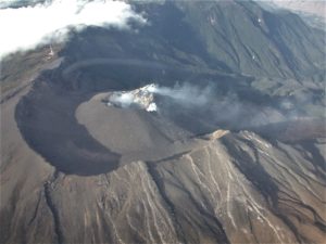
La Réunion , Piton de la Fournaise :
Activity Bulletin from Saturday, October 20, 2018 to 14:00 (local time).
The eruption started on September 15th at 4:25 am local time continues. The intensity of the volcanic tremor (indicator of eruptive intensity at the surface) has remained relatively stable in the last 24 hours (Figure 1).
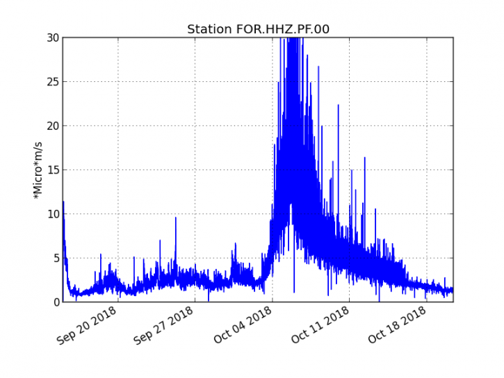
Figure 1: Evolution of the RSAM (indicator of the volcanic tremor and the intensity of the eruption) between 04h00 (00h UTC) on September 15th and 14h00 (10h00 UTC) on October 20th on the seismic station FOR, located near the crater Chateau Fort (2000 m altitude on the southeast flank of the terminal cone). (© OVPF / IPGP)
– No volcano-tectonic earthquake was recorded during the day of 19 October, nor during the current day.
– Inflation (swelling) of the building is always recorded. This inflation reflects the pressurization of a localized source beneath the summit craters (Bory-Dolomieu) at a depth of 1-1.5 km, related to the recharge of the superficial reservoir by deeper magma.

– The surface flow rates could not be estimated today because of lava flows that are too weak at the surface.
– Due to bad weather, no reconnaissance could be done today.
Alert level: Alert 2-2 – Eruption in the Enclos .
Source : OVPF. http://www.ipgp.fr/fr/ovpf/bulletin-dactivite-samedi-20-octobre-2018-a-14h00-heure-locale
Photo : IPR
Philippines , Kanlaon :
KANLAON VOLCANO BULLETIN 21 October 2018 08:00 A.M.
Kanlaon Volcano’s seismic monitoring network recorded three (3) volcanic earthquakes during the past 24 hours. Ground deformation data from continuous GPS measurements indicate pronounced inflation of the edifice since December 2017, signifying pressurization beneath the edifice. Sulfur dioxide (SO2) emission was measured at an average of 600 tonnes/day on 18 October 2018.

Alert Level 2 status prevails over Kanlaon Volcano, which means that the volcano is undergoing a moderate level of unrest due to probable intrusion of magma at depth that may or may not lead to a magmatic eruption. The local government units and the public are strictly reminded that entry into the 4-kilometer radius Permanent Danger Zone (PDZ) is strictly prohibited due to the further possibilities of sudden and hazardous steam-driven or phreatic eruptions. Civil aviation authorities must also advise pilots to avoid flying close to the volcano’s summit as ejecta from any sudden phreatic eruption can be hazardous to aircraft.
DOST-PHIVOLCS is closely monitoring Kanlaon Volcano’s activity and any new development will be relayed to all concerned.
Source : Phivolcs.
Mexico , Popocatepetl :
October 20 11:00 am (October 19 at 16:00 GMT)
In the last 24 hours, through the monitoring systems of the Popocatépetl volcano, 41 exhalations have been identified, accompanied by water vapor and gas. In addition, five volcano-tectonic (VT) events were recorded, the first four yesterday at 11:54, 12:45, 16:18 and 19:15 with magnitudes of 2.4, 2.0, 2.4 and 1.7, respectively. . The last of these events was recorded this morning at 5:45 am with a magnitude of 2.4.

Most of the time, there was no visibility on the volcano. However, during the few moments when the sky was clear, there was a constant emission of water vapor and other gases.
At the time of writing this report, intense cloud cover persists in the crater area. It is therefore not possible to observe it. However, any significant change in seismic activity will be duly notified.
CENAPRED urges NOT to APPROACH the volcano and especially the crater, because of the risk of falling ballistic fragments, and in case of heavy rains, to move away from the bottom of the ravines because of the risk of landslides and mudslides.
The volcanic warning light of the Popocatepetl volcano is located at Amarillo Phase 2.
Source : Cenapred