September 10 , 2018.
Japan , Iwo Jima :
Volcanic earthquakes and increased volcanic activity on Iwo Jima since mid-August, 9 September 2018 0:09
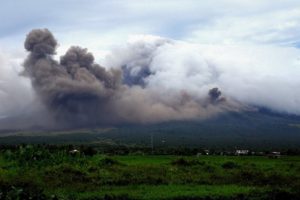
Iwo Jima, in the Ogasawara Islands, has suffered an increase in volcanic earthquakes in the early hours of September 8, said the Meteorological Agency of Japan, as it is possible for an eruption to occur. The agency asked to pay attention to the future of volcanic activity.
And according to the Japan Meteorological Agency, Iwo Jima, in the southern Ogasawara Islands, has seen the number of volcanic earthquakes rise from 2 in the morning of 8 September to 566 on 9 September.
The Meteorological Agency of Japan is asking to warn of continued volcanic activity, to continue to alert around the crater, as it is possible that an eruption will occur on the island or on the coastal sea floor.
The number of volcanic earthquakes per day on Iwo Jima had exceeded 500 since April 27, 2012 six years ago, and before and after that, there were very small steam eruptions, as well as an ocean discoloration, such as that it has been confirmed.
Currently, Iwo Jima is a base of the Defense Force.
Ioto (changed from Iwo-jima in 2007) in the central Volcano Islands portion of the Izu-Marianas arc lies within a 9-km-wide submarine caldera. Ioto, Iwo-jima, and Iojima are among many transliterations of the name. The volcano is also known as Ogasawara-Iojima to distinguish it from several other « Sulfur Island » volcanoes in Japan. The triangular, low-elevation, 8-km-long island narrows toward its SW tip and has produced trachyandesitic and trachytic rocks that are more alkalic than those of other Izu-Marianas arc volcanoes. The island has undergone dramatic uplift for at least the past 700 years accompanying resurgent doming of the caldera. A shoreline landed upon by Captain Cook’s surveying crew in 1779 is now 40 m above sea level. The Motoyama plateau on the NE half of the island consists of submarine tuffs overlain by coral deposits and forms the island’s high point. Many fumaroles are oriented along a NE-SW zone cutting through Motoyama. Numerous historical phreatic eruptions, many from vents on the west and NW sides of the island, have accompanied the remarkable uplift.
Source : NHK , GVP
Photo : cruisemapper.com
Indonesia , Anak Krakatau :
Bandarlampung, Lampung )
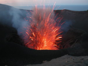
Mount Anak Krakatau has experienced constant tremors during the past three days, and the Anak Krakatau Observatory Post prohibited tourists and fishermen from going to areas near the crater within 2 kilometers.
« Mount Anak Krakatau has experienced continuous tremor activities during the past three days. The visual observations above the volcano were obstructed by fog, but there is no eruption, » head of Mt Anak Krakatau Observatory Post Andi Suardi said here on Monday.
According to Andi, with its unpredictable activity, the volcano in Sunda Straits remains in its alert status and the authority has warned tourists and fishermen to stay away from the volcano.
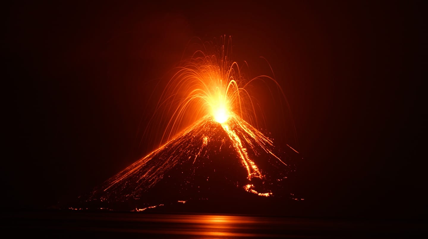
Previously, the Meteorology, Climatology and Geophysics Agency (BMKG) reported that Mt Anak Krakatau during Thursday to Friday (Sept 6-7) experienced constant tremors, and it detected firelights and thunder sounds.
Mt Anak Krakatau has an altitude of 305 meter above sea level. The tremor has indicated volcanic activity and used as a key parameter before the eruption.
Source : ANTARA News , Reportage par Hisar Sitanggang , Édition par Sri Haryati.
Photo : Aris Yanto.
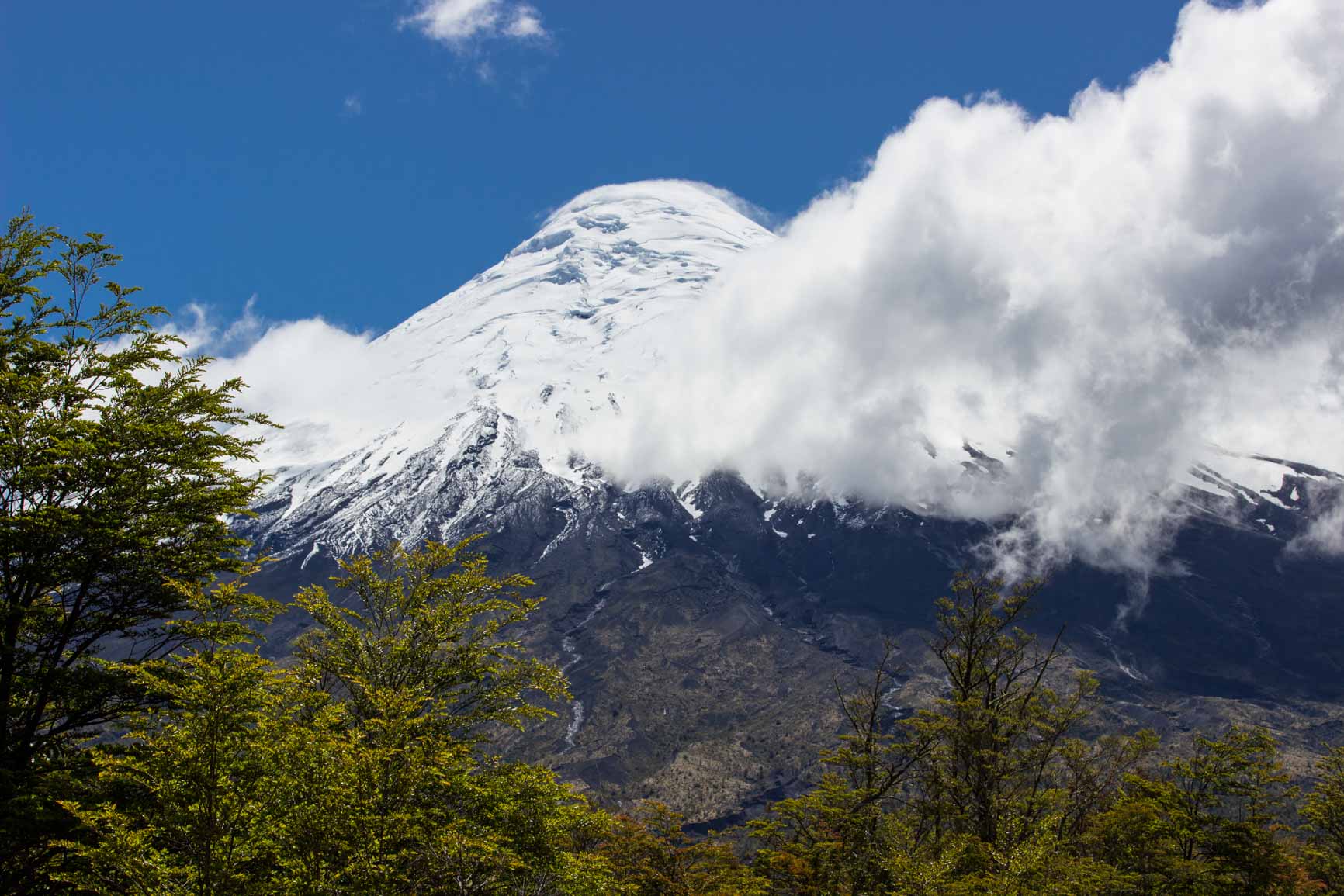
Chile , Osorno :
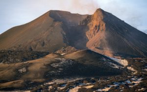
During this period, 98 seismic events were recorded, of which 87 were classified as long-term events (LP) in relation to the dynamics of the fluids inside the volcano and / or with the glacial dynamics. The larger magnitude event had reduced displacement values (DRC) equal to 11 cm2. In addition, 11 volcano_tectonic (VT) type events, associated with the fracturing of rigid materials, have been classified. The event of greatest energy had a local magnitude (ML) equal to M 1.2 and was located 1.3 km north – northwest of the crater at a depth of 4.6 km.
Surveillance camera images did not show any superficial activity when weather conditions allowed observation.
The indications of the electronic inclinometers did not reveal any changes in relation to changes in the internal dynamics of the volcano.
No emissions of sulfur dioxide (SO2) to the atmosphere in the volcano area have been reported, according to data published by the Ozone Monitoring Instrument (OMI) Sulfur Dioxide Group (http: / /so2.gsfc.nasa.gov/) and the National Satellite Environment and Information Data (NESDIS) (http: // satepsanoine nesdis.noaa.gov) ..
No thermal warnings have been reported in the volcano-associated area, according to data processed by Infrared, a means of observing volcanic activity (Mirova) (http://www.mirovaweb.it/) and MODVOLC (http : //modis.higp.hawaii.edu/).
Although the seismicity has decreased in number and energy compared to the previous fortnight, we record the occurrence of processes that can lead to a greater possibility of instability of the volcanic system through volcano-tectonic seismicity which has continued to be recorded under the volcano, even more given episodes that have occurred sporadically in the last few months with a greater magnitude of more than M3.
For the above, the volcanic alert is maintained at the level:
YELLOW LEVEL: Changes in the behavior of volcanic activity – Probable time for an eruption: WEEKS / MONTH.
Source : Sernageomin
Hawaï , Kilauea :
19°25’16 » N 155°17’13 » W,
Summit Elevation 4091 ft (1247 m)
Current Volcano Alert Level: WATCH
Current Aviation Color Code: ORANGE
On Kīlauea Volcano’s lower East Rift Zone (LERZ), minor amounts of incandescence and fume continue to be visible within the fissure 8 cone. Small lava flows have been observed within the fissure 8 cone, however none have extended outside the walls of the cone. There is no change in overall activity from observations over the past several days.

Seismicity and ground deformation remain low at the summit of Kīlauea. Small aftershocks from the magnitude-6.9 earthquake in early May continue to occur on faults located on Kīlauea’s South Flank.
Yesterday, Puʻu ʻŌʻō crater experienced a series of small collapses. These produced episodes of visible brown plume throughout the day (the most prominent at about 10:30AM HST) and generated small tilt offsets and seismic energy recorded by nearby geophysical instruments. The collapses had no discernable effect on other parts of the rift, though we will continue to monitor for longer-term changes.

Tiltmeters in Kīlauea’s middle East Rift Zone continue to record small amounts of inflationary tilt, which may be a sign of refilling of the rift zone. The rates have been steady over the past week and did not show a short-term change following yesterday’s collapses at Puʻu ʻŌʻō.
Sulfur dioxide (SO2) emission rates at the summit, Puʻu ʻŌʻō, and LERZ are drastically reduced; the combined rate is less than 1,000 tonnes/day, which is lower than at any time since late 2007. SO2 emission rates from LERZ vents were below 20 tonnes/day when measured on September 5th, close to the detection threshold of the measurement technique.
Source : HVO