June 20 , 2018.
Pu’u ‘Ō’ō / Kilauea , Hawai :
Monday, June 18, 2018, 10:30 PM HST (Tuesday, June 19, 2018, 08:30 UTC)
19°25’16 » N 155°17’13 » W,
Summit Elevation 4091 ft (1247 m)
Current Volcano Alert Level: WARNING
Current Aviation Color Code: RED
Kīlauea Volcano Lower East Rift Zone
The eruption from vents in the lower East Rift Zone (LERZ) continues with little change.
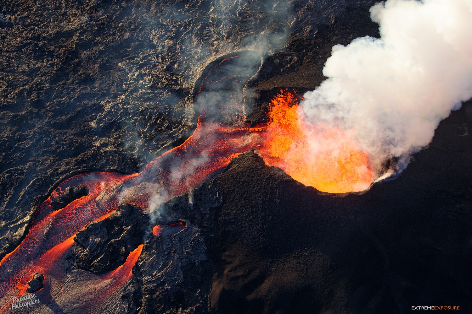
Fissure 8 fountains continue to feed lava into the well-established channel that flows to the ocean at Kapoho. The flow front at the coast is about 1.5 miles across, but lava pours into the ocean at a single entry, creating a large laze plume. Fissures 16/18 continue to ooze lava and Fissure 6 is mildly spattering. The size and shape of the flow field is virtually unchanged upslope, but an additional 120 acres have been added to the western margin of the flow in the coastal area since last Friday, June 15.
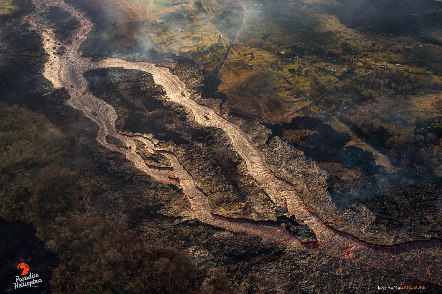
Giant A’A rivers of lava 6/19/18 5PM from shane turpin on Vimeo.
Pele’s hair and other lightweight volcanic glass fragments from the lava fountain at Fissure 8 continue to fall downwind of the fissure, dusting the ground within a few hundred meters (yards) of the vent. High winds may waft lighter particles to greater distances. Residents are urged to minimize exposure to these volcanic particles, which can cause skin and eye irritation similar to volcanic ash.
HVO field crews are on site tracking the fountains, lava flows, and spattering from Fissure 8 as conditions allow and are reporting information to Hawaii County Civil Defense. Observations are also collected on a daily basis from cracks in the area of Highway 130; no changes in temperature, crack width, or gas emissions have been noted for several days.
Volcanic gas emissions remain very high from Fissure 8 eruptions. Winds are expected to bring VOG to the central, south, and western parts of the Island of Hawaii.
Magma continues to be supplied to the Lower East Rift Zone. Seismicity remains relatively low in the area with numerous small magnitude earthquakes and low amplitude background tremor. Higher amplitude tremor is occasionally being recorded on seismic stations close to the ocean entry.
Tuesday, June 19, 2018, 9:44 AM HST (Tuesday, June 19, 2018, 19:44 UTC)
Kīlauea Volcano Lower East Rift Zone
The eruption in the lower East Rift Zone (LERZ) continues with little change.
Fissure 8 lava fountains showered spatter onto the cone overnight and continued to feed lava into the well-established channel that flows to the ocean at Kapoho. Small overflows were observed on the north side of the channel near Pohoiki Road overnight and this morning, with one breakout spreading slowly beyond the flow boundary. Fissure 6 was mildly spattering during this morning’s overflight. The size and shape of the flow field is virtually unchanged upslope, but an additional 120 acres have been added to the western margin of the flow in the coastal area since last Friday, June 15. The overall width of the flow boundary at the coast is about 1.5 miles across. This morning lava was entering the ocean at two entries at the southern part of the entry area, creating laze plumes that were blown southward along the shoreline.
Kīlauea Volcano Summit
At 5:05 a.m. HST, another gas and ash emission from a small subsurface explosion occurred at Kīlauea’s summit, producing a plume that was blown downwind at about 5,000 ft above sea level. Inward slumping of the rim and walls of Halemaʻumaʻu continues in response to ongoing subsidence at the summit.
Tuesday, June 19, 2018, 4:23 PM HST (Wednesday, June 20, 2018, 02:23 UTC)
Kīlauea Volcano Lower East Rift Zone
The eruption in the lower East Rift Zone (LERZ) continues with little change.
Fissure 8 continus to feed lava into the well-established channel that flows to the ocean at Kapoho. Small overflows were observed on the north side of the channel near Pohoiki Road overnight and this morning, but stalled in the afternoon. Another small, sluggish overflow along a section of Luana Street is advancing northwest. Fissure 6, 15, 16 are oozing lava and fume. The size and shape of the flow field is virtually unchanged since the morning of Monday June 18, with the exception of an additional 28 acres, mostly at the southwest margin of the flow in the coastal area.
Kīlauea Volcano Summit
At 5:05 a.m. HST, another gas and ash emission from a small subsurface explosion occurred at Kīlauea’s summit, producing a plume that was blown downwind at about 5,000 ft above sea level. Inward slumping of the rim and walls of Halemaʻumaʻu continues in response to ongoing subsidence at the summit.
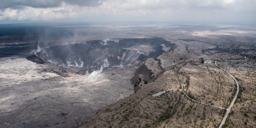
During the helicopter overflight on June 18, crews captured this image of the growing Halema‘uma‘u crater viewed to the southeast. With HVO and Jagger Museum sitting on the caldera rim (right side, middle where the road bends to the left) it is easier to comprehend the scale of subsidence at the summit. The estimated total volume loss is about 260 million cubic meters as of June 15th.
Sulfur dioxide emissions from the volcano’s summit have dropped to levels that are about half those measured prior to the onset of the current episode of eruptive activity. This gas and minor amounts of ash are being transported downwind, with small bursts of ash and gas accompanying intermittent explosive activity.
Source : HVO.
Photos : Karel Smid , Bruce Omori , USGS.
Vidéos : Shane Turpin
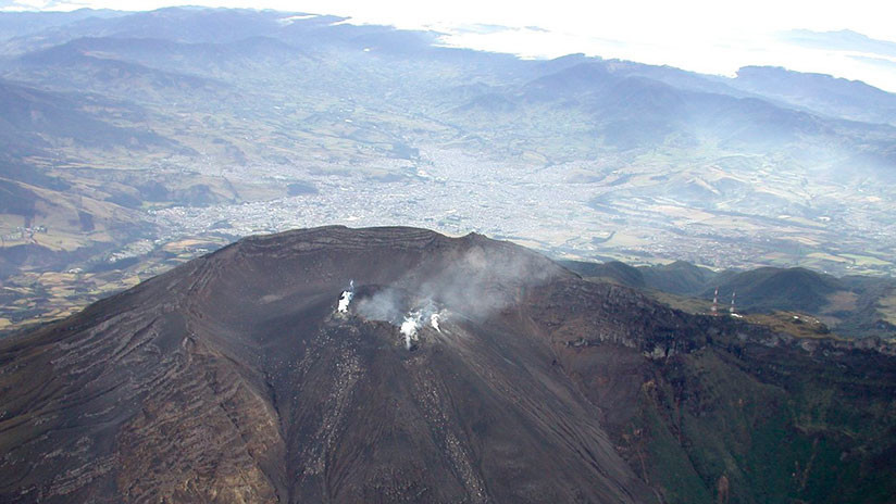
Galeras , Colombia :
Subject: Galeras Volcano Extraordinary Activity Bulletin
The level of activity of the volcano continues at the level:
YELLOW LEVEL ■ (III): CHANGES IN THE CONDUCT OF VOLCANIC ACTIVITY.
Following the activity of the GALERAS volcano, the COLOMBIAN GEOLOGICAL SERVICE informs that:
After the Volcano-Tectonic earthquake occurred on June 12, 2018 at 4:35. Magnitude 4.5 and up to the time of sending this bulletin, a total of 970 earthquakes have been recorded, of which 21 have been reported as felt by the inhabitants of the Galeras Volcanic Complex’s area of influence; the last one corresponds to the one recorded today at 13:23. with a magnitude of M 3.3 on the Richter scale.
This seismicity continues to be located in an area north-east of the Galeras volcano at distances of between 1.0 and 8.0 km and at depths of up to 8 km from the summit (reference level of 4200 meters above sea level).
It is recalled that the seismicity that has been recorded since the end of May and especially since June 12, is located in an active zone where tectonically geological faults coexist with the structure of the volcanic complex of Galeras, therefore, the denomination of this type of earthquakes is noted as Volcano-Tectonic.
Although the frequency of these earthquakes has decreased over the past three days, the seismic energy released (magnitude of earthquakes) has shown some fluctuations, with an increase since yesterday.
It is pointed out that the other geophysical and geochemical monitoring parameters of the Galeras volcano remain without significant change and that is why the activity level has been maintained in yellow or level III, which has not changed since about 7 years.
The COLOMBIAN GEOLOGICAL SERVICE remains attentive to the evolution of the volcanic phenomenon and will continue to inform in a timely manner of the observed changes.
For the period from June 12 to 18, 2018, there was a significant increase in the occurrence and seismic energy released from earthquakes related to the fracturing of rock materials, called Volcano-Tectonics, representing 980 events, of which 22 were reported as felt by the inhabitants of the area of influence of the Galeras Volcanic Complex. The most notable earthquake occurred on June 12, 2018 at 4:35 am with a magnitude of 4.5 on the Richter scale, and the last reported earthquake corresponds to that recorded yesterday at 1:23 pm. with a magnitude of 3.3. These earthquakes are located in a band between 1 and 8 km northeast of the top of the volcanic building. The depths are between 1 and 8 km from the top of the volcano (4200 m).
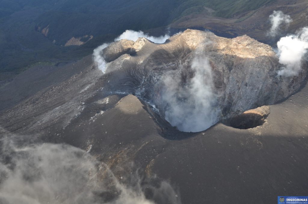
Other geophysical and geochemical parameters of Galeras volcano monitoring did not show any variations indicating a change in the activity level of the volcano. Between June 12 and June 15, it was possible to observe and record the white gas emissions of certain sectors of the active crater with a low exit pressure, a low height and a variable direction depending on the prevailing wind regime. In the region.
Although the rate of occurrence of tectonic volcanic earthquakes has decreased since June 15, the seismic energy released (magnitude of earthquakes) showed some fluctuations, becoming felt as happened on June 17 and 18. The possibility of occurrence of earthquakes that can be felt is not excluded, however, it is recalled that the prediction of earthquakes is not possible.
Source : SGC
Mayon , Philippines :
MAYON VOLCANO BULLETIN 20 June 2018 08:00 A.M.
Mayon Volcano’s seismic monitoring network recorded one (1) volcanic earthquake during the past 24 hours. Moderate emission of white steam-laden plumes that drifted southwest and south-southwest was observed during the day. Fair crater glow from the summit could be observed at night. Sulfur dioxide (SO2) emission was measured at an average of 1361 tonnes/day on 19 June 2018. Precise leveling data obtained on 02-14 April 2018 indicate inflation of the edifice relative to 22-29 March 2018, while electronic tilt data show sudden slight inflation of the mid-slopes beginning 05 May 2018. Medium-term ground deformation data, however, show that the edifice is still deflating consistent with the decline in unrest but is still inflated relative to 2010 baselines.
Alert Level 2 currently prevails over Mayon Volcano. This means that Mayon is at a moderate level of unrest. DOST-PHIVOLCS reminds the public that sudden explosions, lava collapses, pyroclastic density currents or PDCs and ashfall can still occur and threaten areas in the upper to middle slopes of Mayon. DOST-PHIVOLCS recommends that entry into the six kilometer-radius Permanent Danger Zone or PDZ and a precautionary seven kilometer-radius Extended Danger Zone or EDZ in the south-southwest to east-northeast sector, stretching from Anoling, Camalig to Sta. Misericordia, Sto. Domingo must be strictly prohibited. People residing close to these danger areas are also advised to observe precautions associated with rockfalls, PDCs and ashfall. Active river channels and those perennially identified as lahar prone areas in the southern and eastern sectors should also be avoided especially during bad weather conditions or when there is heavy and prolonged rainfall. Civil aviation authorities must advise pilots to avoid flying close to the volcano’s summit as airborne ash and ballistic fragments from sudden explosions and PDCs may pose hazards to aircrafts.
DOST-PHIVOLCS is closely monitoring Mayon Volcano’s activity and any new significant development will be immediately communicated to all stakeholders.
Source : Phivolcs
Photo : wheninmanila
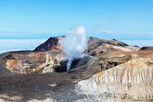
Ebeko , Kamchatka :
VOLCANO OBSERVATORY NOTICE FOR AVIATION (VONA)
Issued: June 18 , 2018
Volcano:Ebeko (CAVW #290380)
Current aviation colour code:ORANGE
Previous aviation colour code:orange
Source:KVERT
Notice Number:2018-52
Volcano Location:N 50 deg 41 min E 156 deg 0 min
Area:Northern Kuriles, Russia
Summit Elevation:3791.68 ft (1156 m)
Volcanic Activity Summary:
According to video data by SVERT and KBGS RAS, explosions sent ash up to 2.5 km a.s.l. from the volcano. Ash cloud drift to the north-east from the volcano.
A moderate gas-steam with some amount of ash activity of the volcano continues. Ash explosions up to 16,400 ft (5 km) a.s.l. could occur at any time. Ongoing activity could affect low-flying aircraft and airport of Severo-Kurilsk.
Volcanic cloud height:
8200 ft (2500 m) AMSL Time and method of ash plume/cloud height determination: 20180618/0500Z – Himawari-8
Other volcanic cloud information:
Distance of ash plume/cloud of the volcano: 3 mi (5 km)
Direction of drift of ash plume/cloud of the volcano: NE
Time and method of ash plume/cloud determination: 20180618/0500Z – Himawari-8
Source : Kvert
Photo : Lyachovets S. /8/2012


