May 19 , 2018.
Pu’u ‘Ō’ō / Kilauea , Hawaï :
051818 6:00am County of Hawaii Civil Defense Message, New eruptive fissure 22:
A message from COUNTY OF HAWAII
This is a Civil Defense Message for Thursday, May 18 at 6 o’clock in the morning.
The Hawaiian Volcano Observatory (HVO) has reported a new fissure 22, between fissures 19 and 20. Several fissures are active with spattering. A lava flow at fissure 17 is covering the existing lava flow, but no new advancement is occurring.
Due to the continued volcanic activity the following policies are in effect:
Do continue to be on the alert for volcanic fumes of SO2.
Volcanic gas such as SO2, is especially dangerous for elderly, children/babies and people with respiratory problems.
People in areas downwind of rifts may intermittently experience higher levels of fumes. People with breathing problems should avoid being outdoors and leave the area if deemed necessary.

New » lava seems to have arrived in Leilani!
Hookupu street fissure, downrift from Makamae inside Leilani is active and flowing! This appears to be Pahoehoe and could be a sign that the new lava has arrived at this fissure location.
This lava is behaving very differently than the previous lava we have seen come out of the fissures
Friday, May 18, 2018, 8:52 AM HST (Friday, May 18, 2018, 18:52 UTC)
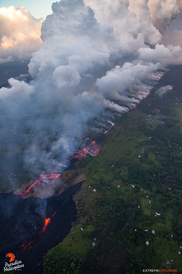
LOWER EAST RIFT ZONE
Moderate-level eruption of lava continues from multiple points along the central and northeast end of the active fissure system. Residents in lower Puna should remain informed and heed Hawaii County Civil Defense closures, warnings, and messages (http://www.hawaiicounty.gov/active-alerts)
Spattering continues from Fissures 15, 17, 18, 20, 21, and 22 with pahoehoe lava flows being erupted from Fissures 17, 18, and 20.
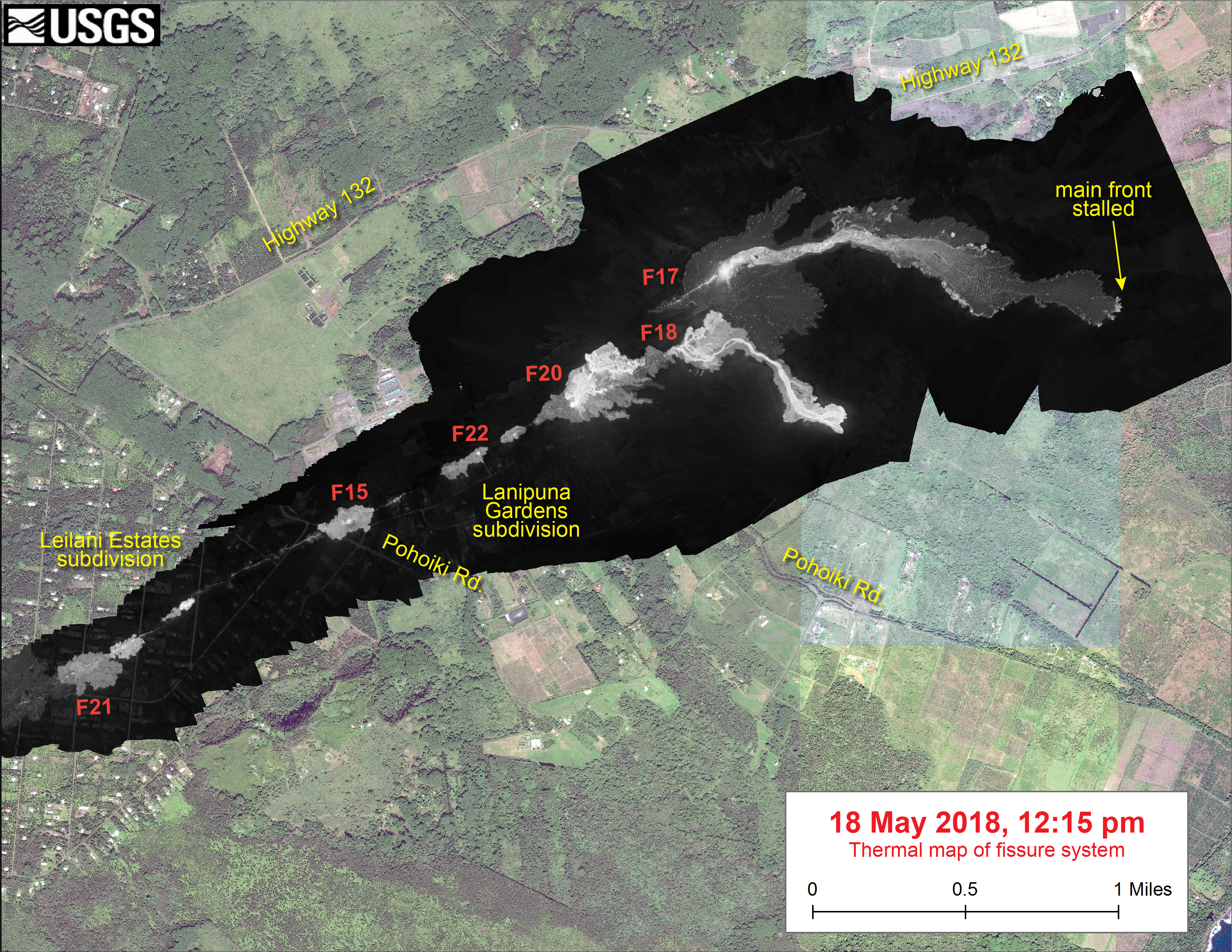
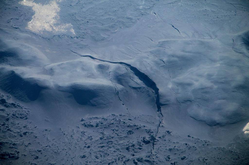
This thermal map shows a close up of the northeastern end of the fissure system, as of 12:15 pm on May 18. The Fissure 17 lava flow had not advanced a significant distance over the past day, but the Fissure 18 flow traveled approximately 1 km (0.6 miles) over the past day. The black and white area is the extent of the thermal map. Temperature in the thermal image is displayed as gray-scale values, with the brightest pixels indicating the hottest areas. The thermal map was constructed by stitching many overlapping oblique thermal images collected by a handheld thermal camera during a helicopter overflight of the flow field. The base is a copyrighted color satellite image (used with permission) provided by Digital Globe.
HVO field crews are on site tracking the lava flow and spattering from multiple fissures as conditions allow and reporting information to Hawaii County Civil Defense.
Volcanic gas emissions remain elevated throughout the area downwind of the vents. Weak winds today means that other areas of Hawaii Island may experience varying levels of vog.
This eruption is still evolving and additional outbreaks of lava are possible. Ground deformation continues and seismicity remains elevated in the area.
Future outbreaks could occur both uprift (southwest) and downrift (northeast) of the existing fissures, or, existing fissures can be reactivated. Communities downslope of these fissures could be at risk from lava inundation. Activity can change rapidly.
KILAUEA SUMMIT :
No explosive eruption of ash have occurred since Thursday morning. Additional explosions possible at any time.No
Seismic levels, which abruptly decreased after explosive eruptions on Wednesday night and early Thursday morning, are slowly increasing.

At this time, based on HVO web cameras, a robust plume of gas and steam is billowing out of the Overlook vent and drifting generally southwest.
At any time, activity may again become more explosive, increasing the intensity of ash production and producing ballistic projectiles very near the vent. Communities downwind should be prepared for ashfall as long as this activity continues.
Seismicity and deformation continue at the Kilauea summit. Deflation is ongoing. Additional earthquakes in the Kilauea summit area are expected as long as the summit continues to deflate.
REMARKS
USGS/HVO continues to monitor the situation at the Kilauea summit and the lower East Rift Zone 24/7 in coordination with Hawaii County Civil Defense and other emergency authorities. HVO geologists are onsite in the area this morning conducting overflights, examining the fissure vent activity for significant changes, and searching for any signs of new or resumed activity.
Friday, May 18, 2018, 3:59 PM HST (Saturday, May 19, 2018, 01:59 UTC)
Kīlauea Volcano Summit
No explosions and no earthquakes greater than magnitude 3.5 have occurred in the summit area in the past day. Background seismic levels have been increasing slowly over the course of the day.
Volcanic gas emissions at the summit remain high.

Kīlauea Lower East Rift Zone
The lower (eastern) end of the fissure system is the most active area today. This afternoon, fissure17 is actively spattering and the flow is active but is not covering new ground. In addition, fissures 18, and 20 are active, and the flow from fissure 18 has traveled approximately 0.6 miles in a southeast direction. An area 50-100 yards wide, parallel to and north of the line of fissures between Highway 130 and Lanipuna Gardens, is disrupted with many cracks. This long cracked area is currently being filled by pahoehoe lava flows from fissures 20 and 21. Fissure 15 was active and produced a lava flow that crossed Pohoiki Road between Leilani and Hinalo Streets.
Volcanic gas emissions remain elevated throughout the area downwind of the fissures.
Magma continues to be supplied to the lower East Rift Zone as indicated by the continued northwest displacement of a GPS monitoring station. Elevated earthquake activity continues, but earthquake locations have not moved farther downrift in the past couple of days.
May 18, 2018 Fire and Fury from Mick Kalber on Vimeo.
USGS/HVO continues to monitor the lower East Rift Zone activity 24/7 in coordination with Hawaii County Civil Defense, with geologists onsite to track ongoing and new fissure activity and the advance of lava flows.
051818 5:00 pm Message of the civil defense, urgent for the Pohoiki road area:
This is a civil defense message for Friday, May 18th at 5 pm.
The fast moving lava crossed Pohoiki Street near Malama Ki Place. Police, firefighters and the National Guard are sent to stop any entry on both sides of Pohoiki and secure the area. There are about 40 isolated houses in the area. Authorities have helicopter access to the area to assess the number of people present and if they need help. All persons in this area are asked to stay where they are and to wait for further instructions.
All people are asked to stay away from this emergency.
Source : HVO, Défense civile Hawai .
Photos : Ryan Finlay , Hvo , Bruce Omori .
Vidéo : Big Island Vidéo news
Bárðarbunga , Iceland :
A brief but sharp earthquake swarm was detected in the Bárðarbunga caldera late yesterday, Thursday afternoon. The relatively short swarm, which counted just a handful of quakes, included two relatively powerful 3.7 and 4.0 magnitude quakes. The epicenter of both tremors was at the surface in the south-east part of the volcano’s main caldera. The last significant tremors were detected in the monster volcano at the end of April.
The seismic monitoring system of the the Icelandic Meteorological Office detected a 3.7 magnitude quake at 15:56, 4.7 km (2.9 mi) east-southeast of the center of the caldera at the surface – a depth of 0 m. A second 4 magnitude quake was detected just four minutes later at 16:00, 6.4 km (4 mi) east-southeast of the center of the caldera at a depth of 100 m (330 ft), followed by a third smaller 1.9 magnitude quake in the same region.
The Bárðarbunga system has been showing increasing levels of activity for the past year or so, following the 2014-15 Holuhraun eruption at the northern edge of the system.
Source : IMO
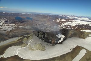
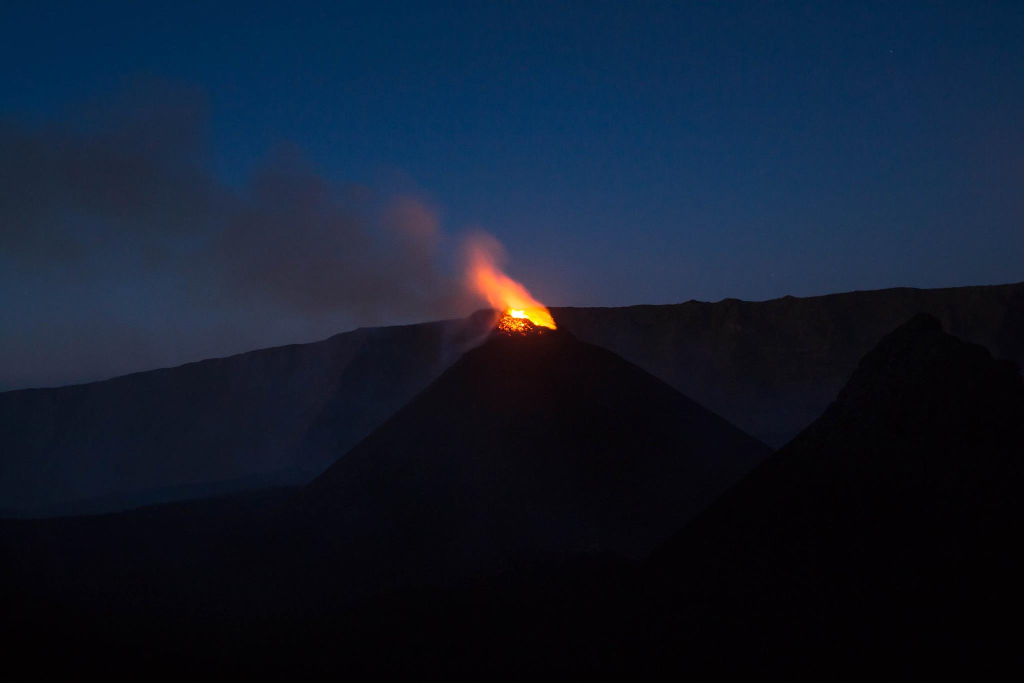
Fuego , Guatemala :
Type of activity: Vulcanian
Morphology: Composite Stratovolcan
Location: 14 ° 28’54˝ Latitude N; 90 ° 52’54˝ Longitude W.
Height: 3,763msnm.
Cloudy weather conditions
Wind: North East 2km / h
Precipitation: 9.3 mm.
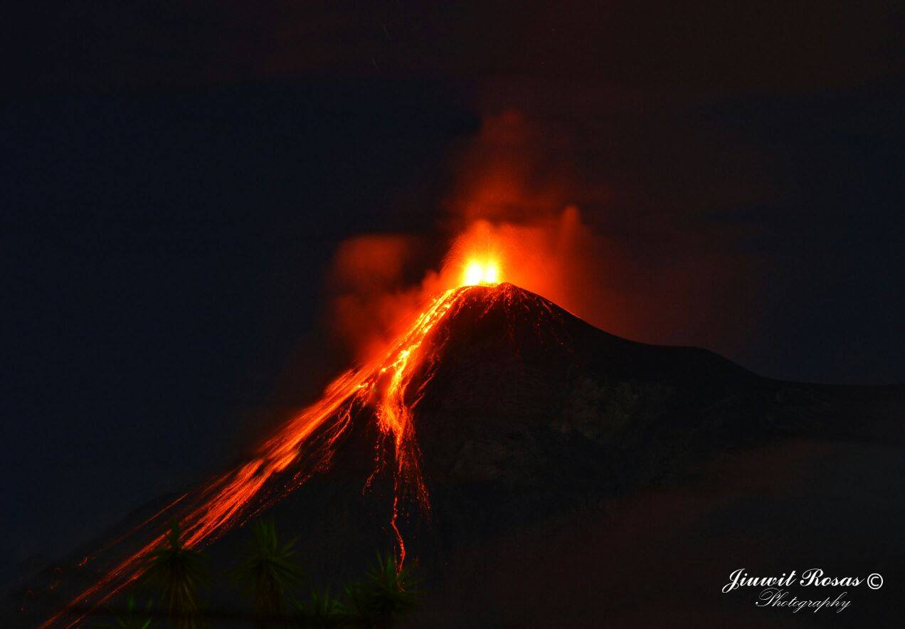
Activity:
Presence of white outgassing at a height of approximately 4,200 m (13,780 feet) dispersed in the northwest, west and southwest directions. An average of 5 to 7 explosions / hours are reported with low to moderate characteristics, generating gray ash columns that reach a height of approximately 4,500 to 4,700 m (14,764 to 15,420 feet) and move 10 km. in the West and Southwest. The explosions are accompanied by moderate to loud rumblings, which cause moderate moderate shock waves within a radius of 25 km. Volcanic vibrations cause vibrations of roofs and windows of houses. The sounds are weak, similar to the train locomotive machine with deviations of 3-5 minutes. Incandescent materials are projected at a height of 200-250 meters above the crater, which causes weak to moderate avalanches on the crater contour, and avalanches towards the Seca, Ceniza and Las Lajas canyons. A lava flow of 600 meters is observed in the direction of Ceniza Canyon.
Source : Insivumeh
Photo : J. Rosas.
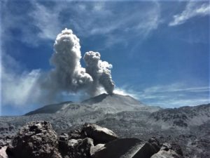
Piton de la Fournaise , La Réunion :
Activity Bulletin from Friday, May 18, 2018 at 3:00 pm (local time).
The eruption started on April 27, 2018 at 23:50 local time continues. The intensity of the volcanic tremor (indicator of surface eruptive intensity) has remained relatively stable over the last 24 hours at values twice as high as those recorded last Week.
– The flow activity is still predominantly in lava tunnels.
– Surface discharges could not be estimated from satellite data in the last 24 hours due to cloud cover on the volcano.
– The inflation of the building continues.
– No volcano-tectonic earthquake has been recorded during the last 24 hours under the Piton de la Fournaise building.
Alert level: Alert 2-2 – Eruption in the Enclos .
Source : OVPF
Photo : Fournaise info.
Sinabung , Indonesia :
VOLCANO OBSERVATORY NOTICE FOR AVIATION – VONA .
Issued: May 19 , 2018.
Volcano: Sinabung (261080)
Current Aviation Colour Code: ORANGE
Previous Aviation Colour Code: orange
Source: Sinabung Volcano Observatory
Notice Number: 2018SIN99
Volcano Location: N 03 deg 10 min 12 sec E 98 deg 23 min 31 sec
Area: North Sumatra, Indonesia
Summit Elevation: 7872 FT (2460 M)
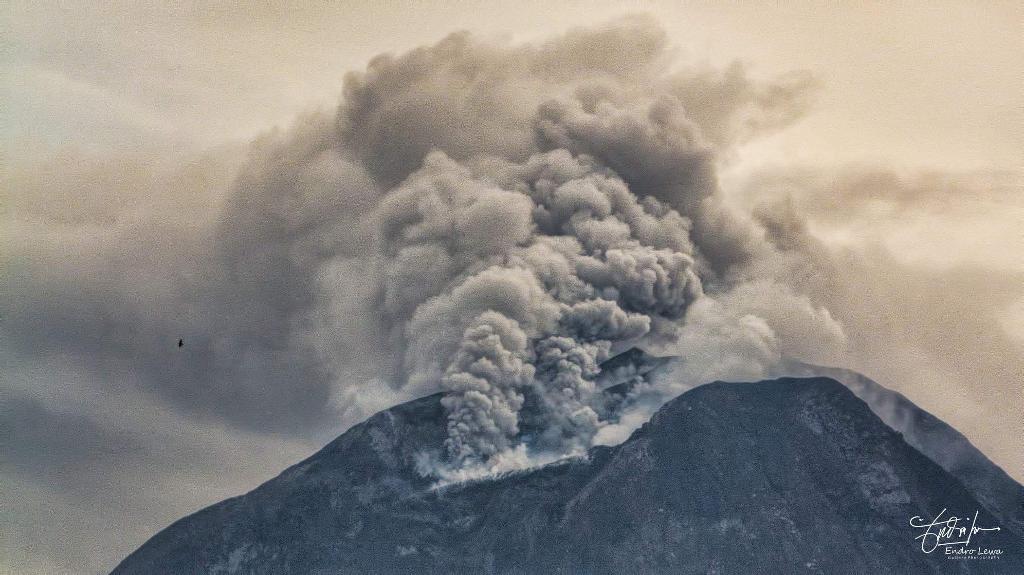
Volcanic Activity Summary:
Eruption with ash clouds at 02:00 UTC ( 09:00 local time). The eruption lasted for 308 seconds
Volcanic Cloud Height:
Best estimate of ash-cloud top is around 10112 FT (3160 M) above sea level, may be higher than what can be observed clearly. Source of height data: ground observer.
Other Volcanic Cloud Information:
Ash cloud is moving to North-west
Remarks:
Seismic activity is characterized by the Deep Volcanic Earthquake, Low Frequency Earthquake, and Hybrid Earthquake. Rock avalanche (Incandescent lava) is not identified
Source : Magma Indonesia.
Photo : Endro Lewa , 9 Mai 2018.