April 30 , 2018.
Piton de la Fournaise , La Réunion :
Activity Bulletin of Sunday, April 29, 2018 at 15:30 (local time).
The eruption started on April 27, 2018 at 23:50 local time continues. After a drop in intensity during the first 14 hours of eruption, the intensity of the volcanic tremor (indicator of eruptive intensity at the surface) has remained relatively stable in the last 24 hours (Figure 1). Only a few small amplitude fluctuations have been observed and are related to morphological changes at the eruptive site (volcanic cone building).
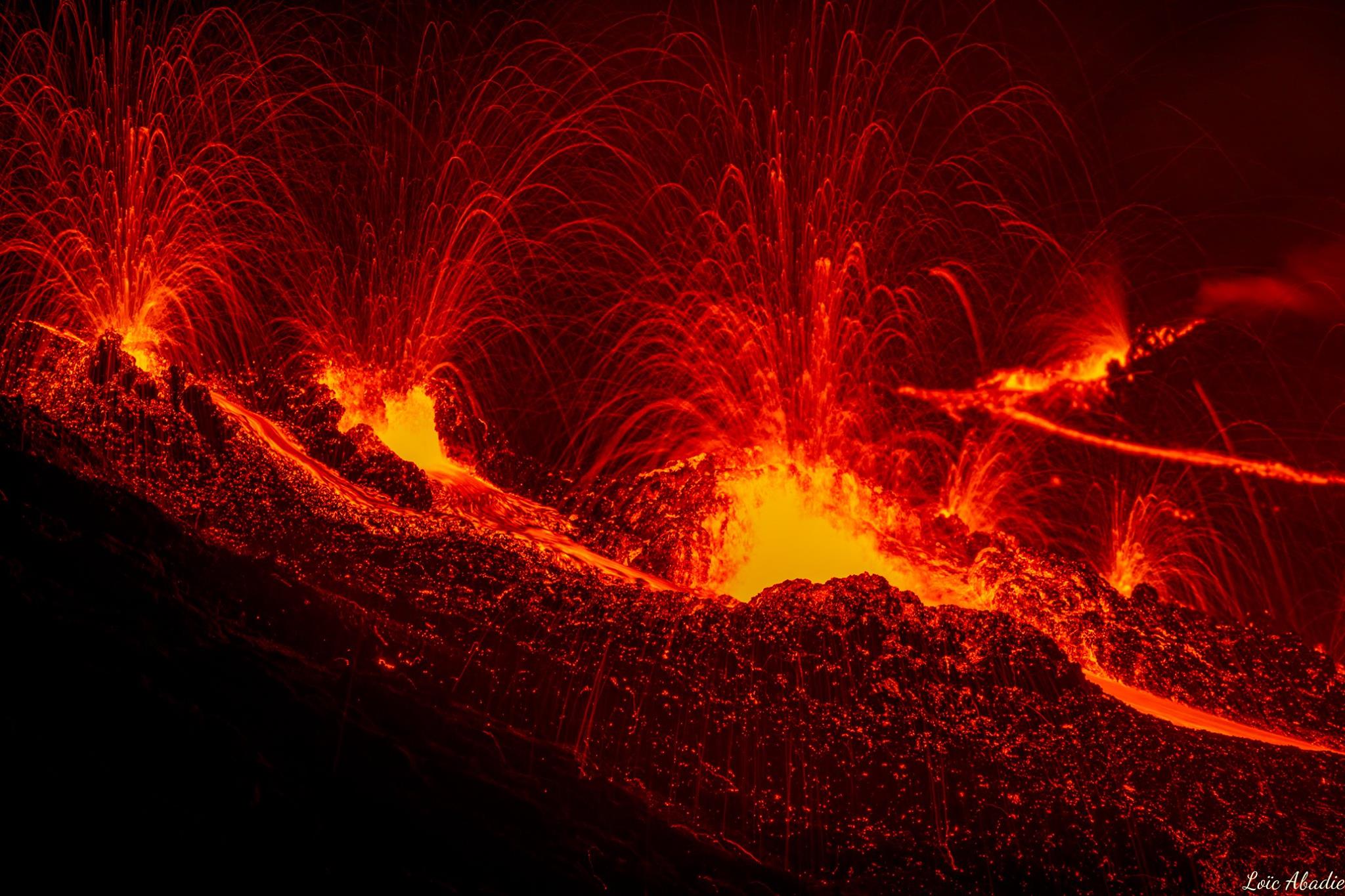
This morning, three eruptive mouths remained active. No recognition could be made today regarding the progress of the flow front.

Figure 1: Evolution of the RSAM (indicator of the volcanic tremor and the intensity of the eruption) between 20:00 (16:00 UTC) on April 27 and 15:30 (11:30 UTC) April 29 on the seismic station BOR (located at the top) . (© OVPF / IPGP)
The surface flows estimated from the satellite data, via the HOTVOLC platform (OPGC – Clermont Ferrand), recorded today were between 2 and 6 m3 / s.
– No significant deformation was recorded during the day on the cone terminal.
– No volcano-tectonic earthquake was recorded during the day under the Piton de la Fournaise building.
Source : OVPF.
Photo : Loïc Abadie.
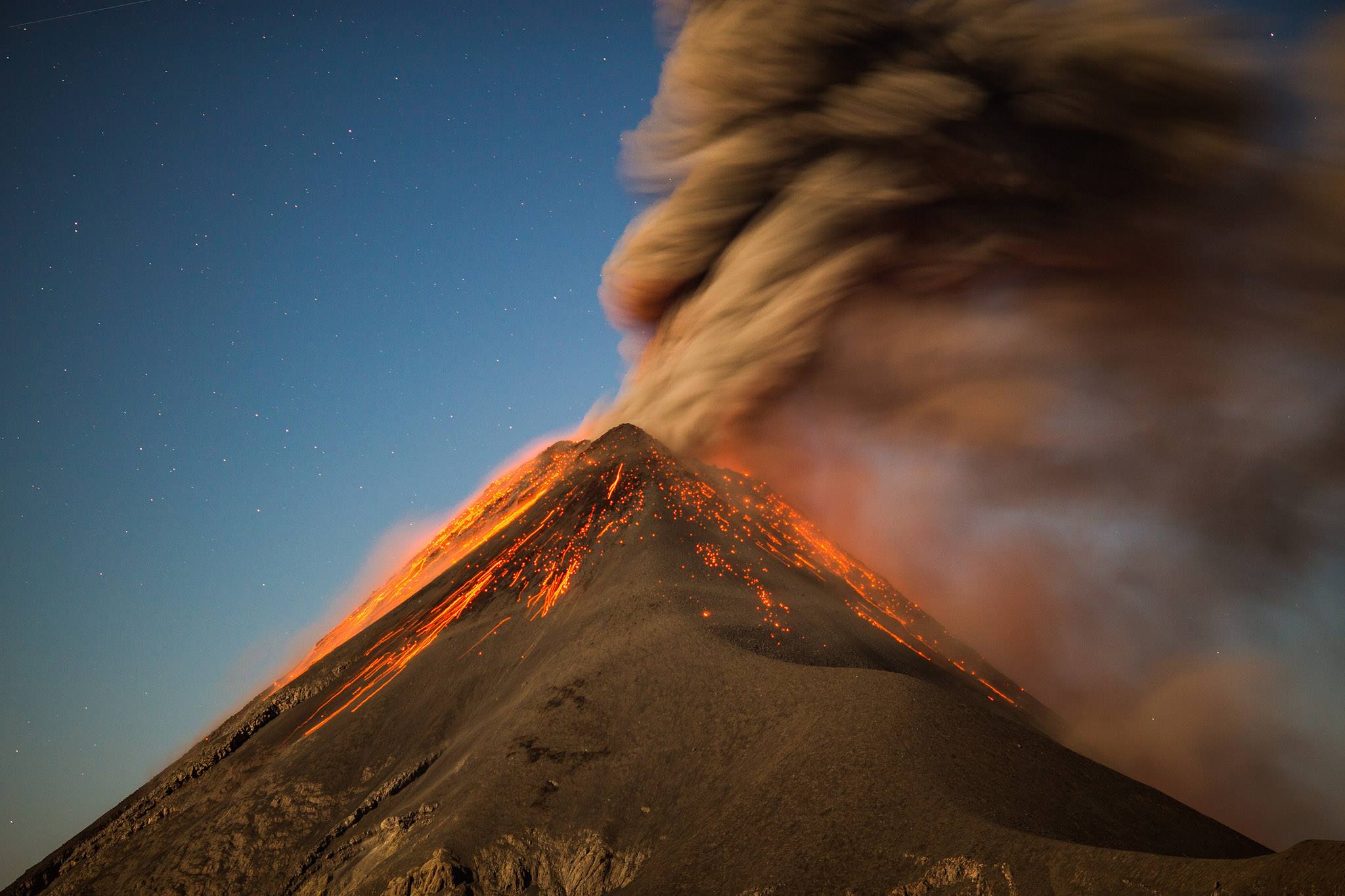
Fuego , Guatemala :
Type of activity: Vulcanian
Morphology: Composite Stratovolcano
Location: 14 ° 28’54˝ Latitude N; 90 ° 52’54˝ Longitude W.
Height: 3,763msnm
Weather Conditions: Clear
Wind: 3 km / h Northeast
Precipitation: 0.0 mm
Activity:
Presence of weak white fumaroles, approximately 4,000 m (13,123 feet) in size, dispersing to the southwest. 4 to 7 weak to moderate gray explosions per hour with column heights of approximately 4,400 to 4,700 m (14,435 to 15,420 feet), dispersing about 10 kilometers to the south and west. Some generate low and moderate rumblings with weak to moderate shock waves over a distance of about 25 kilometers from the volcanic complex. In the evening hours, incandescent impulses are observed at a height of 250 meters above the crater generate moderate avalanches to Barranca Seca, Ceniza, Las Lajas and Honda, as well as glowing lights. Ash falls in the communities of Panimache I and II, Morelia, Santa Sofia, El Porvenir, Palo Verde, San Pedro Yepocapa among others are reported.
Source : Insivumeh.
Photo : Bustor
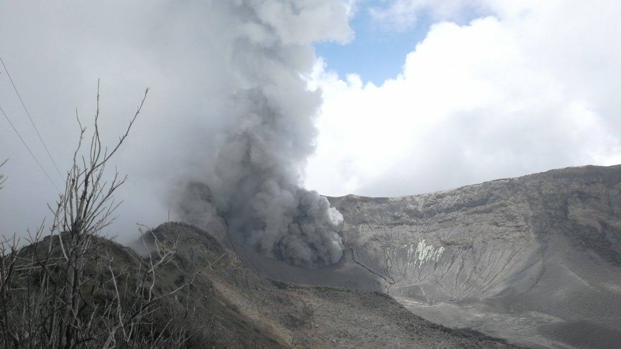
Turrialba , Poas , Rincon de la Vieja , Costa Rica :
Vulcanological and Seismological Observatory of the National University of Costa Rica OVSICORI-UNA Heredia Costa Rica
Daily state report Turrialba, Poás and Rincón de la Vieja volcanoes:
April 29, 2018, updated at 11:00 AM
Turrialba Volcano:
Volcanic seismicity:
The Turrialba volcano maintains a relatively low level of seismic activity characterized by the recording of low amplitude long period (LP) type earthquakes and tremors of very low amplitude and short duration.
Gas, aerosol and heat flows:
The flow of magmatic gases, aerosols and heat through the western crater continues moderately and passively (not explosively). The weak plume of water vapor, gas and aerosols is about 500 meters above the summit.
Influence of the volcanic plume on the ambient air:
During the day, the plume of water vapor, magmatic gases and aerosols was dispersed by prevailing winds to the area west of the volcano, ie towards San Gerardo de Oreamuno, the Irazú Volcano National Park, the Central Valley and the Pacific. Monitoring instruments at the OVSICORI-A Volcanic Aerosol Monitoring Station located in Coronado-San Jose were detected in atmospheric air on April 26-28, with significant concentrations of SO2 exceeding the mean baseline which oscillates around 1 and 2 ppb. Despite this increase in the SO2 concentration observed on April 26 and 28 in the vicinity of Coronado, the averages of the concentration data for these two days comply with the regulation which sets a limit of 75 ppb of the primary pollutant SO2 for 1 periods of one year. hour of human and animal exposure (Air Pollutants Regulation Quality Criteria for Costa Rica (http: //www.digeca.go.cr /…/ reglamento_calidad_del_aire_conta …).
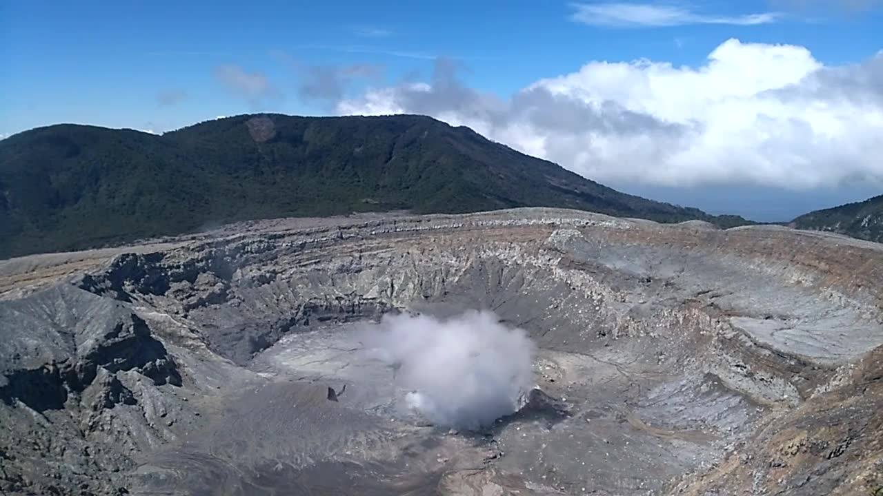
Poas Volcano:
Volcanic seismicity:
The amplitude of the signals recorded by the seismographs located on the Poás is very low and the signals are generated mainly by the instrumental and environmental noise, as well as the low activity of hydrothermal and low temperature fumarole (65-95 ° C ) of the active crater of the volcano.
Gas, aerosol and heat flows:
The Poas has a persistent but weak degassing by a plume of vapor, aerosols and low temperature (<100 ° C) gases directly into the atmosphere since the crater since mid – March 2018. The plume rises less than 300 meters above the crater, and is dispersed by the prevailing winds in the area to the southwest of the volcano.
Rincón de la Vieja Volcano:
Volcanic seismicity:
The amplitude of the signals recorded by the seismographs of Rincon de la Vieja remained in the instrumental and ambient noise. No eruptions have been recorded or observed in recent days. A slight plume of vapor and gas is observed from time to time rising a few dozen meters above the edge of the crater.
Source : Ovsicori
Photo : RSN
Popocatépetl , Mexico :
April 29, 11:15 am (April 29, 16:15 GMT)
During the last 24 hours, thanks to the surveillance systems of the Popocatépetl volcano, 114 exhalations have been identified, accompanied by water vapor, gas and, occasionally, slight amounts of ash. In addition 2 explosions were recorded, one yesterday at 1:19 pm and the second today at 3:06 am. In addition, two volcano-tectonic earthquakes were recorded, the first yesterday at 16h41 and the second today at 06:34 pm, both with a magnitude of M1.5.
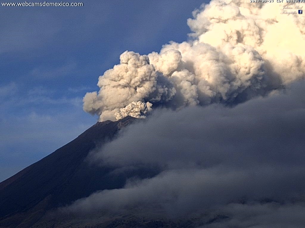
During the night, there were clouds on the crater of the volcano, but at times, there was an incandescence that increased at the time of certain exhalations.
At the time of this report, the continuous emission of volcanic gases is observed as the winds disperse to the east.
CENAPRED asked not to approach the volcano and in particular the crater, because of the risk of falling of projectiles, and in case of heavy rain to remain far from the bottom of the ravines because of the danger of landslides and flows of mud.
The volcanic warning light of the Popocatepetl volcano is located at Amarillo Phase 2.
Source : Cenapred.
Photo : Archive webcamdemexico