April 12 , 2018.
Cumbal , Colombia :
Subject: Cumbal Volcano Activity Bulletin.
The level of activity of the volcano is maintained at the level:
YELLOW LEVEL ■ (III): CHANGES IN THE BEHAVIOR OF VOLCANIC ACTIVITY.
Following the activity of the CUMBAL VOLCANIC COMPLEX, the COLOMBIAN GEOLOGICAL SERVICE informs that:
For the period from April 3 to 9, 2018, seismic activity recorded an increase over the previous week, from 154 to 232 events, mainly earthquakes related to rock fracturing at inside the volcano. The one recorded on April 4 at 23:51. is highlighted, of magnitude M2.5 it has been reported as felt in the city of Cumbal. The other earthquakes were mainly in the vicinity of the La Plazuela crater (north-east of the Cumbal volcanic complex), with depths of up to 10 km from the summit (4700 m) and a maximum local magnitude of M0, 8 on the Richter scale.
Appropriate climatic conditions made it possible to record gas emissions from the El Verde fumarole field, to the north-east of the volcanic complex. The emission columns were observed with little pressure, white color, low height and variable dispersion by wind action.
The COLOMBIAN GEOLOGICAL SERVICE is attentive to the evolution of the volcanic phenomenon and will continue to inform in a timely manner of the detected changes.
Source : SGC
Ambae , Vanuatu :
15.4°S, 167.83°E
Elevation 1496 m
Vanuatu Geohazards Observatory (VGO) reported sustained ash and/or gas emissions from Ambae’s Lake Voui during March through 4 April. Satellite data showed a significant sulfur dioxide gas emission (~0.15 Tg SO2) beginning in the very early hours of 6 April, indicating that the SO2 emission was the largest since Calbuco in April 2015.
No significant high-altitude ash plume accompanied the emission, though the eruption generated lightning detected by the WWLLN (World Wide Lightning Location Network). Pictures of local areas posted on social media showed the continuing and significant ashfall on the island. Within a few days, by 8 April, the sulfur dioxide plume had spread across an area from the E coast of Australia to Tahiti, a distance of about 6,000 km. The Alert Level remained at 3 (on a scale of 0-5).
Sources: Simon Carn, Observatoire des géorisques de Vanuatu, Rocky Planet.
Photo : William S. Mala
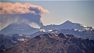
Shinmoedake, Kyushu , Japan:
31.934°N, 130.862°E
Elevation 1700 m
JMA reported that an explosive eruption at Shinmoedake (Shinmoe peak), a stratovolcano of the Kirishimayama volcano group, occurred at 0531 on 5 April and generated an ash plume that rose 8 km above the crater rim. According to news articles lightning was detected in the ash plume. JMA noted that incandescent tephra was ejected 1.1 km from the vent, and a pyroclastic flow traveled 800 m down the SE flank.
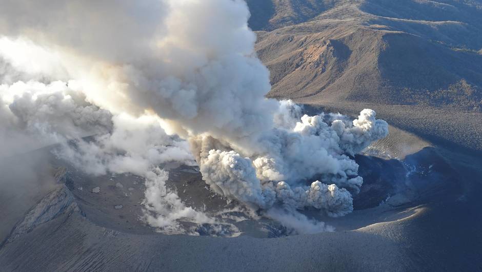
Sulfur dioxide emissions increased to 1,400 tons/day, from 300 tons/day last measured on 28 March. The eruption possibly ceased at 0715. During an overflight later that day scientists confirmed a large amount of ashfall in parts of Kobayashi City and other areas of the Miyazaki Prefecture, in part of Takahara Town, and in areas of the Kumamoto prefecture. White plumes rose 200 m during 6-9 April. The Alert Level remained at 3 (on a scale of 1-5).
Source: Agence météorologique japonaise (JMA).
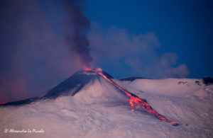
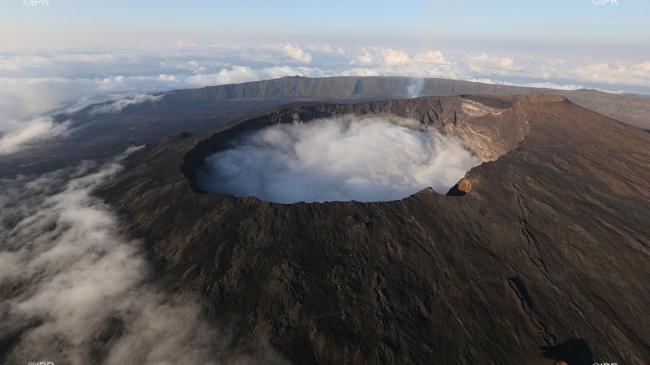
Piton de la Fournaise , La Réunion :
The first eruption of the year of Piton de la Fournaise was furtive, 17 hours and 20 minutes, but the volcano may not have said its last word.
If since the end of the eruption, the seismic activity is down or absent and landslides on the side of the Nez Coupe Sainte-Rose have ceased, pressurization is still felt not to the north flank but to the crater Dolomieu. « A refueling is underway with significant CO2 levels, » said Wednesday Aline Peltier, director of the Volcano Observatory.
A new eruption is possible in the coming weeks or months.
The next rather on the southern flank
On April 3, the volcano erupted. An eruption expected for 7 months, shortly after that of July 14. Everything accelerates at 5:40 am with the beginning of the seismic crisis which lasts 4 hours 50 minutes. « An important duration that indicates that the magma is moving away from the central cone and indeed, the first crack 330m long appears 4 km from the Dolomieu ». The second in foot of rampart. The magma spread from the central cone to the cracks. During this eruption, less than 500 m3 of lava came out of the ground, with a particularity: « this propagation of the crack towards the rampart, which played its role of barrier ». This caused these landslides and the closure of the trail.
A recovery of the activity outside the Enclos was also not discarded and the alert phase 1 « probable or imminent eruption » of the specific device « ORSEC * volcano engaged.
As the activity has refocused on the summit cone for a few days, next Friday, the prefecture and OVPF scientists will carry out an observation in the field.
The next eruption may well be on the south flank. « The longer the time between two eruptions, the more chance there is of alternation ».
Source: Zinfos.974.
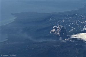
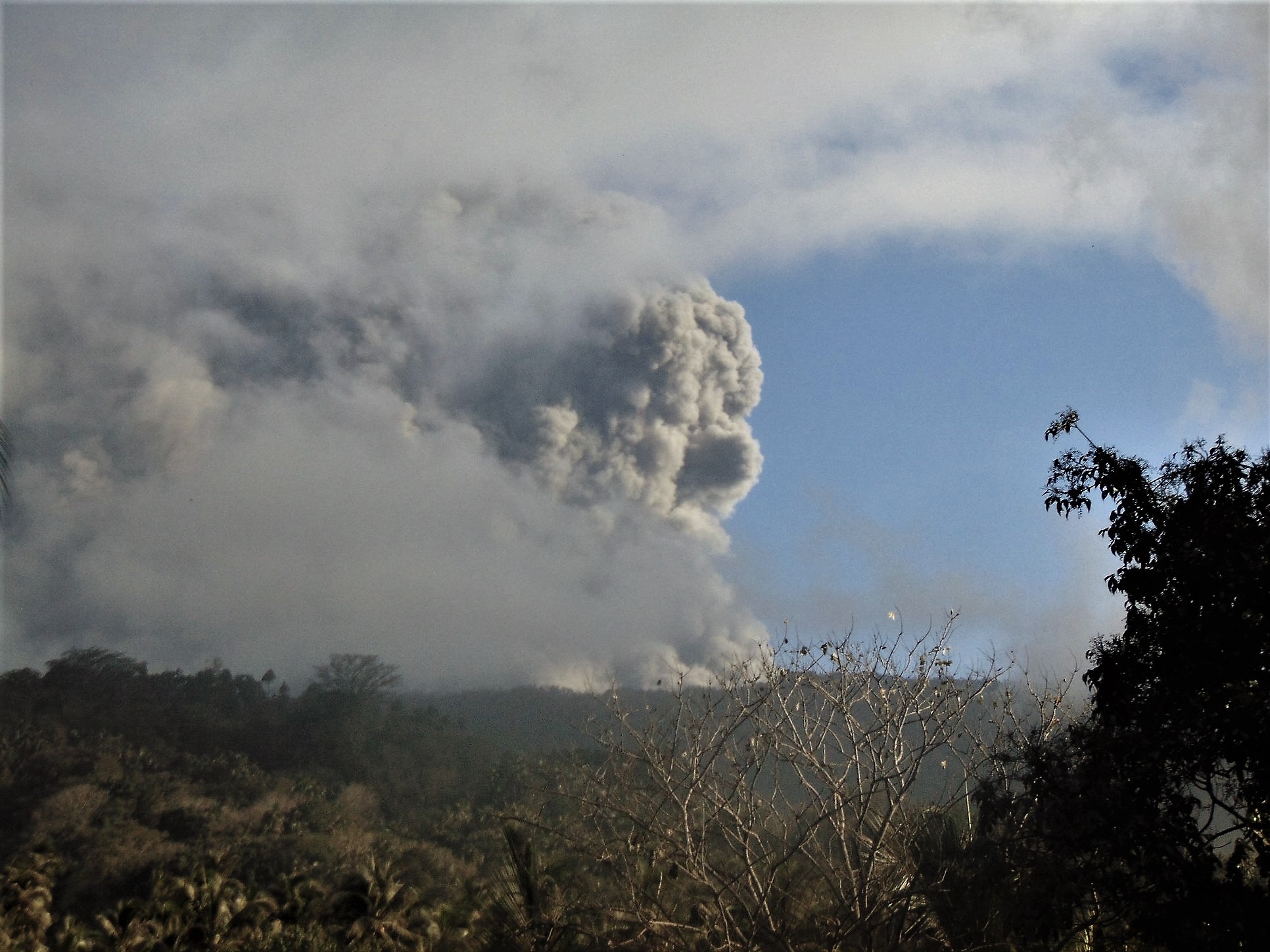
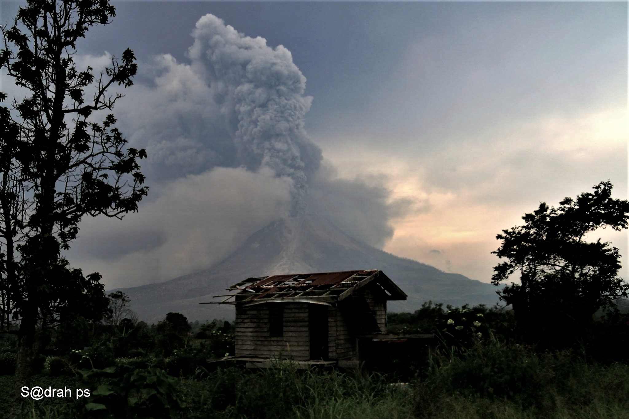
Sinabung , Indonesia :
VOLCANO OBSERVATORY NOTICE FOR AVIATION – VONA.
Issued: April 12 , 2018 .
Volcano: Sinabung (261080)
Current Aviation Colour Code: ORANGE
Previous Aviation Colour Code: red
Source: Sinabung Volcano Observatory
Notice Number: 2018SIN93
Volcano Location: N 03 deg 10 min 12 sec E 98 deg 23 min 31 sec
Area: North Sumatra, Indonesia
Summit Elevation: 7872 FT (2460 M)
Volcanic Activity Summary:
Eruption with ash clouds started at 23:40 UTC ( 06:40 local time). The eruption still continuing
Volcanic Cloud Height:
Best estimate of ash-cloud top is around 8512 FT (2660 M) above sea level, may be higher than what can be observed clearly. Source of height data: ground observer.
Other Volcanic Cloud Information:
Ash cloud is moving to west-northwest
Remarks:
Seismic activity is characterized by the Deep Volcanic Earthquake, Low Frequency Earthquake, Hybrid Earthquake and tremor
Level IV Activity Level (AWAS). The Sinabung (2460 m altitude) has been erupting constantly since 2013.
Since yesterday until this morning, the volcano can be observed visually until the appearance of the fog. Smoke coming out of the crater has been observed of low intensity, white, thick, low pressure up to 200 m above the summit. Surface activity is unaccompanied by eruption. The wind blows slightly to moderately to the south and east.
According to the seismographs of April 10, 2018, it was recorded:
1 emission earthquakes.
1 low frequency earthquake.
7 shallow volcanic earthquakes.
2 tectonic earthquakes.
Recommendations:
Communities / visitors should not do activities within 3 km of the summit, and by sector, 7 km to the South-South-East, 6 km East-South-East and 4 km to the South-East. km northeast.
The deposits formed a dam upstream on the Laborus River. People living in downstream river basins and around the Laborus River need to be vigilant because these dams can collapse at any time and no longer retain water volume, resulting in downstream lahars / floods .
Source : Magma Indonésie
Photo : Sadrah Peranginangin