March 01 , 2018.
Mayon , Philippines :
MAYON VOLCANO BULLETIN 01 March 2018 08:00 A.M.
Mayon’s activity in the past 24 hours was characterized by generally quiet lava effusion and degassing from the summit crater. During daytime yesterday, between 9:14 AM and 5:19 PM, two (2) episodes of lava-collapse pyroclastic density currents (PDC) were visually observed on the Miisi and Bonga-Buyuan Gullies within 4-5 kilometers of the summit crater. At night, lava effusion from the vent continued to feed lava flows that have maintained fronts at 3.3 kilometers, 4.5 kilometers and 900 meters on the Miisi, Bonga and Basud Gullies, respectively, from the summit crater.
A total of twenty-six (26) volcanic earthquakes and ten (10) rockfall events were recorded by Mayon’s seismic monitoring network. Sulfur dioxide (SO2) emission was measured at an average of 1,533 tonnes/day on 28 February 2018. Deflation of the lower slopes that began on 20 February is still being recorded by electronic tilt. Nonetheless, overall electronic tilt and continuous GPS data indicate that the edifice is still swollen or inflated relative to November and October 2017, consistent with campaign Precise Leveling data acquired last week.
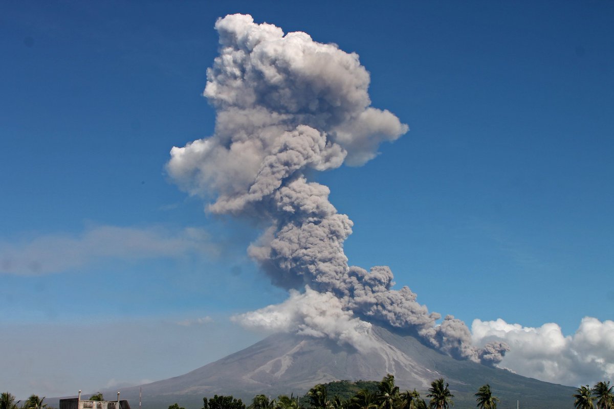
Alert Level 4 still remains in effect over Mayon Volcano. The public is strongly advised to be vigilant and desist from entering the eight (8) kilometer-radius danger zone, and to be additionally vigilant against pyroclastic density currents, lahars and sediment-laden stream flows along channels draining the edifice. Civil aviation authorities must also advise pilots to avoid flying close to the volcano’s summit as ash from any sudden eruption can be hazardous to aircraft.
DOST-PHIVOLCS maintains close monitoring of Mayon Volcano and any new development will be communicated to all concerned stakeholders.
Source : Phivolcs.
Aso , Japan :
Local authorities have lifted a restriction on entry to an area at a volcano in southwestern Japan.
The restriction near the mouth of Mount Aso was set after its eruption in August 2014.
The authorities had kept the restriction in place as another explosive eruption in 2016 damaged monitoring devices and safety fences in the area. The equipment is now fully restored.
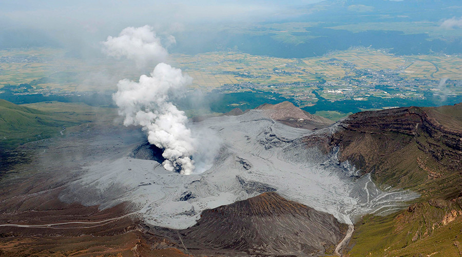
At a ceremony held at a park near the crater on Wednesday, Aso City Mayor Yoshioki Sato said he wants the mountain to be a major tourist spot in the region and Japan. Participants then cut a ribbon to mark the lifting.
Although access to the crater was temporally restricted due to thick fog, many visitors were at the park.
The chairman of a local tourism association said he was waiting for the lifting and called it a sign of a tourism revival at Aso.
Source : 3.nhk.or.jp
Cumbal , Colombia :
Subject: Cumbal Volcano Activity Bulletin.
The level of activity of the volcano is maintained at the level:
YELLOW LEVEL (III): CHANGES IN THE CONDUCT OF VOLCANIC ACTIVITY
Following the activity of the CUMBAL VOLCANIC COMPLEX, the COLOMBIAN GEOLOGICAL SERVICE informs that:
For the week between 20 and 26 February 2018, seismic activity recorded a decrease in the number of events compared to the previous week, from 386 to 174 events, dominated by earthquakes related to the movement of fluids a transient source over time. Most of the time, fracturing-type seismicity has been located near the La Plazuela crater (the north-eastern part of the Cumbal volcanic complex), with depths of up to 5 km from the summit (4700 m) and a magnitude local maximum of M0.6 on the Richter scale.
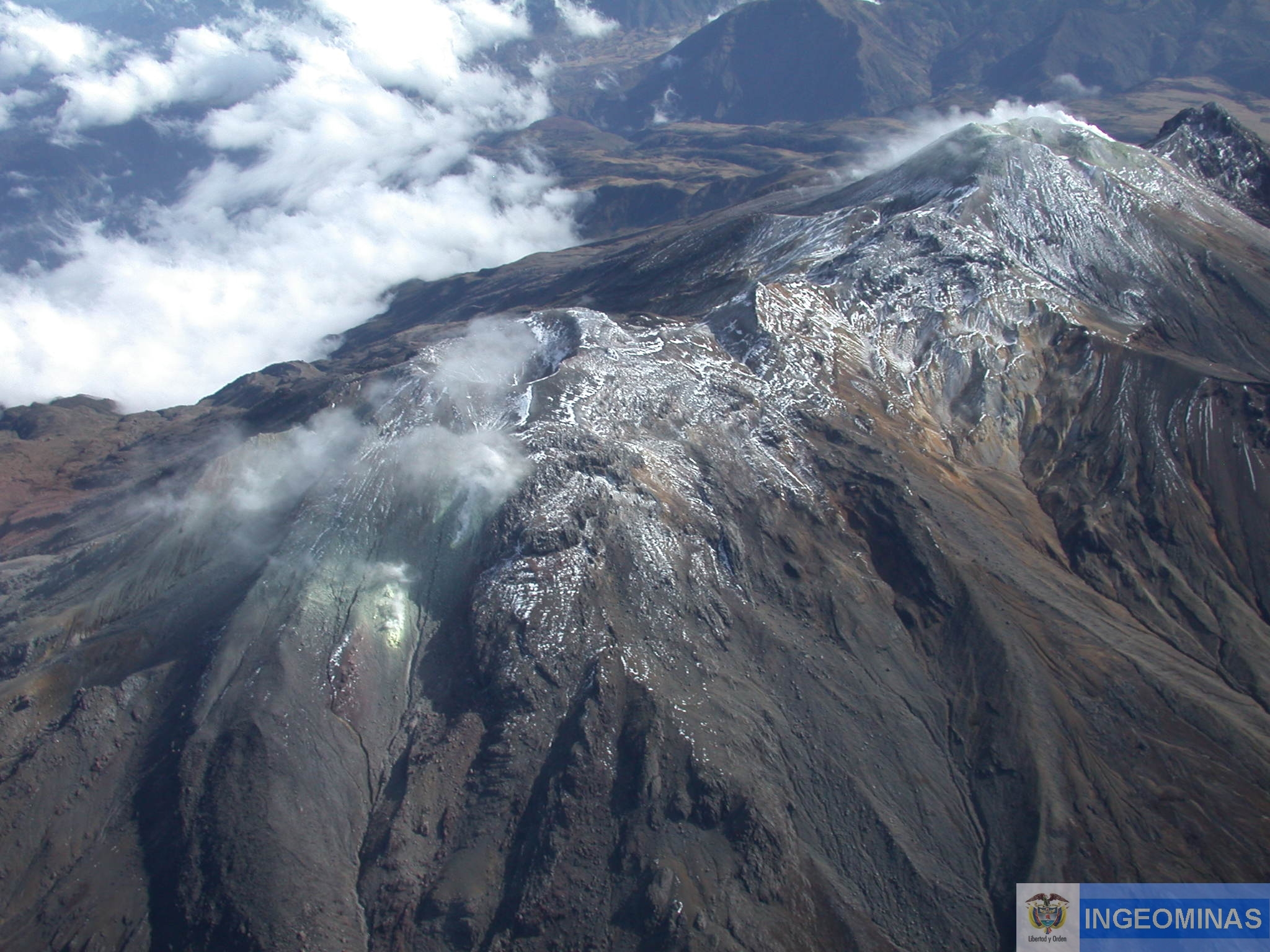
For the evaluation week, the favorable climatic conditions at the summit made it possible to record the emission of gas, in the El Verde fumarolic field north-east of the volcanic complex. The emission columns were observed white, of low height and with a changing direction of dispersion by the action of the wind.
The COLOMBIAN GEOLOGICAL SERVICE is attentive to the evolution of the volcanic phenomenon and will continue to inform in a timely manner of the detected changes.
Source : SGC
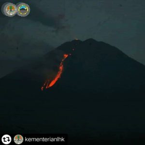
Kadovar , Papua New Guinea :
3.608°S, 144.588°E
Elevation 365 m
RVO reported that lava continued to flow from the SE Coastal Vent resulting in the connection of a reemerged lava island to the coast of Kadovar within a few days of the 1 February collapse. During 14-22 February continuous plumes of white vapor rose from both Main Crater and SE Coastal Vent, punctuated by dense ash emissions from both areas during 16 and 20-22 February and occasional booming noises.
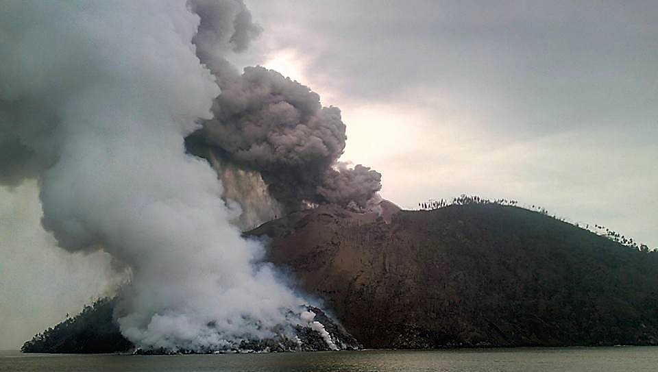
Ash plumes rose 370 m above the island and drifted SE, though on 22 February the winds blew the plumes N and NW. Incandescence from both areas was visible on 22 February. A sulfur odor was noticed by residents on Blup Blup (15 km N) on 16 and 22 February.
Source: Observatoire du volcan Rabaul (OVR), GVP.
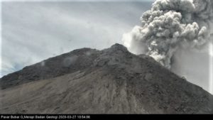
Semeru , Indonesia :
8.108°S, 112.922°E
Elevation 3657 m
According to the Darwin VAAC ash plumes from Semeru rose to an altitude of 4.6 km (15,000 ft) a.s.l. and drifted almost 20 km ESE and WSW. A thermal anomaly preceded the emissions.

Semeru, the highest volcano on Java, and one of its most active, lies at the southern end of a volcanic massif extending north to the Tengger caldera. The steep-sided volcano, also referred to as Mahameru (Great Mountain), rises above coastal plains to the south. Gunung Semeru was constructed south of the overlapping Ajek-ajek and Jambangan calderas. A line of lake-filled maars was constructed along a N-S trend cutting through the summit, and cinder cones and lava domes occupy the eastern and NE flanks. Summit topography is complicated by the shifting of craters from NW to SE. Frequent 19th and 20th century eruptions were dominated by small-to-moderate explosions from the summit crater, with occasional lava flows and larger explosive eruptions accompanied by pyroclastic flows that have reached the lower flanks of the volcano.
Source: Darwin VAAC , GVP.
Photo : Hshdude