December 03 , 2024.
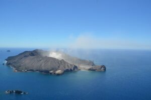
Philippines , Taal :
TAAL VOLCANO ADVISORY , 3 December 2024 , 9:30 AM .
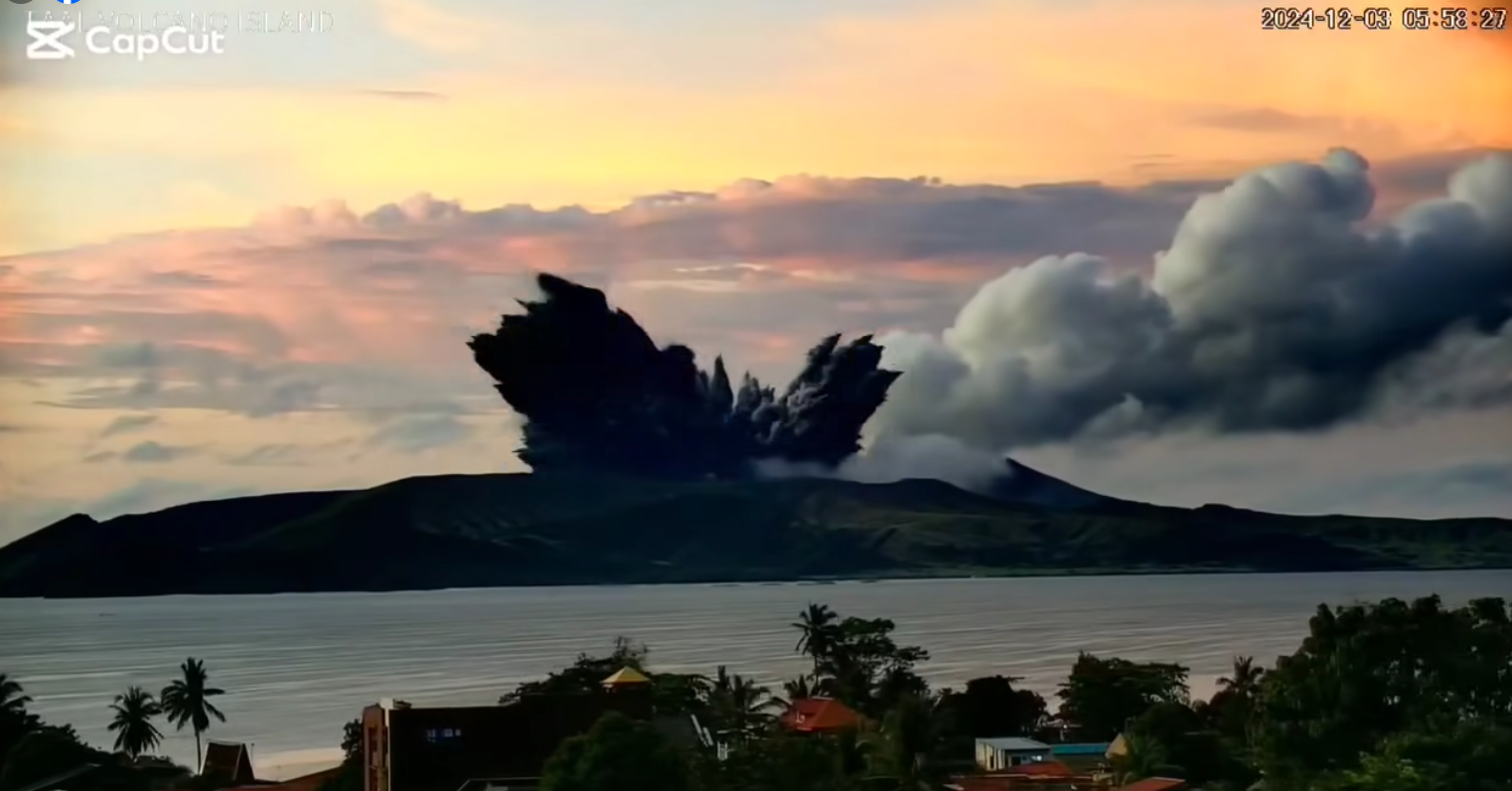
This is a notice for minor phreatomagmatic activity at Taal Volcano.
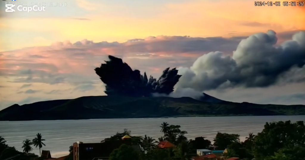
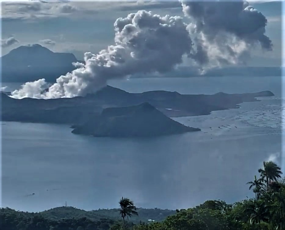
A minor phreatomagmatic eruption at the Taal Main Crater occurred at 5:58 AM today, 3 December 2024, which lasted four (4) minutes based on visual, seismic and infrasound records of the Taal Volcano Network (TVN). The event produced a dark 600 meter-tall jetted plume that subsequently rose 2,800 meters above Taal Volcano Island (TVI) before drifting west-southwest based on IP camera monitors. Traces of ash were reported in Poblacion, Agoncillo and Buso-buso, Laurel, Batangas. Taal has been exhibiting increased volcanic gas emissions and localized ground deformation for the past month although volcanic earthquakes have been at low levels.
Sulfur dioxide (SO2) flux on 30 November 2024 averaged 7,216 tonnes/day, higher than the monthly average of 5,283 tonnes/day. Ground deformation monitors have also been recording localized inflation of TVI since September 2024 although long-term deflation of the Taal Caldera region has persisted since 2020. Today’s phreatomagmatic event was likely driven by sudden contact of water with a small batch of shallow magma that has been in place beneath the Taal Main Crater and that has been degassing sustained levels of SO2 for the past three years. The background levels of volcanic earthquake activity and localized ground deformation detected at Taal indicate that unrest is unlikely to progress into a major magmatic eruption at this time.
DOST-PHIVOLCS reminds the public that Alert Level 1 prevails over Taal Volcano, which means that it is still in abnormal condition and should not be interpreted to have ceased unrest nor ceased the threat of eruptive activity. At Alert Level 1, sudden steamdriven or phreatic or minor phreatomagmatic eruptions, volcanic earthquakes, minor ashfall and lethal accumulations or expulsions of volcanic gas can occur and threaten areas within the Taal Volcano Island (TVI). Should phreatomagmatic activity at Taal persist or intensify, then the Alert Level may be raised to Alert Level 2. Furthermore, degassing of high concentrations of volcanic SO2 continues to pose the threat of potential long-term health impacts to communities around Taal Caldera that are frequently exposed to volcanic gas. DOST-PHIVOLCS strongly recommends that entry into TVI, Taal’s Permanent Danger Zone or PDZ, especially the vicinities of the Main Crater and the Daang Kastila fissure, must remain strictly prohibited. Local government units are advised to continuously monitor and assess preparedness of their communities and undertake appropriate response measures to mitigate hazards that could be posed by long-term degassing and related phreatic activity. Civil aviation authorities must advise pilots to avoid flying close to the volcano as airborne ash and ballistic fragments from sudden explosions and wind-remobilized ash may pose hazards to aircrafts.
DOST-PHIVOLCS is closely monitoring Taal Volcano’s activity and any new significant development will be immediately communicated to all stakeholders.
Source : Phivolcs
Photos : Capture d’écran 2024-12-03, GMA news , Kyle Aranza ( 2022)
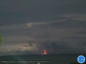
Indonesia , Ibu :
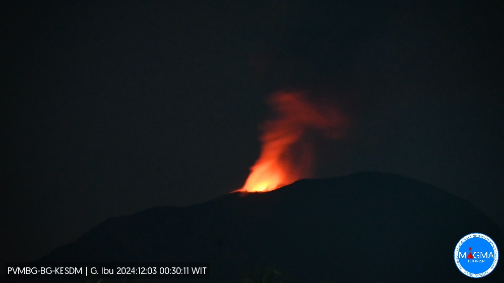
An eruption of Mount Ibu occurred on Tuesday, 3 December 2024 at 17:46 UTC (02:46 local time) with the height of the ash column observed at ± 700 m above the summit (± 2240 m above sea level). The ash column was observed to be grey with a thick intensity, oriented towards the southwest. This eruption was recorded on a seismograph with a maximum amplitude of 28 mm and a duration of 61 seconds.
VOLCANO OBSERVATORY NOTICE FOR AVIATION – VONA
Issued : December 03 2024
Volcano : Ibu (268030)
Current Aviation Colour Code : ORANGE
Previous Aviation Colour Code : orange
Source : Ibu Volcano Observatory
Notice Number : 2024IBU1259
Volcano Location : N 01 deg 29 min 17 sec E 127 deg 37 min 48 sec
Area : North Maluku, Indonesia
Summit Elevation : 4240 FT (1325 M)
Volcanic Activity Summary :
Eruption with volcanic ash cloud at 17h46 UTC (02h46 local).
Volcanic Cloud Height :
Best estimate of ash-cloud top is around 6480 FT (2025 M) above sea level or 2240 FT (700 M) above summit. May be higher than what can be observed clearly. Source of height data: ground observer.
Other Volcanic Cloud Information :
Ash cloud moving to southwest. Volcanic ash is observed to be gray. The intensity of volcanic ash is observed to be thick.
Remarks :
Eruption recorded on seismogram with maximum amplitude 28 mm and maximum duration 61 second.
Source et photo : Magma Indonésie.
United – States , Yellowstone :
Monday, December 2, 2024, 12:40 PM MST (Monday, December 2, 2024, 19:40 UTC)
44°25’48 » N 110°40’12 » W,
Summit Elevation 9203 ft (2805 m)
Current Volcano Alert Level: NORMAL
Current Aviation Color Code: GREEN
Summary
Yellowstone Caldera activity remains at background levels, with 88 located earthquakes in November (maximum = M2.4). Deformation measurements indicate a small amount of caldera subsidence since early October.
Recent Work and News
Steamboat Geyser erupted on November 23, the 6th major eruption of the year. Since that time, there has not been any significant eruptive activity at the geyser, indicating that the next major eruption is at least many weeks, and perhaps months, away.
Yellowstone Volcano Observatory scientists continue to collect data from the Black Diamond Pool area of Biscuit Basin, where a hydrothermal explosion took place on July 23, 2024. Seismic and infrasound (acoustic) data indicate occasional minor explosions and surges of water from the pool, one of which reached about 6 meters (20 feet) in height on November 5 and was witnessed by scientists who were maintaining monitoring equipment.
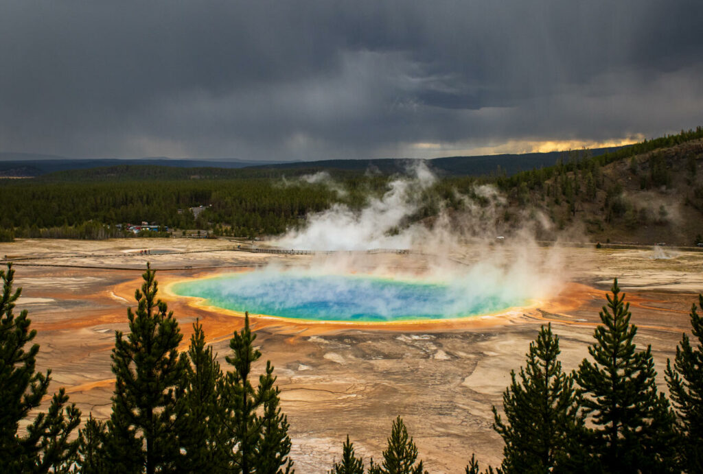
A view of the Grand Prismatic Hot Spring from the vantage point of the Grand Prismatic Overlook Trail in Yellowstone National Park, Wyoming.
Grand Prismatic Spring is the largest hot spring in the United States and one of the largest in the world. The feature is located in Midway Geyser Basin—so named because it is between the Upper and Lower Geyser Basins—and is one of the most popular attractions in Yellowstone National Park.
Seismicity
During November 2024, the University of Utah Seismograph Stations, responsible for the operation and analysis of the Yellowstone Seismic Network, located 88 earthquakes in the Yellowstone National Park region. The largest event of the month was a micro earthquake of magnitude 2.4 located about 16 miles southwest of West Thumb in Yellowstone National Park on November 7 at 9:16 AM MDT.
November seismicity in Yellowstone was marked by one small swarm of 13 earthquakes about 11 miles north-northeast of West Yellowstone, MT, that occurred November 26–28. The largest earthquake in the sequence was a magnitude 1.6 on November 26 at 9:54 AM MST.
Earthquake sequences like these are common and account for roughly 50% of the total seismicity in the Yellowstone region.
Yellowstone earthquake activity is currently at background levels.
Ground Deformation
Continuous GPS stations in Yellowstone Caldera and near Norris Geyser Basin recorded a small amount of subsidence since October. The deformation data are noisier than usual during the second half of November owing to winter storms and snowfall.
Source et photo : YVO ( UGS , 10/2023, Grand Prismatic Spring ).
Peru , Sabancaya :
Analysis period: from November 25, 2024 to December 01, 2024, Arequipa, December 02, 2024
Alert level: ORANGE
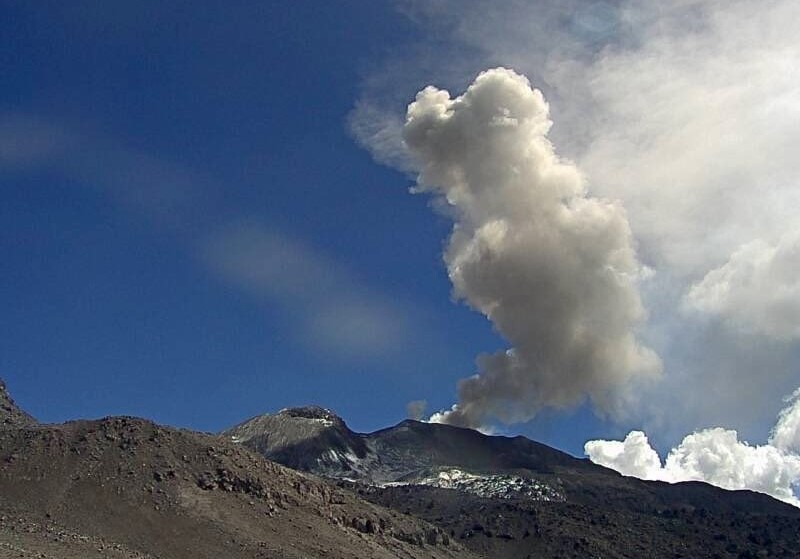
The Geophysical Institute of Peru (IGP) reports that the eruptive activity of the Sabancaya volcano continues. During this period, an average of 6 explosions per day have been recorded, with columns of ash and gas up to 1500 m above sea level above the summit of the volcano. Therefore, the volcanic alert level remains at ORANGE
The IGP has recorded and analyzed the occurrence of 114 earthquakes of volcanic origin, associated with the circulation of magmatic fluids inside the Sabancaya volcano, as well as earthquakes related to rock fracturing. An average of 6 explosions per day have been recorded.
Columns of ash and gas have been observed up to 1500 m above sea level above the summit of the volcano. The predominant direction of these emissions has been towards the West and Southwest sector of the volcano over a distance of less than 10 KM.
A slight inflation process continues to be recorded in the North sector (around the Hualca Hualca volcano).
Satellite recordings have identified the presence of 5 thermal anomalies, with a maximum value of 2 MW, associated with the presence of a body of lava on the surface of the volcano’s crater.
Moderate emissions (436 tons/day) of sulfur dioxide (SO2) have been observed
RECOMMENDATIONS
• Maintain the orange volcanic alert level.
• Do not approach within a radius of less than 12 km of the crater.
Source : Cenvul
Photo : Ingemmet .
Costa Rica , Rincon de la Vieja / Poas :
OVSICORI-UNA Weekly Volcanic Monitoring Bulletin, November 30, 2024
Rincón de la Vieja Volcano
Latitude: 10.83°N;
Longitude: 85.34°W;
Altitude: 1916 m
Current activity level: Warning
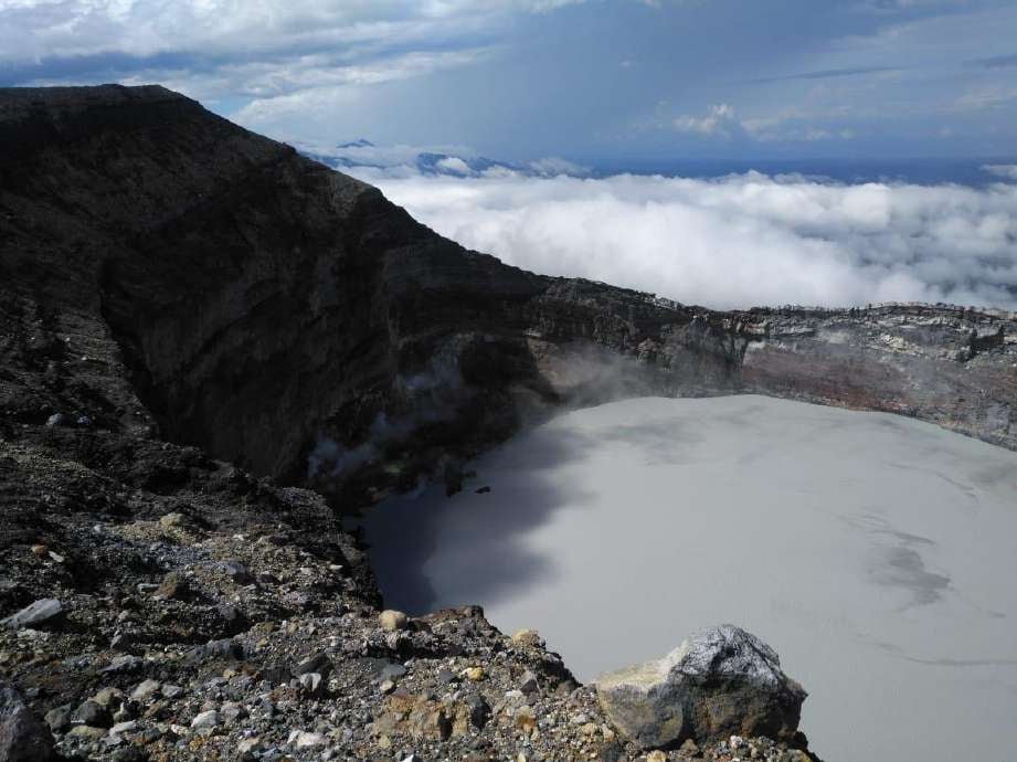
Eruptive activity remained low this week with a single low-energy expiration. This eruptive manifestation is rich in water vapor, gas and volcanic aerosols. On November 25-26, a sequence of banded tremors was recorded. After this sequence, an increase in the background tremor energy and an increase in the low-frequency content (0.2 – 1 Hz) are recorded, with oscillations in the dominant frequency. The appearance of long-period « tornillos » type signals continues. The dominant frequency of the « tornillos » shows a similar trend to the previous week. In recent weeks, geodetic stations have not detected any significant deformation. The MultiGas station recorded low gas concentrations this week. During the last week, the average SO2 flow rate was 297 ± 81 t/d. The last SO2 detection by the TROPOMI Sentinel-5P satellite sensor was on October 19, 2024, a mass of SO2 of 14 tons. The level of the hyperacid lake rose by several meters in 1 month, submerging several fumaroles.
Remote apparent temperature measurements taken at the end of November recorded 130°C for the fumaroles and 44°C for the hyperacid lake.
Poas Volcano
Latitude: 10.20°N;
Longitude: 84.23°W;
Altitude: 2687 m
Current activity level: Warning
Seismic tremor remains moderate to low amplitude with a slight increasing trend.
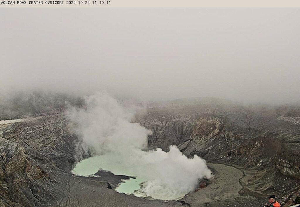
In addition, low intensity acoustic tremor is occasionally observed. Frequent low frequency, low amplitude LP (long period) seismic events are recorded. Since November 18, short repetitive tremors have been recorded. Geodetic observations do not detect significant deformation. The MultiGas station recorded weekly averages of 0.8 ± 0.4 for SO2/CO2 and 0.02 ± 0.02 for H2S/SO2, similar values to the previous week. This week at Visitor Viewpoint, SO2 gas values were recorded up to 5.8 ppm with a weekly average of 0.2 ppm. Over the past week, an average flow rate of 97 ± 45 t/d of SO2 was measured. The TROPOMI Sentinel-5P satellite sensor detected a plume of SO2 gas in the atmosphere twice this week with low values (less than 22 tons of SO2). The level of the hyperacid lake increased by 0.8 m this week.
Source : Ovsicori
Photos : Waldo Taylor / ICE , Ovsicori.

