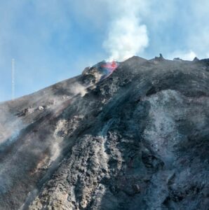
June 27 , 2021.
Italy / Sicily , Etna :
Do you want more ???
Etna is the most active volcano in Europe and it does its job as a volcano quite well. No vacation for him yet.
Press release on ETNA’s activity, June 26, 2021, 4:49 pm (14:49 UTC).
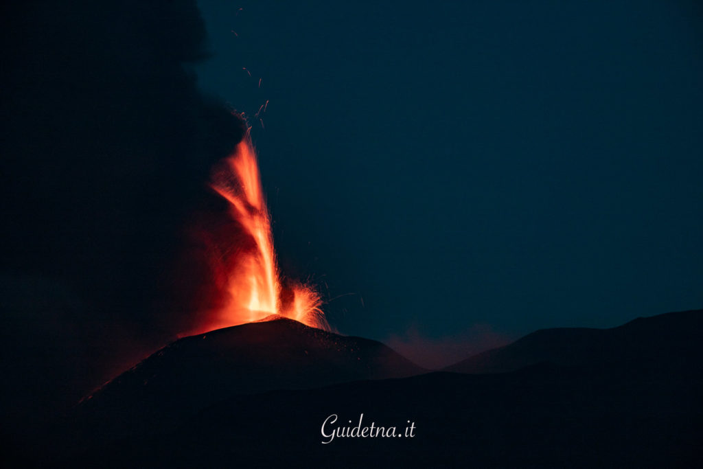
The National Institute of Geophysics and Volcanology, Osservatorio Etneo announces that shortly after 14:30 UTC a resumption of Strombolian activity was observed from two eruptive vents on the Southeast Crater, which gradually intensifies, accompanied by production of modest amounts of volcanic ash. Based on the forecast model, the eruptive cloud produced by the current activity disperses in an East-North-East direction. In the previous hours, the lava flow emitted by a vent at an altitude of about 3050 m on the southeast flank of the Southeast Crater, which had remained active after the eruptive episode last night, has gradually depleted and is currently cooling.
At 14.20 UTC the amplitude of the volcanic tremor was on average values with an increasing trend. The last location of the tremor, at 13.45 UTC, is near the Southeast Crater at a depth of approximately 3.0 km. During the last 10 minutes, no infrasound event has been recorded.
At present, there are no significant variations in the signals from inclinometer and GNSS networks.
At 5:48 p.m. (3:48 p.m. UTC), the Strombolian activity of the Southeast Crater gradually turned into a lava fountain. The emission of pyroclastic material intensifies, feeding a high eruptive cloud which reaches a height of about 5 km above sea level. At the same time, a lava overflow towards the southwest began, overlapping that of the eruptive episode of last night.
At 15:30 UTC the amplitude of the volcanic tremor is on high values with an increasing trend.
The last location of the tremor, at 14:45 UTC, is near the Southeast Crater at a depth of about 3000 m above sea level. .
The number of infrasonic events in the last 10 minutes at 15.24 UTC is average. The last infrasound event is located near the Southeast Crater.
Press release on ETNA’s activity, June 26, 2021, 19:05 (17:05 UTC).
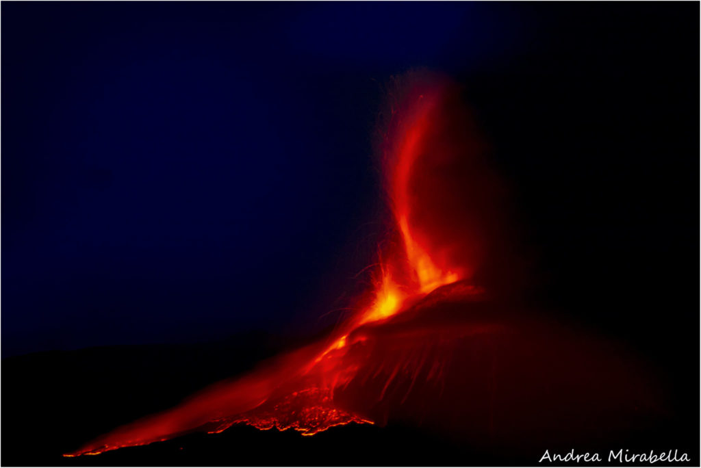
The National Institute of Geophysics and Volcanology, Osservatorio Etneo, announces that the activity of the lava fountain has ceased. A weak emission of ash from the Southeast Crater still persists and a flow of lava continues to extend towards the Southwest and South-Southwest. We also observe a resumption of effusive activity at the mouth located at an altitude of 3050 m on the south-eastern flank of the South-eastern Crater, which feeds a small lava flow of around one hundred meters in length.
Lapilli fall with diameters of 1 to 2 cm in the region of Macchia di Giarre and Zafferana Etnea, and several millimeters in Torre Archirafi (east side of Etna).
At 16:30 UTC, the maximum amplitude of the volcanic tremor was recorded. From this moment began a rapid descent which is still in progress. The last tremor location, at 4:15 p.m. UTC, is near the Southeast Crater at a depth of approximately 3.0 km. The number of infrasound events in the last 10 minutes at 16.35 UTC is high.
The last infrasound event is located near the Southeast Crater.
During the lava fountain episode, very small variations were only recorded at the upper stations of the inclinometric network. No significant change is observed in the signals acquired by the GNSS network.
Press release on ETNA’s activity, June 26, 2021, 22:41 (20:41 UTC).
The National Institute of Geophysics and Volcanology, Osservatorio Etneo reports that the explosive activity at the Southeast Crater has ceased. Instead, effusive activity continues from the vent located on the southeast flank of the Southeast Crater, feeding a lava flow that splits into two branches at an elevation of 2,900 m. The longest and most northerly of these branches at 20:00 UTC had reached an altitude of about 2600 m and had started to cool; the other branch had an active front at about 2700 m. The flow on the southwest side of the Southeast Crater is no longer supplied and cools.
At 20:00 UTC, the amplitude of the volcanic tremor is on medium-low values. The locations of the tremor remain in correspondence with the Southeast Crater at an altitude of about 3000 m. The number of infrasound events is low.
Further updates will be communicated shortly.
Source : INGV.
Photos : Guide Alpine Vulcanologiche Etna , Andrea Mirabella .
Alaska , Gareloi :
51°47’21 » N 178°47’46 » W,
Summit Elevation 5161 ft (1573 m)
Current Volcano Alert Level: ADVISORY
Current Aviation Color Code: YELLOW
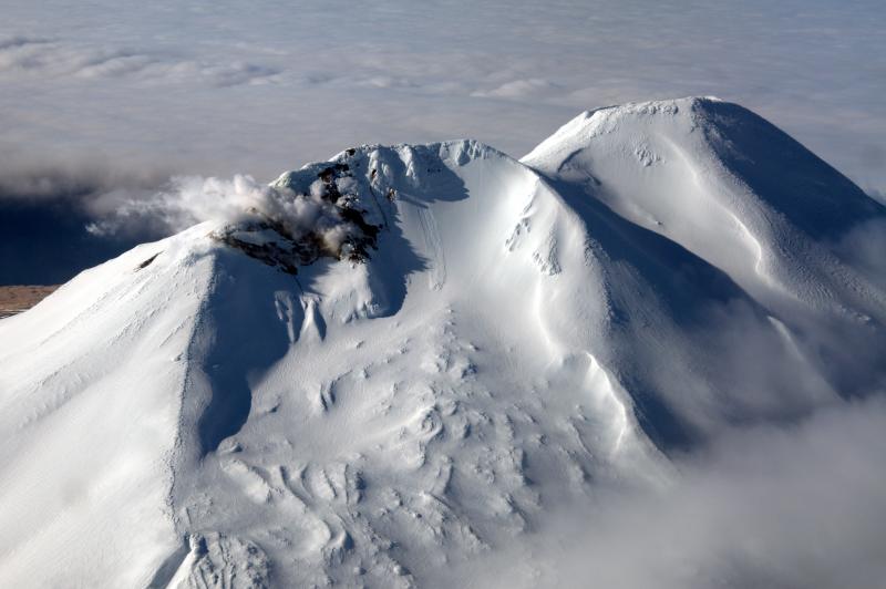
Slightly elevated seismicity is continuing at Gareloi volcano but the level of activity has been gradually declining and is approaching background conditions. Possible sulfur dioxide emissions observed in satellite data, otherwise nothing noteworthy was observed in mostly cloudy satellite and web camera views of the volcano over the past day
Gareloi volcano persistently emits magmatic gases from a fumarole field on the south crater and commonly exhibits low-level seismic activity. These observations suggest the presence of shallow magma and potential interaction with a hydrothermal system. The current increase in seismicity likely reflects a change to the magmatic-hydrothermal system, but it is not clear that the likelihood of a volcanic eruption has increased. AVO will continue to monitor activity to determine if the recent changes are related to influx of new magma or other changes to the magma system.
Gareloi is monitored by a local seismic and infrasound network, satellite data, and regional infrasound and lightning-detection networks.
Source : AVO.
Photo : Read, Cyrus / AVO/USGS.
Chile / Argentina , Nevados de Chillan :
Seismicity parameters associated with rigid material fracturing (VT) processes showed a slight decrease in the number of events and energy released compared to the previous period, while activity related to fluid dynamics ( LP, VLP, TR and EX types) remained at similar levels. .
The highest energy VT-type event, with a local magnitude (ML) of 2.3, was located 4.3 km east-southeast (ESE) of the active crater and at a depth of 4 , 3 km.
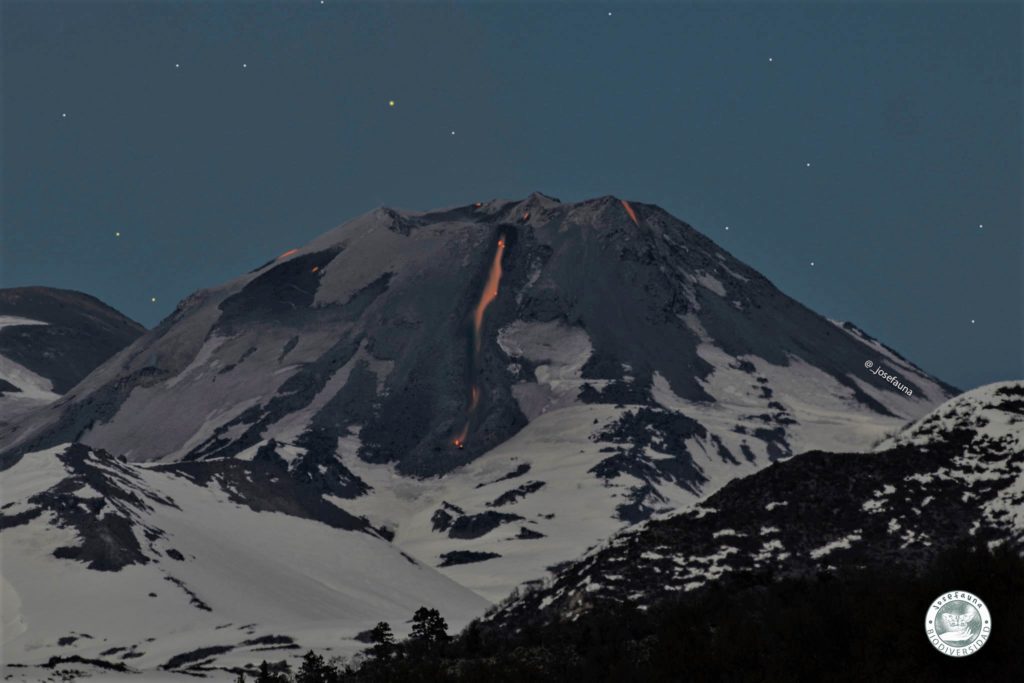
From the analysis of the images provided by the surveillance cameras belonging to the OVDAS as well as the satellite images, it is observed that the growth of the supply crack of the L5 stream is maintained. The emission of the L5 and L6 streams predominates and the simultaneous activity of two emission centers in the nested dome is recognized, which although it does not show growth, and retains a significant part of its structure. The L5 stream has a range of 1 km with almost zero forward speed. The material supply covered the existing morphology, increasing a higher concentration in the distal-intermediate area. The L6 flow has a range of 894 m, being the most accelerated of the flows emitted in this eruptive cycle, although, in recent days, its greatest growth has been towards the sides. Earlier this month, a secondary lava flow was identified with a similar advance and temperature range at L6 and later a new pulse on L6 causing distal accumulations where a radiance anomaly was recognized.
The explosive activity exhibited maximum column heights of less than 1140 m, with a recurring particulate matter content. At the same time, the high level of intensity, distribution and frequency of incandescent events associated with explosions concentrated on the East zone (E) of the crater, affecting to a lesser extent the East, South-East and North slopes. Is, is maintained. The explosions occasionally generated proximal pyroclastic flows with a maximum extension of 0.6 km east of the volcanic edifice.
According to data obtained from the network of GNSS stations installed in the volcano, a change was observed in the vertical components of the stations located on the volcanic building, indicating a deflation with a maximum of -0.57 cm / month. On the monitoring baselines between stations, horizontal components and inclinometer stations remain stable.
Thirty-one (31) thermal alerts were recorded in the area with a maximum value of 86 MW on June 15, considered moderate for this volcano. In turn, radiance anomalies were detected on June 7, 9, 12 and 14 from Sentinel 2-L2A image analysis.
The thermal imagery made it possible to observe temperatures exceeding 360 ° C in the emission zone during the explosions.
Source : Segemar .
Photo : Josefauna.
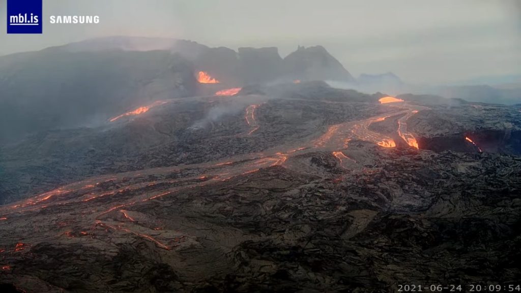
Iceland , Geldingadalur / Fagradalsfjall :
Researchers from the Icelandic Meteorological Office (Veðurstofa Íslands) and the University of Iceland (Háskóli Íslands) believe that lava flow models are useful. In the new article published on the Agency’s website, we can read that such a model was first used in Iceland six years ago, during the eruption of Holuhraun.
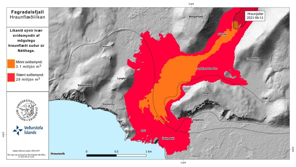
The model shows two possible lava flow scenarios south of Nátthaga. The scenarios show lava flows of 3.1 million m3 on the one hand and 29 million m3 on the other. There is considerable uncertainty as to how long it will take for the Nátthaga region to be filled before lava begins to flow into the valley. (Model: Bureau of Meteorology / University of Iceland / Gro Birkefeldt Möller Pedersen)
The Icelandic Meteorological Office and the University of Iceland have collaborated on the use and development of lava flow models as part of a project funded by the RANNÍS Research Fund. According to Dr. Gro Birkefeldt Möller Pedersen, research specialist at the University of Iceland, even though the volcano has been measured regularly from the start, an irregular flow must be considered, which brings uncertainty to the picture. « To account for the different amounts of lava flow in the Nátthaga Valley, we calculated for two scenarios, ‘smaller’ and ‘larger’, » says Dr. Gro. The smallest is based on a flow of 3.1 km3 and the largest is 29 km3.
“When it comes to lava flows, it might not be as important to answer the question of when the lava reaches a certain spread as what the potential lava path will be,” says Sara. « In this context, we believe that the lava flow models can continue to be useful for the preparation of the emergency plan. »
Source : RUV.
Carte : Gro Birkefeldt Möller Pedersen – Veðurstofan/Háskóli Íslands.
Photo : MBL Is

