January 13 , 2022 .
La Réunion , Piton de la Fournaise :
Press release of January 13, 2022 – 9:00 a.m.
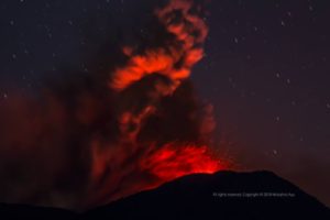
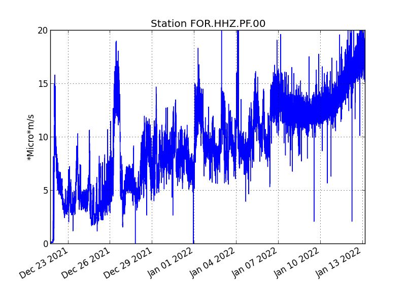
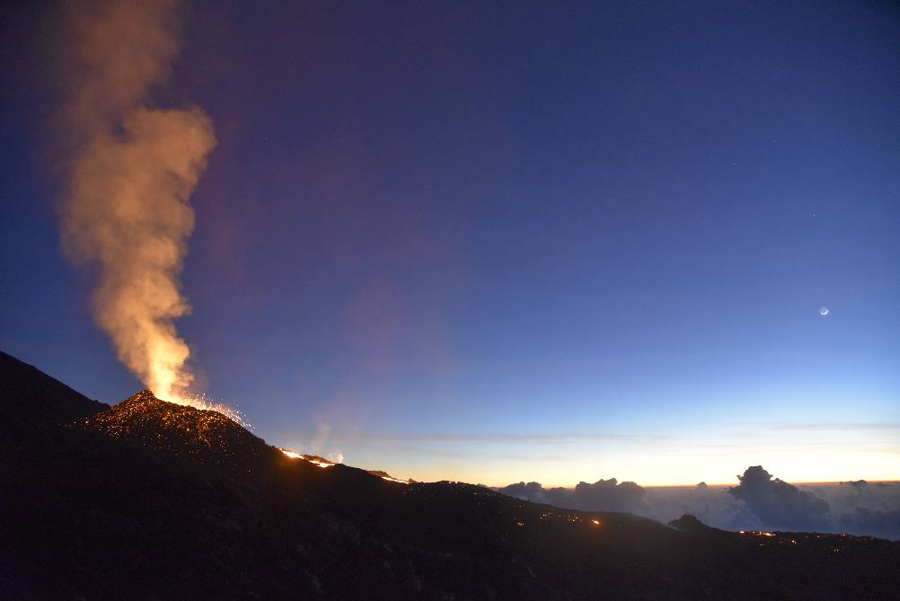
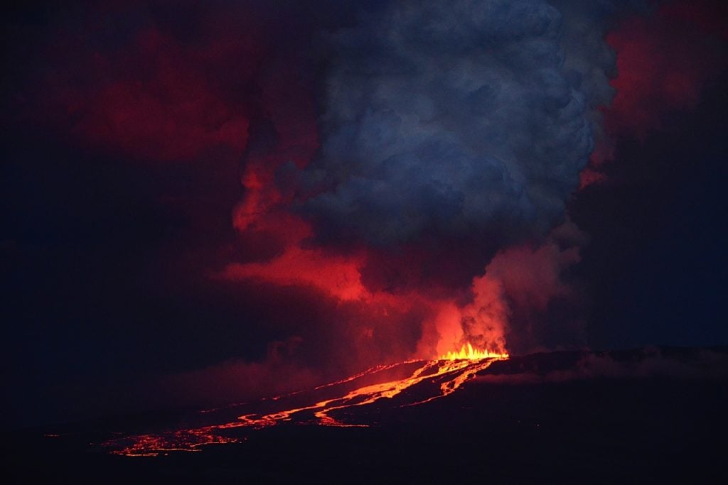
The eruption that began on December 22, 2021 at around 3:30 a.m. local time continues. Over the last 72 hours, the amplitude of the tremor has increased. Fluctuations in the amplitude of the tremor can still occur; they are linked in part to the level of the lava lake, which varies according to the mode of degassing, the erosion of the eruptive duct and the sporadic openings of the tunnels which allow the cone to emptying.
As in most of Reunion, bad weather conditions persist on the eruptive site. However this morning a relatively high cloudy ceiling allowed a few
observations. These show that the lava projections at the level of the cone are still present and occasionally exceed the height of the cone. Regularly overflows of the lava lake are observed as well as numerous resurgences of lava flows at the roof of the lava tunnel downstream of the cone.
Over the last 24 hours:
– Twelve volcano-tectonic earthquakes, of low magnitude (<1.5), were recorded under the summit.
– The surface deformations still show a deflation at the level of the summit zone, linked to the emptying of the magma reservoir located under the summit (at about 2-2.5 km deep) feeding the eruptive site.
– Due to very bad weather conditions, extremely few estimates of lava flow by satellite method with the HOTVOLC platform (OPGC – Clermont Auvergne University) could not be carried out. At around 8:00 p.m. (local time) last night, the flow was estimated at 4 m3 / s.
Alert level: Alert 2-1 (eruption in the enclosure)
Source : OVPF
Photo : Péi volcan – Accompagnateur en montagne / Frederick Leveneur .
Italy , Stromboli :
WEEKLY NEWSLETTER from January 03, 2022 to January 09, 2022 (issue date January 11, 2022)
SUMMARY OF THE STATE OF THE ACTIVITY
In the light of the surveillance data, it is highlighted:
1) VOLCANOLOGICAL OBSERVATIONS: Volcanic explosive activity of Strombolian type coupled with splashing activity, with a total frequency of events at a low level and with a low to medium intensity of explosions in the two areas of the North and Center South crater.
2) SEISMOLOGY: The seismological parameters monitored do not show significant variations.
3) SOIL DEFORMATION: The island’s soil deformation monitoring networks showed no significant changes to report for the period under review.
4) GEOCHEMISTRY: SO2 flux at an average level
CO2 fluxes from soils in the summit area at high values.
C / S ratio in the plume on average values.
There is no update on the isotope ratio of Helium in the wells (latest data from 12/14/2021 on high values).
5) SATELLITE OBSERVATIONS: The thermal activity observed by satellite was low.
VOLCANOLOGICAL OBSERVATIONS
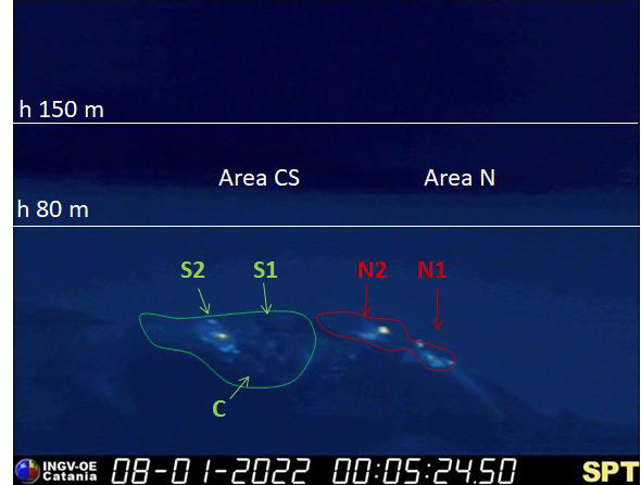
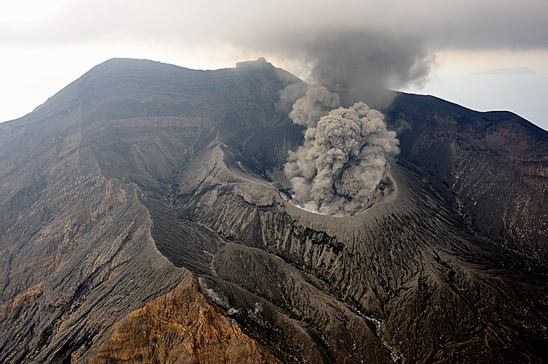
During the observation period, the eruptive activity of Stromboli was characterized by the analysis of the images recorded by the surveillance cameras of the INGV-OE (altitude 190m, Punta Corvi, altitude 400m and Pizzo). The explosive activity was produced by 5 eruptive vents located in the area of the North crater and by 2 located in the area of the Center-South crater; all the eruptive vents are located inside the depression which occupies the terrace of the crater.
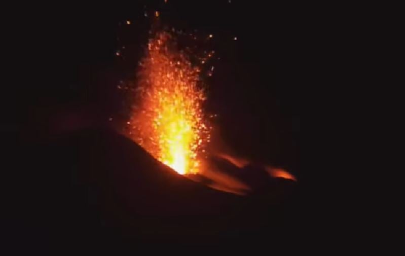
Overall, the eruptive activity of the observation period did not indicate any specific changes compared to what was observed the previous week, settling at a low level and with a prevalence of zone N compared to that of the CS. In detail, the area of the North crater produced an explosive activity of low frequency and intensity ranging from low to medium, emitting mainly coarse materials (lapilli and bombs) mixed with a portion of fine particles. The products were emitted up to ~ 120m high on the crater terrace with radial distribution and in some cases with large fallout along the Sciara del Fuoco. The projection activity produced mainly by N2 with varying intensity and episodically producing modest rheomorphic deposits in the upper part of the Sciara del fuoco continued (e.g., January 5, 2022). Regarding the Center-South crater area, the explosive activity was placed on a low frequency level with low to medium intensity and products emitted up to ~ 100 meters on the crater terrace. The activity was mainly produced by the S2 vent with mainly fine (ash) and secondarily coarse (lapilli / bombs) materials; mouth S1 and sector C showed episodic explosive activity coupled with degassing and blowing.
Source : INGV
Photo : Webcam.
Kamchatka , Karymsky :
VOLCANO OBSERVATORY NOTICE FOR AVIATION (VONA)
Issued: January 13 ,2022
Volcano: Karymsky (CAVW #300130)
Current aviation colour code: ORANGE
Previous aviation colour code: orange
Source: KVERT
Notice Number: 2022-06
Volcano Location: N 54 deg 2 min E 159 deg 26 min
Area: Kamchatka, Russia
Summit Elevation: 1486 m (4874.08 ft)
Volcanic Activity Summary:
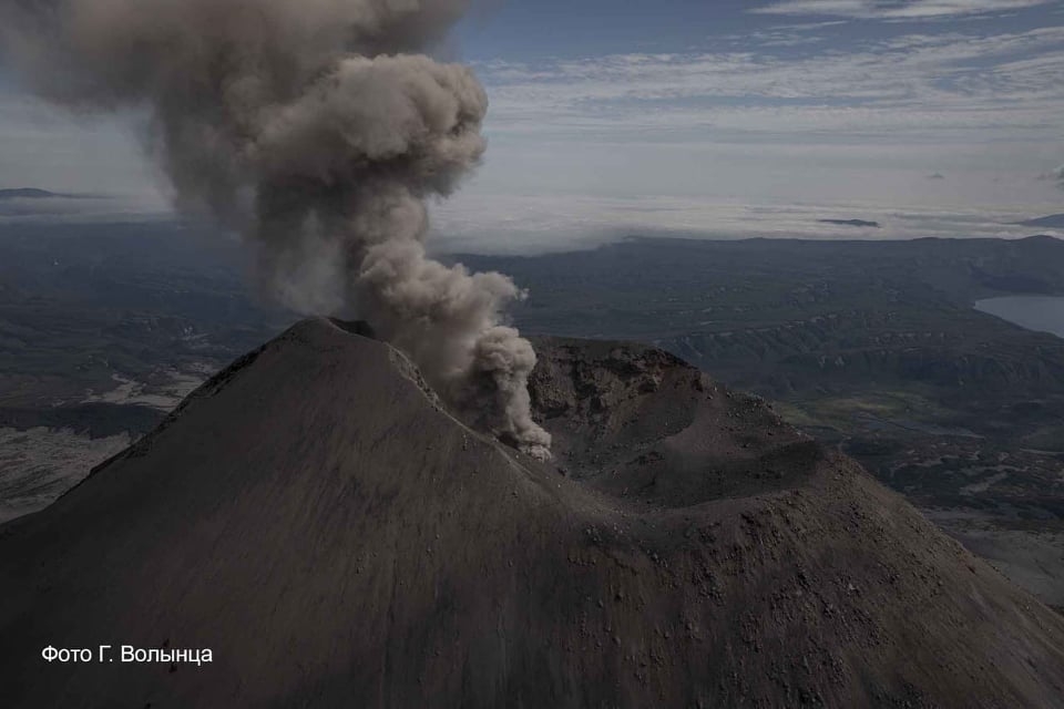
An explosive activity of the volcano continues. Satellite data by KVERT showed explosions sent ash up to 6 km a.s.l. at 00h20 UTC on 13 January. Ash plume extend to the north-northwest of the volcano.
A moderate gas-steam activity of the volcano continues. Ash explosions up to 10 km (32,800 ft) a.s.l. could occur at any time. Ongoing activity could affect international and low-flying aircraft.
Volcanic cloud height:
6000 m (19680 ft) AMSL Time and method of ash plume/cloud height determination: 20220113/0020Z – Himawari-8
Other volcanic cloud information:
Distance of ash plume/cloud of the volcano: 10 km (6 mi)
Direction of drift of ash plume/cloud of the volcano: NNW / azimuth 344 deg
Time and method of ash plume/cloud determination: 20220113/0020Z – Himawari-8
Source : Kvert
Photo : Kvert , G. Volynets.
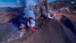
Ecuador / Galapagos , Wolf :
VOLCAN WOLF DAILY ACTIVITY REPORT, Thursday January 13, 2022.
From: January 11, 2022, 11:00 a.m. To: January 12, 2022, 11:00 a.m.
Surface activity level: very high
Surface trend: Descending
Internal: high
Internal tendency: Descending
Seismicity: The seismicity was carried out with data from the FER1 station
Tremors of emissions (TREMI) 1
Emission / ash column:
The gas emissions observed by satellite images remain in a southwest direction.
Other monitoring parameters:
The MIROVA satellite system has reported 2 high thermal alerts (195 and 352 MW) and 1 very high (7,914 MW), similarly, the FIRMS satellite system reports more than a hundred thermal alerts on the Wolf volcano in recent years. 24 hours.
Observation:
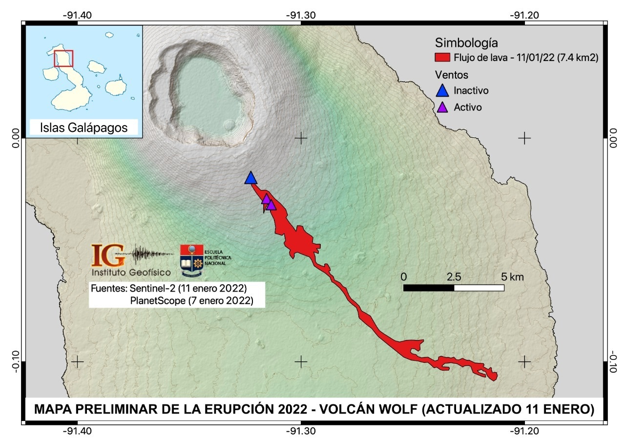
According to the preliminary map of the eruption, based on satellite images from Planet Scope and Sentinel-2, the lava flow (s) covered an area of approximately 7.6 km2. The maximum estimated range of lava flows is 16.5 km from the highest vent (blue triangle: possibly inactive) and 15 km from the active fissure (purple triangle). Therefore, it is considered that at the time of publication of this report, the lava flows did not reach the sea.
IG reported that a seismic swarm at Wolf began at 2100 on 6 January, followed by a M 2.4 earthquake recorded at 21h35, and tremor at 23h15. Fissures opened in an area SE of the summit caldera within five minutes of the onset of tremor and a new eruption began. At 00h20 on 7 January satellite images showed ash-and-gas plumes rising to varying altitudes between 1.9 km (6,200 ft) and 3.8 km (12,500 ft) a.s.l., with the lower parts of the plume drifting NE and the higher parts drifting W. Thermal anomalies indicated advancing lava flows down the S and SE flanks. The Parque Nacional Galápagos and the Galapagos Conservancy evacuated eight people by helicopter, including park rangers and scientists that were working near the rim, as a precaution and noted that habitat for a population of critically endangered Pink Land Iguana was far from the eruption. Photos showed a line of lava fountains rising along the fissure and lava flows advancing over vegetation. Thermal anomalies continued to indicate advancing lava during 8-11 January. Plumes mostly consisting of gas rose as high as 1.3 km (4,300 ft) a.s.l. and drifted W and SW. The lava flows were not far from the ocean by 10 January. Photos posted on 11 January by Parque Nacional Galápagos showed lava fountaining at a growing cone and fluid lava flows advancing from the base of the cone. The lava flows had traveled 15 km SE, then E, by 11 January.
Sources : IGEPN , GVP.
Photo : Comunicación Imparcial Provincia De Santa Elena ( Année et auteur inconnu ) .
Hawaii , Kilauea :
19°25’16 » N 155°17’13 » W,
Summit Elevation 4091 ft (1247 m)
Current Volcano Alert Level: WATCH
Current Aviation Color Code: ORANGE
Activity Summary:
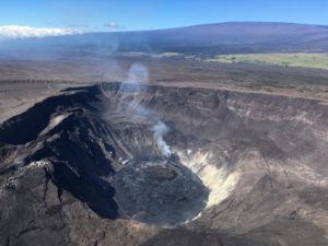
The summit eruption of Kīlauea volcano, within Halemaʻumaʻu crater, resumed at approximately 6:40 p.m. yesterday, January 11, following a short pause. All lava activity is confined to the crater, and there are no indications of activity migrating elsewhere on Kīlauea.
Summit Observations:
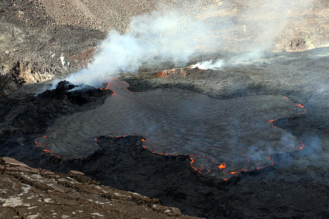
Summit tiltmeters began recording rapid inflation at about 5:00 p.m. January 11, and began recording gradual deflation at about 2:00 a.m. this morning. Volcanic tremor associated with the eruption—as recorded by nearby seismometers—also began increasing around 5:00 p.m , stabilized at about 2:00 a.m., and is now gradually decreasing. A flurry of small-magnitude earthquakes recorded at the summit during recent days, at depths ranging from about 10–14 km (6–9 miles) below sea level, continues at a reduced level compared to yesterday. A sulfur dioxide (SO2) emission rate of approximately 300 tonnes per day (t/d) was measured during the pause, while a rate of approximately 3,300 t/d was measured on the morning of January 6 when the lava lake was active.
Halemaʻumaʻu Lava Lake Observations:
Lava returned to the western vent within Halemaʻumaʻu crater at about 6:40 p.m. January 11. The lava lake level increased approximately 13 meters (43 feet) from the time of lava return until about 3:00 a.m. this morning, recovering and slightly surpassing the lake’s level prior to the pause that began on January 10. The lava lake level is now slightly decreasing, following decreases in summit tilt and tremor. The surface of the lava lake remains active in the western side of the crater. The lake has seen a total rise of about 70 meters (230 feet) since lava emerged on September 29, 2021. Measurements on December 30, 2021, indicated that the total lava volume effused since the beginning of the eruption was approximately 40 million cubic meters (10.5 billion gallons) at that time.
Source : HVO.
Photo : USGS / M. Patrick
Japan , Suwanosejima :
JMA reported that incandescence at Suwanosejima’s Ontake Crater was visible nightly during 3-10 January and 368 explosions were recorded. The explosions produced ash plumes that rose as high as 2 km above the crater rim and ejected material up to 1.1 km away from the crater. Eruption sounds were heard in Toshima village (4 km SSW) and ash fell there during 7-10 January. The Alert Level remained at 3 and the public was warned to stay 2 km away from the crater.
The 8-km-long, spindle-shaped island of Suwanosejima in the northern Ryukyu Islands consists of an andesitic stratovolcano with two historically active summit craters. The summit is truncated by a large breached crater extending to the sea on the east flank that was formed by edifice collapse. Suwanosejima, one of Japan’s most frequently active volcanoes, was in a state of intermittent strombolian activity from Otake, the NE summit crater, that began in 1949 and lasted until 1996, after which periods of inactivity lengthened. The largest historical eruption took place in 1813-14, when thick scoria deposits blanketed residential areas, and the SW crater produced two lava flows that reached the western coast. At the end of the eruption the summit of Otake collapsed forming a large debris avalanche and creating the horseshoe-shaped Sakuchi caldera, which extends to the eastern coast. The island remained uninhabited for about 70 years after the 1813-1814 eruption. Lava flows reached the eastern coast of the island in 1884. Only about 50 people live on the island.
Source: GVP , Japan Meteorological Agency (JMA)
Photo : N. Geshi. Geological Survey of Japan, H.Seo