January 06 , 2022 .
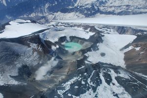
La Réunion Island , Piton de la Fournaise :
Press releases of 05 and 06 January 2022 – 3:00 p.m.
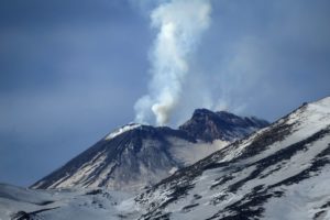
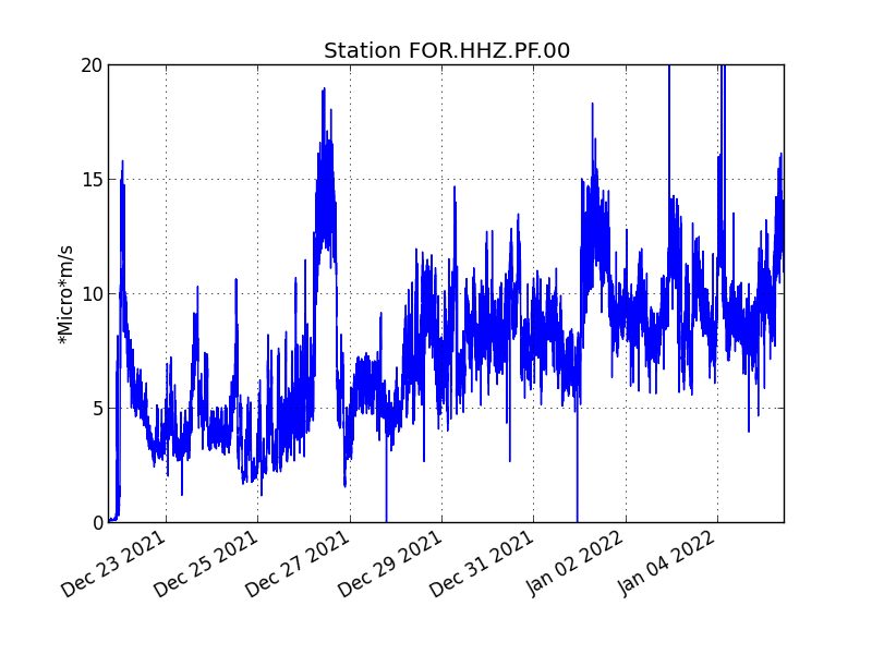
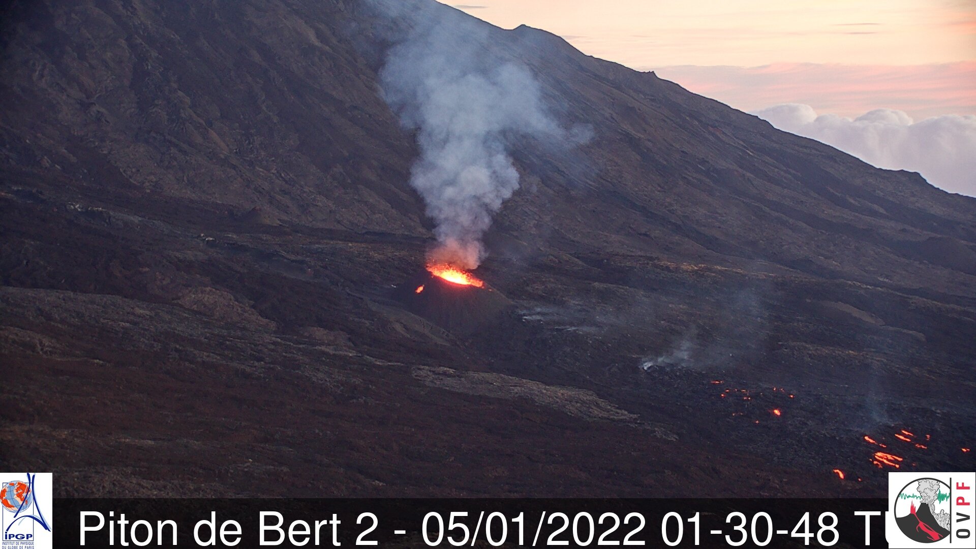
The eruption that began on December 22, 2021 at around 3:30 a.m. local time continues. Over the last 24 hours the amplitude of the eruptive tremor (indicator of an emission of lava on the surface) still shows fluctuations. The fluctuations observed can be linked either to:
– the cone and the field of lava tunnels downstream of the cone, which undergo phases of construction and dismantling, thus influencing the speed of lava flows at the level of the vent;
– or to punctual releases of pockets of gas trapped in the supply ducts which can be released suddenly leading to an increase in the tremor.
The average amplitude of the tremor is (over the past 24 hours) about 70% of its initial amplitude (Figure 1).
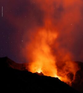
The latest observations still show lava fountain activity within the cone that has built up since the start of the eruption. Videos from OVPF-IPGP-IRT webcams show activity with lava fountains that occasionally exceed the height of the cone. Numerous resurgences of lava flows are still visible on the roof of the lava tunnel which
placed downstream of the cone. These resurgences are sporadic and can last from a few minutes to a few hours.
Over the last 24 hours:
– A volcano-tectonic earthquake of low magnitudes (<0.5) was recorded under the summit.
– The surface deformations again show a slight deflation at the level of the summit zone, linked to the emptying of the magma reservoir located under the summit (at approximately 2-2.5 km from
depth) feeding the eruptive site.
– Lava flows could be estimated by satellite method with the HOTVOLC platform (OPGC – Clermont Auvergne University). They were between 2 and 10 m3 / sec. These variations are explained by the method, which relies on the infrared radiation of the flow, the perception of which by satellites can be greatly influenced by the weather conditions above the flows as well as the surface conditions of the flows.
In the absence of overflight, no precise assessment of the position of the flow front could be made. But given the relief with slightly inclined slopes in the area, the field
of lava continues to extend mainly laterally and by thickening at the level of the network of lava tunnels set up on the plateau downstream of the eruptive cone. Observed from the vicinity of the vent, the flow front does not appear to have progressed significantly.
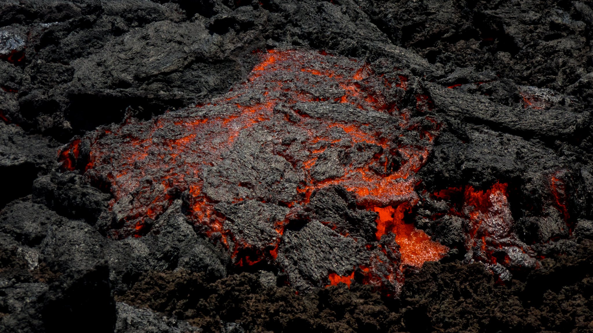
A field mission carried out yesterday afternoon by an OVPF-IPGP team made it possible to carry out new sampling of the lava flow, 300 m downstream from the eruptive cone. These lava samples make it possible to monitor the composition of the lava during the eruption. The chemical composition of lava provides information on its origin.
Alert level: Alert 2-1 (eruption in the Enclos )
Source et photos : OVPF
Iceland , Reykjanes Peninsula :
Icelandic Meteorological Office (IMO) reported that the earthquake swarm at the Krýsuvík-Trölladyngja volcanic system was ongoing with more than 19,000 earthquakes recorded during 21-28 December. Earthquakes M 4 or above totaled 14. The number and size of the earthquakes progressively decreased during 29 December 2021 to 3 January 2022; 200 events were recorded during 0000-1535 on 3 January. The seismicity was located along the same dyke system that fed the recent eruption at Geldingadalir. The Aviation Color Code remained at Orange.
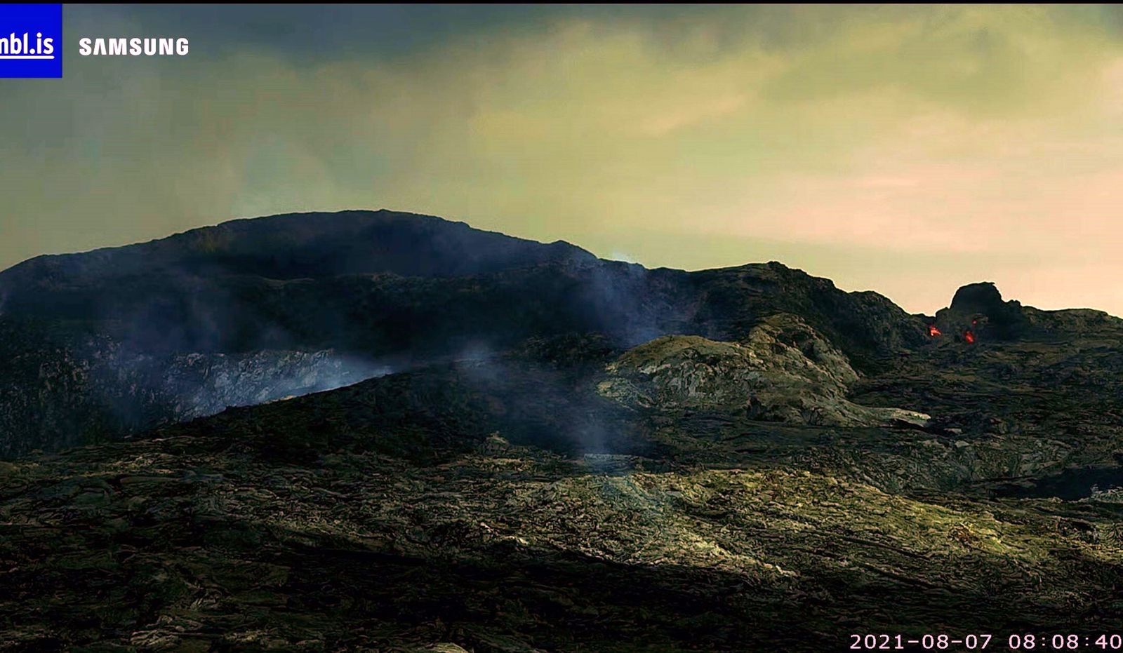
Around 4700 earthquakes were detected by the SIL-seismic network of IMO this week, considerably fewer than the previous week when they counted around 17.500 in total. The earthquake activity, that started the 21st. Of December 2021 in Reykjanesskagi, significantly decreased in the beginning of the week. The largest earthquake was a M3.9 just 1,5km west of Kleifarvatn lake in the Reykjanes peninsula the 28th of December at 14:29. The following day a M3.6 occured in Bárðarbunga volcano at 14:46. The 30th of December at 04:16 a M3.0 occured in the northern part of Ingólfsfjall mountain and was felt in the surrounding area. Around 730 earthquakes have been manually detected by the natural hazard specialist at the IMO during the past week.
Source: GVP , Icelandic Meteorological Office (IMO)
Photo : MBLis (archive).
Tonga Islands , Hunga Tonga-Hunga Ha’apai :
The eruption at Hunga Tonga-Hunga Ha’apai continued intermittently during 29 December 2021 to 4 January 2022, though by 3 January activity had significantly decreased. Several surges of Surtseyan activity, with some periods lasting as long as 30 minutes, occurred during 28-29 December; gas, steam, and ash plumes rose at least to 12.2 km (40,000 ft) a.s.l. and drifted N, though the maximum altitude of the ash-rich portion of the plume was lower. Ashfall was local to areas around the island. Discolored water and rafts of pumice were visible in areas around the island on 30 December, and had been observed since the beginning of the eruption. Steam-and-gas plumes were visible throughout the day, interspersed with occasional tephra ejections. The plumes rose as high as 12 km (39,400 ft) a.s.l. and drifted NNE. During the morning of 31 December intermittent plumes of ash, steam, and gas rose to 3 km (10,000 ft) a.s.l. according to the Wellington VAAC, though the steam-and-gas portion of the plume rose as high as 18 km (59,000 ft) a.s.l. as stated by the Tonga Meteorological Services. The Met Services also noted that ash was no longer visible in the emissions starting around noon.
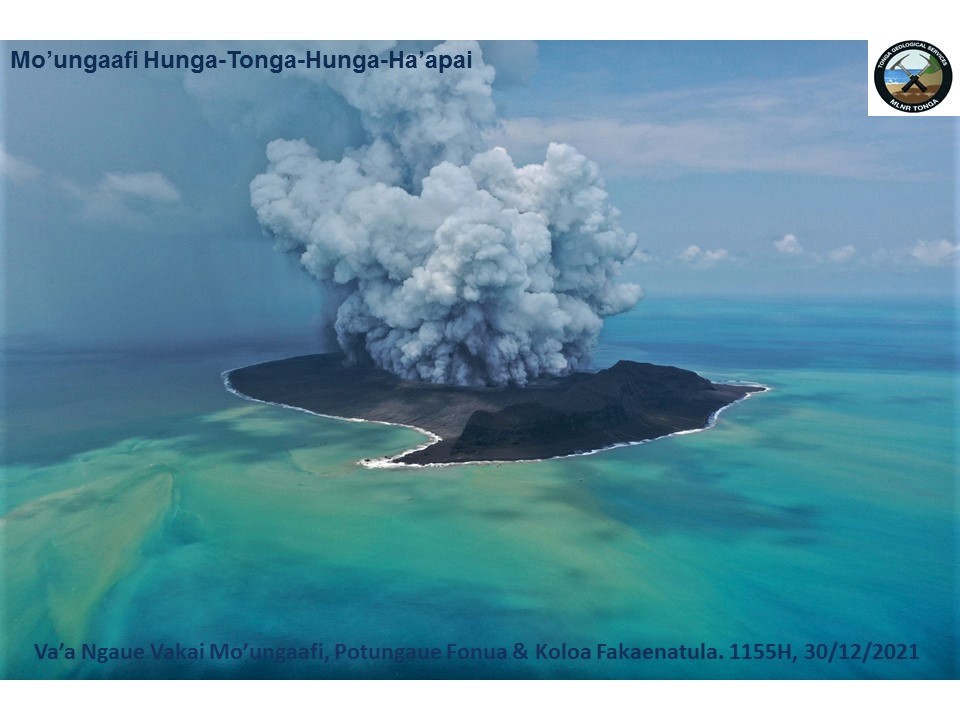
Steam-and-gas plumes were occasional visible in satellite data during 1-2 January. A small ash plume rose 6-7 km (19,700-23,000 ft) a.s.l. during 2220-2230 on 2 January and drifted 10 m NE, dropping in altitude along the way. A cyclone that passed through the area during 3-4 January obscured views of the volcano.
Sources : GVP , Wellington Volcanic Ash Advisory Center (VAAC), Services géologiques des Tonga, Gouvernement des Tonga, Services météorologiques des Tonga, Gouvernement des Tonga
Photo : Government of Tonga
Japan , Fukutoku-Oka-no-Ba :
The Japan Coast Guard reported that during a 27 December overflight of Fukutoku-Oka-no-Ba, observers noted that the island formed in mid-August had become smaller since 14 December, and had almost eroded below the ocean surface. No eruptive activity was observed, though brownish water spouted from the E end of the island. Yellowish-green water and a string of floating pumice, 400 m long, was circulating 5 km E. Discolored water was visible around almost the entire coast of Minami-Ioto (5 km SSW).
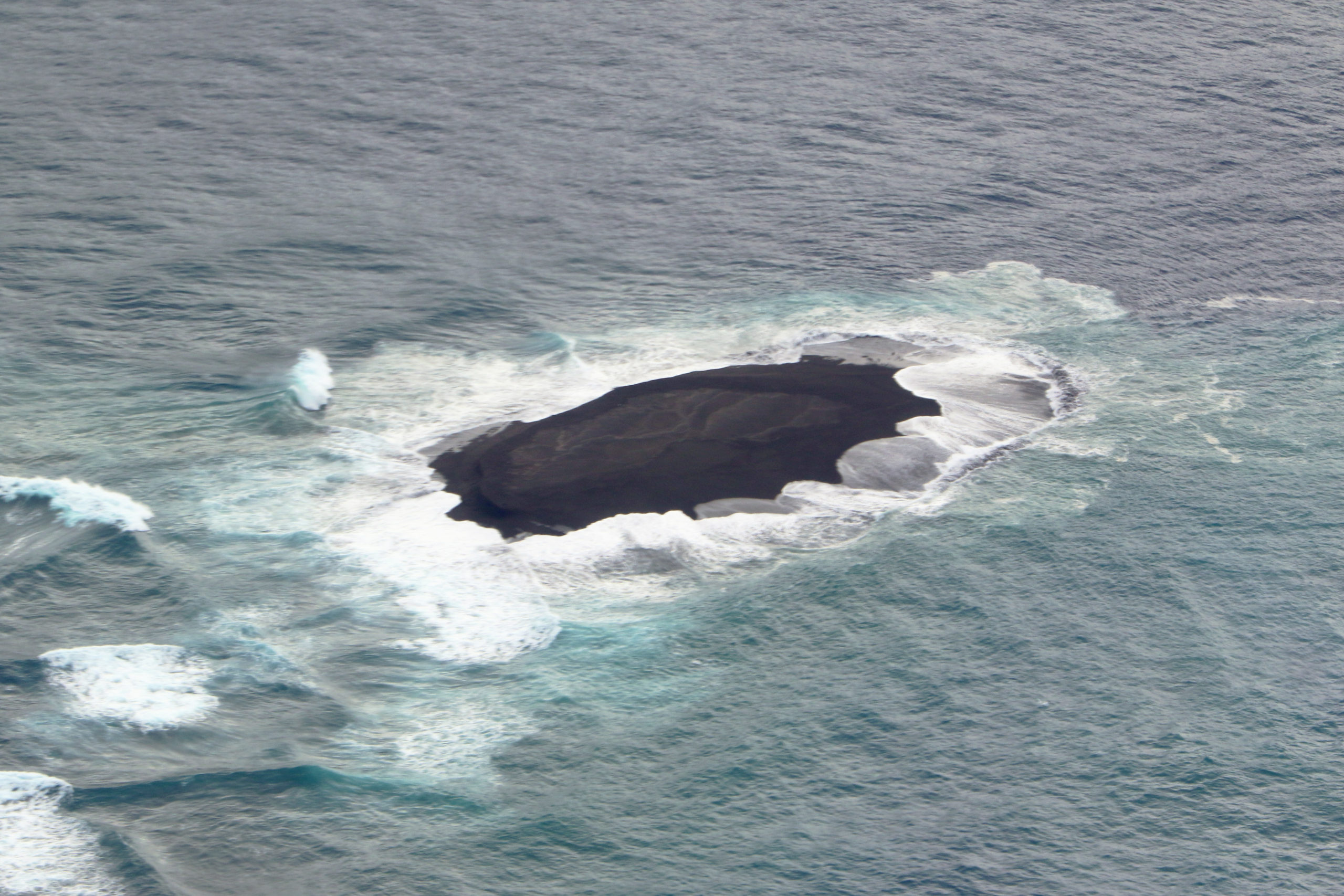
Fukutoku-Oka-no-ba is a submarine volcano located 5 km NE of the pyramidal island of Minami-Ioto. Water discoloration is frequently observed from the volcano, and several ephemeral islands have formed in the 20th century. The first of these formed Shin-Ioto (« New Sulfur Island ») in 1904, and the most recent island was formed in 1986. The volcano is part of an elongated edifice with two major topographic highs trending NNW-SSE, and is a trachyandesitic volcano geochemically similar to Ioto.
Source: GVP , Japan Coast Guard
Photo : Japan Coast Guard
Indonesia , Semeru :
VOLCANO OBSERVATORY NOTICE FOR AVIATION – VONA
Issued : January 05 , 2022
Volcano : Semeru (263300)
Current Aviation Colour Code : ORANGE
Previous Aviation Colour Code : orange
Source : Semeru Volcano Observatory
Notice Number : 2022SMR05
Volcano Location : S 08 deg 06 min 29 sec E 112 deg 55 min 12 sec
Area : East java, Indonesia
Summit Elevation : 11763 FT (3676 M)
Volcanic Activity Summary :
Pyroclastic flow occured from the edge of lava deposit at 01h35 UTC ( 08h35 local )
Volcanic Cloud Height :
Best estimate of ash-cloud top is around 16563 FT (5176 M) above sea level, may be higher than what can be observed clearly. Source of height data: ground observer.
Other Volcanic Cloud Information :
Ash-cloud moving to south
Remarks :
Lava flow is observed through the Southeast direction of the Semeru summit crater.
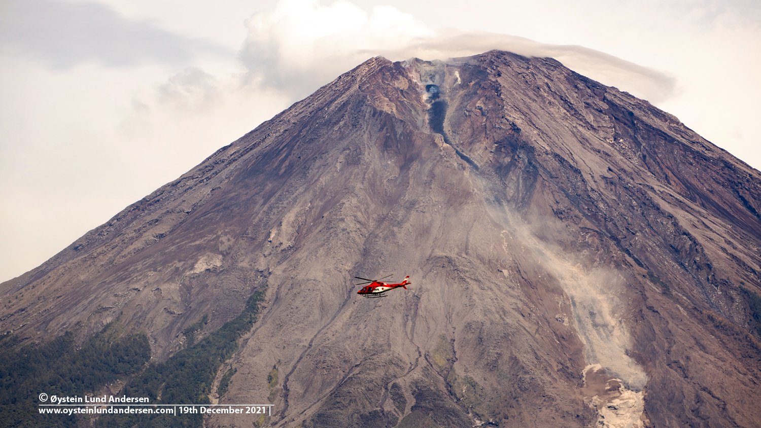
PVMBG reported that the eruption at Semeru continued during 29 December 2021 to 4 January 2022. Crater incandescence was visible during the nights of 31 December-4 January. At 0431 on 31 December a pyroclastic flow was generated from the end of the lava flow and an ash plume that rose 2 km above the summit drifted N. A pyroclastic flow descended the Kobokan drainage a maximum distance of 5 km SE on 1 January. Gray-and-white ash plumes rose as high as 800 m above the summit during 3-4 January and drifted in multiple directions. A pyroclastic flow traveled 5 km SE. The Alert Level remained at 3 (on a scale of 1-4). The public was warned to stay at least 500 m away from Kobokan drainages within 17 km of the summit, and other drainages originating on Semeru including the Bang, Kembar, and Sat, due to lahar, avalanche, and pyroclastic flow hazards.
Sources : Magma Indonésie , GVP.
Photo : Oystein Lund Andersen.