
November 18 , 2021 .
Italy / Sicily , Etna :
Weekly bulletin from November 08, 2021 to November 14, 2021 (issue date November 16, 2021).
SUMMARY OF THE ACTIVITY REPORT
In view of the monitoring data, it is highlighted:
1) VOLCANOLOGICAL OBSERVATIONS: Degassing activity of summit craters.
2) SEISMOLOGY: absence of seismic fracturing activity with Ml> = 2.0; amplitude of the volcanic tremor in the middle level
3) INFRASON: moderate infrasound activity
4) DEFORMATIONS: There are no substantial variations on tilt and GNSS networks.
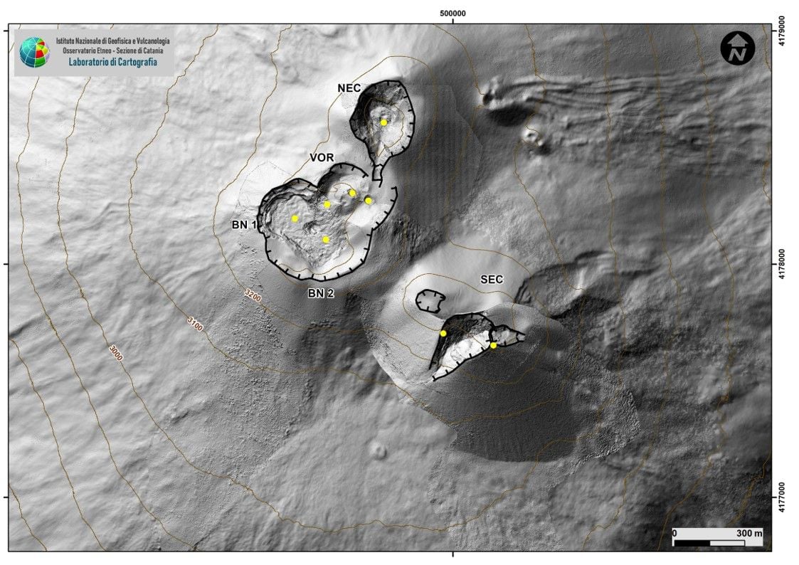
Fig. 3.1 – Map of the summit craters of Etna. Shaded model of the relief of the South East Crater (SEC) obtained from the drone and GPS surveys of October 19, 2021, VOR and BN date from 2020. The perimeter of the sliding surface formed during the paroxysm of October 23, 2021 on the flank East of the SEC is uncertain but designed on the basis of a morpho-structural analysis. The topographic reference base is the DEM 2014 developed by the Aerogeophysical Laboratory – Section Rome 2.
5) GEOCHEMISTRY: The flow of SO2 is placed at an average level.
The flux of CO2 emitted by soils was characterized last week by values that fluctuate from medium to very high, with a peak on November 11.
The partial pressure of CO2 dissolved in water shows a slight increase even though it is at medium levels.
The isotopic ratio of helium appears on average to high values (latest data from 10/20/2021).
There are no updates for the C / S report.
6) SATELLITE OBSERVATIONS: The thermal activity in the summit area was at a low level.
VOLCANOLOGICAL OBSERVATIONS
During the week, the monitoring of the volcanic activity of Etna was carried out by analyzing the images of the surveillance cameras of the INGV, Osservatorio Etneo (INGV-OE).

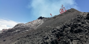
The activity of the summit craters showed no change from what had been observed the previous week. In particular, the activity of degassing the summit craters was mainly carried out by the collapse crater located in the North-West sector of the Bocca Nuova (BN-1 Fig.3.1), and by the North-East crater. The Voragine craters and the South East Crater, on the other hand, showed significant degassing linked to the fumarole systems present along the edges of the crater.
SEISMOLOGY
Seismicity:
The week in question was characterized by a very low level of seismicity linked to the fracturing processes and no earthquake exceeded the threshold of local magnitude 2.0.
Volcanic Tremor: During this week, the average amplitude of the volcanic tremor has shown oscillations, sometimes significant, in the range of average values. The location of the source of the tremor is in the area of the Bocca Nuova crater, at an altitude of between 2800 and 3000 meters above sea level.
Source : INGV.
Photo : Maria Liotta
Spain / La Palma , Cumbre Vieja :
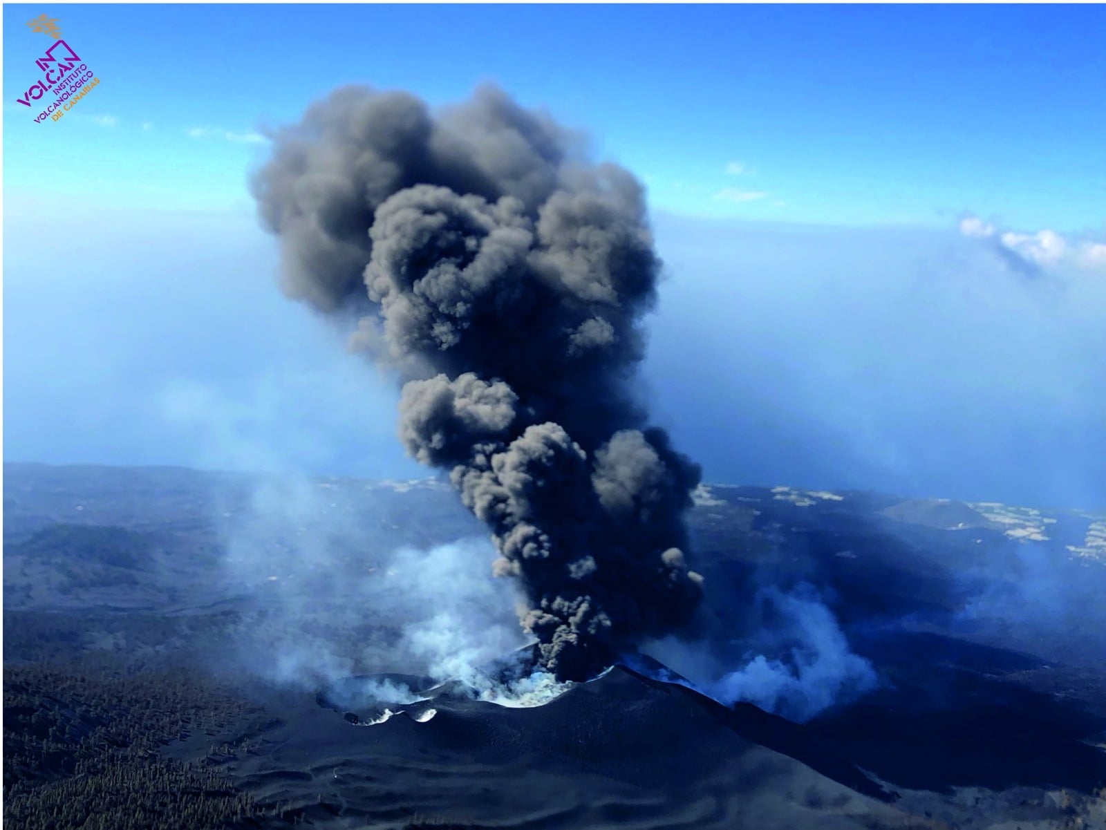
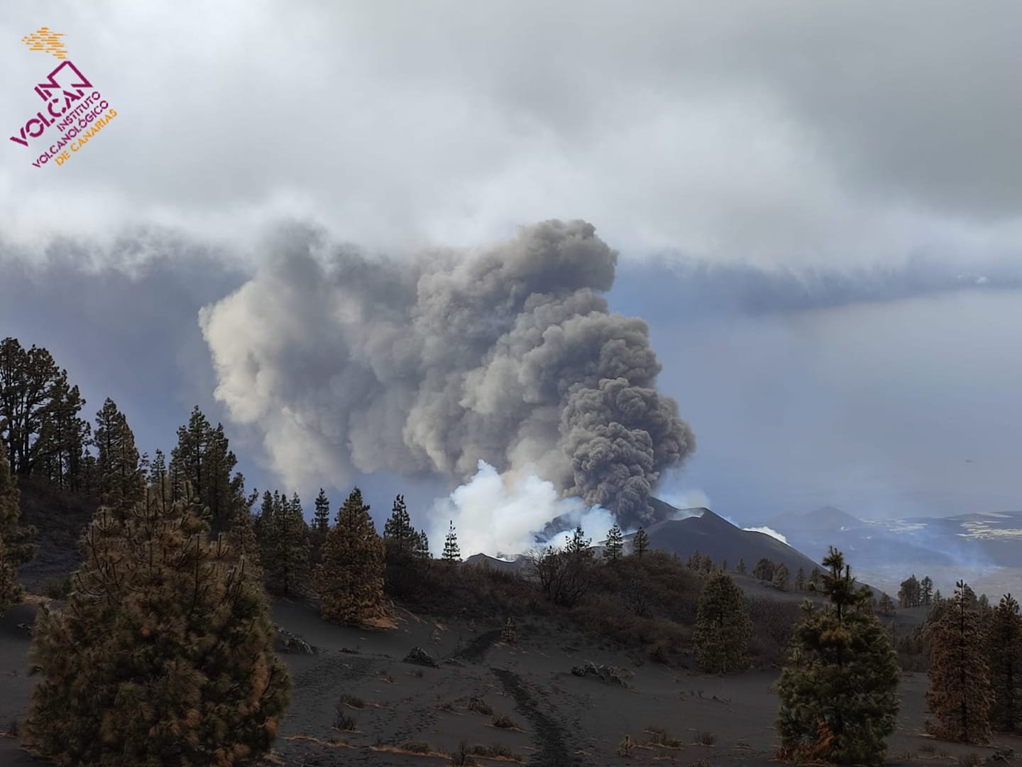
November 17, 2021, 10:00 UTC. Eruptive activity continues on La Palma.
Since the last declaration, 210 earthquakes have been located in the area affected by volcanic reactivation on the island of La Palma, a figure considerably higher than in previous days. Ten of these earthquakes were felt by the population.
As in previous days, the earthquake hypocenters are located under the central area of Cumbre Vieja and divided into two groups depending on the depth, a first group at a depth of 10-15 km and a second group with depths greater than 30km .
The largest earthquake was recorded at 07:17 UTC today with a magnitude of 4.7 mbLg and located 35 km deep. This earthquake was felt with a maximum intensity of IV (EMS) in the epicentral zone.
The volcanic tremor signal has increased compared to the previous days but remains at a low level compared to the values reached throughout the eruption.
The island’s network of permanent GNSS stations shows a slight deformation to the south at station LP03, which is closest to the eruptive centers.
In the rest of the stations, the slight deflation possibly linked to the deep seismicity has stabilized.
The height of the cone is measured by obtaining a value of 1,129 m at sea level.
Seismicity has increased significantly since the early hours yesterday in intermediate areas, but remains the same at depths greater than 20 kilometers. The earthquake of greater intensity (a magnitude of 4.7) was recorded at 7.17 a.m. Wednesday. The tremor increased its amplitude to an average level.
– The current level of seismicity indicates that the maximum intensity 5 and 6 can be reached.
– There are no changes in the deformations.
– Sulfur dioxide emission from the volcanic plume is lower than in previous days, and reached between 2,000 and 3,000 tonnes per day yesterday. In Los Llanos de Aridane and Puntagorda, the air quality was very poor due to these emissions. In the areas of Las Manchas and Puerto Naos, high concentrations of toxic gases were detected last night, so that workers were evacuated from the desalination plants.
– The emission of carbon dioxide is between 2,200 and 2,500 tonnes per day, which does not represent a danger for the population.
The spokesperson for the Volcanological Institute of the Canary Islands (Involcan), David Calvo, said on Wednesday that the volcano which erupted on September 19 in La Palma has been « quite » explosive since yesterday, in a similar situation to that of the end of October.
Calvo said that in the past few hours there has been a slight increase in seismicity, as last dawn 130 earthquakes were located in La Palma. In addition, the tremor, which is the internal noise of fluids, has increased so that the eruption « does not appear » to end in the short term, the spokesperson for Involcan added.
The increase in tremors indicates that there is more pressure in the system, and now it’s « pretty much » like at the end of October. The volcano has completed 60 days of eruption and the damage and discomfort it causes has increased with the onset of the first rains.

La Palma recorded 300 earthquakes this Wednesday after two weeks in which the number of earthquakes was less than 100 per day, which already exceeds the maximum observed during the two months of eruption, which was established on October 24. This rebound occurs when, for several days, there has been a downward trend in several indicators of volcano activity, including seismicity. In fact, the total number of daily earthquakes had been below 200 since October 28 and had been below 100 for almost a week (since November 11).
The maximum number of earthquakes in this entire volcanic crisis occurred a few days before the eruption began on September 14, with more than 300. At that time, a third of the movements were under magnitude 2, while the others were located in values of 2 to 3. This Thursday, two thirds of earthquakes are of magnitude 2 to 3 and the remaining third, from 3 to 4, with an earthquake greater than 4. The various organisms Scientists monitoring the eruption are collecting different data to find out whether what happened this Thursday was a one-time rebound or heralded a change in dynamics in the volcano, after days of seemingly downward activity.
Sources : IGN es , El Pais .
Photos : Involcan.
Ecuador / Galapagos , Fernandina :
SPECIAL VOLCANOLOGICAL REPORT. Surface activity on the Fernandina volcano.
In recent days, on the Fernandina volcano located in the Galapagos archipelago, fumarolic activity has been reported visualized in the area of its crater. In recent months, the volcano has not presented any seismic events suggesting abnormal behavior; however, small episodes of seismic tremor similar to others observed for several years are observed; This can be highlighted in Figure 1, where today’s tremor signals are shown, as well as those from months ago (June 2021).

Figure 1. Spectrograms from the FER2 station, located on the south-eastern flank of the Fernandina volcano, corresponding to the seismic signal of today 11/16/2021 (left) and another of 06/17/2021 (right). In the spectrogram, time is on the vertical axis and frequencies are on the horizontal axis; the greatest amplitudes are observed with red tones. The time scale on the right corresponds to the date and time in Universal Time format, i.e. local Galapagos time + 6 hours, it is indicated on the time scale on the left.
It is not excluded that these events are associated with the activity of the fumaroles and that in the long term, they may evolve into the preliminary activity of a new eruption in the medium-long term (from a few weeks to several years), such as ‘explains the special volcanological report n ° 1, published on November 12. It is important to note that surface manifestations such as fumaroles and volcanic tremors are part of the normal behavior of this active volcano without, to date, that we have evidence of eruptive activity.
There are no human settlements on Fernandina Island and in the event of a new eruption, the local flora and fauna could be affected. The IG-EPN recommends keeping informed of the activity of the Fernandina volcano through official sources.
The Geophysical Institute – EPN continues to monitor the evolution of these parameters and will timely report any changes in the internal or surface activity of the Fernandina volcano.
IG reported that slow deformation at Fernandina has been recorded over the previous 18 months. InSAR data showed that inflation was occurring at a rate of about 400 mm/year in the summit caldera and on the NE flank, while deflation was occurring at a rate of about 100-400 mm/year in areas on the upper W and SW flanks. On 13 October the areas of deflation changed to inflation and the rate of deformation in the caldera increased. On 17 November IG noted that fumarolic activity in the summit crater was visible during the previous few days and may have been related to a small episode of tremor on 16 November. IG also noted that periodic fumarolic activity and small episodes of tremor are common at Fernandina without an eruption.
Sources : IG EPN ( Préparé par : M. Ruiz et F. Naranjo ) , GVP.
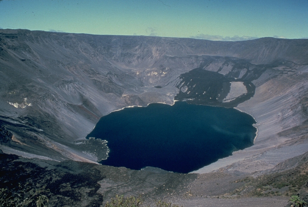
Photo : GVP/ Chuck Wood, 1978 (Smithsonian Institution).
Japan , Fukutoku Okanoba :
Volcanic activity in Fukutoku Okanoba (November 11, 2011)
Situation:
on November 11, observations were made by aircraft belonging to Haneda Air Base, the third regional headquarters of the Coast Guard. the main observation results are as follows.
・ Niijima: Compared to the results of the November 1 sighting, the Niijima Plateau has shrunk slightly, but there has been no significant change in the size of the island.
・ Activity: confirmation of white fumarole rising from the northern tip of Niijima. in addition, a small-scale gush of white foam was recognized at sea level on the north side of niijima.
・ Discolored water: Dark yellow-green discolored water was observed at a distance of about 3 km in diameter centered on Fukutoku Okanoba. Discolored yellow-green water and pumice rafts about 2 km in diameter were observed about 20 km southeast of Fukutoku Okanoba.
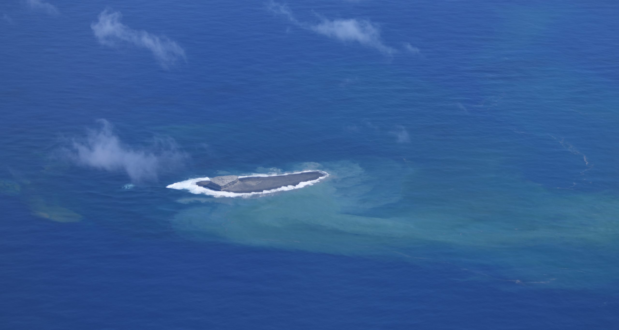
According to the opinion of Professor Kenji Nogami (accompanying the plane) of the Volcanic Fluids Research Center of the Tokyo Institute of Technology, based on the results of this observation, the underwater volcanic activity at Fukutoku Okanoba has not calmed down and thermal activity is still active.
The Japanese Coast Guard reported that during an overflight of Fukutoku-Oka-no-Ba on November 11, observers noted that the size of the West Island was virtually unchanged. White fumarolic plumes were rising from the northern end of the island and bubbles were observed on the ocean surface near the northern end.
Sources : kaiho.mlit.go.jp , GVP.
Photo : Japan Coast Guard.
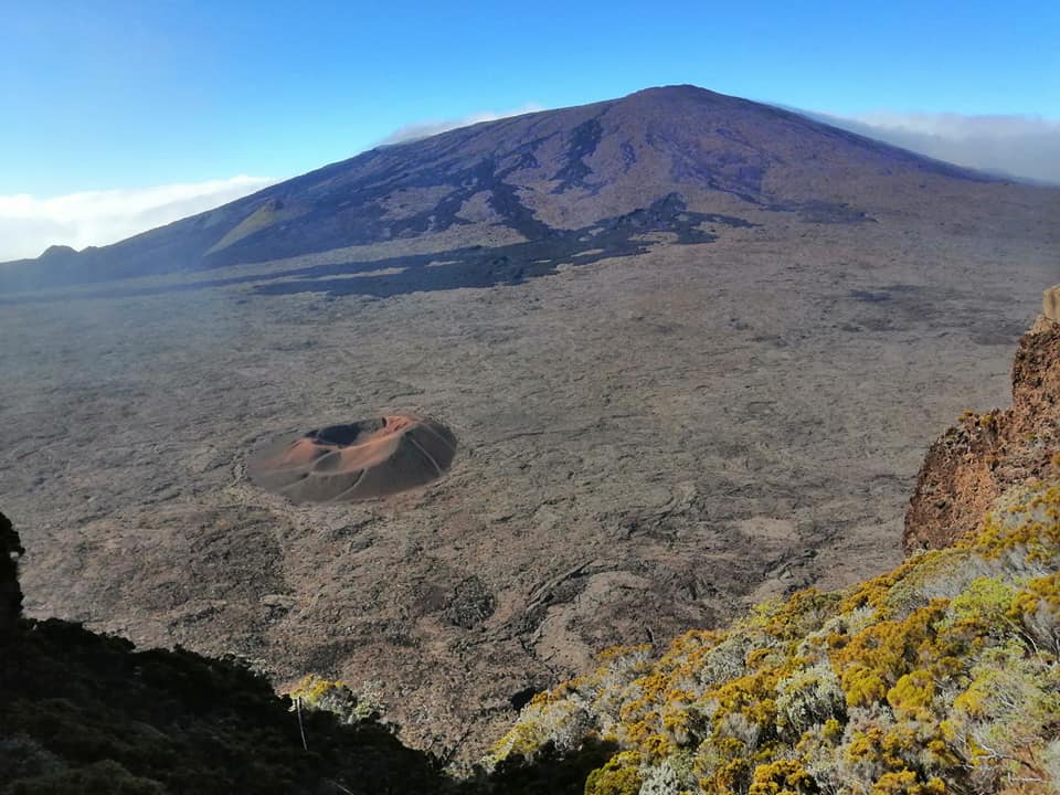
La Réunion , Piton de la Fournaise :
Press release of November 18, 2021 – 8:30 a.m.
A short, low-intensity seismic crisis was recorded on November 17 between 6:12 p.m. UT, (10:12 p.m. local time) and 6:26 p.m. UT, (10:26 p.m. local time), under the summit area of Piton de la Fournaise. A total of 42 superficial volcano-tectonic earthquakes located under the northern edge of the Dolomieu crater were recorded during this crisis (Figure 1).
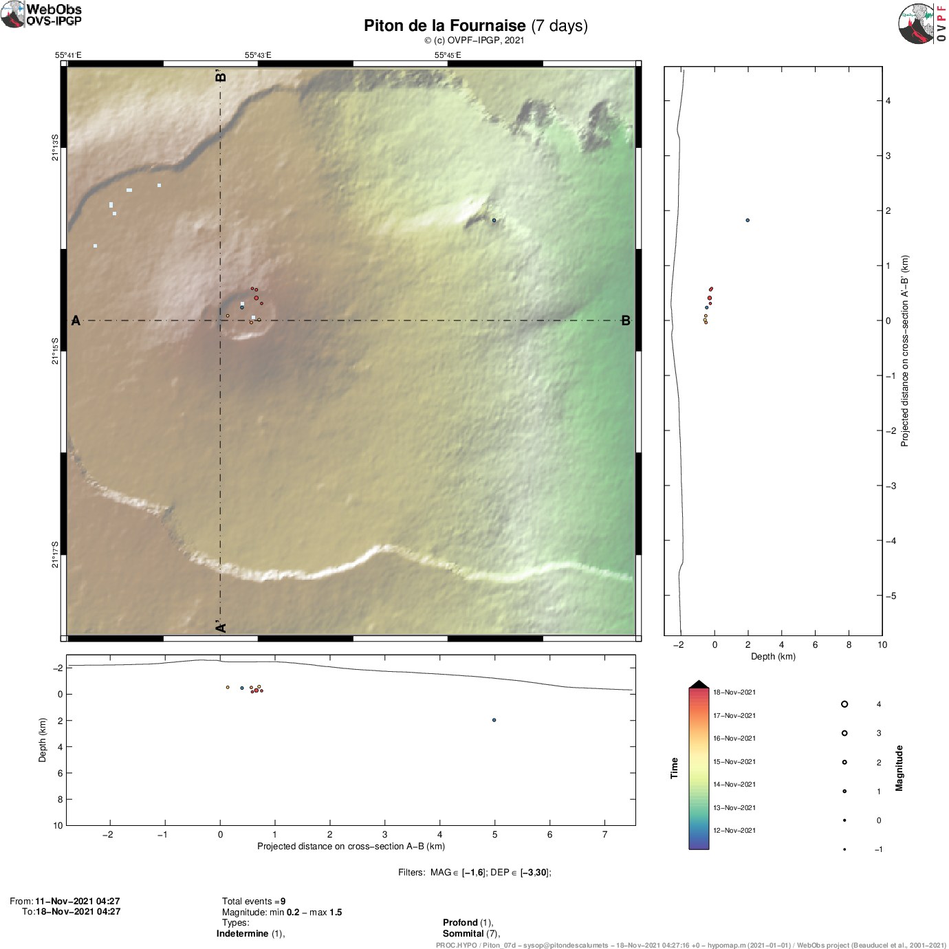
Figure 1: Location map (epicenters) and north-south and east-west sections (showing location at depth, hypocenters)
earthquakes recorded and located manually by OVPF-IPGP over the last 24 hours under the Piton de la Fournaise massif.
Only localizable earthquakes have been shown on the map (© OVPF-IPGP).
No rapid deformation of the ground surface was recorded during this crisis, which means that the magma did not leave the superficial magmatic reservoir.
This seismic crisis shows that the superficial magmatic reservoir continues to pressurize. Following the intrusion of October 18, inflation in the building had resumed (see the October monthly bulletin of the OVPF). This inflation has continued since, testifying to a replenishment of the latter by deeper magma.
Note that this pressurization process can last from several days to several weeks before the roof of the tank weakens and breaks, thus giving rise to an injection of magma to the surface and an eruption, and can also occur. stop without causing a short-term rash.
Alert level: Vigilance
Source : OVPF.
Photo : Nath Duverlie.
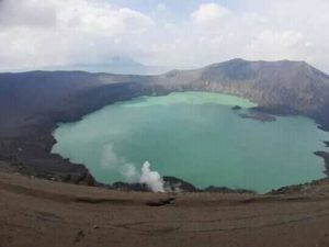
Philippines , Taal :
TAAL VOLCANO BULLETIN 18 November 2021 8:00 AM
In the past 24-hour period, the Taal Volcano Network recorded five (5) volcanic earthquakes, including one (1) volcanic tremor event having duration of two (2) minutes, four (4) low-frequency volcanic earthquakes, and low-level background tremor that has persisted since 7 July 2021.
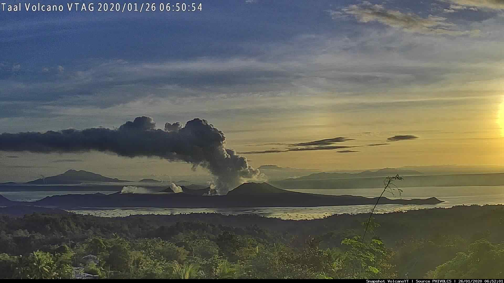
Activity at the Main Crater was dominated by upwelling of hot volcanic fluids in its lake which generated voluminous plumes 3,000 meters tall that drifted south-southwest and southwest. Sulfur dioxide (SO2) emission averaged 10,772 tonnes/day on 17 November 2021. Based on ground deformation parameters from electronic tilt, continuous GPS and InSAR monitoring, Taal Volcano Island has begun inflating in August 2021 while the Taal region continues to undergo very slow extension since 2020.
Source : Phivolcs.
Photo : Archive webcam
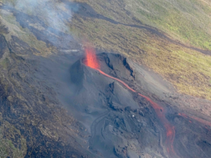
Fuego in Guatemala is my favorite!