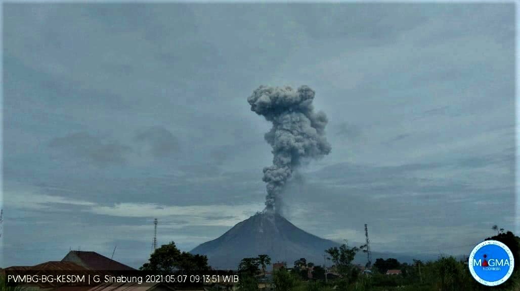
May 07 , 2021.
Indonesia , Sinabung :
VOLCANO OBSERVATORY NOTICE FOR AVIATION – VONA.
Issued : May 07 2021
Volcano : Sinabung (261080)
Current Aviation Colour Code : ORANGE
Previous Aviation Colour Code : orange
Source : Sinabung Volcano Observatory
Notice Number : 2021SIN65
Volcano Location : N 03 deg 10 min 12 sec E 98 deg 23 min 31 sec
Area : North Sumatra, Indonesia
Summit Elevation : 7872 FT (2460 M)
Volcanic Activity Summary :
Eruption with volcanic ash cloud at 02h08 UTC (09h08 local)
Volcanic Cloud Height :
Best estimate of ash-cloud top is around 16832 FT (5260 M) above sea level, may be higher than what can be observed clearly. Source of height data: ground observer.
Other Volcanic Cloud Information :
Ash-cloud moving to E
Remarks :
Seismic activity is characterized by the Eruption
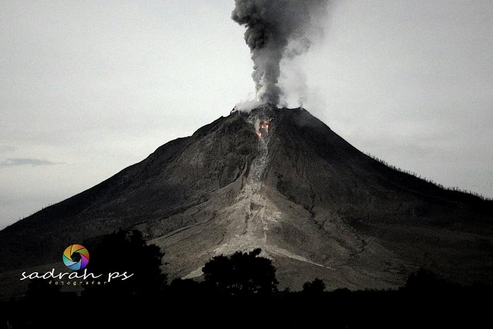
The activity level has been at level III (SIAGA) since May 20, 2019 at 10:00 a.m. WIB. Mount Api Sinabung (2460 m above sea level) has been erupting since 2013. The last eruption occurred on May 6, 2021, gray in color with an eruption column height of 2000 meters. The volcano is clearly visible until it is covered in fog. The main crater emits white smoke with a strong thickness, about 50 to 300 meters above the summit. Avalanches were observed with a sliding distance of 500 to 1,500 meters to the east and south-east. The weather is cloudy to rainy, with light to moderate winds to the east, and to the south-east, west and north-west.
According to the seismographs of May 6, 2021, it was recorded:
2 eruption earthquakes / explosions
168 avalanche earthquakes
9 earthquakes of emissions
3 low frequency earthquakes
17 hybrid / multi-phase earthquakes
5 deep volcanic earthquakes
1 local tectonic earthquake
1 distant tectonic earthquake.
Sources : Magma Indonésie , PVMBG.
Photos : Magma Indonésie , Sadrah PS.
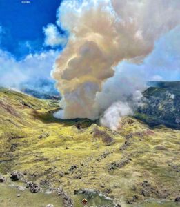
La Réunion Island , Piton de la Fournaise :
Press release of May 06, 2021 – 1:45 p.m.
The eruption that started on 04/09/2021 at 7 p.m. (appearance of the tremor) continues. The amplitude of the volcanic tremor (indicator of a surface lava emission), after stagnating from April 29 to May 1, resumed its tendency to slowly decrease since May 2. However, its amplitude remains significant, still reaching 50% of the maximum amplitude observed during this eruption on the 13th.
april.
– The images from the OVPF and OVPF / IRT cameras over the last 24 hours show that:
• the two cones are still active with degassing which is always more marked at the level of the most downstream cone (Figures 2 and 3),
• the flow of the lava at the exit of the eruptive vents, is done mainly in tunnels and this almost to the upper limit of the large slopes, where resurgences of lava are
visible on the surface,
• the flow front continues its slow progression at the top of the Grandes Pentes.

– Over the last 24 hours, 7 superficial volcano-tectonic earthquakes (between sea level and the surface) have been recorded, all located directly above the summit craters.
– The CO2 fluxes in the soil are still increasing in the far field (Plains region) suggesting that the deep recharge is continuing.
– The slight inflation (swelling) of the summit area continues, which testifies to a pressurization of the surface reservoir in accordance with its recharge by deeper magma.
This confirms the interpretation derived from observations of CO2 fluxes in the soil.
Niveau d’alerte : Alerte 2-2.
Source and photo : OVPF.
Read the article : https://www.ipgp.fr/sites/default/files/ovpf_20210506_13h45_communique_eruption.pdf
Chile , Nevados de Chillan :
Special Report on Volcanic Activity (REAV), Ñuble region, Nevados de Chillán volcanic complex, May 5, 2021, 4:40 p.m. local time (Continental Chile).
The National Service of Geology and Mines of Chile (Sernageomin) publishes the following PRELIMINARY information, obtained thanks to the monitoring equipment of the National Volcanic Monitoring Network (RNVV), processed and analyzed at the Volcanological Observatory of the Southern Andes ( Ovdas):
On Wednesday 05 May at 4:10 p.m. local time (8:10 p.m. UTC), the monitoring stations installed near the Nevados de Chillán volcanic complex recorded an explosion associated with fluid dynamics within the volcanic system with the emission of gases and particles.
The characteristics of the earthquake after its analysis are as follows:
ORIGINAL TIME: 16:10 local time (20:10 UTC)
LATITUDE: 36.865 ° S
LONGITUDE: 71.376 ° W
DEPTH: 0.3 km
REDUCED DISPLACEMENT: 504 (cm * cm)
ACOUSTIC SIGNAL: 3.63 Pascals (Pa) reduced to 1 km
In addition, the characteristics of the associated surface activity are as follows:
MAXIMUM HEIGHT OF THE COLUMN: 320 meters above the point of emission
DISPERSAL DIRECTION: Southwest (SW)
OBSERVATIONS:
The eruptive column reached 320 meters above the point of emission.
The volcanic technical alert remains at the Yellow level.
Source et photo : Sernageomin.
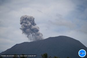
Guatemala , Santiaguito :
VOLCANOLOGICAL SPECIAL BULLETIN
LAHAR MODERATED IN THE NIMÁ I RIVER, FLOWING FROM THE SAMALÁ RIVER.
The descent of moderate lahars into the Nimá River I is recorded. The INSIVUMEH seismic network located on the Santiaguito volcano, records a high frequency seismic tremor as observed in the seismogram of the STG8 station, generated by volcanic materials that descend into the river. Nimá I is a tributary of the Samalá River due to the rain that is currently occurring near the volcanic building.
Heavy rains in the upper part of the domes of the volcanic complex generate the descent of weak to moderate lahars, these can carry pasty material in their path, tree branches and volcanic material such as ash and boulders. 1 to 2 meters in diameter which make the ground vibrate. If the rain persists, the generation of more lahars in this or other channels of the volcanic complex is not excluded.
ACTIVITY:
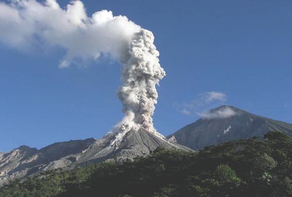
According to the webcam and the seismic station Stg8, we record and observe the activity with weak explosions and moderate explosions, expelling columns of ash to a height of 2800 meters above sea level (9186 feet) moving southwest. Ash falls are reported from Aldeas San Marcos and Loma Linda Palajunoj and others in this area. In the crater, there is a blocky lava extrusion, with avalanches on the flanks, to the east and south, due to the unstable material in the crater.
There is the likelihood of moderate to strong pyroclastic flows, so one should not stay near or in the river beds near the slopes of the volcano. So far, no lava flow has been generated. (The recommendation of special bulletin 007-2021 is maintained). Afternoon and night rains in the volcanic area can generate lahars in the Nimá I, Nimá II, Tambor rivers, tributaries of the Samala river, so it is recommended to take precautions.
Source : Insivumeh .
Photo : La Hora.
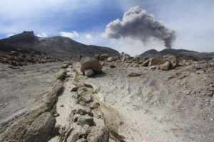
Saint Vincent , Soufrière Saint Vincent :
May 6, 2021. — The Government of Saint Vincent and the Grenadines has lowered the volcanic alert level at La Soufrière to ORANGE based on a recommendation from The University of the West Indies Seismic Research Centre (UWI-SRC).
UWI-SRC/MVO Volcano-seismologist and current Scientific Team Lead, Roderick Stewart made the recommendation to the cabinet on Tuesday May 4, during his update on the current activity at the volcano. Mr. Stewart indicated that the recommendation was being made given that there have been no explosions at the volcano since April 22 and the number of volcanic earthquakes recorded has also decreased significantly. At alert level ORANGE the volcano may resume explosions with less than twenty-four hours of notice.
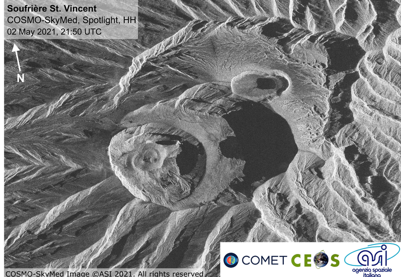
Lahars (mudflows) continue to pose a dangerous threat to the river valleys surrounding the volcano including Wallibou and Rabacca. Mudflows observed over the past several days have contained boulders up to 5m (15 feet) in diameter. Scientists also observed steaming flows, which are likely due to contact with and incorporation of hot volcanic deposits. Lahars can cause damage to property and serious injury to persons in their path. Access to the RED volcanic hazard zone should be limited to government approved essential work only. Conditions remain hazardous and the potential for injury also remains.
The National Emergency Management Organisation (NEMO) and The UWI-SRC continue to be the authoritative sources of information on the eruption of La Soufrière volcano in Saint Vincent.
Source : UWI.
Photo : COSMO-SkyMed image, Susanna Ebmeier and Edna Dualeh University of Leeds.