December 06 , 2020.
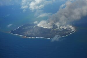
La Réunion , Piton de la Fournaise :
Activity Bulletin for Saturday, December 5 at 5:00 p.m. (local time)
Alert level: Alert 1
Following the seismic crisis which took place on December 4, 2020 from 5:10 am to 5:54 am local time, the number of earthquakes under Piton de la Fournaise continues to decrease with 5 volcano-tectonic earthquakes (located above sea level at summit plumb) recorded today (until 5 p.m. local time).
No change in CO2 flux in soil or SO2 flux in air was recorded during or following the December 4 intrusion. The concentrations of sulfur species (H2S and SO2) in the fumaroles in the summit area remain close to the detection limit.
On the deformation side, the inflation of the volcanic edifice (swelling) seems to pick up again following the intrusion of December 4. This parameter will have to be confirmed in the coming days.
Source : OVPF.
Read the article : http://www.ipgp.fr/fr/ovpf/bulletin-dactivite-samedi-5-decembre-a-1700-heure-locale
Photo : Nath Duverlie .
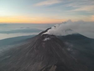
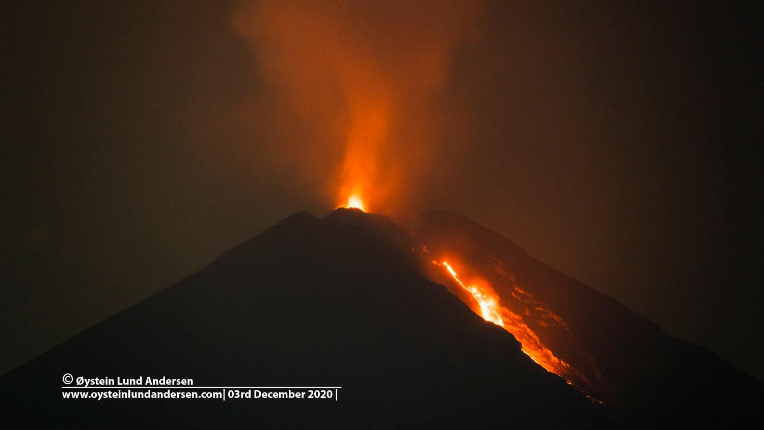
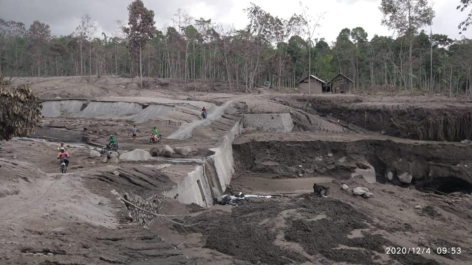
Indonesia , Semeru :
VOLCANO OBSERVATION NOTICE FOR AVIATION – VONA.
Issued: December 05, 2020
Volcano: Semeru (263300)
Current Aviation Color Code: ORANGE
Previous Aviation Color Code: Orange
Source: Semeru Volcano Observatory
Notice Number: 2020SMR118
Location of the volcano: S 08 deg 06 min 29 sec E 112 deg 55 min 12 sec
Zone: East Java, Indonesia
Summit Elevation: 11763 FT (3676 M).
Summary of volcanic activity:
Eruption with volcanic ash cloud at 16:23 UTC (23:23 local)
Height of the volcanic cloud:
Best estimate of ash cloud top is around 14963 FT (4676 M) above sea level, which may be higher than what can be clearly observed. Source of altitude data: ground observer.
Other information about the volcanic cloud:
Ash cloud moving east.
Level of activity level II (WASPADA). G. Semeru (3,676 m above sea level) is continuously erupting. Explosive and effusive eruptions are recorded, causing lava flows towards the southern and southeastern slopes, as well as explosions projecting incandescent rocks around the summit crater.
The volcano was clearly visible until it was covered in fog. The crater emits a white smoke of moderate intensity that was observed, 100 meters above the summit. The weather is sunny to rainy, with light to moderate winds in the North, North-East, East, South-East, South and South-West. Air temperature 22-29 ° C. An eruption was observed with a height of 300 to 500 m and with a thick white smoke directed towards the North. There was a lava avalanche with a slide distance of 200-500 m and hot avalanche clouds with a slide distance of 1500 m towards Besuk Kobokan. An incandescence was observed at a height of 50 to 100 m above the summit.
According to the seismographs of December 5, 2020, it was recorded:
7 eruption / explosion earthquakes
1 hot cloud avalanche earthquake
17 avalanche earthquakes
14 emission earthquakes
3 Harmonic tremor signals
3 distant tectonic earthquakes
1 lahar signal
Recommendation:
At level II status (Alert) people / visitors / tourists must not have activities within a radius of 1 km around the crater / summit of Mount Semeru and at a distance of 4 km in the direction of the opening of the crater in the South-South-East sector. One should be aware of the presence of hot avalanche clouds, lava avalanches and lahars along the river / valley that originates at the top of Mount Semeru. The recommended radius and distance will be continuously evaluated in anticipation of any change in hazard symptoms.
People stay away or have no activities in the hot cloud affected area because the temperature is still high.
Be careful of potential slips along the valley followed by hot clouds towards Besuk Kobokan.
Remain aware of the threat of lahars in the river / valley channels that originate from Mount Semeru (given the large amount of volcanic material that has formed).
Source : Magma Indonésie , PVMBG.
Photos : Oystein Lund Andersen , Peter Rendezvous.
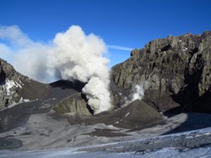
Hawaii , Mauna Loa :
USGS HVO Press Release—Magnitude-4.1 earthquake beneath Mauna Loa’s northwest flank, Island of Hawai‘i ,DECEMBER 4, 2020
The U.S. Geological Survey’s Hawaiian Volcano Observatory (HVO) recorded a magnitude-4.1 earthquake located beneath Mauna Loa’s northwest flank on Friday, December 4, at 7:44 a.m., HST.
The earthquake was centered about 22 km (14 miles) east-northeast of Hōnaunau-Nāpōʻopoʻo, at approximately 5 km depth (3 miles).
Light shaking, with maximum Intensity of IV, has been reported across the Island of Hawai‘i. At that intensity, damage to buildings or structures is not expected. The USGS « Did you feel it? » service (http://earthquake.usgs.gov/dyfi/) received over 130 felt reports within the first hour of the earthquake.
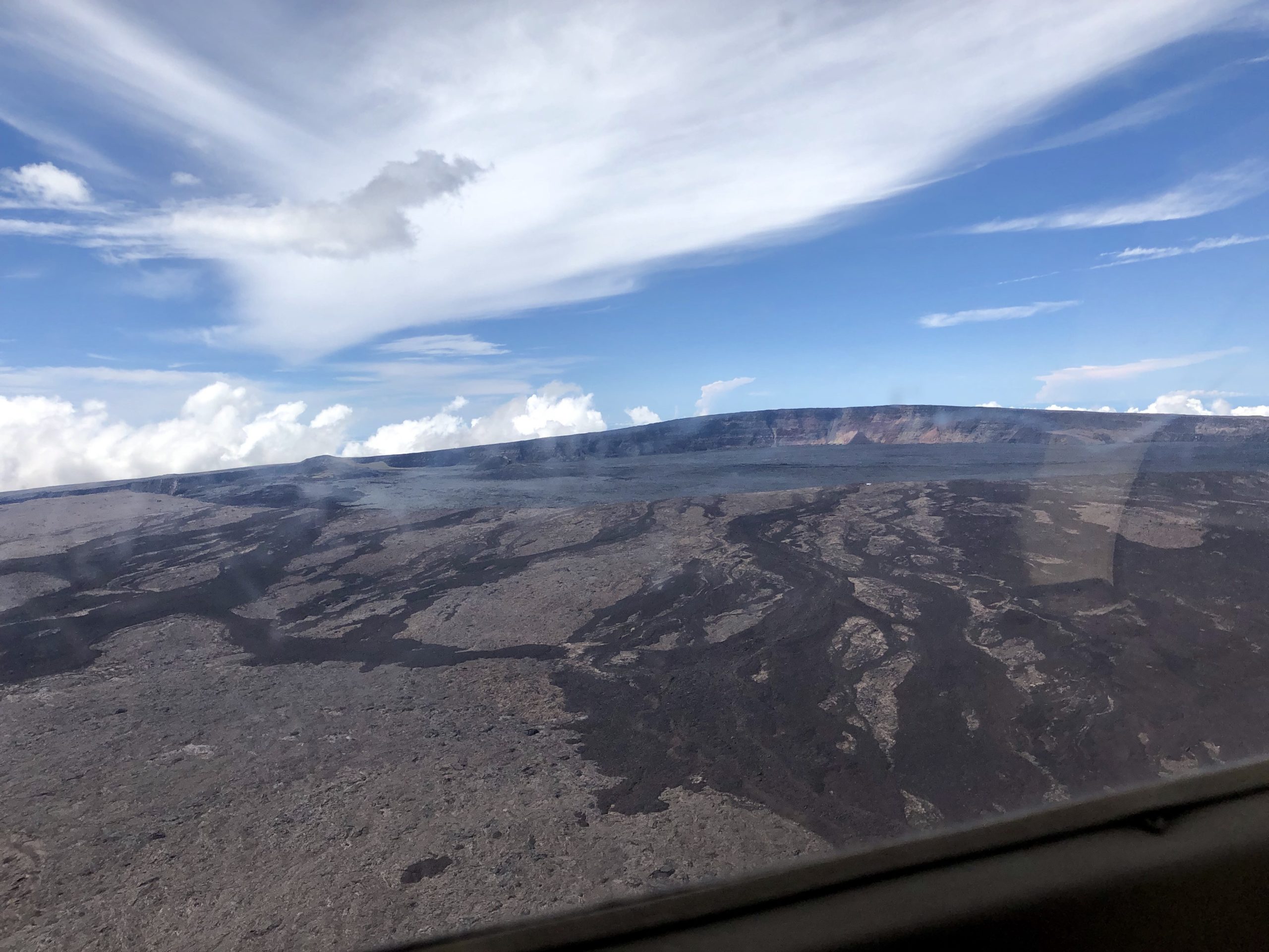
Civil Air Patrol captured this aerial image of Mauna Loa’s summit caldera, Moku‘āweoweo, on Sunday, October 20, 2019. The true summit of Mauna Loa is located just to the right of the center of the image, at the highest location above the caldera wall in the background. The cones that formed during the 1940 (right) and 1949 (left) eruptions are visible in the distant left side of the image. Lava flows in the foreground of the image, which flowed in a direction south of the summit of Mauna Loa, were active prior to formation of the summit caldera approximately 1,000 years ago.
According to HVO acting Scientist-in-Charge David Phillips, the earthquake had no apparent effect on Kīlauea or Mauna Loa volcanoes. “We do not currently observe any changes in activity at Kīlauea or Mauna Loa as a result of this earthquake. Please be aware that aftershocks are possible and may be felt. HVO continues to monitor Kīlauea and other Hawaiian volcanoes for any changes.”
Today’s earthquake does not represent a significant departure from the seismic activity rate for the past year, so the Volcano Alert Level for Mauna Loa will remain at Advisory. Other Mauna Loa monitoring data streams show no significant change in deformation rates or patterns that would indicate increased volcanic hazard at this time. The earthquake this morning occurred in a location that has exhibited seismicity over the past several years. Earthquakes in this location, approximately 5 km (3 miles) northwest of Mauna Loa summit, are generally less than 8 km (5 miles) below the surface and smaller than magnitude-2.
Source et photo : HVO.
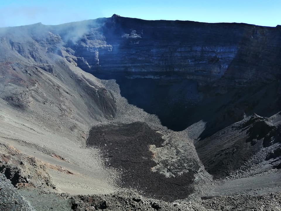
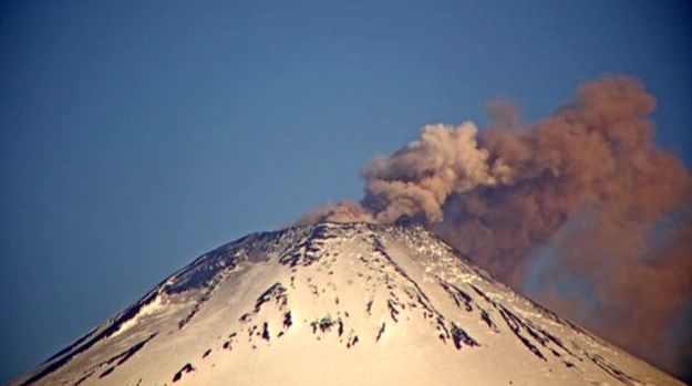
Chile , Villarica :
Special Report on Volcanic Activity (REAV), La Araucanía region, Villarrica volcano, December 05, 2020, 7:50 p.m. local time (Continental Chile).
The National Service of Geology and Mines of Chile (Sernageomin), on the basis of information obtained through the monitoring equipment of the National Volcanic Surveillance Network (RNVV), processed and analyzed at the Volcanological Observatory of the Andes of the South ( Ovdas), and in relation to the activity of the Villarrica volcano, reports the following:
On Saturday December 05, at 6:44 p.m. local time (9:44 p.m. UTC), the IP cameras installed near the volcano recorded a long-period type earthquake (LP), associated with a moderate explosion at the level of the crater, with a displacement value reduced equal to 8.3 cm2.
The data obtained are as follows:
MAXIMUM HEIGHT OF THE COLUMN: 160 m above the crater
DIRECTION OF DISPERSAL: South West (SSO).
Observations:
Explosions were observed on the Villarica volcano, with an emission column 160 m above the crater, with pyroclastic emissions in a south-south-east direction. After the event, there was an ash deposit in the crater area, with a greater extension in the direction of dispersion.
The volcanic alert remains at the Yellow level.
Source et photo : Sernageomin .