July 28 , 2020.
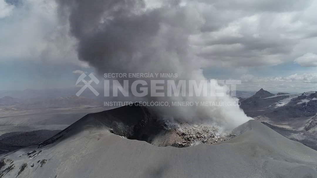
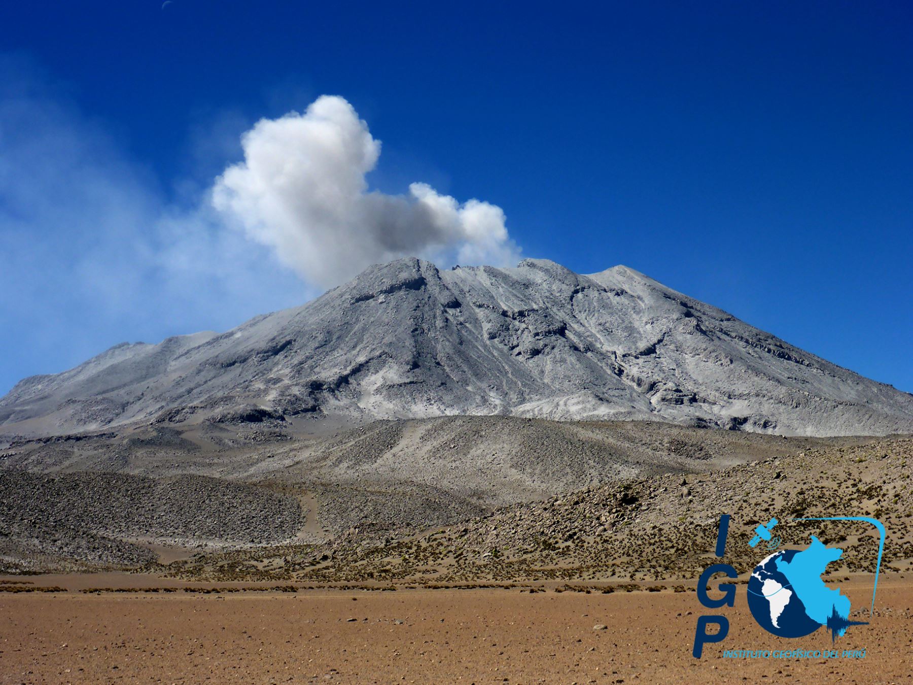
Peru , Sabancaya :
Analysis period: July 20 to 26, 2020, Arequipa, July 27, 2020.
Alert level: ORANGE
The Geophysical Institute of Peru (IGP) reports that the eruptive activity of the Sabancaya volcano remains at moderate levels; that is, with the continuous recording of explosions with emission columns up to 2.4 km high above the summit of the volcano and consequent emissions of ash and gas. Therefore, for the following days, no significant change is expected regarding its eruptive activity.
The IGP recorded and analyzed the occurrence of around 400 earthquakes of volcanic origin, associated with the circulation of magmatic fluids (magma, gas, etc.) within the Sabancaya volcano (Arequipa region). In addition, an average of 13 low to medium intensity explosions was recorded daily.
The monitoring of the deformation of the volcanic structure, using GNSS data (processed with fast orbits), does not present any significant anomalies; however, a slight inflation was recorded in the northern sector (Hualca Hualca volcano) and on the south-eastern flank of the Sabancaya volcano. Visual surveillance identified columns of gas and ash up to 2.6 km high above the summit of the volcano, which were scattered towards the South, South-East, South-West and West sectors of Sabancaya. Satellite monitoring has identified the presence of 5 thermal anomalies with values between 1 MW and 4 MW, associated with the presence of a lava body on the surface of the volcano’s crater.
RECOMMENDATIONS
• Maintain the volcanic alert level in orange.
• Do not approach within a radius of less than 12 km from the crater. If ash falls, cover your nose and mouth with wet rags or masks. Keep doors and windows of houses closed.
• Implement prevention and mitigation actions in the face of increased volcanic activity.
Source : IGP.
Photo : Galeria del Ministerio de Defensa del Perú , Ingemmet .
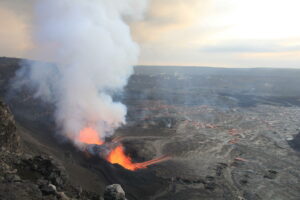
Hawaii , Kilauea :
Magnitude-4.7 earthquake south of the Island of Hawai‘i
The U.S. Geological Survey’s Hawaiian Volcano Observatory (HVO) recorded a magnitude-4.7 earthquake located south of the Island of Hawai‘i on Monday, July 27, at 06:06 a.m., HST.
The earthquake was centered about 20 km (12.4 miles) southeast of Nā‘ālehu, at a depth of 35 km (21.7 miles). A map showing its location is posted on the HVO website at http://volcanoes.usgs.gov/hvo/earthquakes/.
Light shaking, with maximum Intensity of IV, has been reported across parts of the Island of Hawai‘i. At that intensity, significant damage to buildings or structures is not expected. The USGS received over 400 felt reports within the first hour of the earthquake.
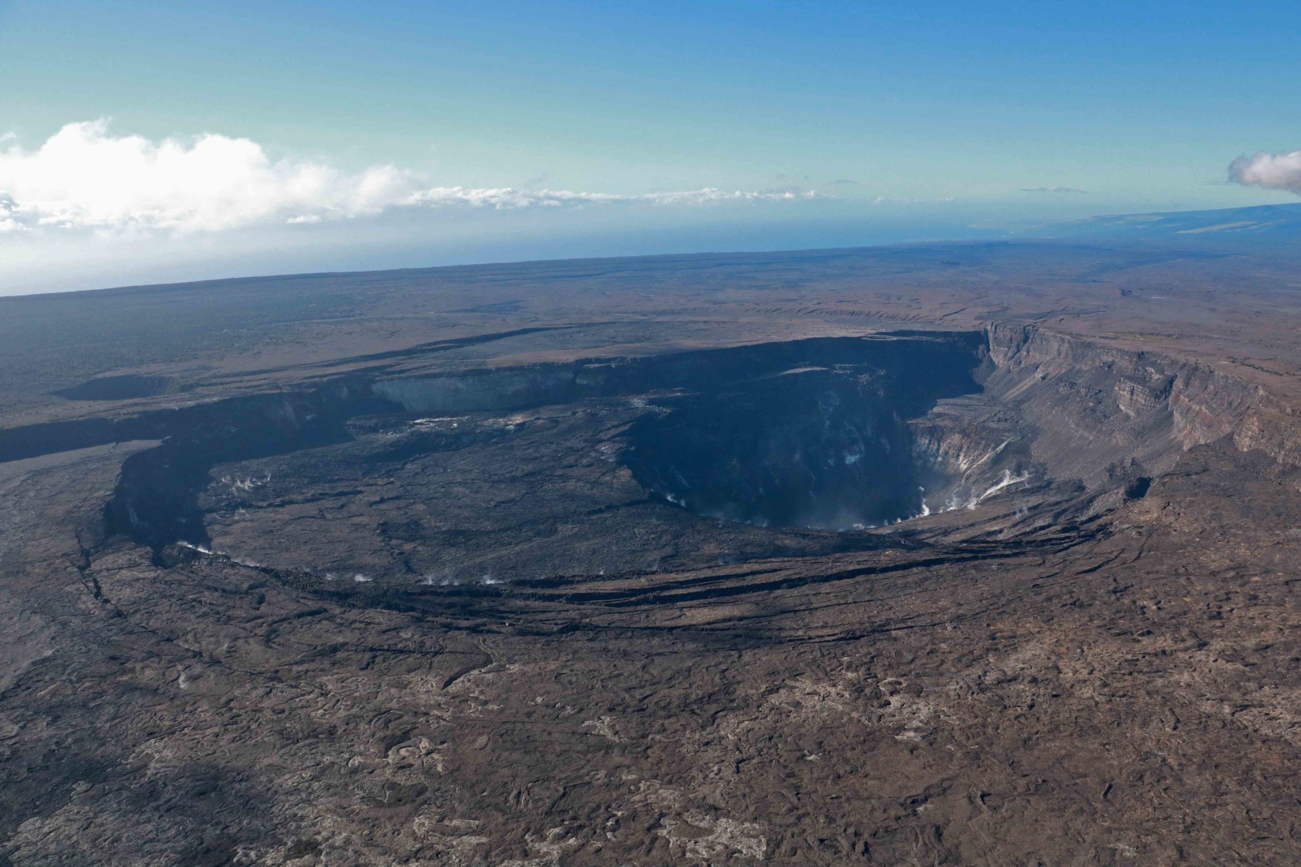
According to HVO acting-Scientist-in-Charge, David Phillips, the earthquake had no apparent effect on Kīlauea or Mauna Loa volcanoes. « We see no detectable changes in activity at the summits or along the rift zones of Mauna Loa or Kīlauea as a result of this earthquake. Aftershocks are possible and could be felt. » HVO continues to monitor Mauna Loa and other Hawaiian volcanoes for any changes.
The depth, location, and recorded seismic waves of the earthquake suggest a source due to bending of the oceanic plate from the weight of the Hawaiian island chain, a common source for earthquakes in this area. Aftershocks are possible and could be felt.
According to the Pacific Tsunami Warning Center, there is no tsunami threat from this earthquake.
Source : HVO.
Photo : K Mulliken
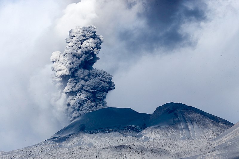
Peru , Ubinas :
Analysis period: July 20 to 26, 2020, Arequipa, July 27, 2020.
Alert level: ORANGE
The Peruvian Geophysical Institute (IGP) reports that the Ubinas volcano (Moquegua region) continued to record during the analysis period a slight increase in its seismic activity; therefore, it is suggested to the authorities and the population to keep an eye on the bulletins published by the IGP.
During the analysis period, the occurrence of 20 earthquakes with a magnitude less than M1.5 was identified, events associated with rock breaking processes that occur inside the volcano. On average, the occurrence of 3 earthquakes per day was recorded. Likewise, 6 seismic signals were recorded, associated with movements of volcanic fluids (water vapor and gas); Within these, two Tornillo-type events were identified, earthquakes linked to the increase in the internal pressure of the volcano. There was no seismic activity linked to the rise of the magma.
Surveillance cameras recorded columns of gas and water vapor reaching heights of up to 700 m above the summit of the volcano; these emissions dispersed towards the south-eastern sector of the volcano.
Both the monitoring of the deformation of the volcanic structure, using GNSS instruments, and the satellite monitoring through the SENTINEL, IMO-NASA (SO2 gas) and MIROVA (thermal anomalies) systems did not record any anomalies. during the analysis period.
Source : IGP.
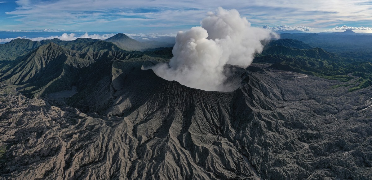
Indonesia , Dukono :
Level of activity at level II (Waspada). The Dukono volcano (1229 m above sea level) is experiencing a continuous eruption.
The volcano is clearly visible until it is covered in fog. The smoke from the crater is observed white / gray in color with thick intensity, which rises approximately 100-200 meters above the summit. The weather is sunny to cloudy, the winds are light to moderate to the west and northwest.
According to the seismographs of July 27, 2020, it was recorded:
Continuous tremor with an amplitude of 0.5 to 4 mm, mainly 2 mm
Recommendation:
The community around G. Dukono and visitors / tourists should not move, climb and approach the Malupang Warirang crater within a radius of 2 km.
Since volcanic ash eruptions occur periodically and ash dispersion follows the direction and speed of the wind, the ash is not fixed, it is recommended that people around G. Dukono always wear masks / nose and mouth cover to be used when needed to avoid the threats of the danger of volcanic ash in the respiratory system.
VOLCANO OBSERVATORY NOTICE FOR AVIATION – VONA
Issued : July 27 , 2020
Volcano : Dukono (268010)
Current Aviation Colour Code : ORANGE
Previous Aviation Colour Code : orange
Source : Dukono Volcano Observatory
Notice Number : 2020DUK64
Volcano Location : N 01 deg 41 min 35 sec E 127 deg 53 min 38 sec
Area : North Maluku, Indonesia
Summit Elevation : 3933 FT (1229 M)
Volcanic Activity Summary :
Eruption with volcanic ash cloud at 22h40 UTC ( 07h40 local).
Volcanic Cloud Height :
Best estimate of ash-cloud top is around 5853 FT (1829 M) above sea level, may be higher than what can be observed clearly. Source of height data: ground observer.
Other Volcanic Cloud Information :
Ash-cloud moving to west
Remarks :
Eruption and ash emission is continuing
Source : PVMBG , Magma Indonésie .
Photo : Martin Rietze .