July 23 , 2020.
Italy / Sicily , Etna :
ETNA PRESS RELEASE [UPDATE n. 61]
The National Institute of Geophysics and Volcanology, Etneo Osservatorio, reports that in recent hours a slight increase in explosive activity has been observed, mainly at the New Southeast Crater (NSEC), with a slight increase in the frequency of explosions and ash emissions, which quickly disperses in the summit area. It should be noted that this activity has however a variable intensity, as observed in the previous press release (n ° 60).
The amplitude of the volcanic tremor shows oscillations around the average values and in particular there was a decay phase from 19:30 UTC. The location of the source of the tremor does not show significant variations, resulting in the New Southeast Crater (NSEC) area, at an altitude of 2900-3000 m above sea level.
The deformations of the ground show no significant variation.
Further updates will be communicated shortly.
Source : INGV .
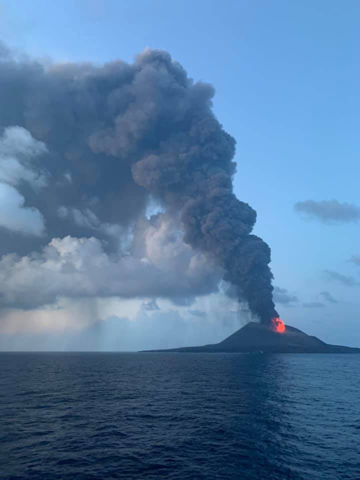
Japan , Nishinoshima :
27.247°N, 140.874°E
Elevation 25 m
JMA scientists observed Nishinoshima from a ship on 11 July. They reported that a large amount of ash was emitted from the summit crater; plumes rose about 1.7 km and drifted W, dropping ash into the sea. Deposits of large blocks at the foot of the cone were visible. Lava fountains that rose 200 m above the crater were observable at night, along with lightning in the ash plumes. The cone had grown to about 200 m, about 40 m higher than an estimate on 1 December 2019. The report stated that ships should stay at least 2.5 km away from the cone.
Based on satellite data and pilot observations, the Tokyo VAAC reported that during 16-21 July ash plumes rose to 3.7-6.4 km (12,000-21,000 ft) a.s.l. and drifted N, NE, and E. Satellite data showed a sulfur dioxide plume reaching the western USA on 18 July, after traveling over 9,000 km from Nishinoshima.
Sources: Japan Meteorological Agency (JMA), Tokyo Volcanic Ash Advisory Center (VAAC), Simon Carn , GVP .
Photo : Osamu Kobayashi via Sherine France .
Kadovar , Papua New Guinea :
3.608 ° S, 144.588 ° E
Elevation : 365 m
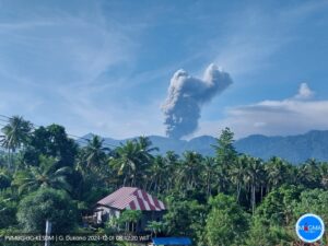
RVO reported minor eruptive activity at Kadovar during 1-15 July consisting of occasional light gray ash plumes of variable densities rising a few hundred meters above the summit crater. Fluctuating summit incandescence was visible at night. Activity intensified on 5 July as emissions became dark gray and dense. Explosions at 16h52 and 18h15 generated dense dark gray ash plumes that rose 1 km and drifted W.
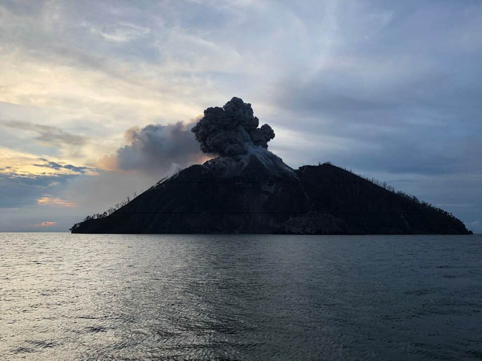
Loud rumbling accompanied the explosion. Activity subsided later that day but was again more intense during 8-10 July. Explosions recorded at 20h45 on 8 July, 11h45 and 14h00 on 9 July, and at 09h50 and 11h25 on 10 July produced ash plumes that rose 1 km above the summit.
Source: Observatoire du volcan Rabaul (RVO).
Photo : Philippe Stern , eruption archive 2018.
Ecuador , Reventador :
DAILY REPORT OF THE STATE OF THE REVENTADOR VOLCANO, Wednesday July 22, 2020.
Information Geophysical Institute – EPN.
Surface activity level: High, Surface trend: Increasing.
Internal activity level: High, Internal trend: No change.
Seismicity: There is no seismicity data.
Rains / lahars: There were no rains in the area.
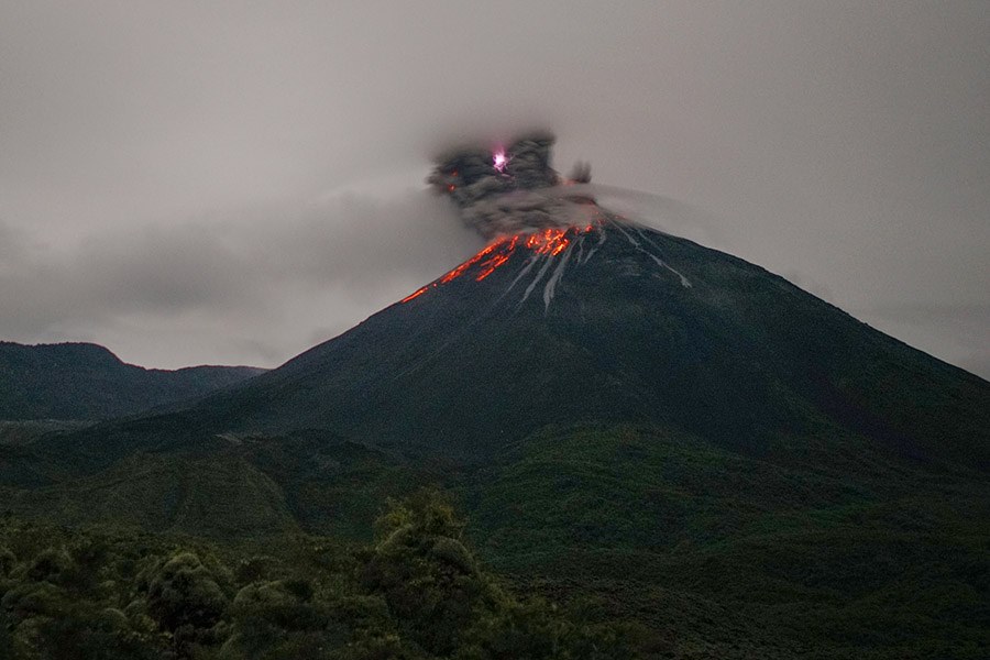
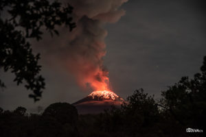
Emission / ash column: Several gas and ash emissions were observed in the morning, the height of which varied from 800 m to 1000 m above the crater level; their direction went from west to northwest. The Washington VAAC reported 4 alerts of emissions observed by the satellites which continued to move west. Their height did not exceed 1000 meters above the level of the crater.
Other monitoring parameters: no change.
Observations: On rare occasions, when the volcano cleared, gas and ash emissions were observed. At night, an incandescence was observed in the crater, explosions occurred which generated a rolling of blocks on the sides of the volcano up to 800 m below the level of the crater. Pyroclastic deposits have been identified on the northern flank up to 600 m below the crater level. There is no seismic data due to data transmission problems from the reference station.
Niveau d’alerte: Orange.
Source : IGEPN.
Photo : Martin Rietze .
Guatemala , Pacaya :
SPECIAL BEPAC VOLCANOLOGICAL BULLETIN # 47-2020
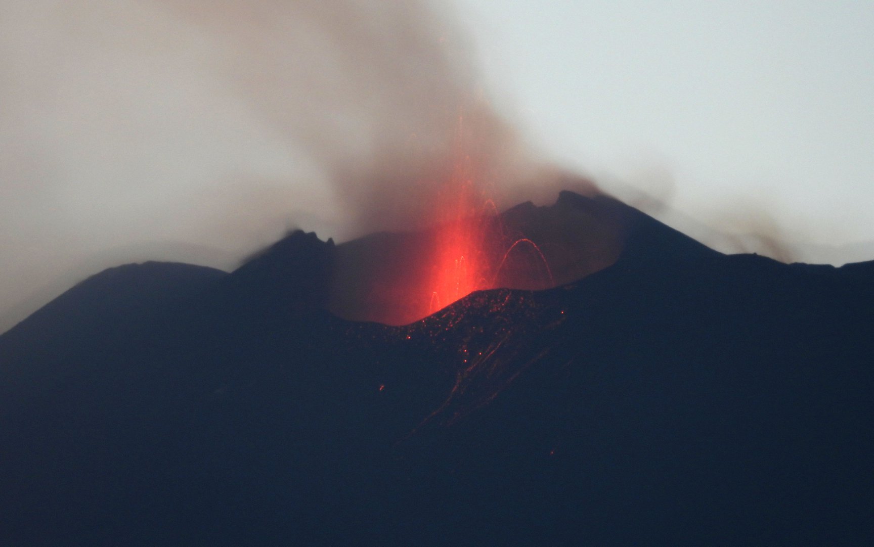
Type of activity: Strombolian.
Morphology: composite stratovolcano
Geographical location: 14 ° 22’50˝ North Latitude; 90 ° 36’00˝ Longitude West
Height: 2552 m.
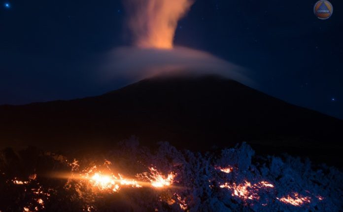
The Pacaya volcano, according to observations made in the field on the 21st of this month and the recording of the PCG and PCG5 seismic stations, has shown a gradual increase in its activity over the last few hours. As a result of this increase, permanent degassing and incandescence is observed in the Mackenney crater, as well as lava flows and weak to moderate explosions. The following graph represents the seismic energy released from July 9 to 21 and indicates that the increase has been gradual over the last few hours, reaching values close to 10,000 RSAM in amplitude.
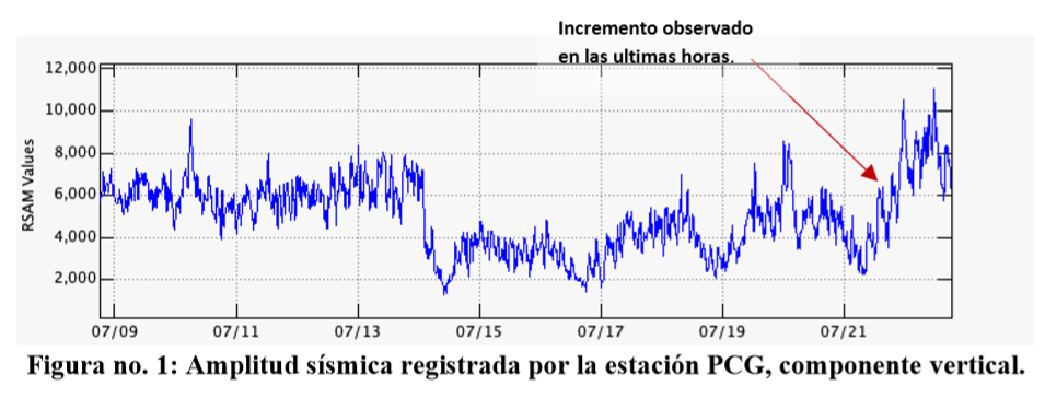
Seismic amplitude recorded by the PCG station, vertical component.
The activity of recent lava flows inside the plateau continues, in the vicinity of the northwest flank, they have a length of about 300 m. These lava flows flow at high temperatures giving off an odor of sulfur. In figure no. 2 It is possible to observe the displacement, direction and relative temperature of the flows, which allows us to observe which areas of the flow remain hotter than others. These can stay at high temperatures for several weeks or months. Continuous explosions in the crater partly generate the destruction of the slag cone formed by the Strombolian explosions of the daily activity of the Mackenney crater. During certain periods of a few minutes to a few hours, a column of gas and ash is visualized at a height of 2800 meters above sea level (9186 feet) which moves towards the southwest flank, reaching distances of up to approximately 7 kilometers.
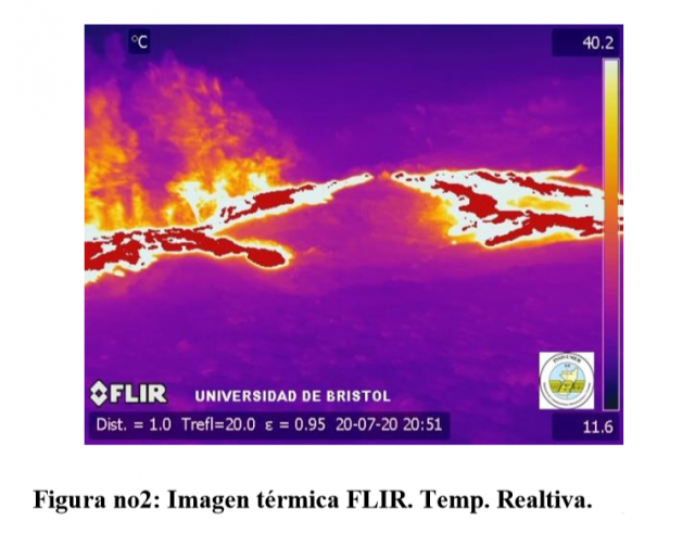
Figure no. 2: FLIR thermal image. Temp. Realtive.
Increase observed in the last hours.
The explosive activity generates low to moderate rumblings that vibrate the windows and roofs of houses in the villages of San Francisco de Sales, El Patrocinio, El Rodeo, and others, located 4 kilometers from the volcano.
The INSIVUMEH, provides visual and instrumental monitoring, through a webcam and the PCG and PCG5 stations, which record the seismic activity generated by the Pacaya volcano.
Source : Insivumeh