
May 28 , 2020.
Italy , Stromboli :
Weekly bulletin from May 18, 2020 to May 24, 2020 (issue date May 26, 2020)
SUMMARY OF THE STATUS OF THE ACTIVITY.
In light of the monitoring data, it is underlined:
1) VOLCANOLOGICAL OBSERVATIONS: A normal explosive activity of strombolian type was observed accompanied by a degassing activity. The hourly frequency of explosions oscillated between low values (2 events / h on 05/22) and medium-low values (6 events / h on 05/18) except on 23/05 with 11 events / h (average values ). The intensity of the explosions was mainly low in the area of the North crater and medium in the area of the Center-South crater.
2) SEISMOLOGY: The seismological parameters do not present significant variations.
4) DEFORMATIONS: Data from the Stromboli soil deformation monitoring networks did not show any significant changes last week.
5) GEOCHEMISTRY: The flow of SO2 is at an average level. The last measurement of the CO2 / SO2 ratio is at an average value (last update on 02/09/2020). The isotopic ratio of helium remains on average values (last update of 09/03/2020). There is no update on the CO2 released by the soil.
6) SATELLITE OBSERVATIONS: The thermal activity in the summit area is at a medium-low level.

VOLCANOLOGICAL OBSERVATIONS
The analysis of the images recorded by the cameras placed at an altitude of 400m, at an altitude of 190m and at Punta dei Corvi made it possible to characterize the eruptive activity of Stromboli. During the reporting period, the explosive activity was mainly produced by at least 3 (three) eruptive vents located in the area of the North crater and by at least 2 (two) eruptive vents located in the area of the Center-South crater . All the mouths are placed inside the depression which occupies the terrace of the crater. Due to the unfavorable visibility conditions, the image analyzes for the description of the explosive activity were not carried out on May 20.
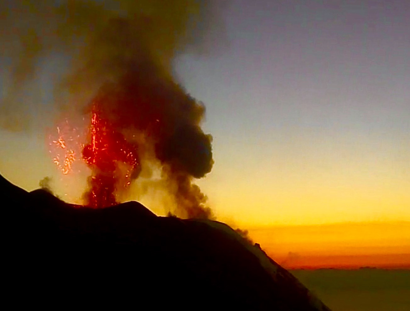
In the North zone, the explosions were mainly of low intensity (less than 80 m in height) emitting coarse materials (lapilli and bombs). The average frequency of explosions in the North zone varied between less than 1 and 10 events / h. The explosive activity of the Center-South zone produced explosions of mainly coarse material (lapilli and bombs), sometimes mixed with ashes, with a medium intensity (less than 150 m high). The frequency of explosions in the Center-South zone varied between less than 1 and 4 events / h.
The amplitude of the volcanic tremor had values between low and medium-low.
Source : INGV.
Read the whole article : file:///C:/Users/Utilisateur/AppData/Local/Packages/Microsoft.MicrosoftEdge_8wekyb3d8bbwe/TempState/Downloads/BollettinoStromboli20200526%20(1).pdf
Photos : Webcam via Wolfgang Künker , Webcam .
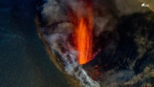
Kamchatka , Karymsky :
VOLCANO OBSERVATORY NOTICE FOR AVIATION (VONA).
Issued: May 27 , 2020.
Volcano: Karymsky (CAVW #300130)
Current aviation colour code: ORANGE
Previous aviation colour code: orange
Source: KVERT
Notice Number: 2020-101
Volcano Location: N 54 deg 2 min E 159 deg 26 min
Area: Kamchatka, Russia
Summit Elevation: 4874.08 ft (1486 m)
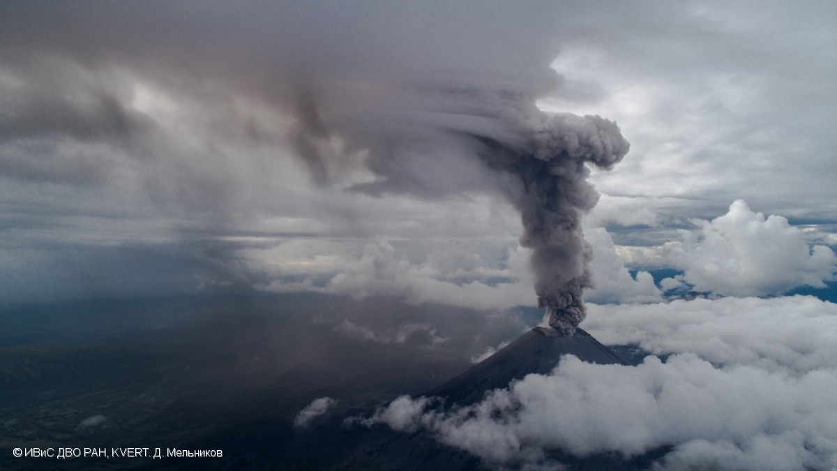
The explosive activity of Karymsky volcano on 14 August, 2019.
Volcanic Activity Summary:
A moderate explosive activity of the volcano continues. According to satellite data, ash explosions send ash up to 6 km a.s.l. and ash plume drift to the east-northeast from the volcano.
This activity continues. Ash explosions up to 16,400- 23,000 ft (5-7 km) a.s.l. could occur at any time. Ongoing activity could affect low-flying aircrafts.
Volcanic cloud height:
18040-19680 ft (5500-6000 m) AMSL Time and method of ash plume/cloud height determination: 20200527/0200Z – Himawari-8
Other volcanic cloud information:
Distance of ash plume/cloud of the volcano: 12 mi (20 km)
Direction of drift of ash plume/cloud of the volcano: ENE / azimuth 77 deg
Time and method of ash plume/cloud determination: 20200527/0220Z – Himawari-8
Source : Kvert.
Photo : D. Melnikov, IVS FEB RAS, KVERT.
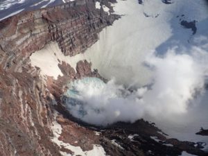
Colombia , Nevado del Ruiz :
Activity level bulletin of the Nevado del Ruiz volcano.
The level of activity continues at the level of yellow activity or (III): changes in the behavior of volcanic activity.
Regarding the monitoring of the activity of the Nevado del Ruiz volcano, the COLOMBIAN GEOLOGICAL SERVICE reports that:
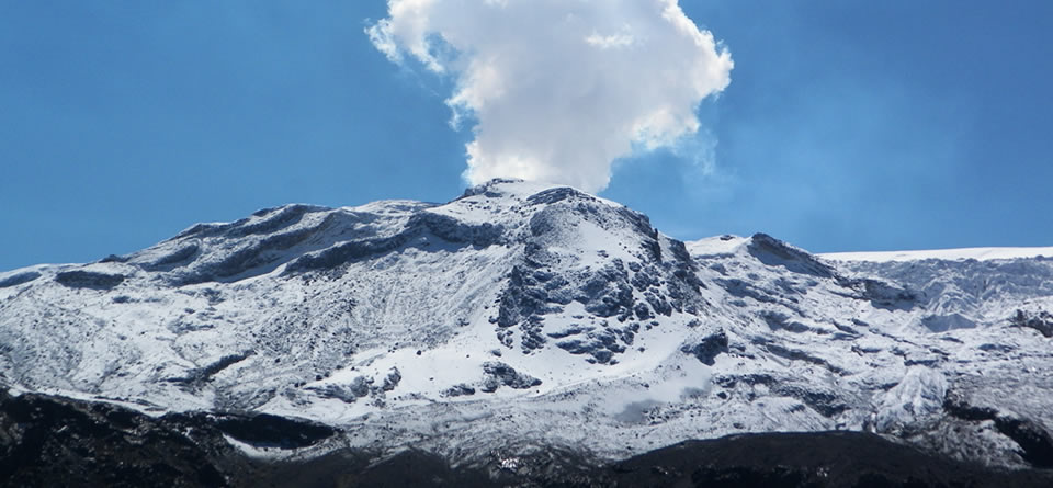
The seismicity linked to the dynamics of the fluids, inside the volcanic conduits, presented an increase in the number of events and similar levels in the seismic energy released, compared to the previous week. This seismic activity was characterized by the occurrence of continuous volcanic tremors, tremor pulses, earthquakes of the long period type and of the very long period type. These earthquakes presented varying energy levels and spectral content. Some of these signals were associated with small emissions of gas and ash, which was confirmed by cameras installed in the volcano area and by reports from SGC personnel in the volcano area and through reports from SGC field staff.
The occurrence of a minor episode of « Drumbeat » type seismicity associated with long-term earthquakes, recorded on May 25, stands out. This episode was characterized by its low energy level.
The seismicity generated by the fracturing of the rocks maintained similar levels, in number of earthquakes and in released seismic energy, compared to the previous week. This type of seismicity was mainly located in the West-South-West, South-South-East and in the Arenas crater, and to a lesser extent, in the North-East and North-North-West sectors of the volcano. The depth of the earthquakes ranged from 0.5 to 6.3 km. The maximum magnitude recorded during the week was 1.1 ML (local magnitude), corresponding to the earthquake recorded on May 25 at 7:32 p.m. (local time), located 5.9 km west-southwest from the Arenas crater, 4.6 km deep. It should be noted that the largest earthquake was recorded during a slight seismic increase that occurred on May 25 in the West-Southwest sector of the volcano.
The Nevado del Ruiz volcano continues at a yellow activity level.
Source : SGC.
Photo : Milton H Arias
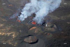
Iceland , Reykjanes Peninsula :
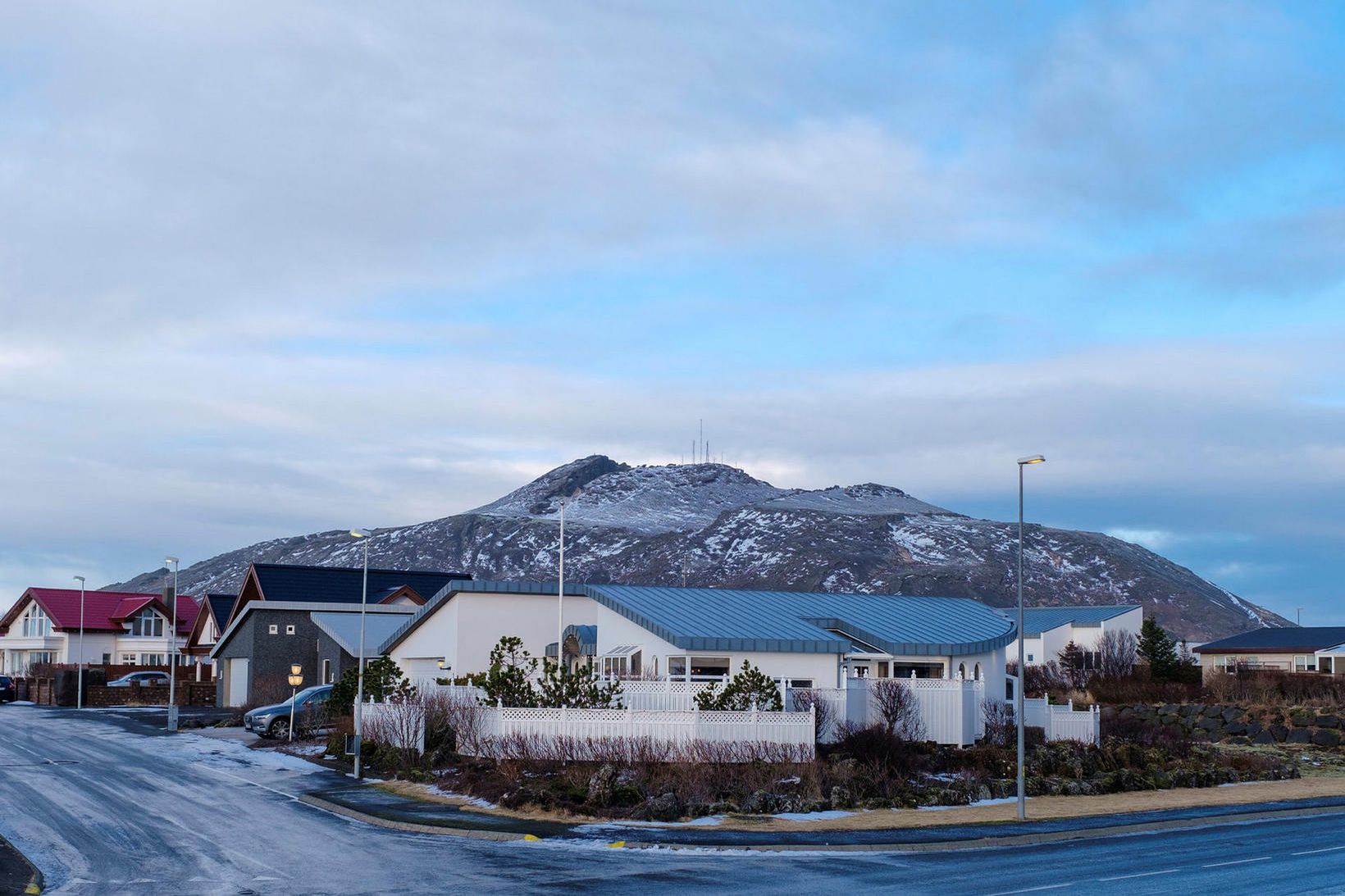
Seismic activity on Reykjanes peninsula
Seismic activity has decreased on Reykjanes peninsula in recent weeks. Last week (20th to 27th of May) around 120 earthquakes were located there, fewer than in the previous week when they were just more than 200. The largest earthquake of the week there was M2.1.
New data were acquired/processed yesterday afternoon (26.05), which include InSAR, GPS and radon measurements. These new observations indicate subtle sign of slow re-inflation in the vicinity of Þorbjörn. A longer time series of data is needed to better constrain the ongoing process and evaluate the associated hazards.
Uncertainty phase that Civil Protections declared due to this activity is still in force.
Week overview 18 May – 24 May
Around 510 earthquakes were located by the IMO¿s SIL seismic network this week, similar numbers as last week when 490 earthquakes were located. Similar activity was on the Reykjanes peninsula as last week, most of them near Reykjanestá, around 200 earthquakes.Less activity was in the North and in the Mýrdalsjökull glacier than last week. The largest earthquake of the week was M2.5 inside the Bárðarbunga caldera on May 23rd at 11:40.Eight earthquakes were located in Grímsvötn, the largest one M1.6. No earthquakes where detected in Hekla during the week.
Source : IMO.
Photo : mbl.is/Kristinn Magnússon.
Mexico , Popocatepetl :
May 27, 11:00 a.m. (May 27, 4:00 p.m. GMT)
Over the past 24 hours, 244 exhalations and 67 minutes of tremors have been identified according to the monitoring systems of the Popocatépetl volcano, these events were accompanied by emissions of volcanic gas and sometimes small amounts of ash dispersed towards the Southeast and the South. In addition, a volcano-tectonic earthquake was recorded yesterday at 4:18 pm, with a calculated magnitude of 2.7.
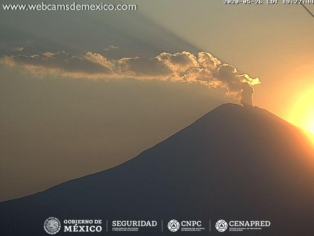
At the time of this report and from the early hours of the morning, we can observe the emission of gases mainly dispersed towards the South.
CENAPRED urges not to get near the volcano and especially the crater, because of the danger involved in the fall of ballistic fragments and, in the event of heavy rain, to move away from the bottom of the ravines because of the danger of mud and debris.
The Popocatépetl volcanic alert signaling light is in YELLOW PHASE 2.
Source : Cenapred .
Photo : Cenapred.
whoa so many at the same time