October 30 , 2019.
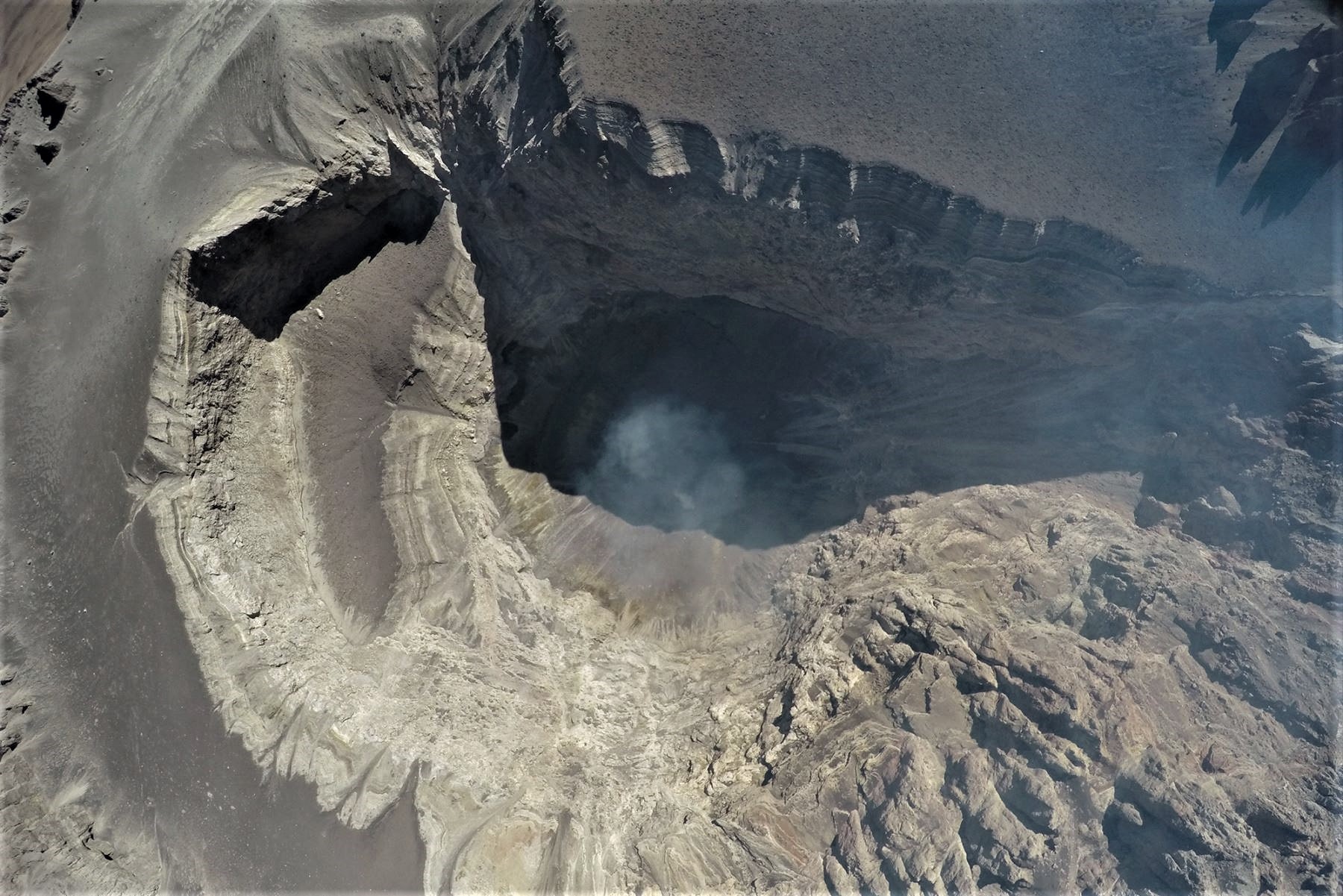
New Zealand , White Island ( Whakaari ) :
Volcanic Alert BulletinWI – 2019/08 .Wed Oct 30 2019 1:30 PM; White Island Volcano
Volcanic Alert Level remains at 1
Aviation Colour Code remains at Green
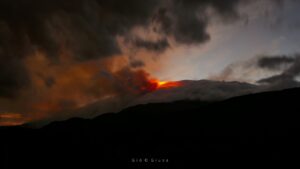
Volcanic unrest continues at Whakaari/White Island and some monitored parameters show an increase in activity, with a level of uncertainty about what this means. Hazards on the island remain unchanged and the Volcanic Alert Level remains at Level 1.
Over the last several months, we have observed a change in the amount of SO2 gas output and level of volcanic tremor. Both show an increasing trend and are at the highest level since 2016. The SO2 gas originates from magma (molten rocks) at depth and the data suggests a possible increase in gas passing through the volcano from depth. Volcanic tremor can occur for many reasons, including the movement of gas through the volcano, changes in the geothermal system, and even surface activity (geysering or ash emissions).

Changes in volcano monitoring parameters are common and can be explained by a range of processes, including an increased level of unrest, or general variations in background and surface activity. Slight uncertainty about the exact meaning of these changes arises from these possible processes.
The crater lake level has been rising since early-August. The rising lake level has impacted the surface activity around the active vents on the west side of the crater floor, and geysering-type activity has been observed in this area. Other recent measurements made on the island (soil gas, fumarole and water chemistry, ground deformation, magnetics, visual images from the web cameras, and earthquake activity) show no significant changes.
Overall, none of the monitored parameters are outside the expected range for minor volcanic unrest and associated hazards. While the pattern of signals shows similarities with the 2011—2016 period and could suggest that Whakaari/White Island may be entering a period where eruptive activity is more likely than normal, recent observations can also be explained by the increased gas flux which leads to geysering and lake level changes. The link between gas flux and future activity is not well understood and the subject of ongoing research efforts.
The Volcanic Alert Level remains at level 1. There is no change in the Aviation Colour Code: Green.
GNS Science and the National Geohazards Monitoring Centre continues to closely monitor Whakaari/White Island for further signs of activity. While Volcanic Alert Level 1 is mostly associated with environmental hazards, eruptions can still occur with little or no warning.
Source : Geonet / Yannik Behr , Duty Volcanologist .
Photos : Geonet.
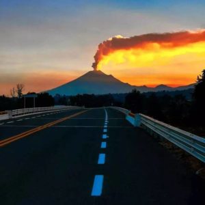
Peru , Ubinas :
Period of analysis: 21-27 October 2019 Arequipa, 28 October 2019
Current alert level: ORANGE
The Geophysical Institute of Peru (IGP) reports that the Ubinas volcano continues its eruptive process. To date, the energy of earthquakes that is associated with the rise of magma to the surface has decreased. Sporadic emissions of bluish (magmatic) gas and water vapor observed with surveillance cameras are recorded. In this scenario, the probability of recording volcanic explosions and / or ash emissions is low.
During the period from 21 to 27 October, the IGP recorded and analyzed 1196 seismic events associated with the eruptive process of the Ubinas volcano, with predominant seismicity of the volcano-tectonic (VT) type, related to rock fracturing at inside the volcano, with an average value of 104 events per day, all with magnitudes lower than M1.9. There has been a decrease in the number and energy of seismic signals that are related to the rise of the magma (hybrid type), which recorded an average of 53 earthquakes per day during this period. In addition, there has been no volcanic explosion since September 12th.
The surveillance cameras recorded light and sporadic emissions of blue gas (magmatic origin), with heights below 800 m above the summit of the volcano. The monitoring of the deformation of the volcanic structure, using GNSS data (processed with fast orbits), presents no anomalies. MIROVA satellite monitoring recorded 2 thermal anomalies with values between 1 and 2 MW.
Source et photo : IGP Pérou .
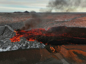
Italy / Sicily , Etna :
Weekly activity bulletin, period from 21 October 2019 to 27 October 2019 (date of issue 29 October 2019)
SUMMARY OF ACTIVITY:
In light of the surveillance data, we highlight:
1) VOLCANOLOGICAL OBSERVATIONS: Strombolian intra-craterical activity in the crater of Bocca Nuova. Emissions of ash from the Northeast Crater and Voragine Crater. Ordinary degassing activity of the New Southeast Crater.
2) SISMOLOGY: Modest seismic activity due to fracturing; stationary parameters of volcanic tremor.
3) INFRASONS: infrasonic activity supported in the first days of the week.
4) DEFORMATIONS: Etna soil deformation monitoring networks did not show any significant changes to communicate over the last week, apart from a modest deformation associated with the seismic swarm of October 26, 2016 , recorded on some tilt sensor stations.
5) GEOCHEMISTRY: SO2 fluxes are at a medium-low level. Underlying CO2 flows confirm a slightly upward trend, reaching average values. The partial pressure of CO2 in the soil does not show any significant changes. Helium isotope ratio values show a further increase, stabilizing at medium-high values (latest data available on October 15).
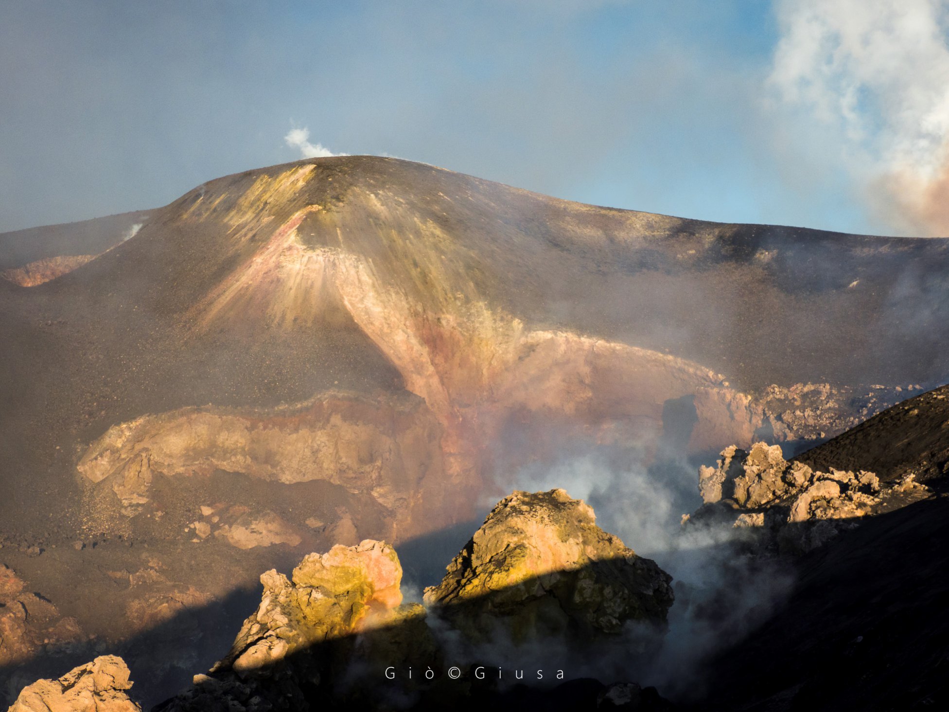
Crater of Voragine (central of 1945) at sunset. Craters of Etna, October 2019.Photo: Giò Giusa.
VOLCANOLOGICAL OBSERVATIONS:
The monitoring of the volcanic activity of the craters of Etna, during the week was carried out by analyzing the images of the network of surveillance cameras of the INGV section – Catania, Osservatorio Etneo (INGV -OE) and by inspections in the area of the summit. Adverse weather conditions have limited observations, especially at weekends.
The Northeast craters and Voragine were affected by ash emissions that dispersed rapidly in the summit area. At the Bocca Nuova Crater, explosive Intraspenetic Strombolian activity has been observed with multiple vents, accompanied by the launching of coarse material at heights that sometimes exceed the edge of the crater. Finally, the New Crater of the Southeast showed an intense degassing of the mouth of its summit and fumaroles present on the edges and the walls of the cone.
https://www.facebook.com/Etnaedintorniinfoto/videos/414244702625406/
Seismicity: During the week in question, four earthquakes exceeding the 2.0 magnitude threshold were recorded, indicating a slight decrease in the seismicity rate compared to the previous week. The seismicity was located in the middle part of the western slope and in the middle eastern part of the volcanic building. The main release of energy is due to an earthquake with a local magnitude of 3.4, located near Monte Fontane at a hypocentric depth of 6 km in the middle of the east flank of the volcano.
Volcanic tremor: the temporal trend of the mean amplitude of volcanic tremor did not show significant changes from the previous week and remained at an average level, although it was characterized by obvious fluctuations that short periods of high values. The location of the tremor source is located below the summit craters at a depth of approximately 2,800 to 3,000 meters above sea level.
Source : INGV.
Lire l’article en entier : file:///C:/Users/Utilisateur/AppData/Local/Packages/Microsoft.MicrosoftEdge_8wekyb3d8bbwe/TempState/Downloads/Bollettinoetna20191029%20(1).pdf
Photo et video : Gio Giusa.
Colombia , Chiles / Cerro Negro :
Weekly activity bulletin of Chiles and Cerro Negro volcanoes
The level of activity of volcanoes continues as at level: YELLOW LEVEL ■ (III): CHANGES IN THE BEHAVIOR OF THE VOLCANIC ACTIVITY.
Following the activity of the VOLCANS CHILES AND CERRO NEGRO, the COLOMBIAN GEOLOGICAL SERVICE (SGC) reports that:
From 22 to 28 October 2019, in the Chile – Cerro Negro volcano region, the processes associated with rock fracture within the volcanic system continue to predominate in the seismic component. The level of occurrence remains similar to that recorded the previous week, from 894 to 861 earthquakes, while the energy level of these events has decreased by more than an order of magnitude. The localized earthquakes were located in three main sources in relation to the Chiles volcano: one in the west, at a distance of less than 6 km; another to the West-South-West, at a distance of less than 5 km, and the third, a little more dispersed in the South zone of the volcano, at a distance of less than 9 km. Depths ranged from 2 to 17 km from the top of Chiles volcano (4700 m) and magnitudes below 2.4 on the Richter scale. None of the earthquakes were felt by the inhabitants of the area of influence of these volcanoes.

With regard to the new thermal spring (hitherto formed by three wells), located in the zone of influence of the Chiles-Cerro Negro volcanic complex, reported on Ecuadorian territory by the Ecuadorian media, the Institute of Geophysics of the polytechnic school will start field work for the verification and characterization of physicochemical parameters of this source. In terms of temperature, the maximum was measured in the water of the central well with a value of 85 ° C; in addition, the gas sample resulted in a water vapor concentration of about 98% and 2% CO2; No sulfur content value has been identified. The Ecuadorian authorities recommend not to approach this source because it is an area of instability and high temperatures can affect the integrity of people. .
The Colombian Geological Service and the Institute of Geophysics of the National Polytechnic School of Ecuador are attentive to the evolution of the volcanic phenomenon and inform in a timely manner of observed changes.
Source : SGC.
Photo : hablemosdevolcanes.com.
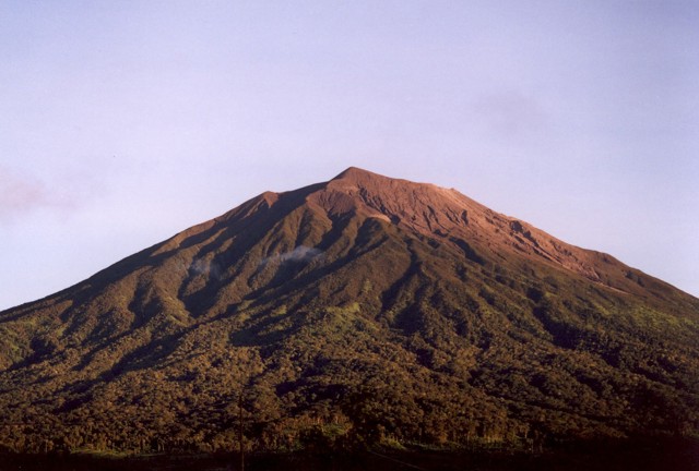
Indonesia , Kerinci :
VOLCANO OBSERVATORY NOTICE FOR AVIATION – VONA.
Issued: October 29 , 2019
Volcano: Kerinci (261170)
Current Aviation Colour Code: YELLOW
Previous Aviation Colour Code: yellow
Source: Kerinci Volcano Observatory
Notice Number: 2019KER24
Volcano Location: S 01 deg 41 min 49 sec E 101 deg 15 min 50 sec
Area: Jambi, West Sumatra, Indonesia
Summit Elevation: 12176 FT (3805 M)
Volcanic Activity Summary:
Observed brownish white ash emission at 23:14 UTC (06:14 local time)
Volcanic Cloud Height:
Best estimate of ash-cloud top is around 14736 FT (4605 M) above sea level, may be higher than what can be observed clearly. Source of height data: ground observer.
Other Volcanic Cloud Information:
ash plume moving to east-southeast-northeast
Remarks:
Seismic activity is dominated by gas emission and continuous volcanic tremor with amplitude of 0,5-3mm (dominan 1 mm)
Source : Magma Indonésie .
Photo : Umar Rosadi, 2005 (Centre of Volcanology & Geological Hazard Mitigation, Volcanological Survey of Indonesia).