March 04 , 2019.
La Réunion , Piton de la Fournaise :
Activity Bulletin from Sunday, March 3, 2019 to 18:00 (local time).
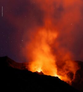
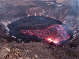
The eruptive activity that resumed on February 19, 2019 at Piton de la Fournaise around 7:10 pm local time continues. Despite slight fluctuations in intensity and relative constancy since February 25, an upward trend has been taking shape for a few days (Figure 1).
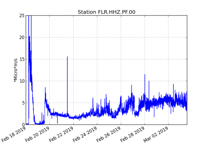
Figure 1: Evolution of the RSAM (indicator of the volcanic tremor and the intensity of the eruption) between 09h48 (05h48 UTC) on February 18th and March 3rd at 17h46 (13h46 UTC) on the seismic station of FLR. (© OVPF / IPGP)
– Over the last 36 hours, 2 superficial superficial volcano-tectonic earthquakes (above sea level) have been recorded.
– After a deflation of the building related to the transfer of magma that occurred on 18/02/2019, the deformations of the summit zone do not show any particular signals.
– The CO2 concentrations in the near-field soil (Cottage volcano area) remain high.
– Over the last 36 hours, surface flows estimated from satellite data, via the HOTVOLC platform (OPGC – University of Auvergne), fluctuated between <1 and 12 m3 / s. Note that low values (or zero values) are recorded when cloud cover does not allow acquisition.
Alert level: Alert 2-2.
Source : OVPF.
El Salvador , Santa Ana ( Ilamatepec ) :
Location: shared by the departments of Santa Ana and Sonsonate
Altitude: 2381 meters above sea level
Type of volcano: Stratovolcano
Attraction type: Vulcanian – Strombolian
Last eruption: October 1, 2005.
The seismic vibration of the volcano has fluctuated between 27 and 39 RSAM units on average, that is to say in the normal range. The seismic station of San Blas recorded 46 earthquakes related to the movement of fluids in the volcanic system. With regard to earthquakes associated with the rupture of solid media, four have been recorded and located, with depths of less than two kilometers and magnitudes between 1.0 and 1.5. None would have been felt by the inhabitants of the region.
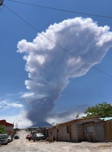
With regard to sulfur dioxide (SO2) emissions, they fluctuated between 10 and 680 tonnes per day, with an average of 176 tonnes, values considered within the reference limits (<300 tonnes / day) and typical of a volcanic system with constant degassing. On February 22, MARN resources visiting the crater reported a small plume of gas coming out of the small water pond and rising about 400 meters from the bottom of the crater. Despite the measured changes in gas emissions, the activity of the volcano is typical and normal for an active volcano.
Source : Marn.
Photo : Volcano.USAF.C-130.3.
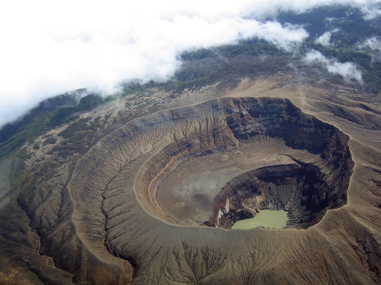
Costa Rica , Poás / Arenal :
Daily report of the state of volcanoes. , Date: 02 March 2019, Updated at: 11:08:00.
Poás Volcano:
No eruption is reported.
The seismic activity is similar to that of yesterday.
At the time of writing, winds are blowing from the Southwest.
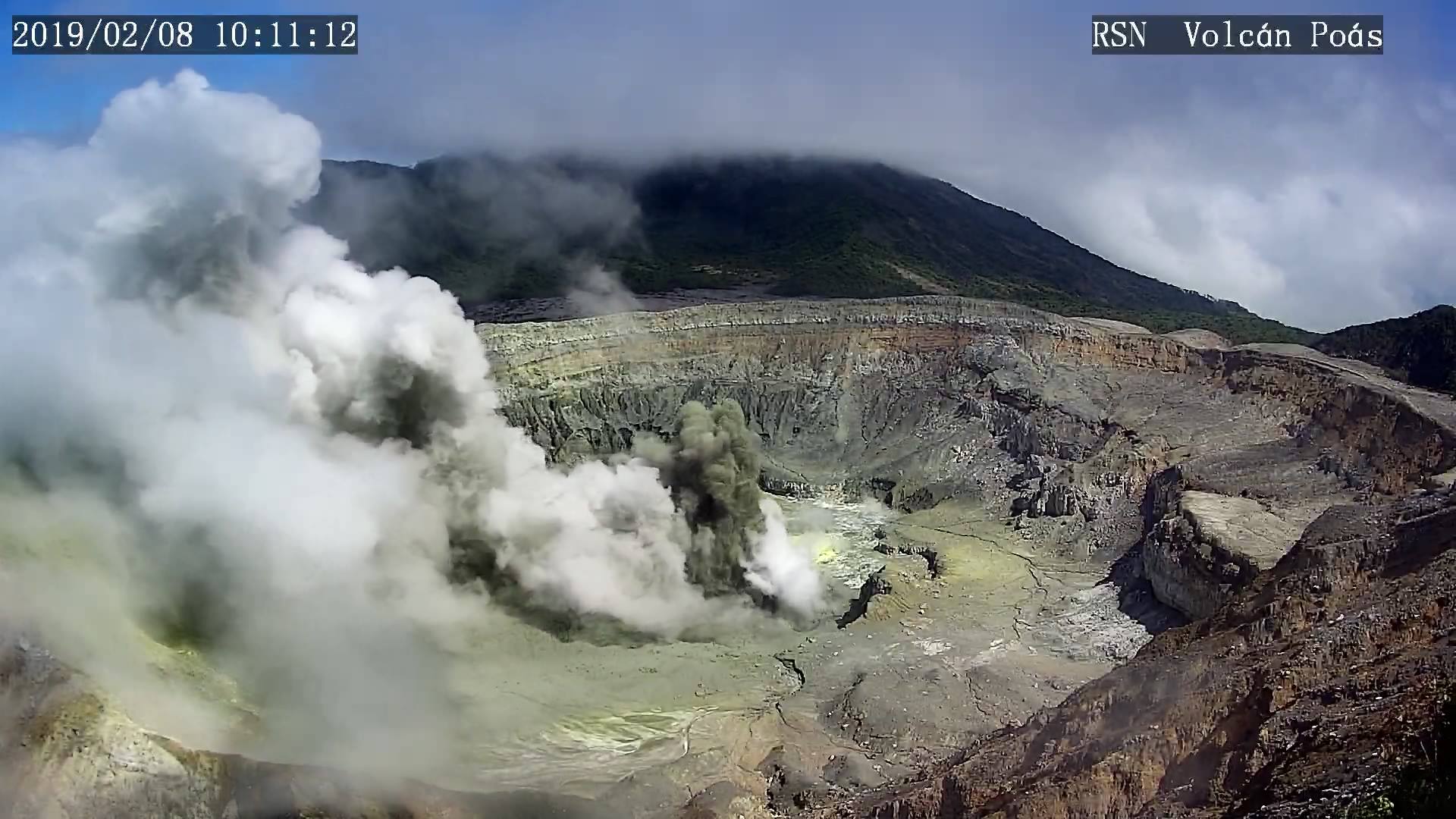
During the time it was possible to observe via our webcam, constant degassing was observed through fumaroles of the main crater. The plumes rise about 500 meters above the crater when there is no wind.
No ash fall or smell of sulfur has been reported.
Arenal Volcano:
On a clear day, on the Arenal volcano, you can see small plumes of water vapor. It is the product of condensation and the remaining heat that persists at the top of the main crater.
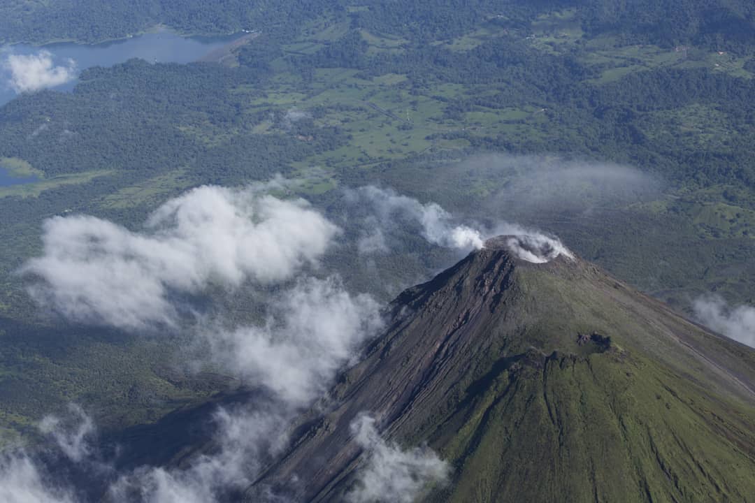
In the photo, we can see in the foreground the cone that existed before the eruption of 1968, then the main crater and in the background, the Sangregado dam of the Arenal hydroelectric project of ICE
Source : OVSICORI-UNA , RSN.
Photo : RSN , Dr. Paulo Ruiz Junio 2017
Mexico , Popocatepetl :
March 03 at 11:00 am (March 03 at 17:00 GMT)
During the last 24 hours, through the monitoring systems of the Popocatépetl volcano, 46 exhalations have been identified, accompanied by water vapor, gas and ash that the winds have dispersed preferentially towards the South-South-East. In addition, 110 minutes of harmonic tremor and five explosions were recorded, three yesterday at 11:04, 16:52 and 22:52, and two today at 1:20 and 2:11, as well as two volcano-tectonic events, one yesterday at 17:54 and one this afternoon at 14:58, with a preliminary magnitude of 1.9 and 2, respectively. During the night, incandescence and a continuous emission of water vapor and volcanic gases were observed.
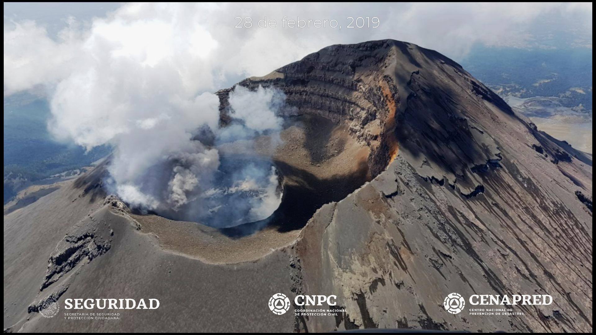
At the time of writing this report, a continuous emission of water vapor and volcanic gases is observed, which the wind disperses continuously towards the South-South-West.
CENAPRED urges NOT to APPROACH the volcano and especially the crater, because of the risk of falling ballistic fragments, and in case of heavy rains, to move away from the bottom of the ravines because of the risk of landslides and mudslides.
The Popocatepetl Volcanic Warning Light is located at Amarillo Phase 2.
Source : Cenapred.
United-States , California Volcanoes :
CALIFORNIA VOLCANO OBSERVATORY MONTHLY UPDATE
U.S. Geological Survey
Friday, March 1, 2019, 9:35 AM PST (Friday, March 1, 2019, 17:35 UTC)
Current Volcano Alert Level: all NORMAL
Current Aviation Color Code: all GREEN
Activity Update: All volcanoes monitored by CalVO using telemetered, real-time sensor networks exhibit normal levels of background seismicity and deformation. Volcanoes monitored include Mount Shasta, Medicine Lake Volcano, Clear Lake Volcanic Field, Lassen Volcanic Center, Long Valley Volcanic Region, Coso Volcanic Field, Ubehebe Craters, and Salton Buttes.
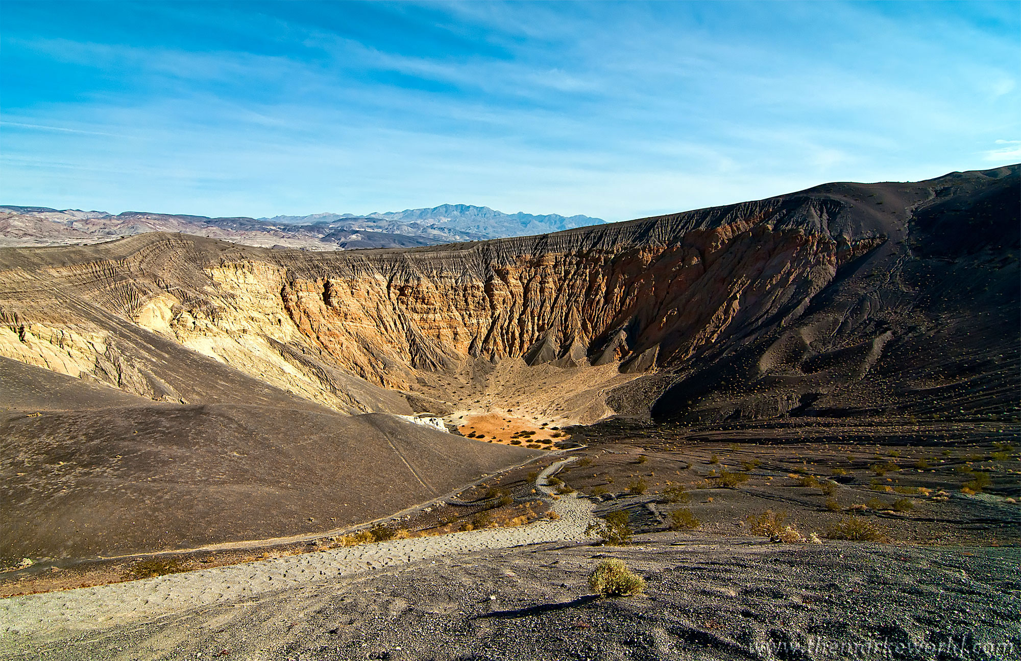
Ubehebe Crater
Observations for February 1, 2019 (0000h PST) through February 28, 2019 (2359h PST):
Mt Shasta: One M1.32 earthquake was detected.
Medicine Lake: No earthquakes at or above M1.0 were detected.
Lassen Volcanic Center: Four earthquakes at or above M1.0 were detected, with the largest registering M1.59.
Clear Lake Volcanic Field: One M2.09 earthquake was detected. [Note: The typical high level of seismicity was observed under the Geysers steam field located at the western margin of CLVF. The largest event was M2.72].
Long Valley Volcanic Region: In Long Valley Caldera, 16 earthquakes of M1.0 or greater were detected, with the largest registering M3.00. Seven earthquakes at or above M1.0 were detected in the Mono Craters region, with the largest registering M2.67. Three earthquakes at or above M1.0 were detected under Mammoth Mountain. The largest registered M1.62 [Note: The typical high level of seismicity was observed south of the caldera in the Sierra Nevada range, with the largest registering M2.30.]
Ubehebe Craters: No earthquakes at or above M1.0 were detected.
Salton Buttes: Thirty earthquakes were detected registering M1.0 or greater, with the largest registering M2.27.
Coso Volcanic Field: Sixteen earthquakes of M1.0 or greater were detected, with the largest registering M2.82.
The U.S. Geological Survey will continue to monitor these volcanoes closely and will issue additional updates and changes in alert level as warranted.
Source : Calvo