09 Décembre 2018
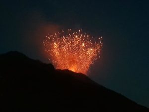
Papua New Guinea , Manam :
Update on the activity of Manam volcano (Papua New Guinea): Very strong explosive eruption
Saturday, December 08, 2018 1:46 PM.
A significant explosive phase occurred today, with sustained emissions of up to 13.5 km above sea level from about 3:00 am to 9:00 am UTC and a persistent plume up to about 8 km. It is almost certain that this event will be a big IEV 3- but not major.
The Manam volcano in Papua New Guinea erupted yesterday with a strong earthquake near Papua New Guinea. 09/12/2018.
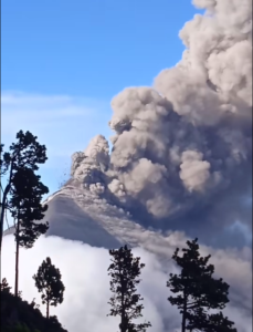
The Darwin Volcanic Ash Advisory Center (VAAC) released the following report:Le centre d’avis de cendres volcaniques de Darwin (VAAC) a publié le rapport suivant:
Posted at 18:26 UTC on 12/08/18 from ADRM VA ADVISORY
VAAC: DARWIN
VOLCANO: MANAM 251020
ZONE: PAPUA NEW GUINEA
SUMMIT ALTITUDE: 1807M
ADVISE NO: 2018/93
SOURCE OF INFORMATION: HIMAWARI-8, RVO, PIREP
AVIATION COLOR CODE: RED
Source : | Volcanodiscovery / MJFLEGEND , VAAC DARWIN .
Photo :Jhay Mawengu
Chile, Puyehue – Cordon Caulle :
During the evaluated period, a total of 663 seismic events were recorded, of which 5 were classified as long period (LP), in relation to the dynamics of the fluids within the volcanic edifice. The higher energy event had a reduced displacement value (DRc) of 17.1 cm2. Also, 658 volcano-tectonic (VT) earthquakes associated with rock fracturing processes were recorded. The higher energy event had a local magnitude (ML) equal to M 2.4, and was located below the 2011 emission center at a depth of 3.8 km.
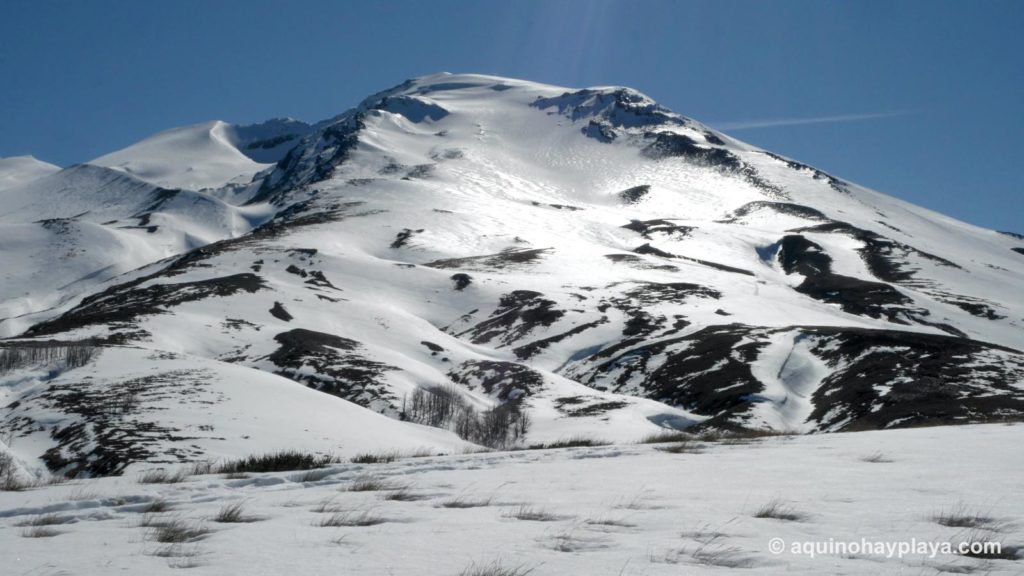
We note the occurrence of a seismic swarm of volcano-tectonic type, occurred on November 03 between 1:21 and 2:50. The largest magnitude quake of this swarm had a local magnitude of 2.4 M and a depth of 3.8 km and was located below the emission center of 2011.
The images provided by the IP cameras installed around the volcano do not show any superficial changes.
According to the data provided by three GNSS stations, we observe that the inflationary process reported previously has been accelerated. The maximum horizontal variation rate recorded by the permanent network is 0.63 cm / month and the vertical rate of 1.74 cm / month for the station closest to the maximum deformation point, similar size also measured by the analysis by radar interferometry, carried out in the area of the volcanic complex.
No sulfur dioxide (S02) emissions have been reported in the area’s atmosphere near the volcanic building, according to data published by the Ozone Observatory Sulfur Dioxide Group (http: // mon2.gsfc.nasa.gov/). ) and the National Information and Satellite Data Service on the Environment (NESDIS) (http://satepsanoine.nesdis.noaa.gov).
No thermal warning was reported in the area associated with the volcanic complex during the period, according to data processed by the mean infrared observation of volcanic activity (MIROVA) (http://www.mirovaweb.it /) and the Temporal thermal monitoring of global hot spots (MODVOLC) (http://modis.higp.hawaii.edu/).
Apart from the acceleration of the inflation process, the seismicity remains at levels considered low and suggest a relative stability of the volcanic system.
Because of the above, the volcanic warning is kept at the level:
GREEN LEVEL: Changes in the behavior of volcanic activity – Probable time for an eruption: WEEKS / MONTH.
Source : Sernageomin .
Photo : Wikiloc , lmneuquen.
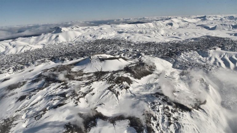
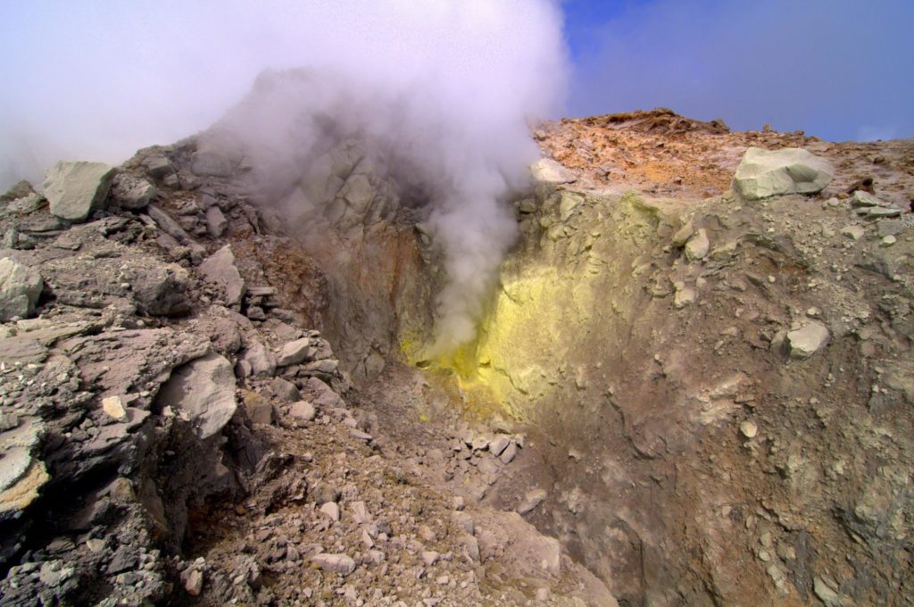
France / Guadeloupe , La Soufrière :
Since the beginning of 2018, we have been witnessing a cyclic process of deep magmatic gas injection at the base of the hydrothermal system at a depth between 2 and 3 km below the summit. This generates a recurring process of overheating and overpressure of the hydrothermal system which results in:
1) disturbances of the circulation of hydrothermal fluids;
2) the evolution of fumarole activity at the summit, one of which is indicative of the projection of hot and acidic mud over a few meters;
3) an increase in volcanic seismicity in swarms;
4) some volcanic earthquakes felt (four between February and April 2018) including an earthquake of magnitude M4.1 on April 27, 2018, the strongest since 1976;

5) deformations of small amplitude and limited to the La Soufrière dome of the order of 3-7 mm / year and the continuation of the opening of the summit fractures;
6) fluctuation of the flow of fumarolic gas from a pressurized hydrothermal reservoir;
7) a progression of thermal anomalies in the soil at the top of La Soufrière.
If these phenomena encourage the observatory to instrumental vigilance, they are currently not clearly associated with an anomaly of other monitoring parameters that could indicate a possible rise of magma. The latter would appear, but not systematically, by numerous deep and / or felt earthquakes, large-scale deformations beyond the dome, and the emission of sulfur gases at high temperatures (> 150 ° C).
The probability of eruptive activity in the short term remains low. However, given the renewed seismic and fumarolic activity recorded since February 2018,
a change of regime of the volcano has been observed such that one can not exclude an intensification of the phenomena in the future. As a result, the OVSG-IPGP is in a state of heightened vigilance. The gaseous fumes in the vicinity and leeward of the main fumaroles of the summit (notably the Crater South, the Tarissan, and the Gouffre 1956) present, since 1998, proven risks of irritation and burns (eyes, skin, respiratory tracts) and burning mud and acid sludge. Due to the presence of these toxic gases, the municipal by-law of the city of Saint-Claude No. 01-296 of October 29, 2001, amended on January 27, 2015, prohibits public access to certain areas of the summit.
Source : OVPF
Photo : aide-voyage.com , F. BEAUDUCEL/IPGP 2010
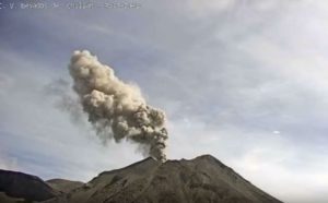
Mexico , Popocatepetl :
December 07, 11:00 am (December 07, 17:00 GMT)
In the last 24 hours, through the monitoring systems of the Popocatepetl volcano, 83 low intensity exhalations have been identified, accompanied by water vapor and gas; as well as two explosions recorded yesterday at 1:23 pm and today at 6:43 am, with an approximate height of 2.5 km and 1.8 km respectively, which caused a fall of ashes in the cities of Amecameca and Tlalmanalco. In addition, six minutes of harmonic tremor of low amplitude were recorded.

During the night, an incandescence was observed on the crater, which increased during certain exhalations.
At the time of writing, the volcano was visible and there was volcanic gas emission to the north-northeast.
Last update of the 08 December 00h15 (08 December, 06:15 GMT)
The Popocatepetl volcano surveillance system recorded two explosions, one at 22:44 and the other at 23:22, which were accompanied by 1.5 km and 2 km ash columns, respectively, which projected incandescent fragments on the flanks of the volcano. The direction of the winds is oriented towards the North-East and one should expect to fall of ashes in the zones of this sector.
CENAPRED maintains the surveillance permanently, any change of activity will be reported as soon as possible
CENAPRED urges NOT to APPROACH the volcano and especially the crater, because of the risk of falling ballistic fragments and in case of heavy rains to move away from the bottom of the ravines because of the risk of landslides and flows of mud.
The Popocatepetl volcanic warning light is located at Amarillo Phase 2.
Source : Cenapred.