September 09 , 2018.
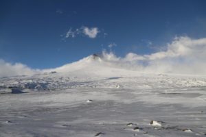
Chile , Copahue :
During this period, 51 seismic events classified as volcano-tectonic (VT) were recorded, associated with fracturing processes of rigid materials. The event with the greatest energy obtained a local magnitude equal to M 2.5 and was located 1.2 km west (O) of the active crater El Agrio, 4.4 km deep.
Similarly, 35 earthquakes associated with fluid dynamics were recorded in the volcanic building, classified as long period type events (LP), with a maximum displacement value (DRC) of 4.8 cm2. In addition, 44 Very Long Period (VLP) earthquakes were recorded, with a maximum reduced displacement value of 5.8 cm2.
https://www.facebook.com/519093828469624/videos/245002896199634/
The continuous tremor signal showed oscillations in its amplitude between low and medium intensity values with dominant frequencies between 1 and 3 Hz mainly.
IP cameras installed near the volcano recorded a constant degassing of the active crater (El Agrio) at a maximum height of 400 m with gray ash emissions and incandescence during the night period, when weather conditions allowed to observe the volcano. .
According to the analysis of data obtained from four geodetic monitoring stations, there is almost no displacement of the volcanic building during the evaluated period. The same thing is observed in the lines of surveillance that cross the active crater. The calculated rates of change have a maximum of 0.12 cm / month, so there is no evidence of a significant deformation process associated with activity on the volcano.
Sulfur Dioxide (SO2) emissions from DAS equipment for Mellizas, located 5 km east-northeast of the active crater, had an average value of 1568 + / – 338 t / day, with a maximum value of 4510 t / day reported on August 26th. SO2 emissions are considered moderate if one looks at the current state of the volcano.
One (1) thermal warning was reported in the zone associated with the volcanic building during the period considered, with a volcanic radiative power (VRP) of 3 MW on August 19, value considered low according to the data processed by observation medium infrared. volcanic activity (MIROVA) (http://www.mirovaweb.it/) and near-real-time thermal monitoring of global hot spots (MODVOLC) (http://modis.higp.hawaii.edu/) .
The process of ash emissions generated by the interaction of hydrothermal and surface magmatic systems continues. In this activity setting, minor phreatic explosions can occur and evolve into continuous ash emissions or Strombolian activity, such as those recorded in previous years.
Therefore, the alert level is maintained at the level:
YELLOW LEVEL: Changes in the behavior of volcanic activity – Probable time for an eruption: WEEKS / MONTH.
Observation: A zone of assignment is considered to be a radius of 1 kilometer around the crater.
Source : Sernageomin
Vidéo et photos : Descolgagos en el Sur
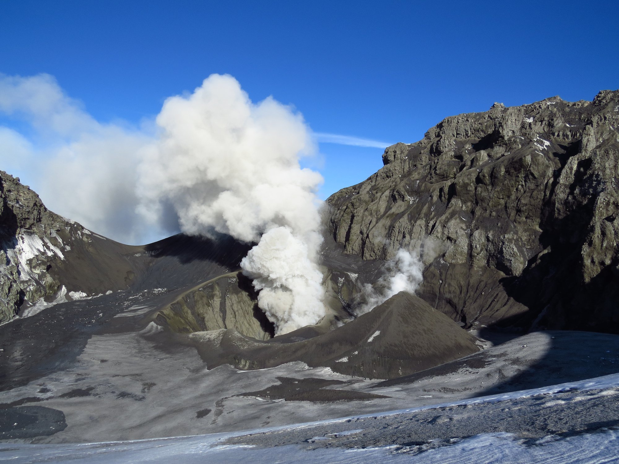
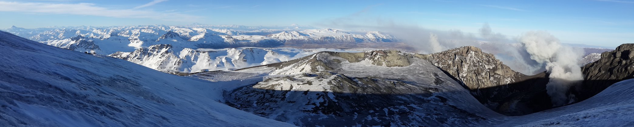
Colombia , Cumbal :
The level of activity of the volcano is maintained at the level: LEVEL YELLOW ■ (III): CHANGES IN THE BEHAVIOR OF THE VOLCANIC ACTIVITY
Following the activity of the CUMBAL VOLCANIC COMPLEX, the COLOMBIAN GEOLOGICAL SERVICE (SGC) reports that:
Between August 28 and September 3, 2018, the seismicity of the Cumbal Volcanic Complex increased in number and energy from 280 to 377 events. The largest contribution in this case comes from the events associated with the fracturing of rocks inside the volcano. The earthquakes were located and located at distances between 0.6 and 7.6 km around the crater Plazuelas with depths between 0.2 and 8 km compared to the height of the crater Plazuelas (4700 m) with a local maximum amplitude of M1.0 on the Richter scale.
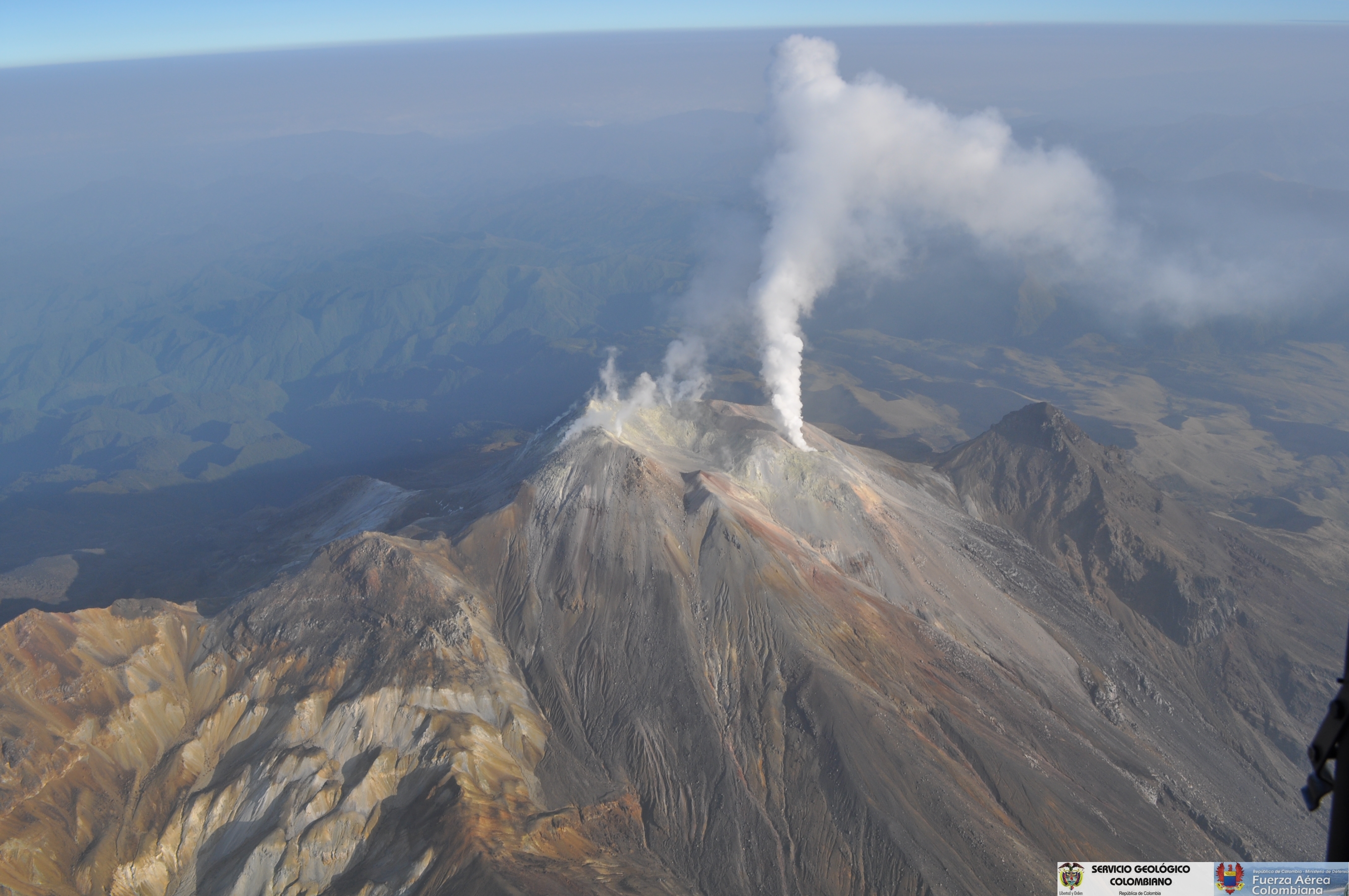
During the period under review, gas emissions could be observed from the El Verde fumarole field, to the north-east of the volcanic complex, with emissions of white columns, which spread northwards under the action of strong winds.
The COLOMBIAN GEOLOGICAL SERVICE is attentive to the evolution of the volcanic phenomenon and will continue to inform in a timely manner the detected changes.
Source : SGC
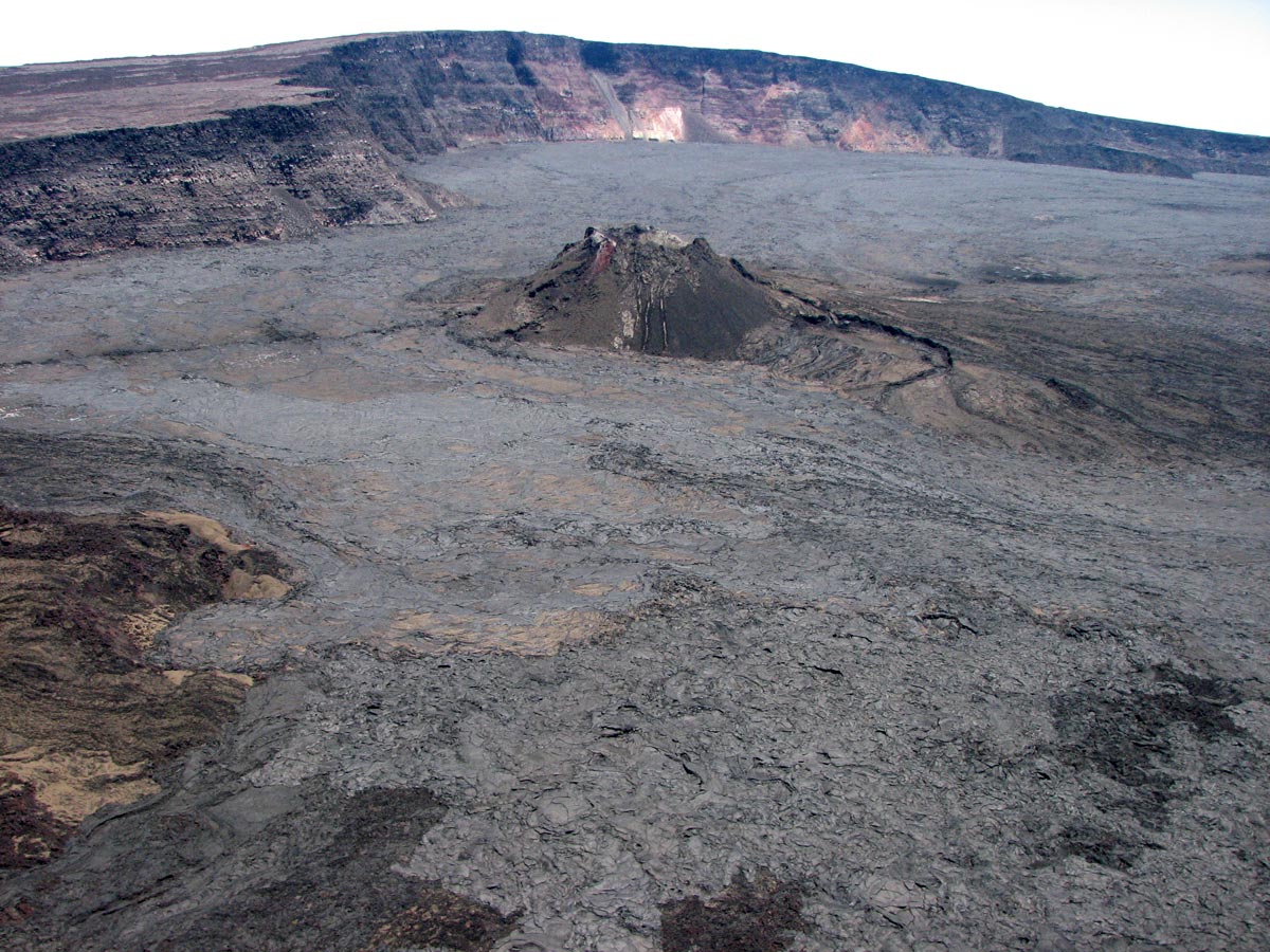
Hawaï , Kilauea :
19°25’16 » N 155°17’13 » W,
Summit Elevation 4091 ft (1247 m)
Current Volcano Alert Level: WATCH
Current Aviation Color Code: ORANGE
Kīlauea summit and lower East Rift Zone
On Kīlauea Volcano’s lower East Rift Zone (LERZ), small amounts of incandescence were visible within the fissure 8 cone overnight. However there were no changes to the glowing area, which suggests stationary sources. Small lava flows have been observed within the fissure 8 cone, however none extend outside the walls of the cone. There is no change in overall activity from observations over the past several days.
090818 Plume on upper East Rift zone, about 10:00 am. I’m guessing it’s Puu Oo, but it looks slightly down rift, above Royal Gardens Subdivision.
David Ford
Seismicity and ground deformation remain low at the summit of Kīlauea Volcano. Small aftershocks from the magnitude-6.9 earthquake in early May continue to occur on faults located on Kīlauea’s South Flank.
Tiltmeters in Kīlauea’s middle East Rift Zone are recording small amounts of inflationary tilt, which may be a sign of refilling of the rift zone. The current rates are much smaller than those measured during the period of major eruptive activity and have been steady over the past Week.
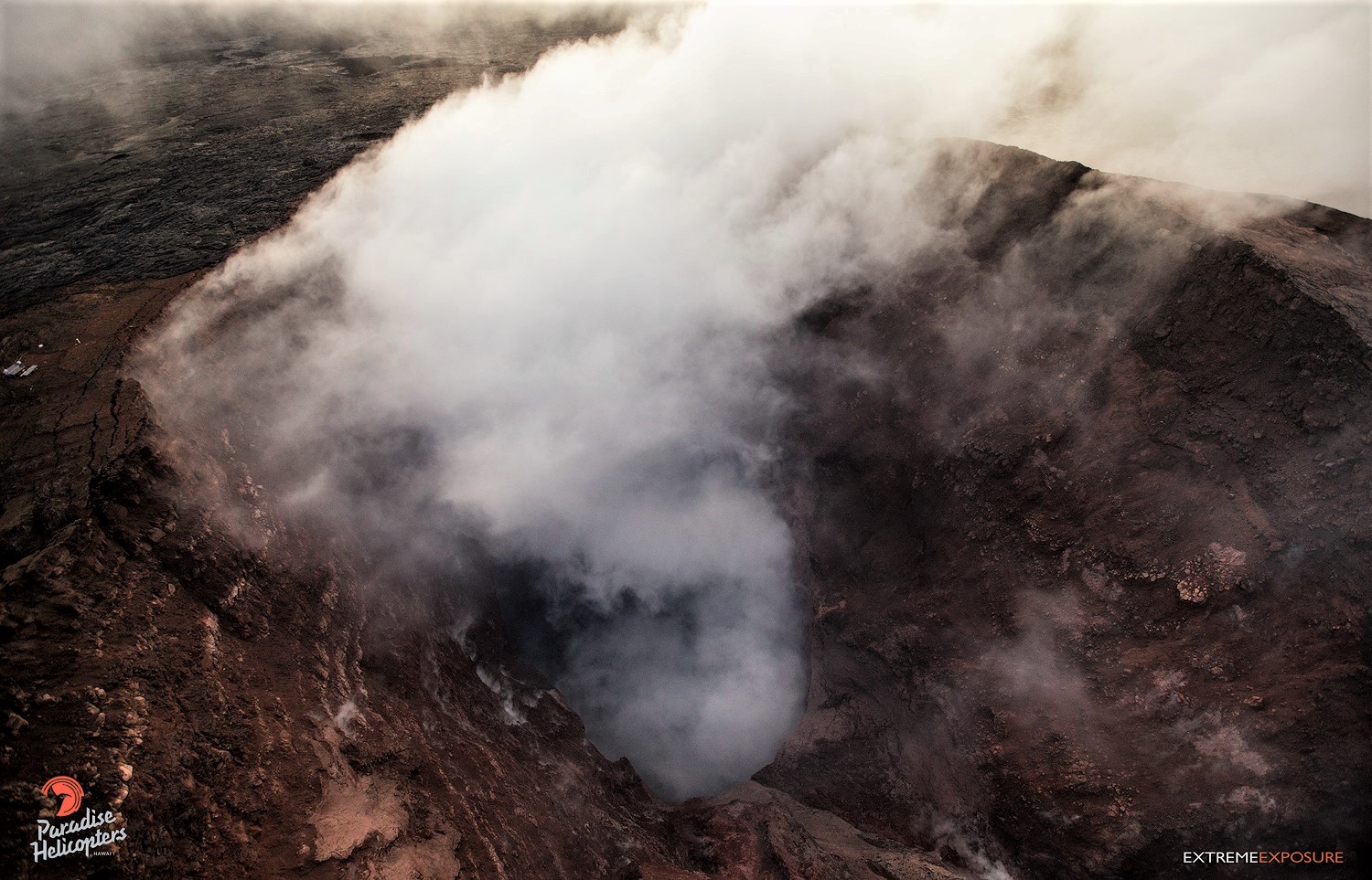
A look down into the vast emptiness of Pu‘u ‘O‘o, as a bit of gas rose from its depths.
Sulfur dioxide emission rates at the summit, Puʻu ʻŌʻō, and LERZ are drastically reduced; the combined rate is less than 1,000 tonnes/day, which is lower than at any time since late 2007. SO2 emission rate measurements from LERZ vents measured on September 5th were below 20 tonnes/day, close to the detection threshold of the measurement technique.
The Hawaiian Volcano Observatory (HVO) continues to closely monitor Kīlauea’s seismicity, deformation, and gas emissions for any sign of reactivation, and maintains visual surveillance of the summit and LERZ. HVO will continue to issue daily updates and additional messages as needed.
Source : HVO.
Photo : David Ford , Bruce Omori.
Hawaï , Mauna Loa :
19°28’30 » N 155°36’29 » W,
Summit Elevation 13681 ft (4170 m)
Current Volcano Alert Level: NORMAL
Current Aviation Color Code: GREEN
Over the past month, earthquake activity at Mauna Loa increased slightly over the previous six months. Clusters of small earthquakes have been recorded beneath the summit caldera, upper west flank, upper Southwest Rift Zone and southeast flank but these have been minor and short-lived. Elevated earthquake counts beneath the southeast flank are in part due to strong deflation at Kīlauea volcano’s summit during July.
HVO deformation monitoring instruments on Mauna Loa have also shown changes related to ongoing strong deflation of the Kīlauea summit. There is no clear evidence of resumed magma recharge into the shallow reservoir.
HVO will continue to monitor the volcano closely.
Source : HVO.
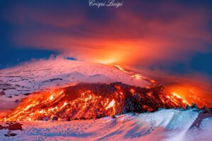
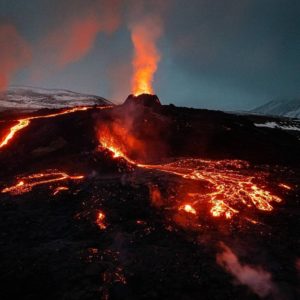
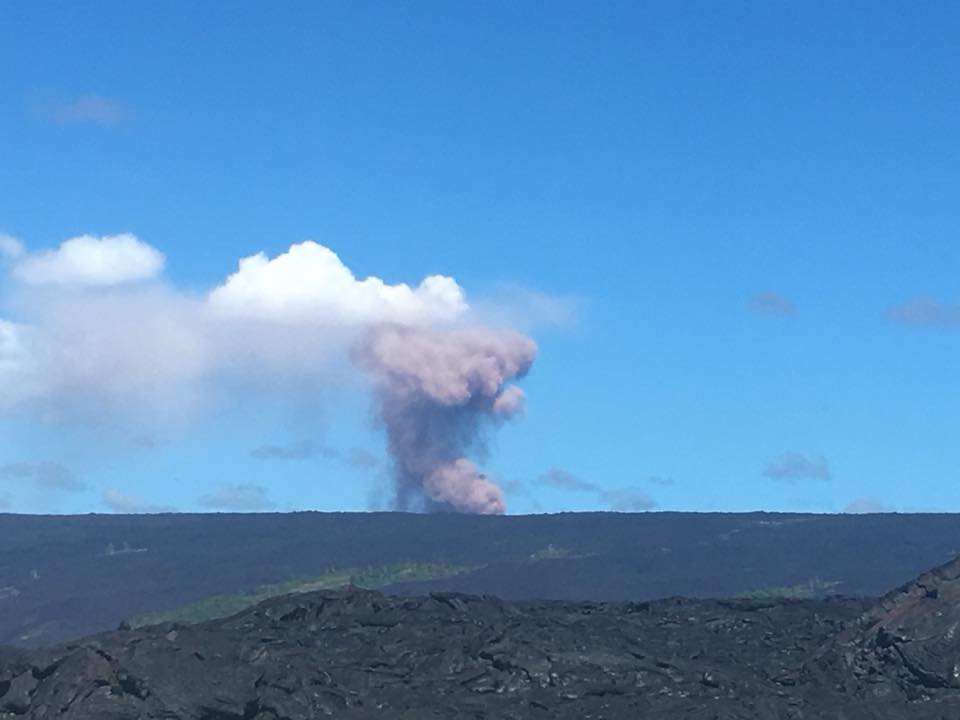
Guatemala , Fuego :
Fuego Volcano , avalanche bulletin, September 7, 2018, 11:00 am local time.
At 07:31 local time there was an avalanche on the Fuego volcano, caused by a crack in the upper part of Las Lajas Canyon. During the descent of the materials this raised fine materials that were carried by the wind in the Southwest direction. This activity was visible in Alotenango, on the South coast, in the RN-14 and Escuintla area.
For security reasons, CONRED has been informed that PROVIAL would not allow temporary passage to both ends of the RN-14.
Start at 1mn 10 ‘
The observation of the events is maintained and given the fact that the surveillance system has not shown this type of activity, the convenience of temporarily allowing passage through the national road 14 has been announced, taking precautions with regard to at the speed of and in case of warning of another event, traffic must be restricted.
According to the observations, in the middle part of the volcano, there are existing cracks through which volcanic materials emanate and avalanches are generated as above, this being an unusual event that can be generated again.
INSIVUMEH continues to watch this activity, but the volcano continues its explosions in the crater with an approximate height of 4,300 to 4,700 meters. These move 10 km to the West and South West.
According to the analyzes carried out, the rain can gradually increase from Sunday, September 9, persisting at the beginning of the work week and promote the formation of lahars.
Source : Insivumeh
Video : CRNNOTICIAS