June 28 , 2018.
Sierra Negra , Galapagos /Ecuador :
Sierra Negra Volcano Special Report No. 10-2018
Update of the state of the volcano eruption
The eruption of the Sierra Negra volcano began at 13:40 (Galapagos local time) on June 26th. The subsequent eruptive activity has been described in Special Reports Nos. 7, 8 and 9. In the last hours a decrease in seismic activity levels has been observed.
This behavior is seen on the seismograph of the VCH1 station located in the Chico volcano area, on the northeastern edge of the Sierra Negra volcano caldera, on the island of Isabela. Here, we observe that the amplitude of recorded earthquakes, as well as that of tremor decreased. However, there are still sporadic earthquakes and a low amplitude tremor in the continuous register (Figure 1).
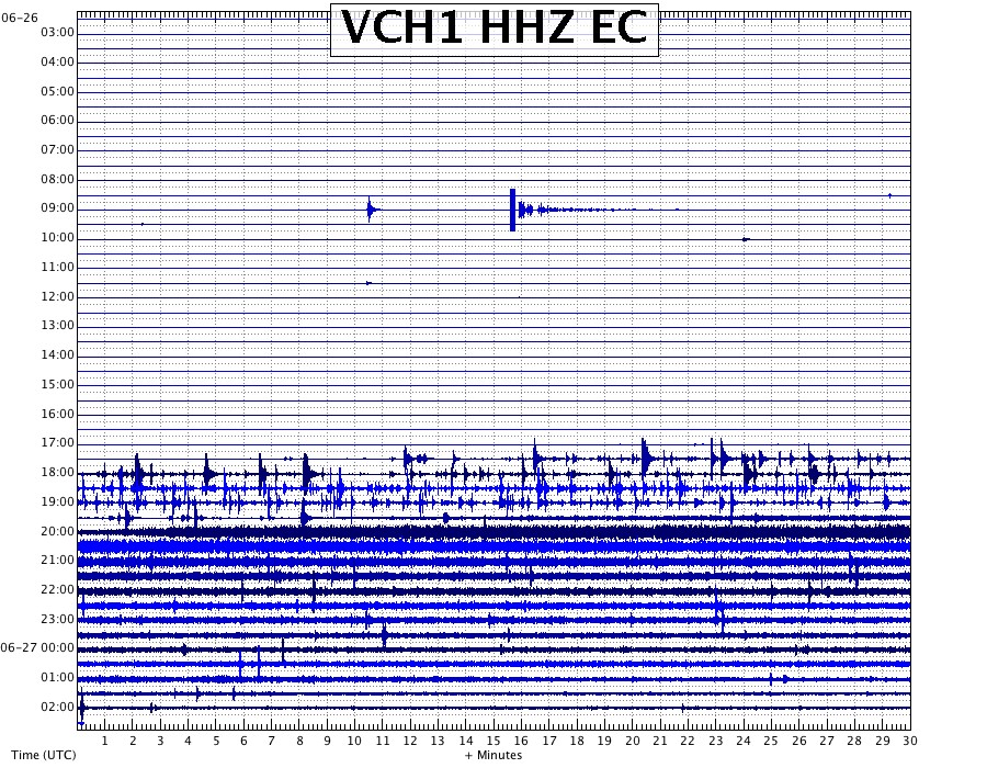
Fig. 1 seismogram of the VCH1 station, located on the Chico Volcano from 03:00 GMT on June 26 at 03:00 on June 27 (8:00 pm Galapagos local time) The earthquake swarm that preceded the eruption and the live tremor that accompanies the eruption.
It should be mentioned that there were no signs of large explosions associated with this eruption.
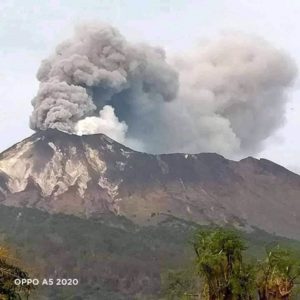
On the surface, thanks to the photos and videos shared by the staff of the Galapagos National Park, you can see several eruptive cracks on the northern flank, whose lava flows are directed towards the sea between Elizabeth Bay and Punta Morena. It has also been confirmed that there is a crack inside the caldera that feeds the lava flow. So far, none of the lava flows go to agricultural or residential areas.
https://www.facebook.com/GalapagosTravels/videos/667047746972789/
In addition, a cloud of gas and ash is observed at about 10.5 km altitude, directed towards the West. So far, no ashes have been reported in Puerto Villamil.
Despite the decrease in seismic activity, the volcano is still in an eruptive phase, so the Institute of Geophysics continues its monitoring work and any changes observed in the activity of the volcano will be communicated in a timely manner.
Sierra Negra Volcano, Special Report No. 11-2018
Update of the state of the volcano eruption
The Sierra Negra volcano located south of Isabela Island, started an eruption at 13:40 (local time of Galapagos-TG) on June 26, 2018. As indicated in previous reports (from N.-7 to N.-9) , the eruption was preceded by an earthquake of magnitude 5.3 Mlv at 3:15 (TL Galapagos) the same day. Approximately eight hours later, an earthquake swarm that started at 11:17 (TL Galapagos) and lasted until 13:40 (TG), in which appeared a continuous signal both in the seismic domain and infrasound has been recorded, giving rise to the eruptive process.
During the last 12 hours the eruptive volcanic activity is characterized by the progressive decrease of the seismic and acoustic jolt, however, the presence of tremors, although of low amplitude in the seismic and acoustic recordings indicate that the eruption continues but with less intensity. In addition, 102 tectonic volcanic earthquakes were recorded. The largest seismic event had a magnitude of 3.3 MLv, and its epicenter was located south of the caldera at a depth of 4.3 km. The rest of the localized events had lower depths. Figure 2 shows the distribution of epicentres from earthquakes that have occurred since yesterday, concentrated in the southwestern and northwestern areas of the volcano caldera.
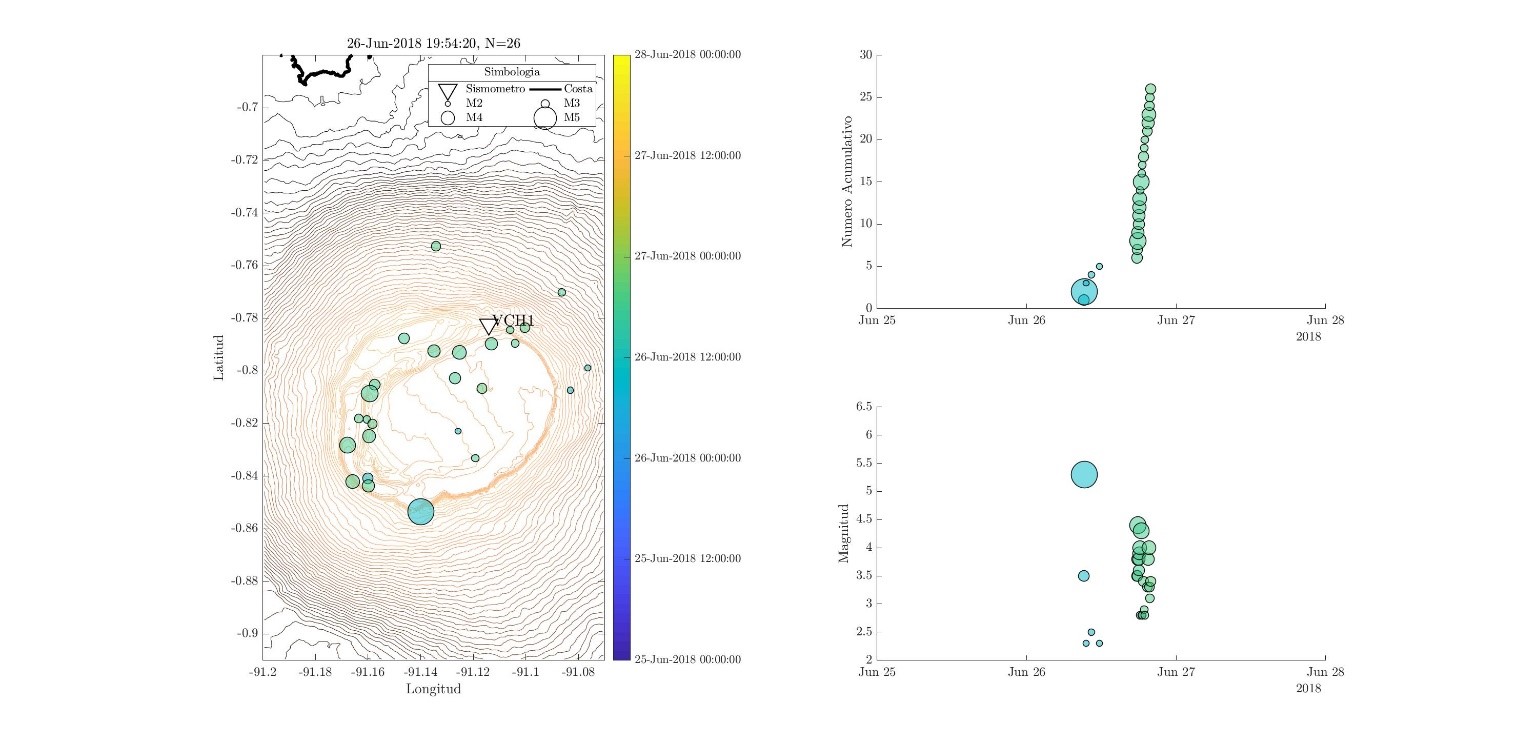
Figure 2. On the left, you can see the epicentres of earthquakes recorded since yesterday. On the right there is a cumulative curve of the number of earthquakes with time and below, the distribution of amplitudes of localized earthquakes.
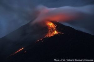
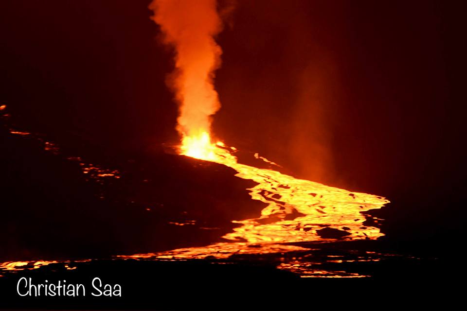
At present, lava emissions are expected to continue from the same locations where emissions have been located since yesterday.
If this process is maintained and there are no new magma deposits on the surface, the eruption will end in the next few days, otherwise it may take some time.
Source : DP, MR, BB , Institut de géophysique , École nationale polytechnique.
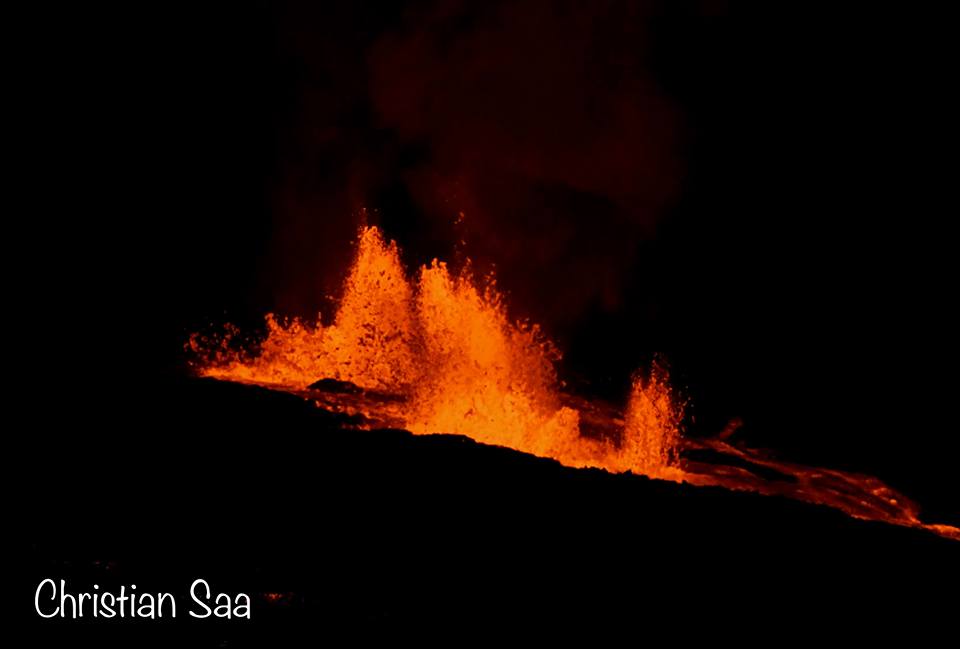
Photo : Christian Saa.
Video : Galapagos travel
Kilauea , Hawai :
Wednesday, June 27, 2018, 10:07 AM HST (Wednesday, June 27, 2018, 20:07 UTC)
19°25’16 » N 155°17’13 » W,
Summit Elevation 4091 ft (1247 m)
Current Volcano Alert Level: WARNING
Current Aviation Color Code: ORANGE
Kīlauea Volcano Lower East Rift Zone
The eruption in the lower East Rift Zone (LERZ) continues with no significant change during the past 24 hours.
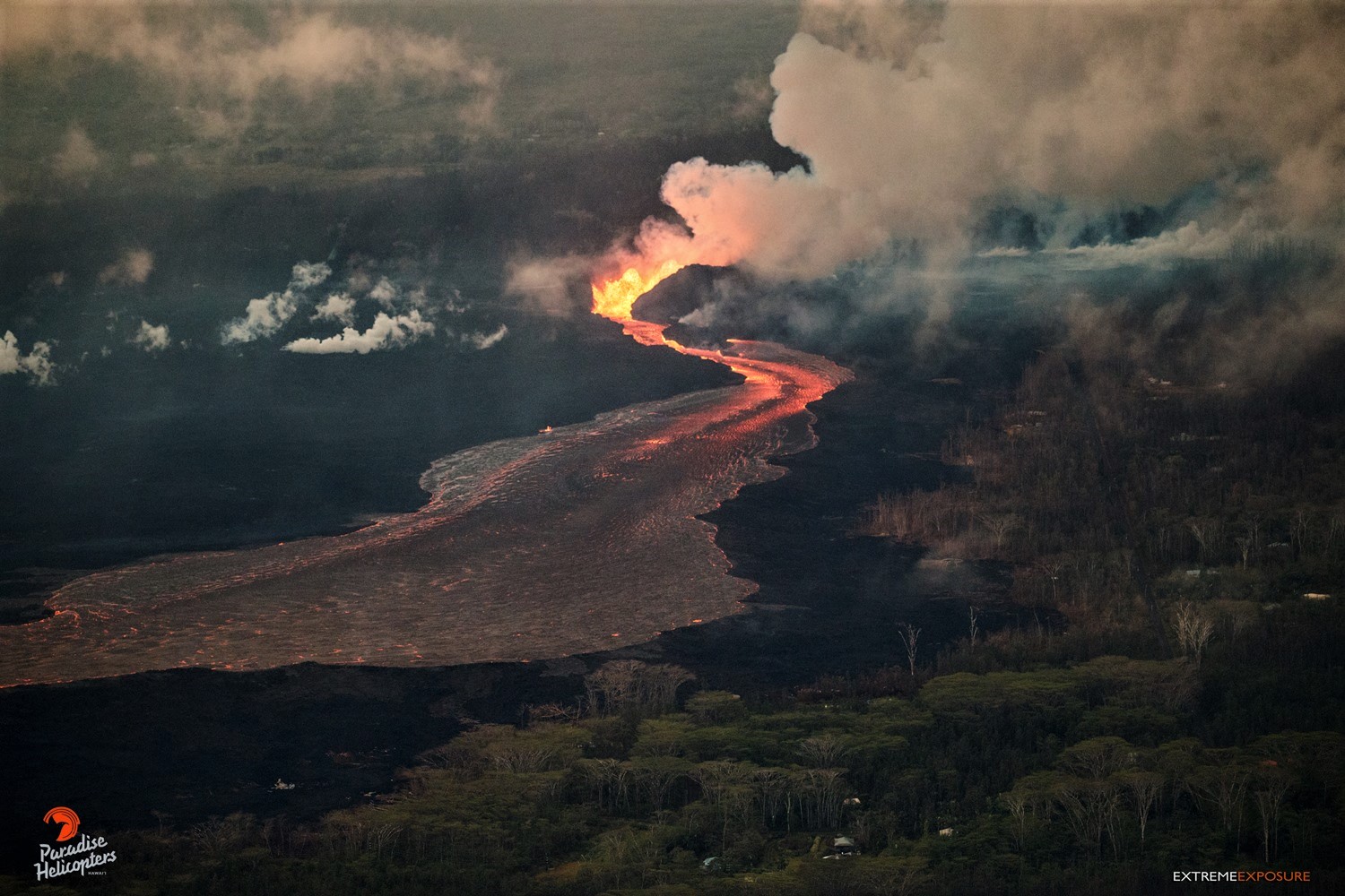
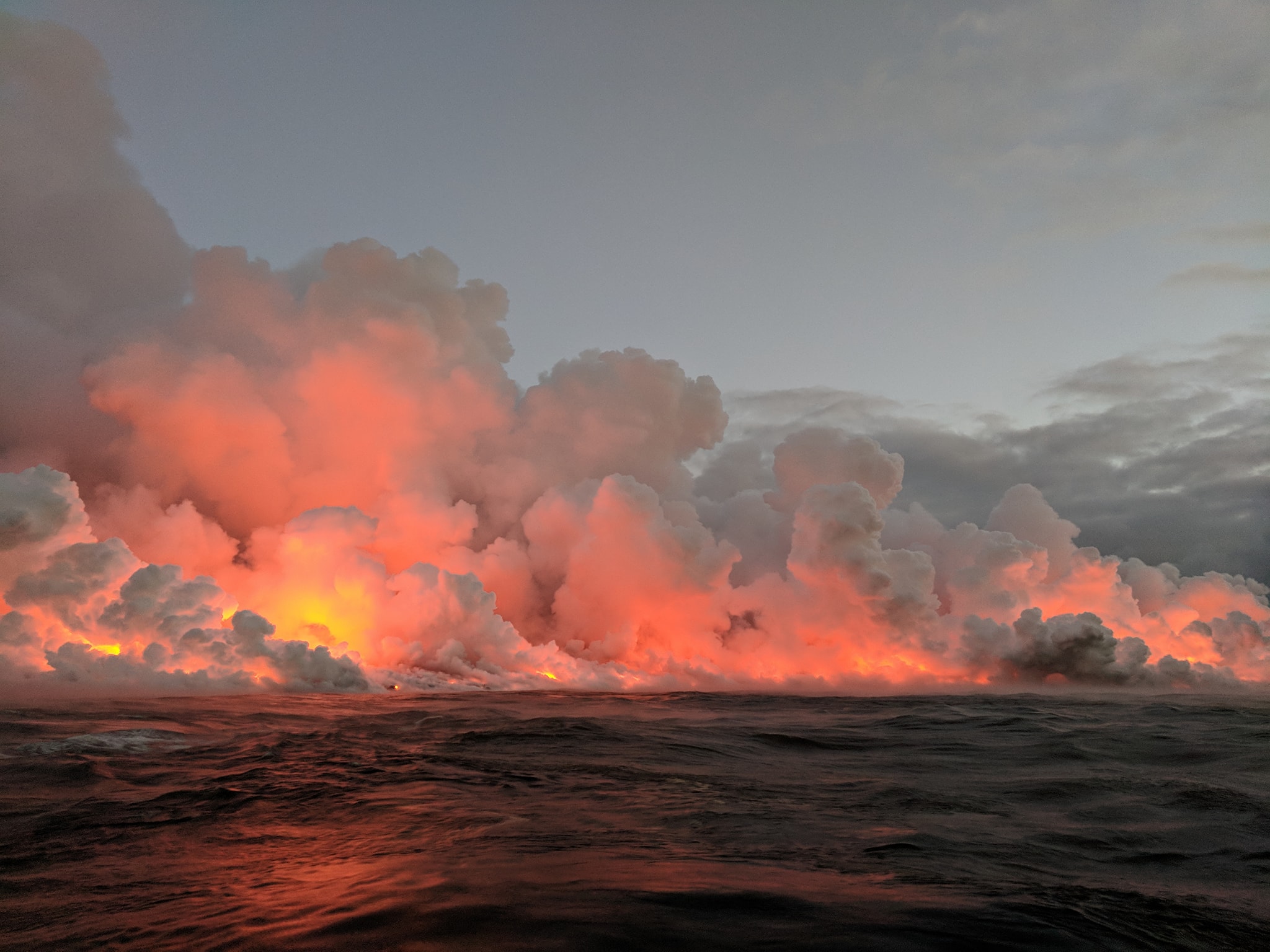
Fountains from Fissure 8 spatter cone continue to supply lava to the open channel with only small, short-lived overflows. Small overflows on both sides of the upslope portion of the channel occurred shortly after midnight, June 27. None of these overflows extended past the existing flow field. The spatter cone is now 180 ft tall at its highest point, and fountains only occasionally rise above that point. Lava is entering the sea this morning on the southern side of the entry area primarily through the open channel, but also along a 1-kilometer (0.6 mi) wide area. The morning overflight revealed that the northern margin of the flow field at the coast is oozing fresh lava at several points in the area of Kapoho Beach Lots.
Pele’s hair and other lightweight volcanic glass fragments from the lava fountain at Fissure 8 continue to fall downwind of the fissure, dusting the ground within a few hundred meters (yards) of the vent. High winds may waft lighter particles to greater distances. Residents are urged to minimize exposure to these volcanic particles, which can cause skin and eye irritation similar to volcanic ash.
HVO field crews are on site tracking the fountains, lava flows, and spattering from Fissure 8 as conditions allow and are reporting information to Hawaii County Civil Defense. Observations are also collected on a daily basis from cracks in the area of Highway 130; no changes in temperature, crack width, or gas emissions have been noted for several days.
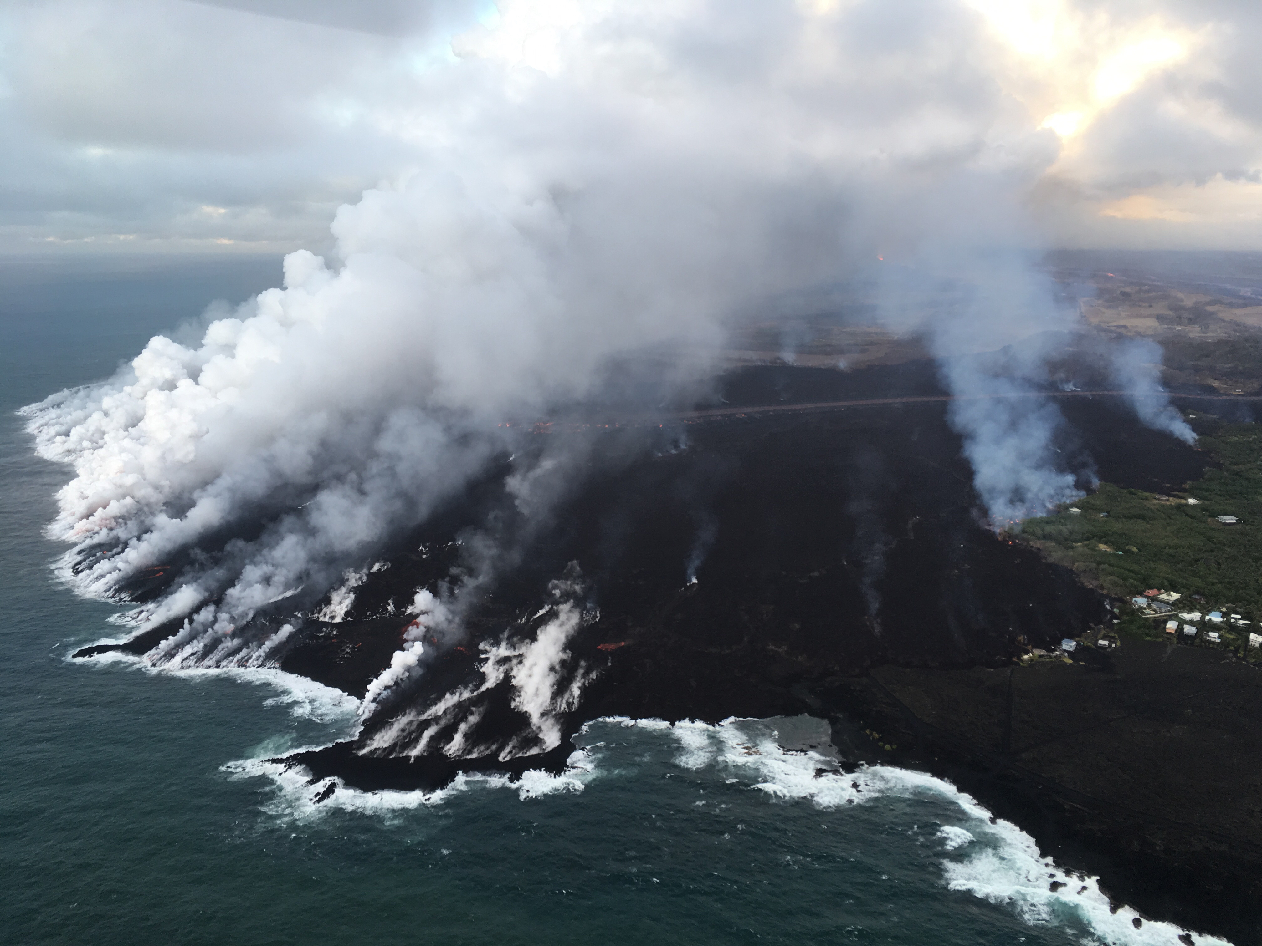
Lava continues to enter the sea along the southern Kapoho coastline. Lava enters the ocean primarily through an open channel, but also along a 1-km (0.6 mi) wide area. Also visible in the image (center right) is an area at the northern margin of the flow field that is oozing fresh lava at several points in the area of Kapoho Beach Lots.
Volcanic gas emissions remain very high from Fissure 8 eruptions. Continuing trade wind conditions are expected to bring VOG to the southern and western parts of the Island of Hawaii.
The ocean entry is a hazardous area. Venturing too close to an ocean entry on land or the ocean exposes you to flying debris from sudden explosive interaction between lava and water. Also, the lava delta is unstable because it is built on unconsolidated lava fragments and sand. This loose material can easily be eroded away by surf, causing the new land to become unsupported and slide into the sea. Additionally, the interaction of lava with the ocean creates « laze », a corrosive seawater plume laden with hydrochloric acid and fine volcanic particles that can irritate the skin, eyes, and lungs.
Kīlauea Volcano Summit
At 10:41 PM HST on June 26, after approximately 25 hours of elevated seismicity, a collapse explosion occurred at the summit producing an ash-poor steam plume that rose less than 1,000 ft above the ground surface (< 5000 ft above sea level) before drifting to the SW. The energy released by the event was equivalent to a magnitude 5.4 earthquake. Seismicity dropped abruptly from a high of 25-35 earthquakes per hour (many in the magnitude 2-3 range) prior to the collapse explosion down to 10 or fewer earthquakes per hour afterwards. Within 4 hours seismicity began to creep up again averaging about 25 earthquakes per hour by daybreak (June 27). Inward slumping of the rim and walls of Halemaʻumaʻu continues in response to ongoing subsidence at the summit.
Sulfur dioxide emissions from the volcano’s summit have dropped to levels that are about half those measured prior to the onset of the current episode of eruptive activity. This gas and minor amounts of ash are being transported downwind, with small bursts of ash and gas accompanying intermittent explosive activity.
Source : HVO
Photos : Bruce Omori , USGS , Ryan Finlay.
Great Sitkin , Alaska :
AVO/USGS Volcanic Activity Notice
Current Volcano Alert Level: NORMAL
Previous Volcano Alert Level: ADVISORY
Current Aviation Color Code: GREEN
Previous Aviation Color Code: YELLOW
Issued: Wednesday, June 27, 2018, 10:49 AM AKDT
Source: Alaska Volcano Observatory
Location: N 52 deg 4 min W 176 deg 6 min
Elevation: 5709 ft (1740 m)
Area: Aleutians
Volcanic Activity Summary:
Earthquake activity at Great Sitkin Volcano has declined gradually and no further indications of increasing unrest have been observed since AVO detected a brief steam and ash explosion on June 10. For the time being, the volcano has returned to normal background levels of activity and AVO is thus lowering the Aviation Color Code and Alert Level to GREEN/NORMAL.
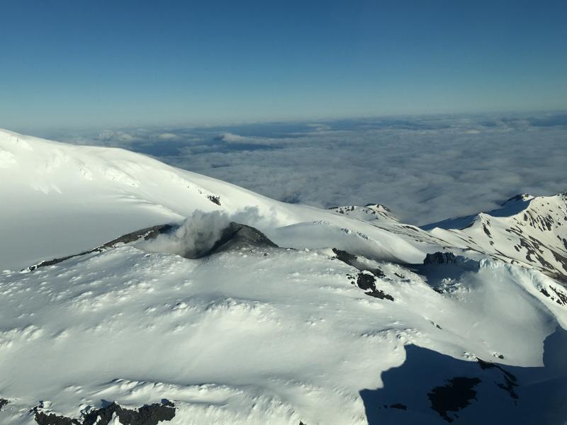
Minor steaming at the summit of Great Sitkin, June 17, 2018. Photo courtesy of Alaska Airlines Captain Dave Clum. A small ash deposit extends away from the vent, likely deposited during the June 10, 2018 explosion event.
Great Sitkin Volcano is monitored by a five-station seismic network on Great Sitkin Island and with additional seismic stations on the nearby islands of Igitkin, Adak, Kagalaska, and Kanaga. A six-element infrasound array to detect explosions (atmospheric pressure waves) was installed on Adak Island in June, 2017, although it is currently (June 2018) only partly operational. AVO also uses satellite imagery to monitor Great Sitkin Volcano.
Recent Observations:
[Volcanic cloud height] not applicable
[Other volcanic cloud information] Unknown
Remarks:
Great Sitkin Volcano is a basaltic andesite volcano that occupies most of the northern half of Great Sitkin Island, a member of the Andreanof Islands group in the central Aleutian Islands. It is located 43 km (26 miles) east of the community of Adak. Great Sitkin erupted at least three times in the 20th century, most recently in 1974. That eruption produced at least one ash cloud that likely exceeded an altitude of 25,000 ft above sea level. A poorly documented eruption occurred in 1945, also producing a lava dome that was partially destroyed in the 1974 eruption. A seismic swarm occurred from July 2016 through the end of 2017.
Source : AVO
Photo : Clum, Dave , 17 Juin 2018.
Nishinoshima , Japan :
27.247°N, 140.874°E
Elevation 25 m
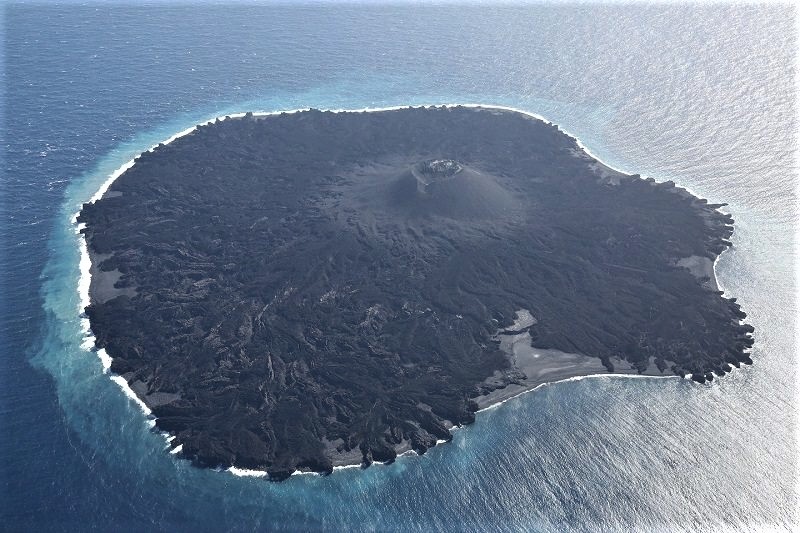
JMA reported that seismic, thermal, RADAR, and sulfur dioxide data all showed no eruptive activity at Nishinoshima since mid-August 2017. During an overflight on 14 June the Japan Coast Guard noted white fumarolic plumes rising about 20 m from the E side of main cone’s inner wall and from the center of the crater. Ocean water all around the island was discolored, especially in the N-to-NW quadrant where the yellowish brown water extended 200-300 m from the shore. On 20 June the JMA reduced the warning level for the island, specifying hazards were less severe “around the crater” (encompassing areas within 500 m).
Source: Agence météorologique japonaise (JMA)
Photo : Atlas Obscura
Kadovar , Papua New Guinea :
3.608°S, 144.588°E
Elevation 365 m
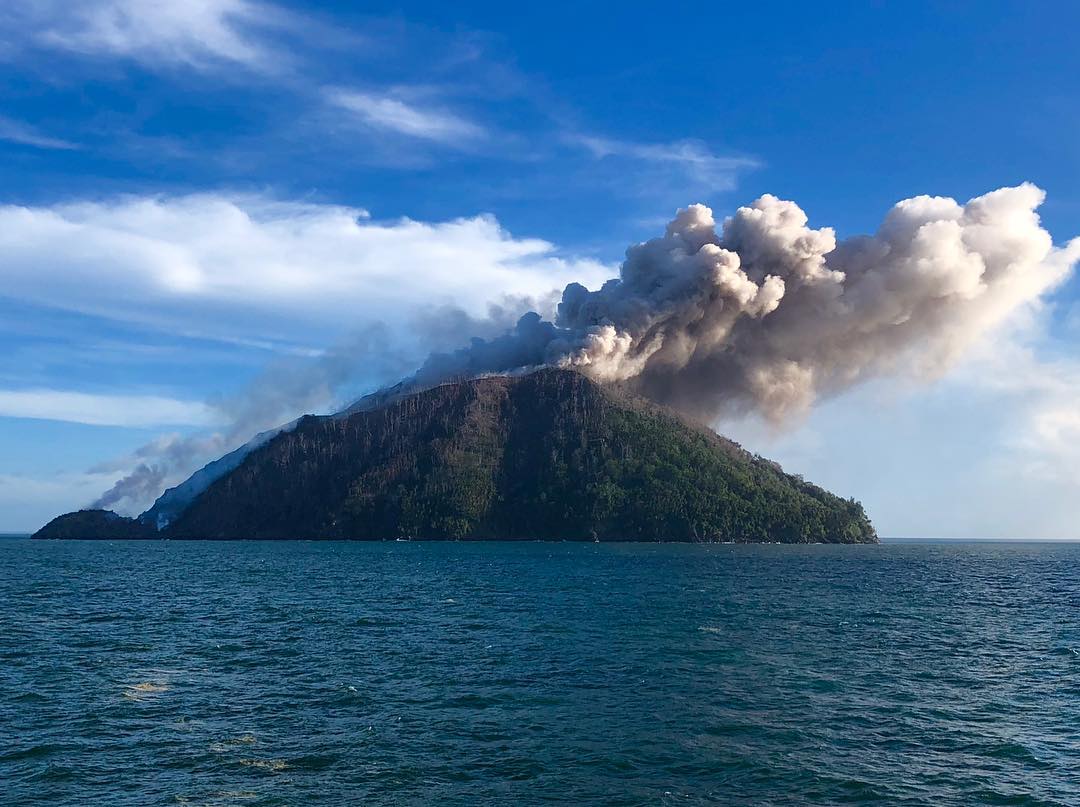
According to the Darwin VAAC an ash plume from Kadovar identified by a pilot and in satellite images rose to an altitude of 1.8 km (6,000 ft) a.s.l. on 20 June and drifted W.
Source : Darwin Volcanic Ash Advisory Center (VAAC) , GVP .
Photo : Shari Kalt