May 6 , 2018.
Pu‘u ‘Ō‘ō. / Kilauea , Hawai :
PUNA, BIG ISLAND .
A large, 6.9-magnitude quake jolted Hawaii Island on Friday afternoon, just an hour after another sizable quake, amid an ongoing eruption of Kilauea that’s triggered mandatory evacuations in Leilani Estates, sent lava spewing into streets and threatened homes.
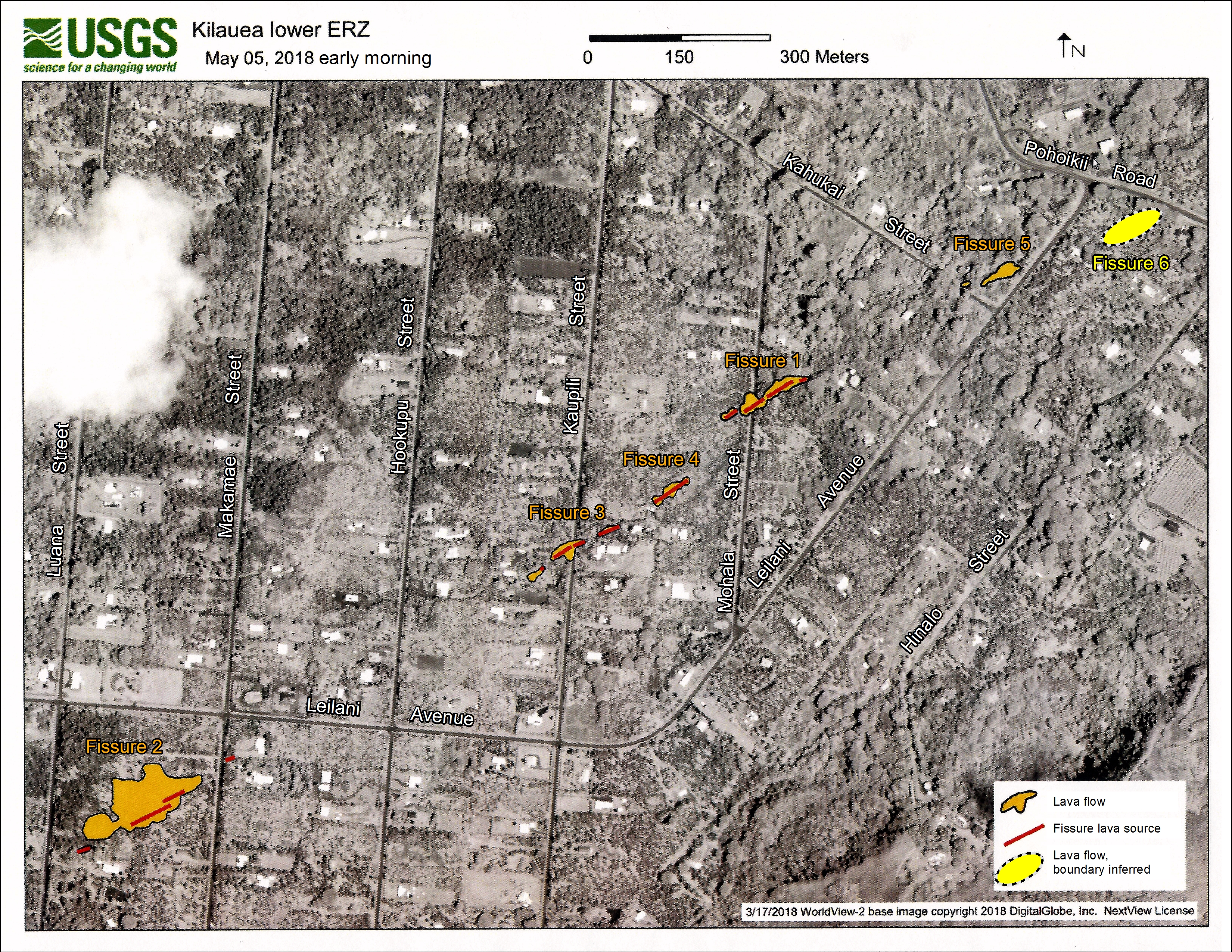
Six fissures — each several hundred yard longs — have been confirmed in the Puna subdivision, officials say.
The extent of the damage isn’t yet known, but officials did say at least two structures were significantly damaged and a number of roads have been covered in lava or severely cracked.

« Everything is still elevated, » said Talmadge Magno, administrator of Hawaii County Civil Defense. « It kind of gets you nervous. »
The 6.9-magnitude quake, which happened about 12:30 p.m., was the largest in Hawaii since 1975 and generated small tsunami waves around the Big Island. Hawaii County Civil Defense said sea fluctuations ranged from 8 inches in Hilo to 16 inches at Kapoho.
The temblor, centered on the south flank of Kilauea, was felt as far away as Oahu and triggered several landslides along the Hamakua Coast, including one that closed a lane for several hours.
After the quake, about 14,000 customers lost power in Kaumana, Hilo and Puna. Power has since been restored.
The temblor came about an hour after a 5.4 magnitude shook the Big Island on Friday morning, which was followed by a fifth eruption spewing lava into Leilani Estates. That quake was also centered near the south flank of Kilauea — about 18 kilometers southwest of Leilani Estates, the USGS reported.
The quakes added to an already busy day for the Big Island, which is now grappling with six separate fissures in Leilani Estates.
Hawaii County Civil Defense authorities said the situation in the subdivision continues to get more dangerous and have issued this ominous warning to households that choose not to heed mandatory orders to leave: « First responders may not be able to come to the aid of residents who refuse to evacuate. »
Big Island Mayor Harry Kim reiterated that warning Friday, but also sought to reassure residents, saying they could return to their homes as soon as the area was deemed safe
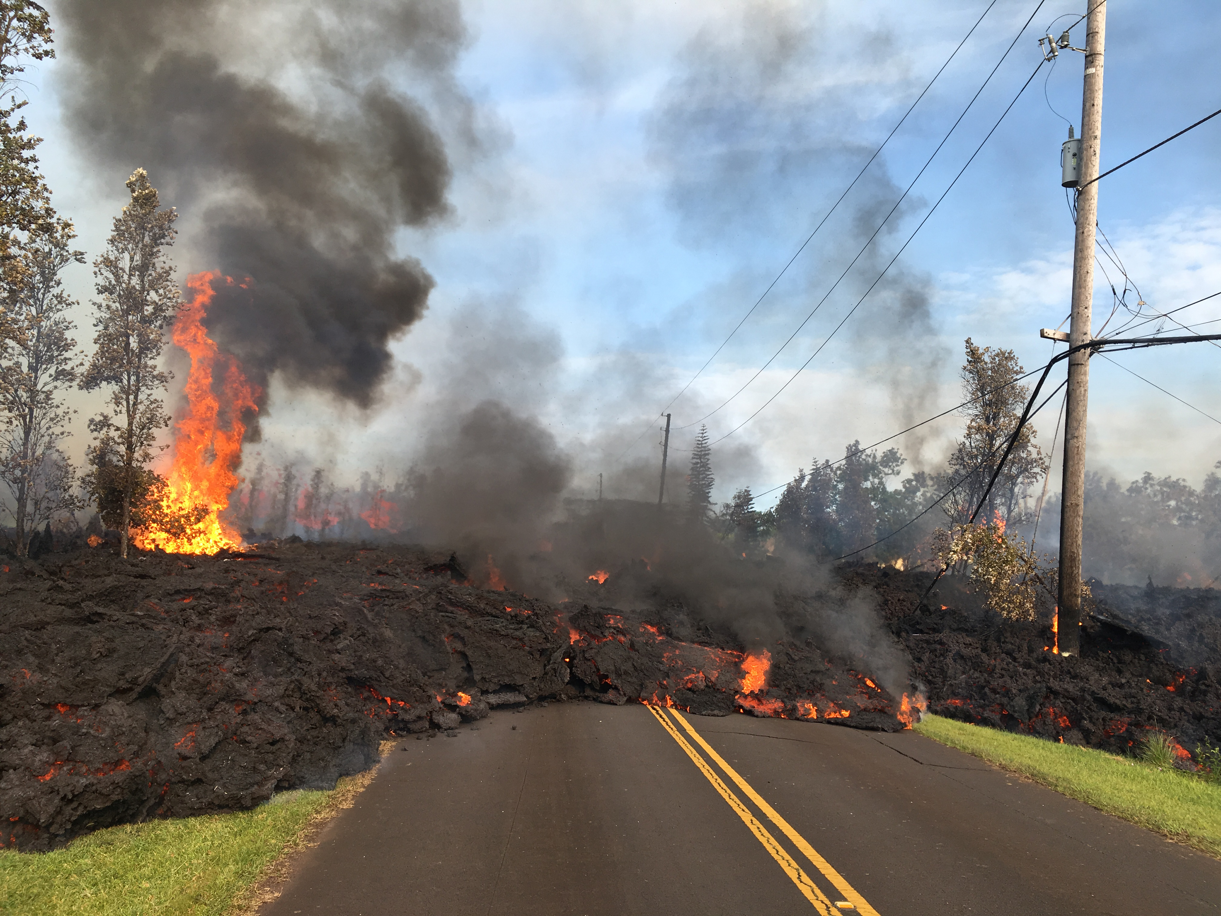
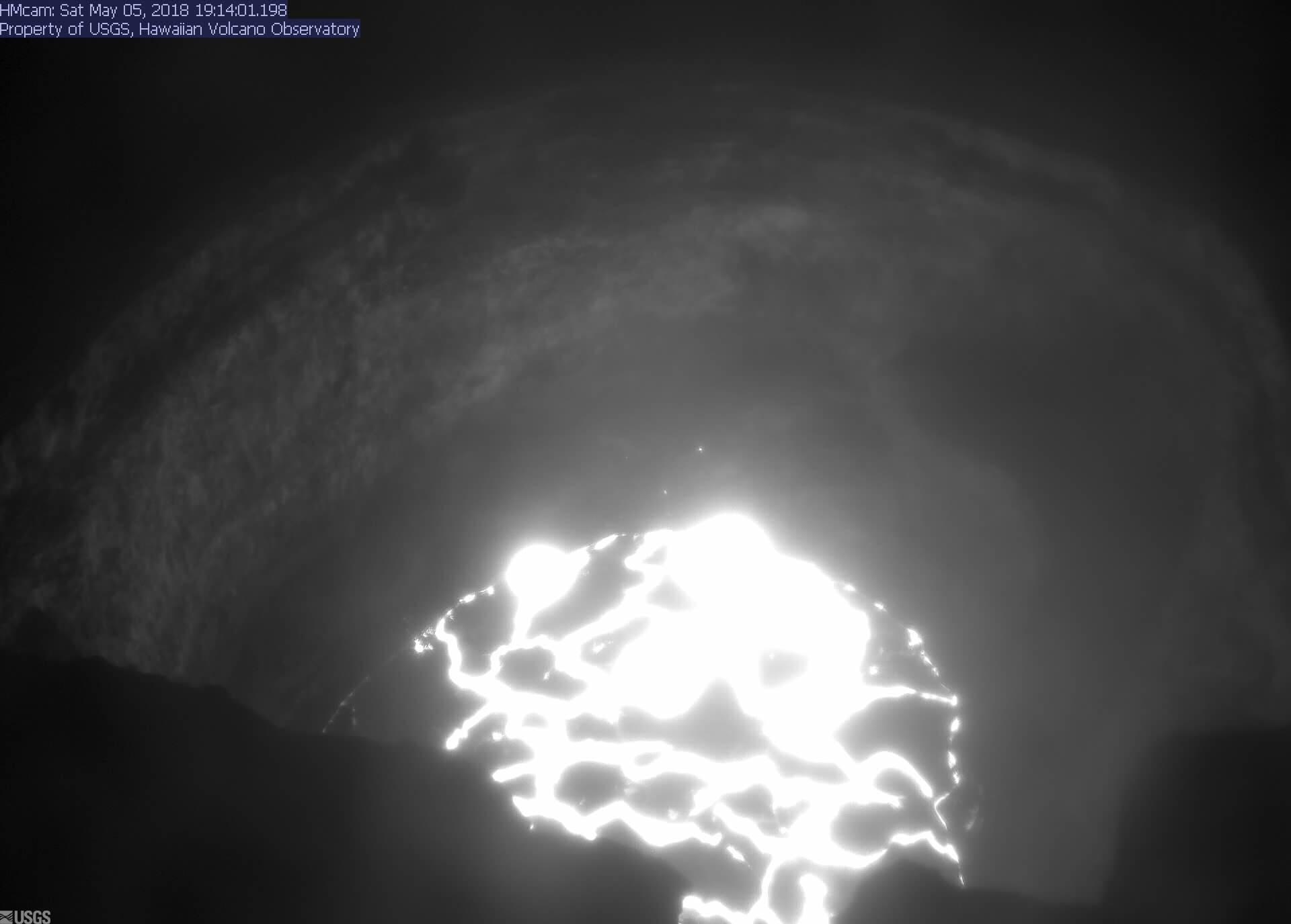
At 07:45 a.m. HST, today, lava from fissure 7 slowly advanced to the northeast on Hookapu Street in Leilani Estates subdivision on Kīlauea Volcano’s lower East Rift Zone.
19°25’16 » N 155°17’13 » W,
Summit Elevation 4091 ft (1247 m)
Current Volcano Alert Level: WARNING
Current Aviation Color Code: ORANGE
Summary:
Active eruption of lava and gas continues along Kīlauea Volcano’s lower East Rift Zone within the Leilani Estates subdivision. Additional fissure vents producing spatter and small lava flows developed early this morning, and additional outbreaks in the area are likely. Deflationary tilt at the summit of the volcano continues and the lava lake level continues to drop. There is no active lava in the Puʻu ʻŌʻō area. Aftershocks from yesterday’s M6.9 earthquake continue and more should be expected, with larger aftershocks potentially producing rockfalls and associated ash clouds above Puʻu ʻŌʻō and Halemaʻumaʻu Crater.
Residents of the Puna District should remain alert, review individual, family, and business emergency plans, and watch for further information about the status of the volcano.
Hawaii County Civil Defense messages regarding conditions, warning, and evacuations may be found at http://www.hawaiicounty.gov/active-alerts/.
Summit Observations:
Deflationary tilt at the summit continues. In concert, the summit lava lake is dropping. Tremor amplitude is fluctuating with lava lake spattering. No large rockfalls or ash plumes related to rockfalls into the lava lake, such as occurred yesterday during the large earthquake sequence, have occurred. Elevated summit sulfur dioxide emission rates persist. Gas emissions remain elevated. Current webcam views are here: https://volcanoes.usgs.gov/volcanoes/kilauea/multimedia_webcams.html
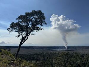
Puʻu ʻŌʻō Observations:
Seismicity remains elevated at Puʻu ʻŌʻō but tiltmeters near the cone show no significant deformation overnight. No lava is active in the area and the 61g lava flow is no longer being fed. The summit crater of the cone will likely continue to collapse intermittently producing small plumes of ash. Yesterday, there were several vigorous episodes of ash emission in response to collapse, including immediately after the nearby M6.9 earthquake.
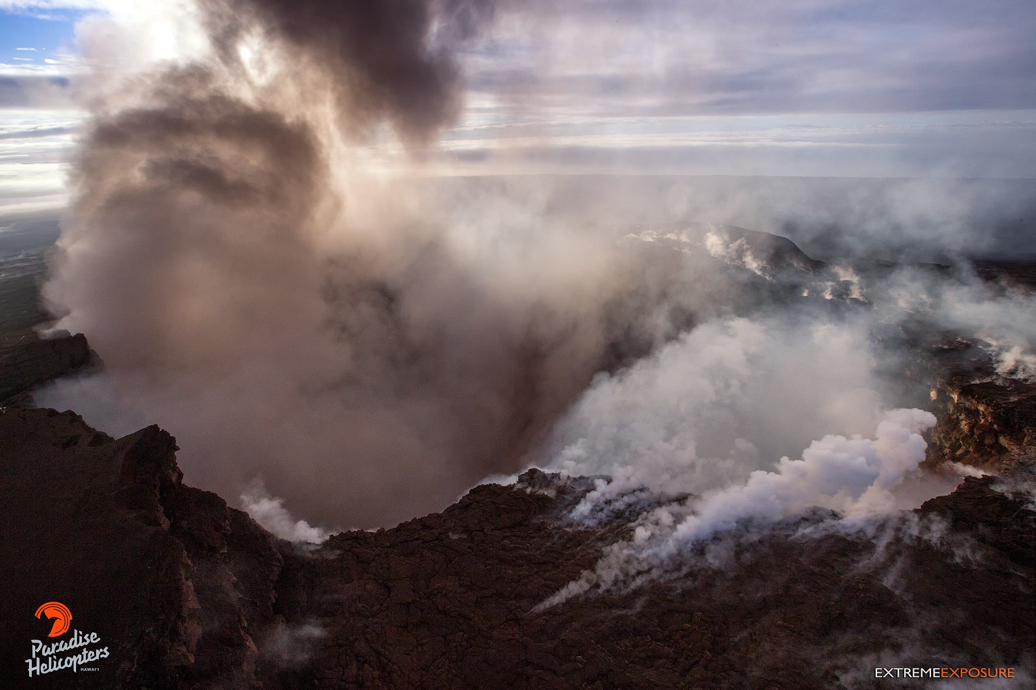
Pu‘u ‘O‘o and Kilauea’s east rift zone overflight: What was once a chamber filled to capacity with magma, is now an empty pit hundreds of feet deep. The notch on the right, covered with white gas, is where the west pit and its lava lake sat. Now, there’s no visible molten lava at all… Mind-blowing to comprehend that vast volume going somewhere in such a short period of time!
Hazard Analysis:
Additional fissure outbreaks producing spatter and lava flows are likely. Locations cannot be forecast with certainty, but new outbreaks thus far have been preceded by ground cracking, then strong steam and volcanic gas release. Areas uprift and downrift of the current fissure zone are the most likely to see further outbreaks.
Areas downslope of an erupting fissure or vent are at risk of lava inundation. Currently, lava flows from active fissures are sluggish and not moving very quickly or far. The general area of the Leilani subdivision remains at greatest risk. However, as the eruption progresses, other areas of the lower East Rift Zone may also be at risk.
High levels of volcanic gas including sulphur dioxide are being emitted from the fissure vents. In addition, smoke from burning houses and burning asphalt is a health concern and should be avoided.
As the lava lake level inside Halemaʻumaʻu drops, rockfalls from the enclosing walls may increase in frequency prompting explosions of spatter from the lake onto the nearby crater rim and lofting plumes of ash. Dustings of ash from these events can occur downwind. Yesterday’s strong earthquakes were responsible for some of these plumes and associated ashfall, both from Kīlauea Volcano’s summit lava lake and the Puʻu ʻŌʻō vent.
Additional aftershocks from yesterday’s M6.9 earthquake are expected and some may be strong.
Source : HawaiiNewsNow , HVO.
Photo : Mick Kalber/Tropical Visions Video, Bruce Omori ,
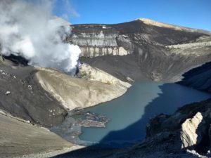
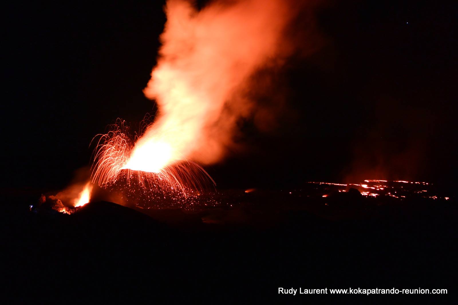
Piton de la Fournaise , La Réunion :
Activity Bulletin from Saturday, May 5, 2018 at 3:00 pm (local time).
The eruption started on April 27, 2018 at 23:50 local time continues. The intensity of the volcanic tremor has dropped significantly since 24 hours (Figure 1).
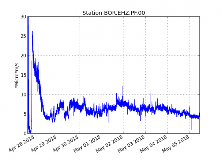
Figure 1: Evolution of the RSAM (Indicator of Volcanism and Intensity of Eruption) between 20:00 (16:00 UTC) April 27 and 15:00 (11:00 UTC) May 5 at the BOR seismic station (at the top). (© OVPF / IPGP)
An overflight of the eruptive site realized this morning by the OVPF indicates at 10:30 (local time) an activity mainly in lava tunnel. Two arms of lava were visible downstream of the main tunnel rooted at the central vent (Figure 2), which is the only one to regularly project lava projections.
The flow front has not progressed in recent days.
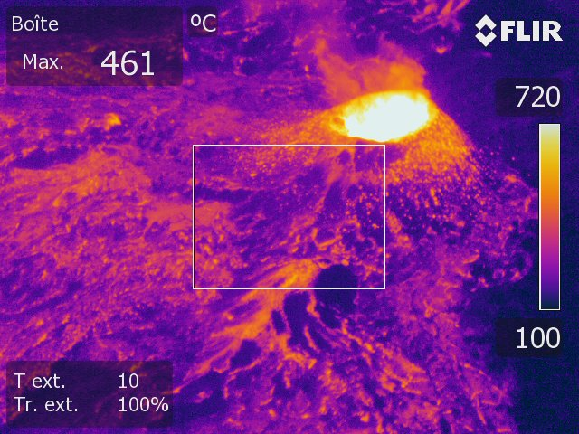
Figure 2: Thermal image of the eruptive site on May 04 (16:30 local time). (© OVPF / IPGP)
– The surface flows estimated from the satellite data, via the HOTVOLC platform (OPGC – Clermont Ferrand), recorded today were between 1 and 2.5 m3 / s.
– A very slight deflation (deflation) of the volcano is always recorded on the OVPF deformation sensors. This means that the volume of magma coming out of the reservoir to feed the eruption is greater than the volume of magma that replenishes it.
– No volcano-tectonic earthquake has been recorded in the last 24 hours under the Piton de la Fournaise building.
Alert level: Alert 2-2 – Eruption in the Enclos.
Source : OVPF
Photo : Tunnels de lave, Randonnées & Trekkings à la Réunion – Kokapat Rando
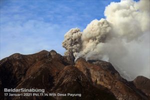
Cleveland , Alaska :
AVO/USGS Volcanic Activity Notice
Current Volcano Alert Level: WATCH
Current Aviation Color Code: ORANGE
Issued: Friday, May 4, 2018, 11:12 PM AKDT
Source: Alaska Volcano Observatory
Notice Number:
Location: N 52 deg 49 min W 169 deg 56 min
Elevation: 5676 ft (1730 m)
Area: Aleutians
Volcanic Activity Summary:
Local seismic and infrasound sensors recorded a small explosion tonight at 05:49 UTC (21:49 local time). A few small earthquakes were also recorded at the volcano during the previous several days.
Satellite data show that the recent explosion of Cleveland volcano at 05:49 UTC (21:49 local time) produced a small ash cloud up to 22,000 ft asl moving southeast. No other significant activity has been detected.
Explosions from Cleveland typically produce relatively small volcanic ash clouds that dissipate within hours; however, more significant ash emissions are possible.
Cleveland volcano is monitored with a limited real-time seismic network, which inhibits AVO’s ability to detect precursory unrest that may lead to an explosive eruption. Rapid detection of an ash-producing eruption may be possible using a combination of seismic, infrasound, lightning, and satellite data.
Recent Observations:
[Volcanic cloud height] 22,000 ft asl
[Other volcanic cloud information] Ash seen in satellite imagery. Cloud drifting southeast
Hazard Analysis:
[Ash cloud] 22,000 ft asl
Source : AVO
Photo : Lyons, John , 25 Juillet 2016 6:30 .
San Miguel ( Chapparastique ) , El Salvador :
Special Report No. 5
The seismic vibration of the Chaparrastic volcano remains weak.
Date and time of publication: 04 May 2018, 13:00:00
Over the last seven days, the seismic vibration of the San Miguel volcano has remained fluctuating between 39 and 61 RSAM units mean time, when the normal is 150. That is, low, indicating a loosening of the system (Figure 1 ).
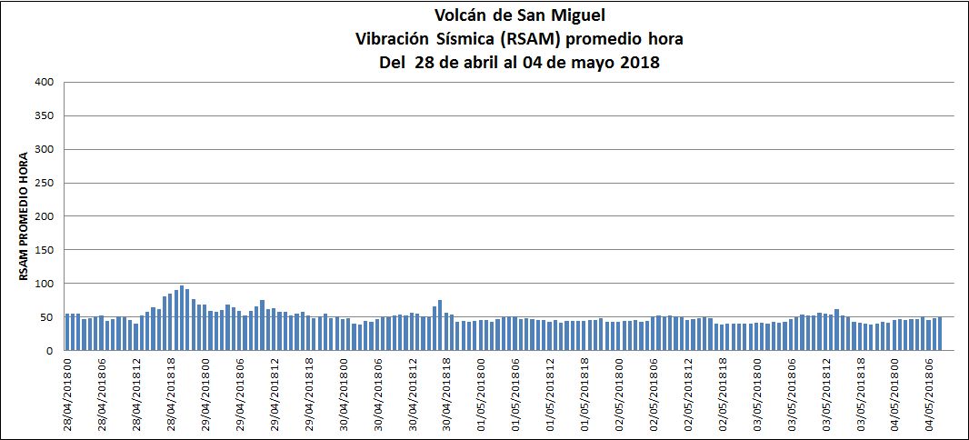
Figure 1. The seismic vibration of the volcano remains less than 100 units.
Figure 2 shows the seismic record of the San Miguel volcano station, the last four days has exhibited low seismic activity.
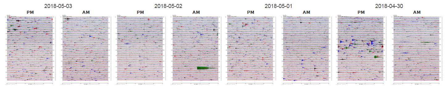
Figure 2. The seismograms of the San Miguel volcano station indicate that it remains stable.
The volcano was surrounded by meteorological clouds and no pulse or gas plume was observed (Figure 3). Nor is there any report of changes in volcano activity by the network of local observers. The active state of the volcano and the type of seismicity indicate that it will continue to show sudden changes in its behavior.
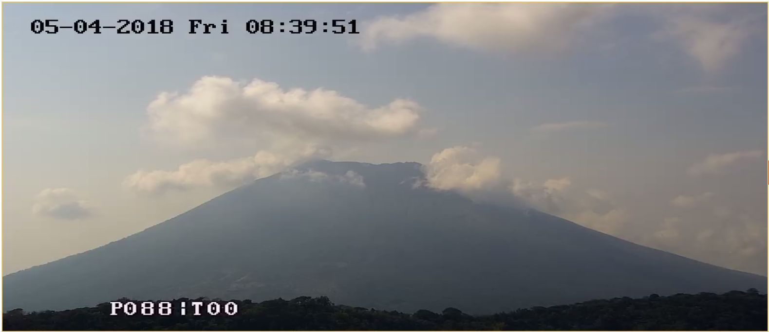
Figure 3. View of the volcano with the web camera located on the Pacayal volcano at 8:39.
The behavior described above indicates that the magmatic fluids moving in the internal ducts of the volcano have come down considerably, but it is not excluded that in the coming weeks or months there will be changes in their activity.
The Ministry of Environment and Natural Resources (MARN) continues the systematic monitoring of the volcano and maintains close communication with the Directorate General of Civil Protection and the Network of Local Observers.
In addition, he calls on the population to stay away from the top of the volcano, as abrupt changes in behavior often occur and can cause physical damage.
Source : Snet El Salvador