March 28 , 2018.
Chiles / Cerro Negro , Colombia :
Subject: Activity bulletin of Chiles and Cerro Negro volcanoes.
The level of activity of volcanoes is maintained at the level:
YELLOW LEVEL ■ (III): CHANGES IN THE CONDUCT OF VOLCANIC ACTIVITY.
On monitoring the activity of Chiles and Cerro Negro volcanoes, the Geological Survey of Colombia (CGT) reports that:
For the period between March 20 and 27, 2018, a significant increase in seismic activity compared to the previous week was recorded, reaching a total of about 1,550 earthquakes by March 24. The recorded seismicity was mainly associated with rock fracturing.
It highlights the presence of reported earthquakes as felt mainly by the inhabitants of the community of Chiles – municipality of Cumbal. The earthquakes were located south and southeast of the cone of Chiles volcano, at distances up to 10 km and depths that reached 10 km from the summit (4700 m). The maximum intensity of these earthquakes was of a local magnitude of M 3.7 on the Richter scale and as indicated in the special bulletin of March 21, the earthquake was reported as felt in the municipalities of Cumbal , Túquerres, Pupiales and Ipiales.
The Colombian Geological Survey and the National Institute of Geophysics of the Polytechnic School of Ecuador closely monitor the evolution of this seismic and volcanic activity and report without delay on the changes detected.
Source : SGC
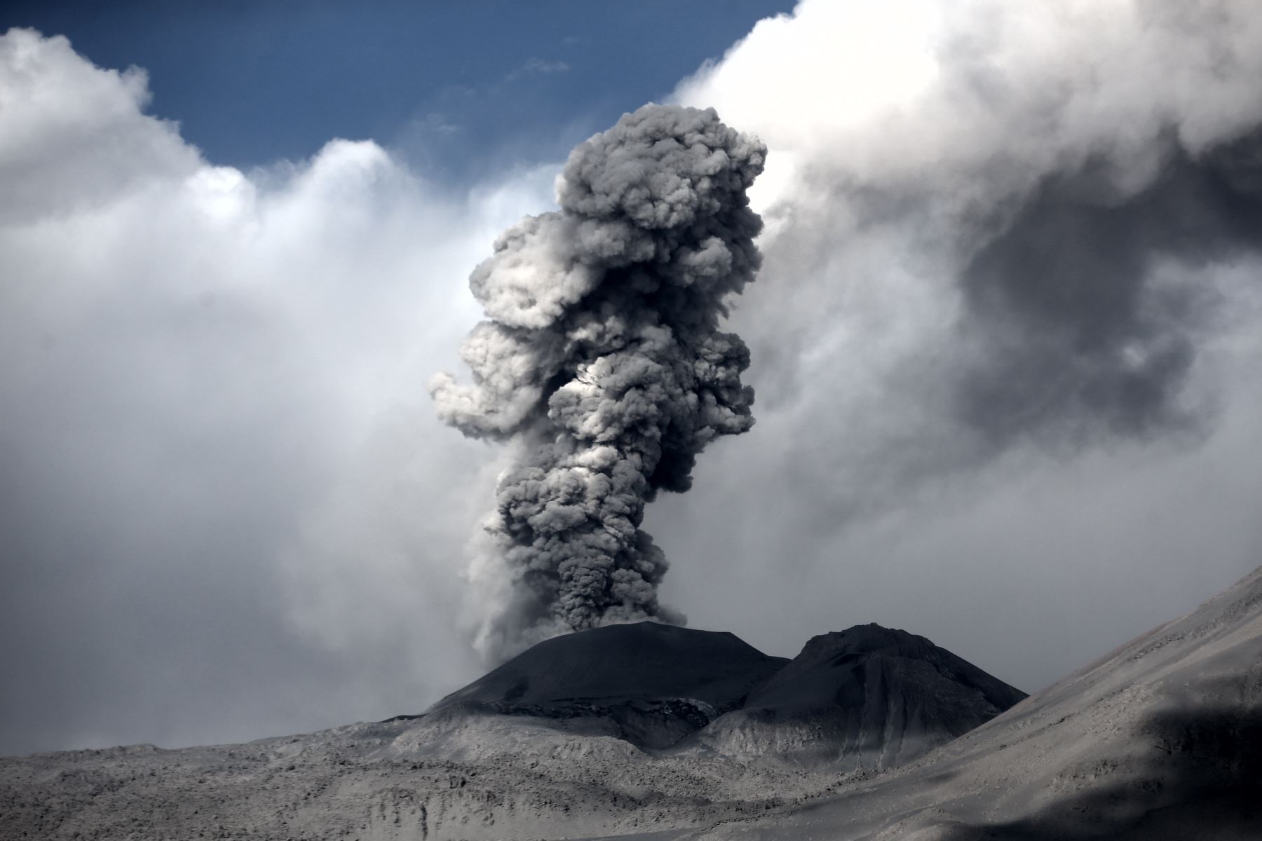
Sabancaya , Peru :
The ash that was emitted this morning by the Sabancaya volcano, located in Arequipa, after recording an explosion, was dispersed mainly in the northwest direction, affecting the cities of Huambo, Cabanaconde, Pinchollo, Maca and Tapay, said the Geophysical Institute of Peru. .
The event occurred at 08:53 and the ash cloud reached 3,500 meters above the crater.
The scattering radius of the ash was greater than 30 kilometers around the Sabancaya volcano.
Recommendations:
IGP experts point out that volcanic ash can cause environmental problems and affect people’s health. Therefore, it is recommended to protect your eyes by using lenses and airways with masks.
It also advises competent authorities and institutions to carry out a permanent assessment of the impact of ashes on water, soil, air and human health.
Source : IGP/ Andina.pe
Ebeko , Kuril Islands , Russia :
VOLCANO OBSERVATORY NOTICE FOR AVIATION (VONA).
Issued: March 27, 2018.
Volcano: Ebeko (CAVW # 290380)
Current Aviation Color Code: ORANGE
Previous aviation color code: orange
Source: KVERT
Number of reviews: 2018-32
Location of the volcano: N 50 deg 41 min E 156 deg 0 min
Region: North Kuril Islands, Russia
Summit: 3791.68 ft (1156 m)
Summary of volcanic activity:
According to the video data, the explosions sent ash up to an altitude of 2.0 km. The ash plume drifts to the north-northeast of the volcano.
Moderate gas-vapor activity with a certain amount of ash continues on the volcano. Ash explosion up to 16,400 feet (5 km) could occur at any time. The ongoing activity could affect low-flying aircraft and Severo-Kurilsk airport.
Height of volcanic clouds:
6550 ft (2000 m) AMSL. Time and method for determining ash plume / cloud height: 20180327 / 2128Z – Video data
Other information about volcanic clouds:
Distance from ash plume / volcano cloud: 5 km
Direction of drift of ash plume / volcano cloud: NNE
Time and method for ash cloud / plume determination: 20180327 / 2128Z – Video data.
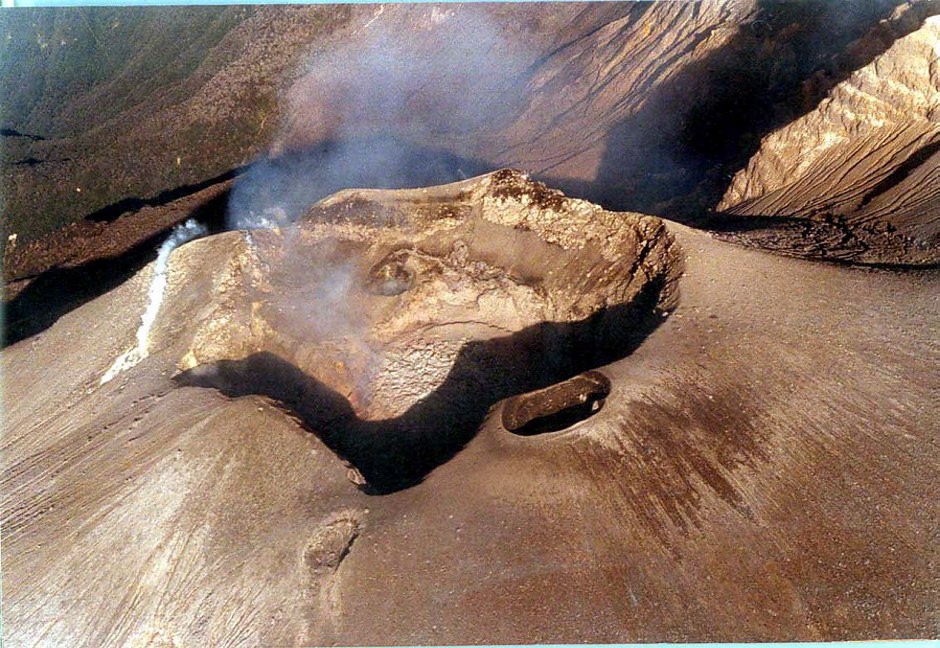
Active crater of Ebeko, August 2012 (Photo: Sergej Lyachovets).
Ebeko is one of the most active volcanoes on the Kuril Islands, located north of Paramushir Island, south of Kamchatka.
The Ebeko volcano has a flat top with 3 summit craters aligned SSW-NNE. The eastern part of the South crater contains a large boiling source. The middle crater has a hot lake with solfataras along its shore. The lower north crater has a small cold lake and is separated from the middle crater by a narrow ridge.
The historical activity has been recorded since the late 18th century and consisted of explosive eruptions, small to moderate summit craters. Strong fumarolic activity occurs in the Ebeko summit craters and on the outer sides of the cone, as well as in the lateral craters of explosion.
Source : Kvert, vulcanologia esia.
Photo: Sergej Lyachovets
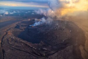
Pu’u ‘Ō’ō , Hawaï :
A small lava flow was observed this weekend in the main crater of Pu’u ‘Ō’ō, while the cone inclinometer, in the eastern zone of Kīlauea volcano, continues to record the « strong surge of inflation. « which started on March 12th.
According to the USGS Hawaiian Volcano Observatory, March 26:
Continuous recording of GPS stations on Pu`u `O`o has also begun recording the extension across the cone on that date. Last night, lava flowed from one of the long-term incandescent sources in the crater of Pu’u’Ō’ō on the bottom of the crater. Views from the webcam have shown splashing in the West Pit Lava Basin in recent days. This is probably due to the ground subsidence observed over the last two months, followed by the recent rise in the level of the lava pond surface, coinciding with the recent inflationary tilt.
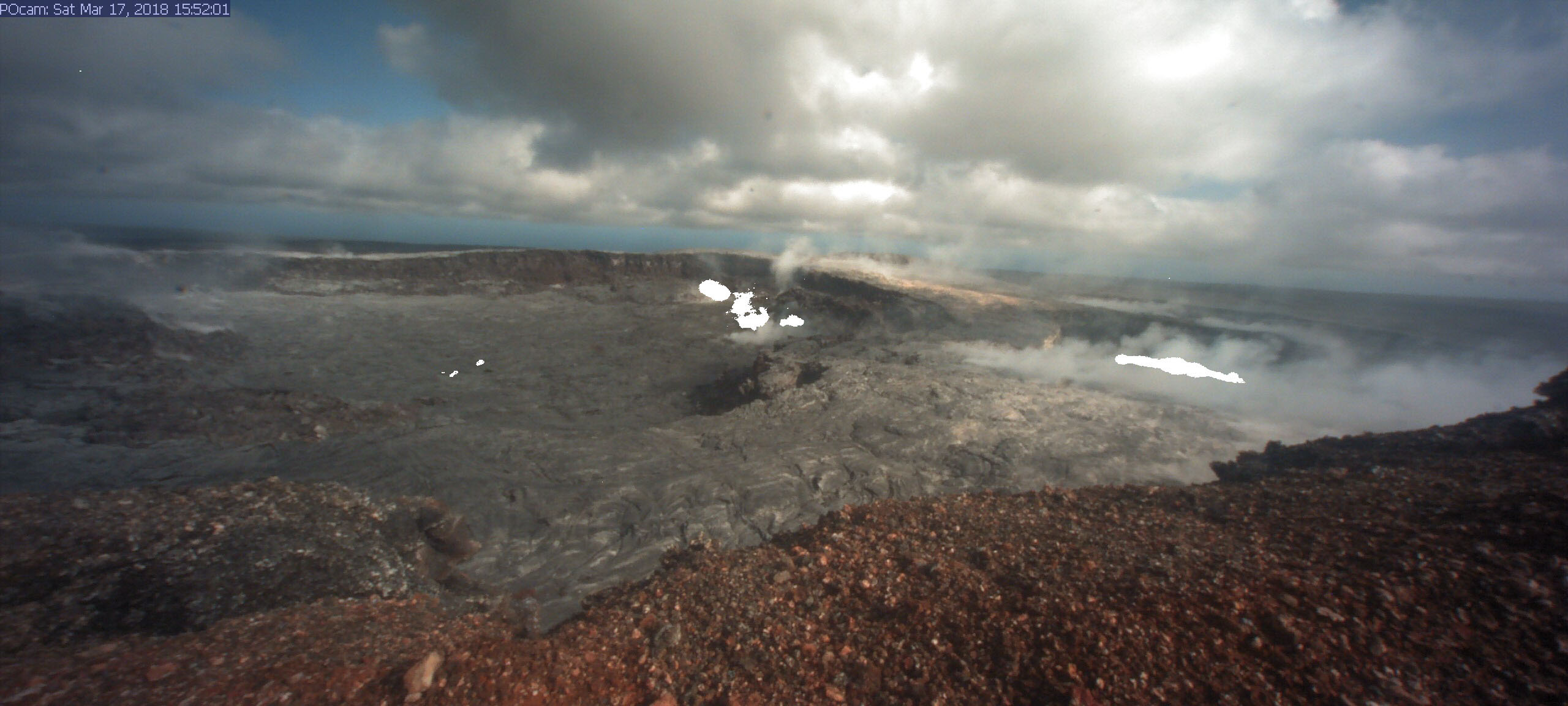
This photo of the HVO (POcam) webcam’s Pu’u ‘Ō’ō of March 17 is a composite image (several webcam images captured during the night) in which active lava areas appear bright white. Since March 22, spatter has been observed intermittently from the lava pond in the west trench (right). In the main crater of Pu’u ‘Ō’ō (left), a small lava flow began to sink on the floor of the crater last night and remains active this afternoon (March 26).
On March 25, between 10:06 and 22:08, scientists say that a small lava flow began to flow on the floor of Pu’u’ŌŌ crater for the first time since May 2016. This type of activity is not unusual for Pu ‘u’ Ō’ō, say scientists, and does not reflect a significant change in the current eruption.
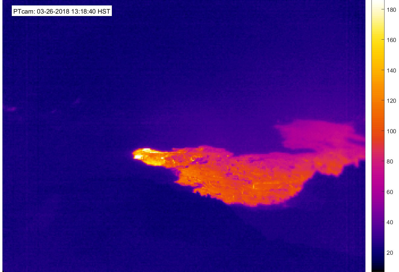
In the March 26th thermal image, the USGS states that « the flow (bright color) seems to be fed by one of the small cones of projections in the southern indentation of the crater. The lava flow did not extend beyond the crater. «
Scientists say that the sulfur dioxide emission rate from the East Rift Zone vents has been stable over the last few months and remains significantly below the peak emission rate.
Source : Bigisland vidéo news.