March 11 , 2018.
Shinmoedake , Japan :
TOKYO (Jiji Press) — The Japan Meteorological Agency expanded on Saturday its warning area from 3 kilometers to 4 kilometers from the crater of Shinmoedake, after explosive eruptions.
The agency said large ash deposits reached as far as 1.8 kilometers from the crater after an explosive eruption in the small hours of Saturday.
The volcanic alert for Shinmoedake was kept at Level 3, which restricts entry to the volcano, part of the Kirishima mountain range straddling Miyazaki and Kagoshima prefectures.
The agency warned of the possible arrival of large ash deposits within 4 kilometers of the crater and pyroclastic flows within 2 kilometers.
The explosive eruption occurred at 1:54 a.m., with volcanic smoke reaching as high as 4,500 meters from the crater, the agency said.
After another eruption at 4:27 a.m., ash deposits also reached a point 1.8 kilometers from the crater.
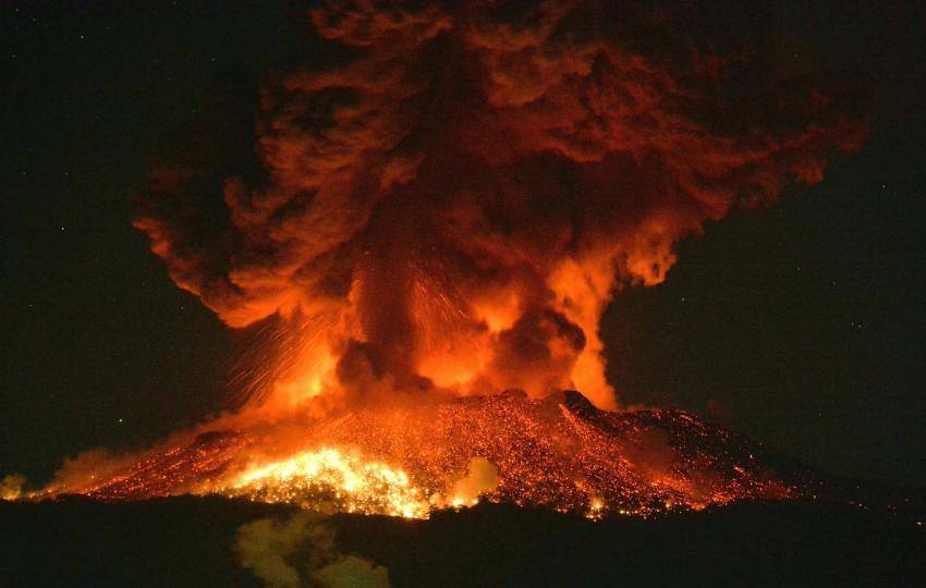
IMAGE: Explosive eruptions continue at Mt Shinmoe early Saturday morning
Warning area expanded as Mt Shimmoe continues powerful éruptions.
10 MARCH 2018. Powerful eruptions continued at Mt. Shimmoe in southwestern Japan on Saturday, with the weather agency expanding the area possibly affected by flying rocks.
Two explosive eruptions were observed at around 1:55 a.m. and 4:25 a.m. at the 1,421-meter high volcano straddling Kagoshima and Miyazaki prefectures, the Japan Meteorological Agency said.
Huge rocks flew about 1.8 kilometers from the crater, with ash spewed up to 4,500 meters above it, the highest since the recent series of eruptions started on March 1, according to the agency.
While continuing to restrict access to the mountain, the agency expanded the area possibly affected by large flying rocks to 4 km from the crater, up from 3 km.
Source : Japan news , Japan today.
Photo: KYODO
Kilauea , Hawai :
19°25’16 » N 155°17’13 » W,
Summit Elevation 4091 ft (1247 m)
Current Volcano Alert Level: WATCH
Current Aviation Color Code: ORANGE
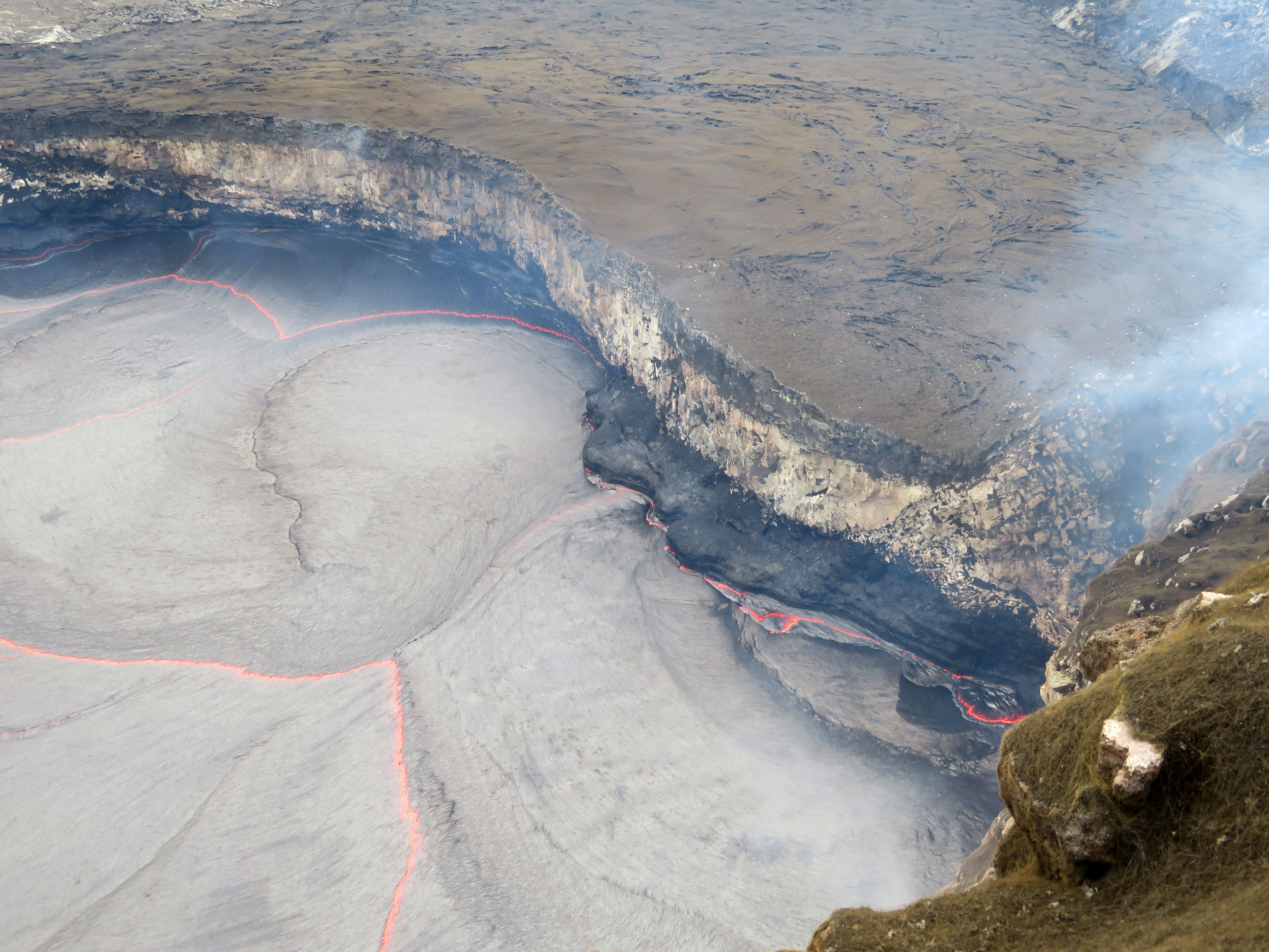
Another ledge along the eastern margin has been building out from the vent wall, showing the recent high lava lake level mark (new black lava).
Activity Summary:
Eruptions at Kīlauea Volcano’s summit and East Rift Zone continue with no significant changes. The Episode 61g lava flow continues to produce surface flows on the upper portion of the flow field and on Pulama pali. Lava is not entering the ocean at this time. These lava flows pose no threat to nearby communities. The summit lava lake was 33 m (108 ft) below the floor of Halemaʻumaʻu when measured yesterday morning. Low rates of ground deformation and seismicity continue across the volcano.
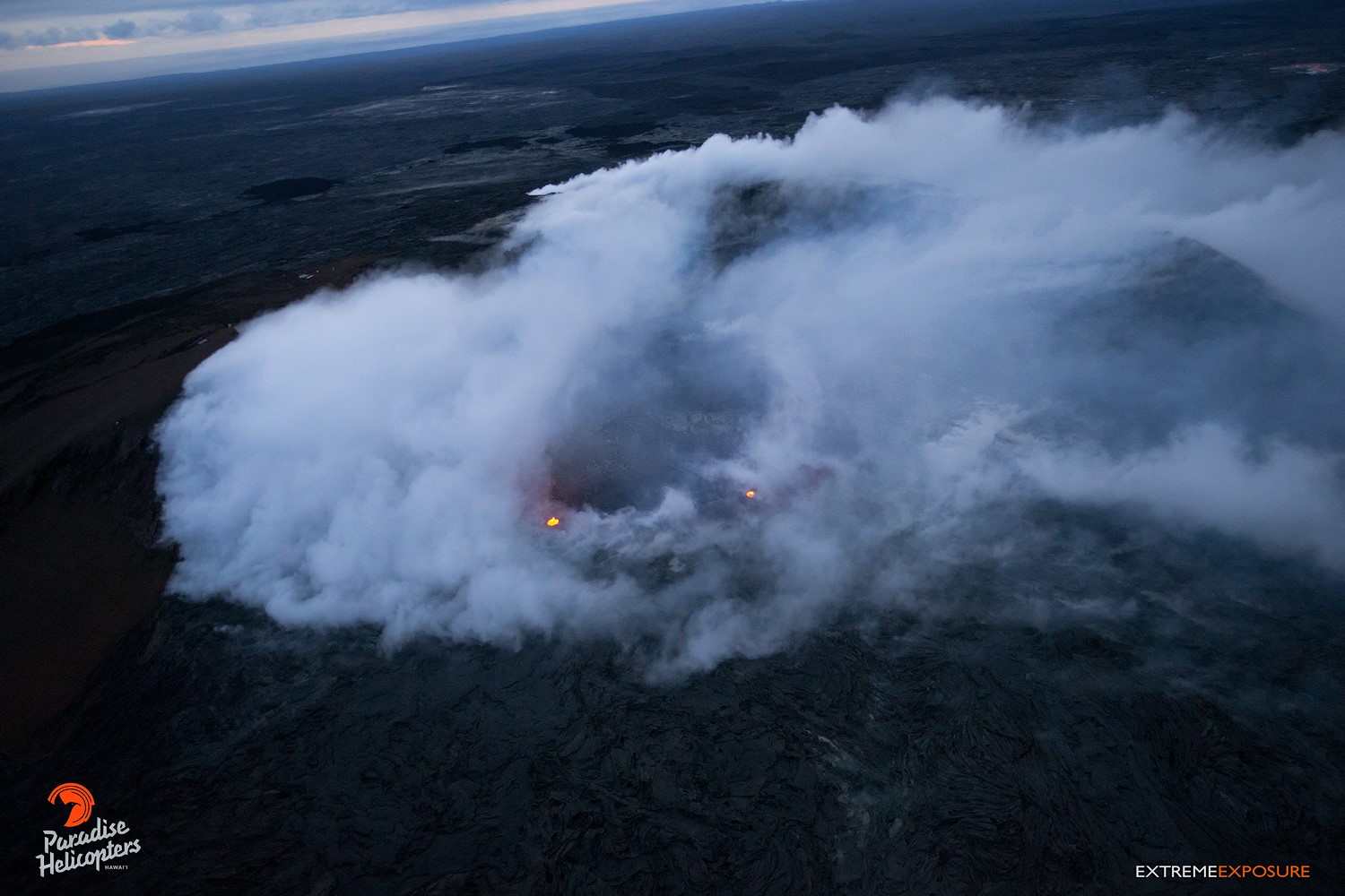
A couple of glowing spots of activity within Pu‘u ‘O‘o’s crater greeted us, but thick gases blowing over prevented us from getting too much closer for better shots.
Summit Observations:
Summit tiltmeters have record inflationary tilt since yesterday afternoon, consistent with the inflation phase of a summit DI event. The height of the summit lava lake was 33 m (108 ft) below the rim of the Overlook crater when measured yesterday morning. Seismicity near the summit is within normal, background rates, with tremor fluctuations associated with lava lake spattering. Summit sulfur dioxide emission rates remain high.
Puʻu ʻŌʻō Observations:
Available webcam images over the past 24 hours show persistent glow at long-term sources within the crater and from a small lava pond on the west side of the crater. A small amount of inflationary tilt was recorded over the past day. The sulfur dioxide emission rate from the East Rift Zone vents has been steady over the past several months and remains significantly lower than the summit emission rate.
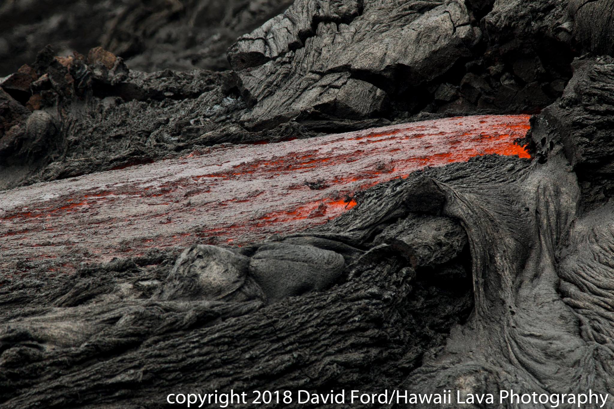
Lava Flow Observations:
The episode 61g flow is still active, but no lava is flowing into the ocean. Webcams show continuing surface flow activity on the upper portion of the flow field and on Pulama pali. None of these flows poses any threat to nearby communities at this time.
Source : HVO
Photos : HVO , Bruce Omori , David Ford.
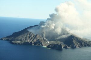
Mayon , Philippines :
MAYON VOLCANO BULLETIN 11 March 2018 08:00 A.M.
Mayon’s activity in the past 24 hours was characterized by degassing, weak lava fountaining and lava flow from the summit crater. Twelve (12) obscured lava fountaining events between 12:35 PM and 9:48 PM yesterday lasting four (4) to twenty (20) minutes were seismically recorded. Degassing events generated white to gray ash plumes that rose 300 to 2500 meters above the summit before drifting southwest. These events were accompanied by rumbling sounds audible within 10 kilometers of the summit crater. At night, lava flows were observed to continue moving downslope within 3.3 kilometers, 4.5 kilometers and 1.9 kilometers from the crater on the Miisi, Bonga and Basud Gullies, respectively.
A total of one hundred eighty-six (186) volcanic earthquakes and seventeen (17) rockfall events were recorded by Mayon’s seismic monitoring network. Sulfur dioxide (SO2) emission was measured at an average of 2,060 tonnes/day on 08 March 2018. Deflation of the lower flanks that began on 20 February is still being recorded by electronic tilt, although a period of slight inflation of has been recorded by Precise Levelling (PL) surveys this past week. Overall ground deformation data indicate that the edifice is still swollen or inflated relative to pre-eruption baselines.
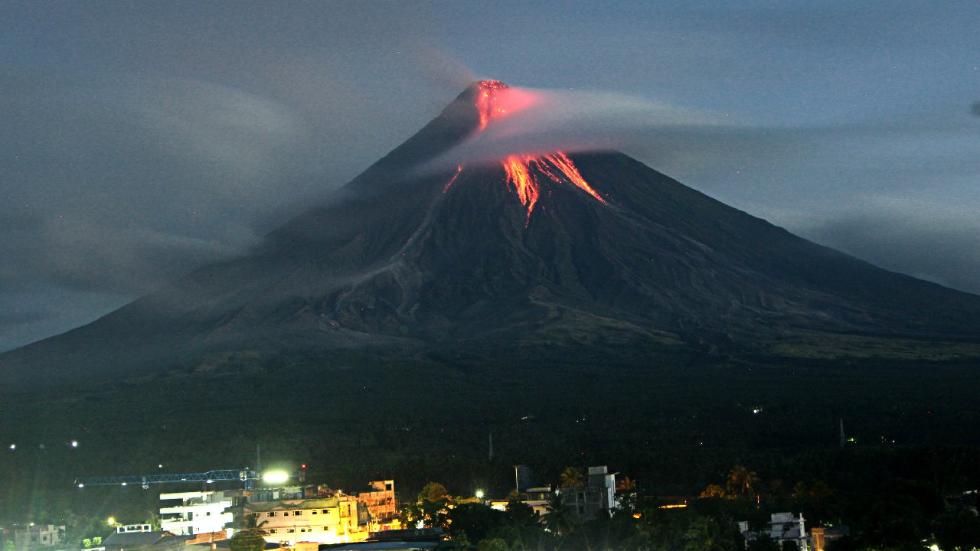
Alert Level 3 currently prevails over Mayon Volcano. This means that although Mayon’s unrest continues, there is a decreased likelihood of hazardous explosive eruption to occur. PHIVOLCS-DOST reminds the public of sudden explosions, lava collapses, pyroclastic density currents or PDCs and ashfall can still occur and threaten areas in the upper to middle slopes of Mayon. PHIVOLCS-DOST recommends that entry into the six kilometer-radius Permanent Danger Zone or PDZ and a precautionary seven kilometer-radius Extended Danger Zone or EDZ in the south-southwest to east-northeast sector, stretching from Anoling, Camalig to Sta. Misericordia, Sto. Domingo, must be strictly prohibited. People residing close to these danger areas are also advised to observe precautions associated with rockfalls, PDCs and ashfall. Active river channels and those perennially identified as lahar prone areas in the southern and eastern sectors should also be avoided especially during bad weather conditions or when there is heavy and prolonged rainfall. Civil aviation authorities must advise pilots to avoid flying close to the volcano’s summit as airborne ash and ballistic fragments from sudden explosions and PDCs may pose hazards to aircrafts.
PHIVOLCS-DOST is closely monitoring Mayon Volcano’s activity and any new significant development will be immediately communicated to all stakeholders.
Source : Phivolcs
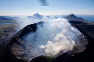
Agung , Indonesia :
VOLCANO OBSERVATORY NOTICE FOR AVIATION – VONA.
Issued: March 10 , 2018.
Volcano: Agung (264020)
Current Aviation Colour Code: YELLOW
Previous Aviation Colour Code: orange
Source: Agung Volcano Observatory
Notice Number: 2018AGU16
Volcano Location: S 08 deg 20 min 31 sec E 115 deg 30 min 29 sec
Area: Bali, Indonesia
Summit Elevation: 10054 FT (3142 M)
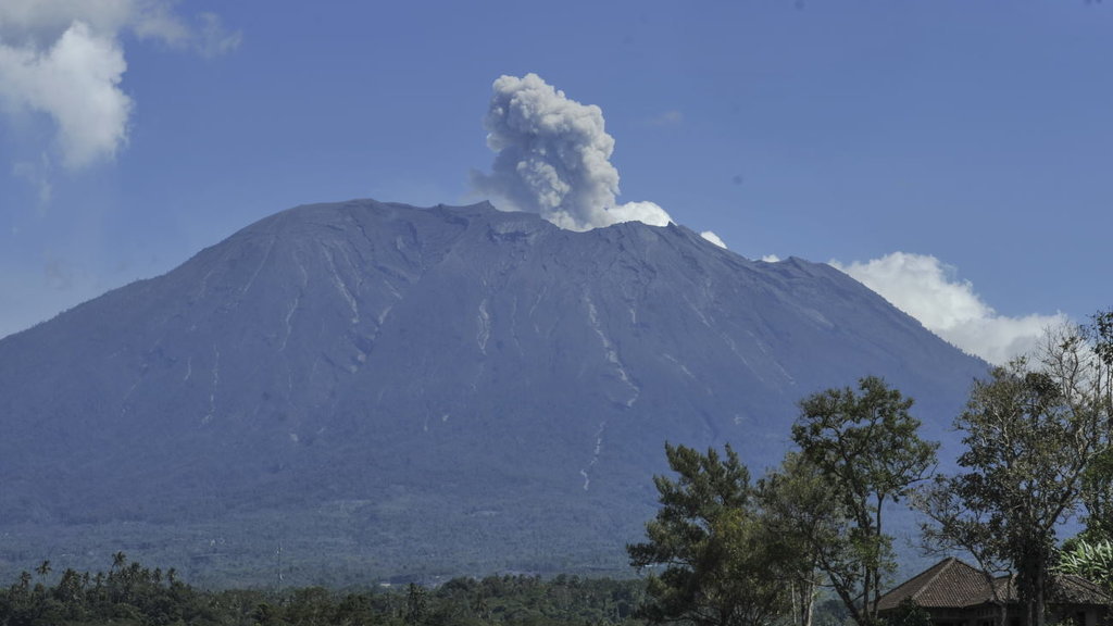
Volcanic Activity Summary:
In the past week, occasionally white steam plume can be observed with a maximum height of about 600 m above the summit crater.
Volcanic Cloud Height:
Ash cloud not visible.
Other Volcanic Cloud Information:
Wind is moving East and West
Remarks:
Seismic activity is dominated by low-frequency earthquakes related to steam and gas emission on the crater. Some high-frequency volcanic earthquakes are still recorded, indicating that magma movement inside the volcano remains active, however with low intensity.
Source : Magma
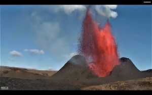
Pacaya , Guatemala :
Type of activity: Strombolian.
Morphology: Composite Stratovolcan
Location: 14 ° 22’50˝ Latitude N; 90 ° 36’00˝ Longitude W.
Height: 2,552msnm.
Weather conditions: Clear
Wind: South
Precipitation: 0.0 mm.

Activity:
Low white and blue fumaroles are found 500 m above the crater and disperse to the south. There are Strombolian explosions that raise incandescent materials at an approximate height of 5 to 25 meters above the crater, there is a lava flow that is approximately 50 to 150 meters to the east, on the slopes of the volcano.
Source : Insivumeh.
Photo : R. Villeda