March 10 , 2018.
Shinmoedake , Japan :
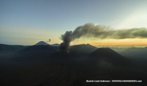
The volcano in southwestern Japan resumed erupting on Friday afternoon after it had stopped for half a day.
The Meteorological Agency says Mt. Shinmoe, which straddles Kagoshima and Miyazaki prefectures, erupted shortly before 4PM on Friday. Eruptions had stopped early in the morning.
Plumes of smoke reached 3,200 meters, the highest since the eruptions began on March 1st. Large pieces of rock sailed 800 meters from the crater.
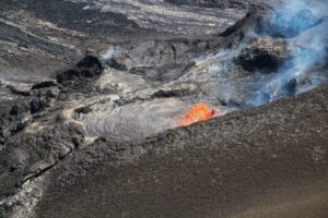
Agency officials said there was a lava flow on the slope northwest of the crater.
They say people don’t need to evacuate at this time because no homes or tourist facilities are on the slope and the lava is flowing slowly.
The agency is keeping the volcanic alert level at 3, on the scale of 1 to 5. This means people should stay away from the mountain.
A flow of lava has been confirmed at Mount Shinmoe in south Kyushu, following a series of eruptions starting earlier this month, the Japan Meteorological Agency (JMA) said on March 9.
At around 10:10 a.m. on March 9, a worker from the National Institute of Advanced Industrial Science and Technology involved in an on-site inspection informed the JMA that lava could be seen flowing from the northwest section of the mountain’s crater. The agency later confirmed a lava flow, and is investigating its range.
The JMA had announced on the same day that eruptions of the volcano, which straddles Miyazaki and Kagoshima prefectures, had stopped at 1:45 a.m., but it seems that lava built up inside the crater subsequently spilled over.
The agency has kept its volcanic alert at level 3 — restricted entry to the volcano — and people are being urged to watch out for large ash deposits within 3 kilometers of the crater, as well as pyroclastic flows across a range of 2 kilometers.
Meanwhile, the Geospatial Information Authority of Japan announced on March 9 that analysis of satellite images indicated a circular landform change within the volcano’s crater had expanded in size.
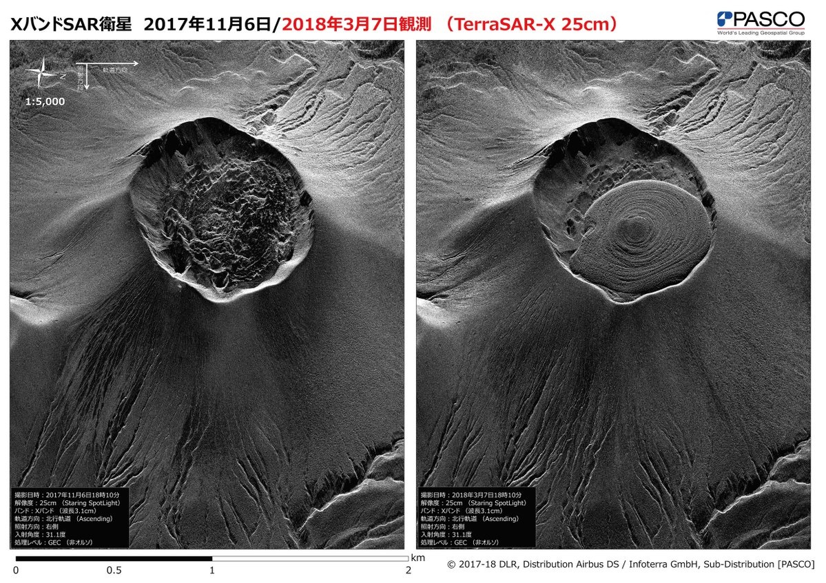
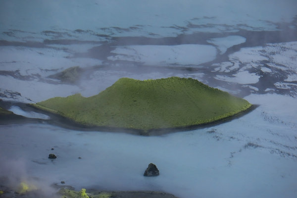
The crater of Shinmoedake and the « lava cake » – on the left, 06.11.2017 – on the right, 07.03.2018 – doc.PASCO
The geomorphic change now measures around 650 meters in diameter, up from about 550 meters on March 7. An expert has pointed out that this is a lava dome.
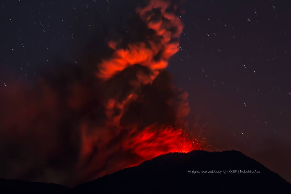
The first of the most recent eruptions at the volcano occurred on March 1. This was followed on March 6 by the first explosive eruptions in seven years. In total, there were 34 explosive eruptions up until March 7.
Source : 3.nhk.or.jp ,Mainichi.jp.
Photo : Art photo AYA , via Sherine France.
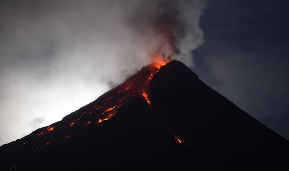
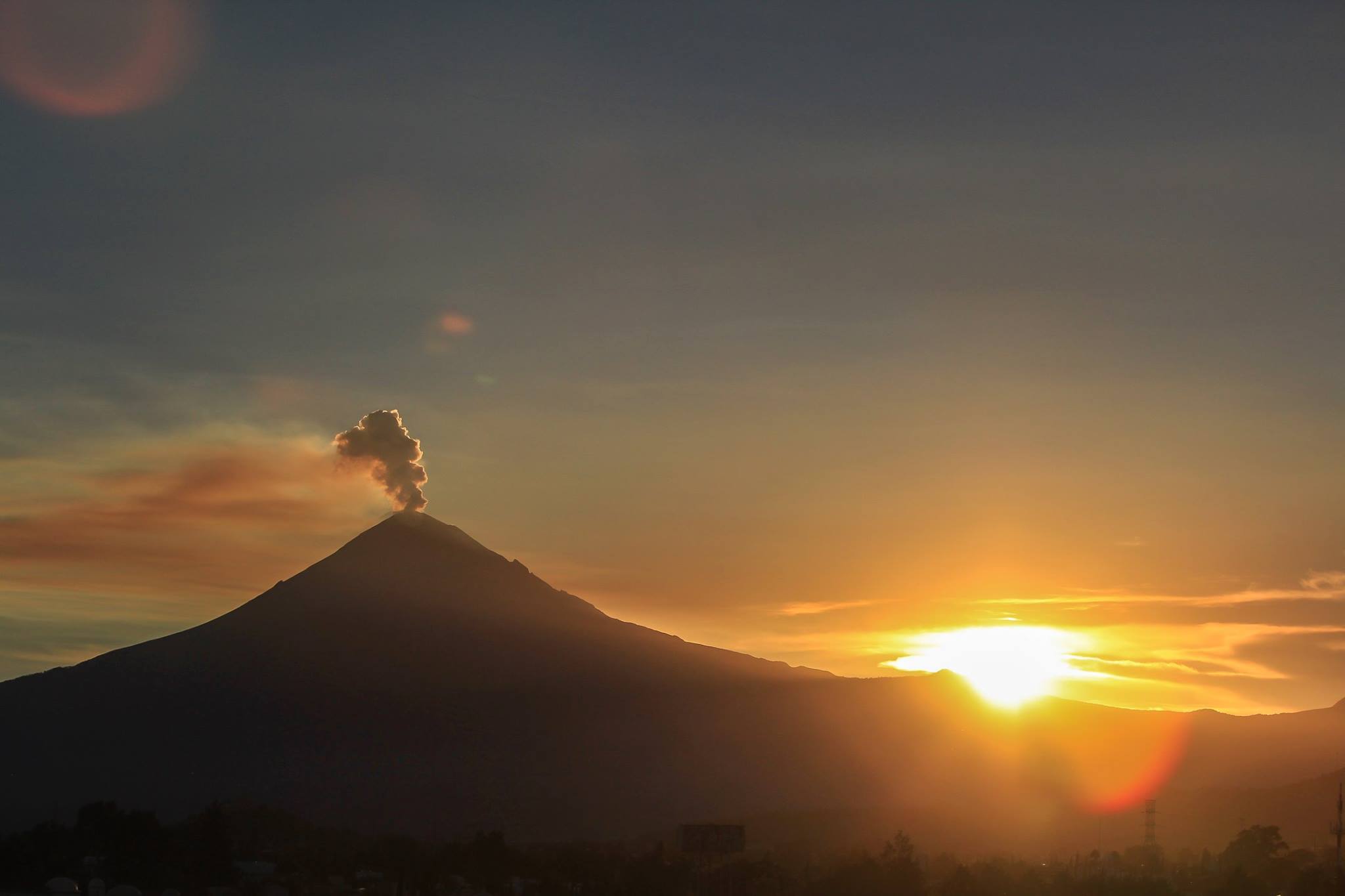
Mayon , Philippines :
MAYON VOLCANO BULLETIN 09 March 2018 08:00 A.M.
Mayon’s activity in the past 24 hours was characterized by lava fountaining, lava flow and degassing from the summit crater. Seven (7) lava fountaining events from 07:19 AM yesterday to 06:00 AM today, generated ash plumes that rose 300 meters above the summit crater before drifting southwest. These were accompanied by rumbling sounds audible beyond 10 kilometers of the summit crater. At night, lava flows were observed to continue moving downslope within 3.3 kilometers, 4.5 kilometers and 1.9 kilometers from the crater on the Miisi, Bonga and Basud Gullies, respectively.
A total of one hundred eighty seven (187) volcanic earthquakes and thirty one (31) rockfall events were recorded by Mayon’s seismic monitoring network. Sulfur dioxide (SO2) emission was measured at an average of 2,060 tonnes/day on 08 March 2018. Deflation of the lower slopes that began on 20 February is still being recorded by electronic tilt and by Precise Levelling (PL) surveys. Nonetheless, overall ground deformation data indicate that the edifice is still swollen or inflated relative to pre-eruption baselines.
Alert Level 3 currently prevails over Mayon Volcano. This means that although Mayon’s unrest continues, there is a decreased likelihood of hazardous explosive eruption occurring. PHIVOLCS-DOST reminds the public of sudden explosions, lava collapses, pyroclastic density currents or PDCs and ashfall can still occur and threaten areas in the upper to middle slopes of Mayon. PHIVOLCS-DOST recommends that entry into the six kilometer-radius Permanent Danger Zone or PDZ and a precautionary seven kilometer-radius Extended Danger Zone or EDZ in the south-southwest to east-northeast sector, stretching from Anoling, Camalig to Sta. Misericordia, Sto. Domingo, must be strictly prohibited. People residing close to these danger areas are also advised to observe precautions associated with rockfalls, PDCs and ashfall. Active river channels and those perennially identified as lahar prone areas in the southern and eastern sectors should also be avoided especially during bad weather conditions or when there is heavy and prolonged rainfall. Civil aviation authorities must advise pilots to avoid flying close to the volcano’s summit as airborne ash and ballistic fragments from sudden explosions and PDCs may pose hazards to aircrafts.
PHIVOLCS-DOST is closely monitoring Mayon Volcano’s activity .
MAYON VOLCANO BULLETIN 10 March 2018 08:00 A.M.
Mayon’s activity in the past 24 hours was characterized by general quiescence, gravity-driven lava flow and degassing from the summit crater. Moderate emission of white steam-laden plumes that rose 2,500 meters above the summit crater before drifting southwest was observed early this morning at 5:30 AM. At night, lava flows were observed to continue moving downslope within 3.3 kilometers, 4.5 kilometers and 1.9 kilometers from the crater on the Miisi, Bonga and Basud Gullies, respectively.
A total of eighteen (18) volcanic earthquakes and nineteen (19) rockfall events were recorded by Mayon’s seismic monitoring network. Sulfur dioxide (SO2) emission was measured at an average of 2,060 tonnes/day on 08 March 2018.
Source : Phivolcs.
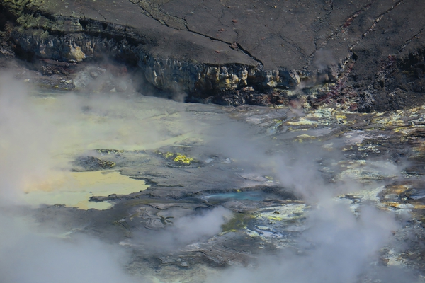
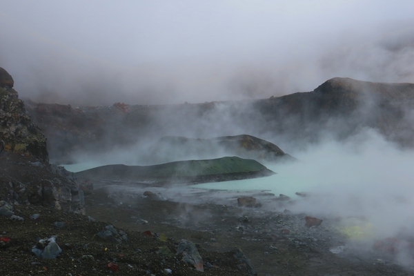
Poas , Costa Rica :
The crater lake of Poas volcano has dried up.
March 9, 2018. The hot lagoon of Poás volcano has disappeared and dried up in the last 12 days. Experts attribute this to a decrease in rainfall and an increase in the temperature of the crater floor.
As of March 5, only small puddles persisted. In addition, it became clear that gas production has increased. These changes were not expected. They were first seen by specialists on February 18th.
On Monday, March 5th, there were only small puddles left and it was very obvious that gas production was increasing. Raul Mora Pictures
This is considered a natural event based on a decrease in the water supply of the volcano’s hydrothermal system. This has already happened before and is not considered a source of concern.
The Poás volcano surprised the volcanologists with a new change. Now, in the space of 12 days, the hot water lagoon has dried up.
The transformation began to be seen by specialists on February 18 and Monday, March 5, they verified that there were only small puddles of water.
Raul Mora Amador, a State University volcanologist (UNED), said the change is due to reduced rainfall in the area where the volcano is located, increased heat from the crater and a drop in water supply. hydrothermal system of the volcano.
The expert warned that this does not mean a risk of an immediate eruption, because the seismicity, according to the reports of the National Seismological Network (RSN) and the National Observatory seismological and volcanological (OVSICORI), is very low.
Mora, who Monday was on the volcano, added that the small amount of liquid could facilitate the release of gases emitted by the volcano and this would lead to respiratory problems for people who perceive them directly.
On February 18, the lake and the pyroclastic cone formed in 2017 were observed. The sulfur-filled wall (yellow-green) can also be seen, and it seems that the lake level is starting to drop. Photo of Raul Mora
« The behavior is normal for an active volcano.The lake before its eruption (in April 2017) had a depth of 50 meters and dried up in June.The park guards see January 8 (this year) small puddles of water and on January 20 the lagoon could be seen again, it could reach 10 to 15 meters deep.
« The lagoon we had before had a diameter of about 300 meters, the one that was formed now was bigger, it had a shape of eight and only one of these parts could be 300 meters in diameter, » explains Mora.
On January 23, the lagoon was well formed, in which a sulfur cone was protruding. This cone was destroyed by the dynamics of the lake. We also see sulfur floating in the water. Photo of Raúl Mora.
It was not the first time that the hot water lagoon, inside the crater, is drying up.
The first time this happened, and a report of which is given, took place in 1953. Ten years later, in 1963, the formation of a small puddle was discussed, and it was not until 1965 that the lake was formed.
In April 1989, it dried up and recovered in May of the same year. The same thing happened in 1994. From then on, there were occasions when the volume of water had dropped, but it did not completely dry.
Source : COSTARICAN TIMES NEWS , nacion.com .
Photos : Raul Mora Amador,
Popocatépetl , Mexico :
March 09, 11:00 am (March 09, 17:00 GMT)
In the last 24 hours, thanks to the surveillance systems of the Popocatépetl volcano, 305 low intensity exhalations accompanied by water vapor and gas have been identified.
During the night, an incandescence was observed on the crater at the time of some exhalations.
From today, this morning until the moment of this report, the crater of the volcano has not been observed continuously, because of cloud conditions.
CENAPRED urges not to approach the volcano and especially the crater, because of the danger of falling ballistic fragments, and in case of heavy rains to move away from the bottom of the ravines because of the risk of landslides and flows mud.
The volcanic warning light of the Popocatepetl volcano is located at Amarillo Phase 2.
Source : Cenapred