January 8 , 2026.
Italy / Sicily , Etna :
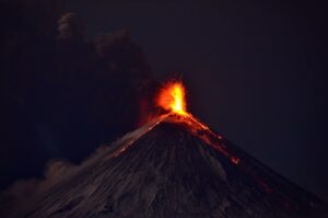
Etna Activity Update, January 6, 2026, 1:07 PM (12:07 UTC).
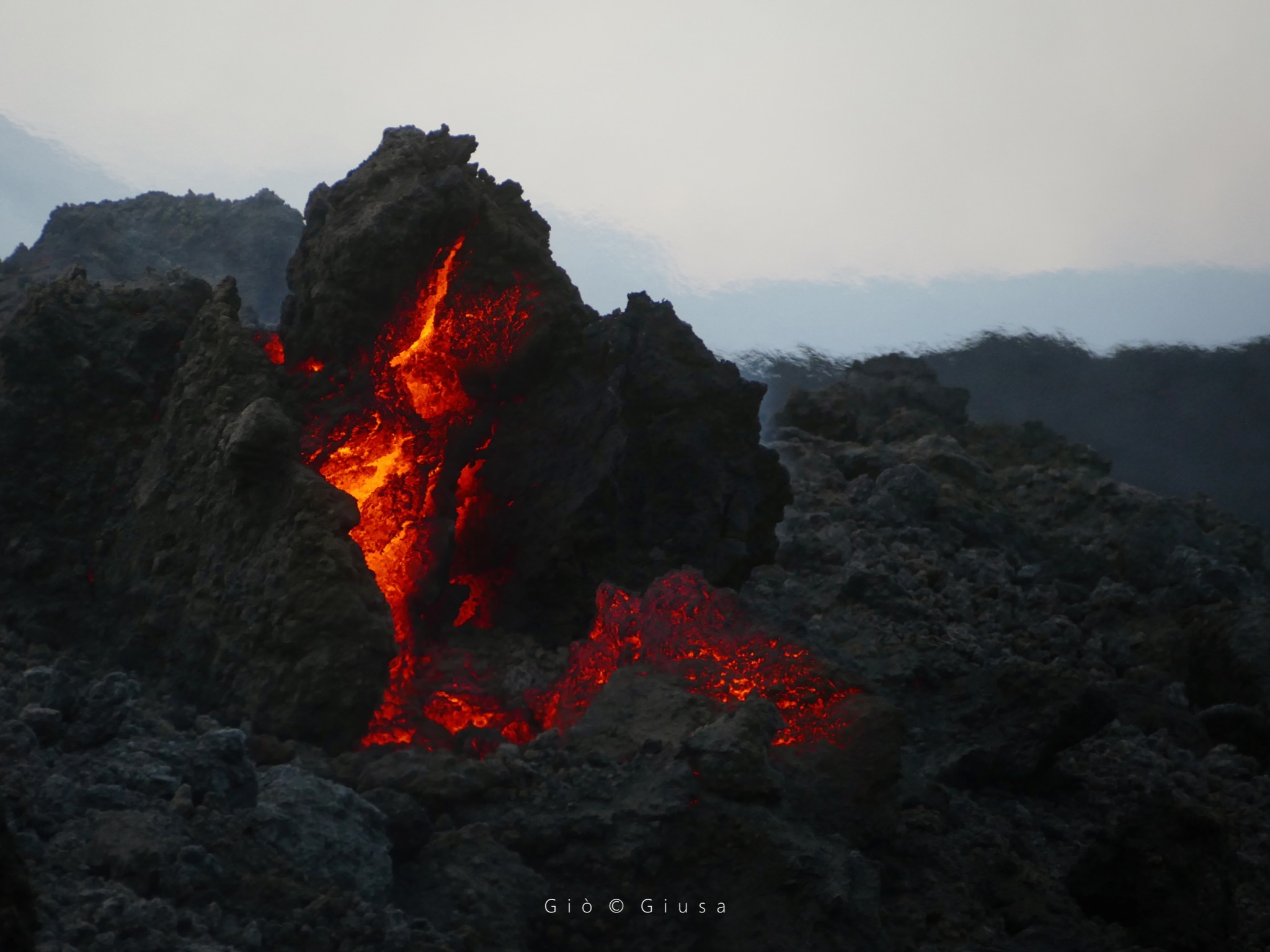
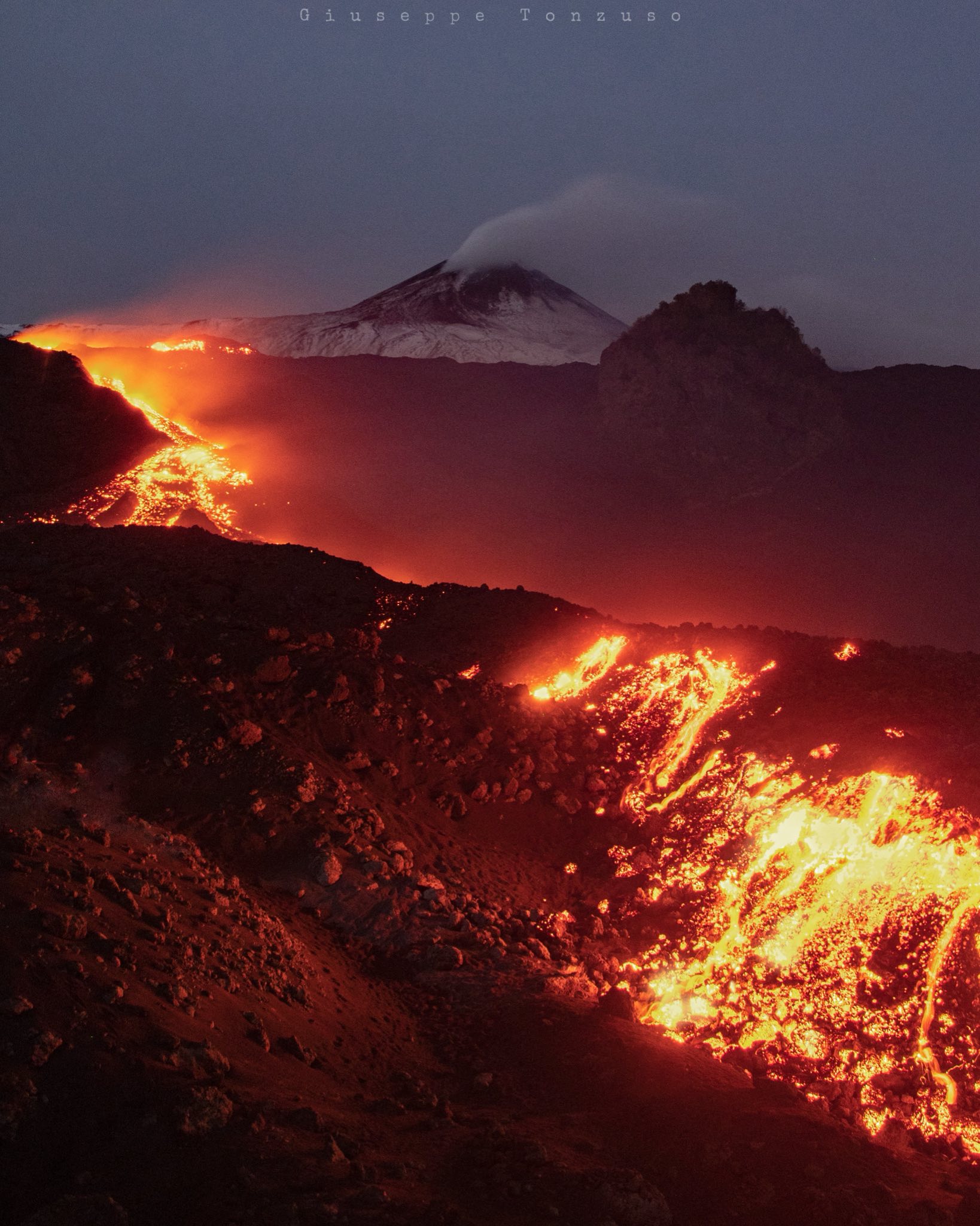
The National Institute of Geophysics and Volcanology (INGV), Etna Observatory, reports that surveillance cameras and field surveys conducted by INGV personnel show that the Valle del Bove lava field remains active, with the most advanced front located at an altitude of approximately 1,360 m. Further upstream, between 1,600 and 1,400 m, additional overlapping lava flows are observed. Due to heavy cloud cover, it was not possible to observe the summit area of the volcano.
From a seismic perspective, the amplitude of the volcanic tremor, currently within the average range, continues its slow increase phase already described in the previous report, overlapping with large oscillations lasting approximately ten hours. The center of gravity of the volcanic tremor sources appears to be located east of the Voragine crater, at an altitude of approximately 2,900 meters.
Regarding infrasound signals, it was not possible to conduct a reliable assessment, either in terms of frequency of occurrence or source location, due to significant noise caused by adverse weather conditions.
As indicated in the previous press release, the DRUV extensometer is exhibiting an oscillatory pattern characterized by rapid compression phases followed by slow stability phases, and then decompression. Currently, an accumulation of approximately 10 nanostrains has been recorded since the first compression phase reported in the previous press release. A similar pattern is being recorded by the ECP inclinometer. No changes are observed on the high-frequency GNSS network.
Etna Activity Press Release, January 6, 2026, 2:17 PM (1:17 PM UTC).
The National Institute of Geophysics and Volcanology (INGV), Etna Observatory, announces that this press release supersedes the previous one (No. 16 at 1:12 PM UTC today).
From a seismic perspective, the situation has not changed significantly compared to the previous press release. Volcanic tremor has reached high levels, while its origin remains east of the Voragine crater. Counting and locating infrasound events is difficult due to weather conditions.
Due to heavy cloud cover, it is impossible to observe the summit area of the volcano with surveillance cameras. However, INGV personnel on the ground have heard detonations attributable to explosive activity at the summit.
Ground deformation monitoring networks show no further changes compared to previously reported information.
Etna Activity Report, January 6, 2026, 21:57 (20:57 UTC).
The National Institute of Geophysics and Volcanology (INGV), Etna Observatory, reports that field surveys conducted by INGV staff between 6:00 PM and 9:00 PM (local time) show that the portion of the lava field located between Rocca Musarra and Rocca Capra is no longer being fed and that the lava fronts are stationary and cooling.
From a seismic perspective, volcanic tremor has returned to average levels. The source of the tremor is located near the Voragine crater, at an altitude of approximately 1,800 meters.
Counting and locating infrasound events is difficult due to adverse weather conditions.
Currently, ground deformation monitoring networks are not showing any significant changes.
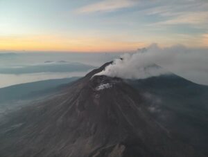
Etna Activity Update, January 7, 2026, 5:05 PM (4:05 PM UTC).
The National Institute of Geophysics and Volcanology (INGV), Etna Observatory, announces that field surveys conducted by INGV staff confirm the findings of Information Bulletin No. 18 of January 6, 2026, which indicated that the portion of the lava field located between Rocca Musarra and Rocca Capra was no longer being fed and that the lava fronts were stationary and cooling. Due to adverse weather conditions, it is currently impossible to determine the activity status of the vents. INGV staff have not heard any detonations attributable to explosive activity at the summit, suggesting that explosive activity at the Voragine vent may have ceased.
From a seismic perspective, the average amplitude of volcanic tremor remains within normal limits. The center of gravity of the volcanic tremor sources is located near the Northeast Crater, at a depth of between 1,800 and 2,400 meters above sea level. Infrasound activity is very low, but due to weather conditions, the available time series may not be representative of the volcano’s actual explosive activity.
The GNSS-HF and tiltmeter networks show no significant variations. The DRUV dilatometer indicates the slow resumption of a compression phase after the relative stability observed during the second half of January 6.
Further information will be released soon.
Source : INGV.
Photos : Gio Giusa , Giuseppe Tonzuzzo .
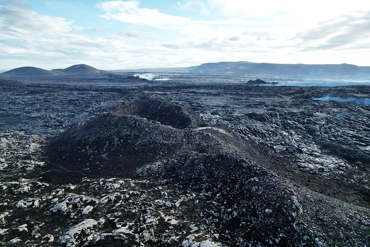
Iceland , Reykjanes Peninsula :
Continued increased likelihood of an eruption on the Sundhnúkur crater row .Updated 6 January 2026
Key points
Magma accumulation continues beneath Svartsengi
Continued increased likelihood of a magma intrusion and an eruption
Earthquake activity remains low in the area
Hazard assessment remains unchanged until 3 February, unless activity changes
Magma accumulation
Land uplift and magma accumulation at Svartsengi continue at a steady rate, similar to recent weeks. According to modelling results, just over 19 million cubic metres of magma have now accumulated beneath Svartsengi since the last eruption in July. The likelihood of a magma intrusion and an eruption therefore continues to increase, but the timing of the next eruption remains uncertain and may range over several months.

Results of model calculations showing the total volume for each magma accumulation period at Svartsengi since December 2023. The orange bars show the total volume accumulated between magma intrusions or eruptions. The red bar represents the volume accumulated since the July eruption to the present day. The grey shaded area indicates the range of inflation volumes which accumulated beneath Svartsengi prior to triggering the last 5 events.
Earthquake activity
Earthquake activity in the area remains low.
Source : IMO.
Photos : Steinninn , IMO.
Philippines , Mayon :
A total of 162 rockfall events have been recorded in the past 24 hours as Alert Level 3 is maintained over Mayon Volcano in Albay, the Philippine Institute of Volcanology and Seismology (PHIVOLCS) said.
From 12 a.m. on Wednesday to 12 a.m. on Thursday, PHIVOLCS said that 50 pyroclastic density currents (PDCs) have been observed in the volcano.
PDCs are mixtures of fragmented volcanic particles (pyroclastics), hot gases, and ashes that rush down the volcanic slopes or rapidly outward from a source vent at high speeds, PHIVOLCS said.
“Yung PDC na na-observe natin ay umabot ito ng 1.5 kilometers from the crater from the summit,” PHIVOLCS chief Teresito Bacolcol told Dobol B TV in an interview.
One volcanic earthquake was recorded while the volcano’s edifice was still inflated.
A fair crater glow on the volcano was also visible.

Mayon Volcano emitted 702 tonnes of sulfur dioxide gases on January 5, according to PHIVOLCS. A moderate volcanic plume rose up to 200 meters above the crater and drifted northeast.
Under Alert Level 3, the volcano shows an intensified unrest or magmatic unrest.
Authorities strictly prohibit entry into the six-kilometer permanent danger zone (PDZ) and warn against unnecessary activity in the extended danger zone (EDZ).
Flying any aircraft close to the volcano is also prohibited due to potential ash and ballistic hazards.
Mayon could generate rockfalls or landslides or avalanches; ballistic fragments; lava flows and lava fountaining; pyroclastic density currents; moderate-sized explosions; and lahars during heavy and prolonged rainfall.
A total of 3,515 people or 964 families in Albay were affected by the volcano’s activity, according to a report of National Disaster Risk Reduction and Management Council (NDRRMC) on Wednesday.
The affected barangays are Camalig, Guinobatan, Ligao, Malilipot, and Tabaco.
Of the total affected population, the NDRRMC said 3,476 individuals or 952 families were staying in evacuation centers while 39 persons or 12 families were taking shelter in other places. —VAL, GMA Integrated News
Sources : VAL, GMA Integrated News.
Photo : Father Paulo Barandon.
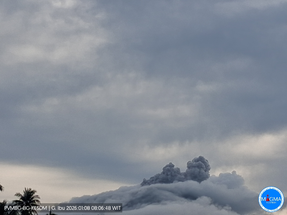
Indonesia , Ibu :
Mount Ibu experienced an eruption on Thursday, January 8, 2026 at 8:08 AM WIT. An ash column was observed approximately 300 meters above the summit (at an altitude of about 1,625 meters). This ash column, white to gray in color, was highly concentrated and extended to the south and southwest. At the time of writing, the eruption was still ongoing.
Seismic Observations
59 eruption earthquakes with amplitudes of 10 to 28 mm and durations of 30 to 60 seconds.
1 emission earthquake with an amplitude of 15 mm and a duration of 38 seconds.
11 harmonic tremors with amplitudes of 2 to 3 mm and durations of 22 to 103 seconds.
60 low-frequency earthquakes with amplitudes of 2 to 15 mm and durations of 17 to 29 seconds.
71 shallow volcanic earthquakes with amplitudes of 2 to 28 mm and durations of 7 to 21 seconds.
2 deep volcanic earthquakes with an amplitude of 28 mm and durations of 15 to 20 seconds.
Eight tectonic earthquakes, spaced 2 to 28 mm apart, with durations ranging from 26 to 215 seconds.
Recommendations
1. Residents living around Mount Ibu and visitors/tourists are advised to refrain from all activities within a 2 km radius and a 3.5 km zone around the crater opening in the northern part of the active Mount Ibu crater.
2. In the event of ashfall, people engaging in outdoor activities are advised to wear a mask covering their nose, mouth, and eyes, as well as protective eyewear.
Source et photo : Magma Indonésie .
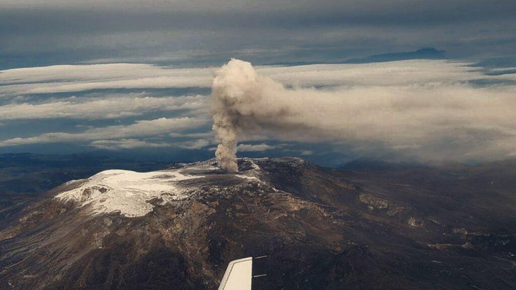
Colombia , Nevado del Ruiz :
Manizales, January 6, 2026, 3:45 PM
Regarding the monitoring of activity at the Nevado del Ruiz volcano, the Colombian Geological Survey (SGC), an agency under the Ministry of Mines and Energy, reports the following:
During the week of December 30, 2025, to January 5, 2026, the volcano continued to exhibit unstable behavior. Compared to the previous week, the main variations in monitored parameters were as follows:
– Seismicity associated with fluid dynamics within the volcanic conduits increased, both in the number of earthquakes and in the seismic energy released. In particular, an increase in long-duration signals was recorded; however, their energy level remained low.
Other seismic signals showed varying energy levels, ranging from weak to, occasionally, moderate. Thanks to the cameras (conventional or thermographic) used to monitor the volcano, several pulsed ash emissions have been confirmed to be associated with certain seismic signals, as well as with variations in the apparent temperature of the materials emitted during these emissions.
– Seismic activity associated with rock fracturing processes within the volcanic edifice decreased, both in the number of recorded earthquakes and in the seismic energy released.
The recorded earthquakes were of magnitude less than 1 and were located primarily in the Arenas crater and on the north-northeast, north, northeast, northwest, and southeast flanks of the volcano, at distances of up to 13 km from the crater and at depths ranging from less than 1 km to 9 km.
– The emission of water vapor and volcanic gases, primarily sulfur dioxide (SO₂), from the Arenas crater to the atmosphere was variable. Estimated daily SO₂ fluxes increased compared to the previous week. Additional satellite monitoring revealed low SO₂ emissions.
The height of the column of gas, water vapor, or ash reached a maximum of 1,100 m vertically, measured above the summit of the volcano, while its dispersal height was 1,600 m during the pulsed ash emission on January 2 at 4:48 a.m. Regarding the direction of dispersal, the column showed a preferential tendency towards the northwest, west-northwest, and south-southwest flanks of the volcanic structure.
– Satellite monitoring of thermal anomalies at the bottom of the Arenas crater detected several anomalies, mainly of low intensity and occasionally of moderate intensity. Among the latter, the value recorded on December 29, 2025, is particularly noteworthy; it had not been observed since April 2025.
Source et photo : SGC.